
Tropical system in the Gulf expected to gradually strengthen the next couple of days off the Florida Panhandle and Alabama coasts. Instances of flash flooding will be possible through Thursday along the eastern and central Gulf Coast. Severe thunderstorms will develop and move along a cold front crossing the Upper Midwest, and through the Ohio Valley/Mid-Atlantic on Tuesday. Read More >
Midland/Odessa
Weather Forecast Office
SE NM and Permian Basin Wildfires April 6
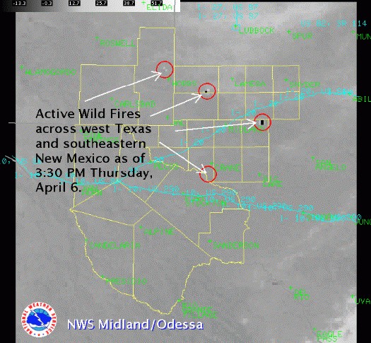
A strong upper level storm system moving across the southern Rockies brought strong westerly winds to west Texas and southeastern New Mexico on Thursday. Extremely low relative humidities also accompanied the westerly winds and these conditions resulted in several wild fires across the region. The following is a satellite image depicting active wild fires as of 3:30 PM CDT Thursday.
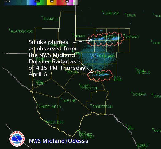
Below is a radar image showing the smoke plumes from ongoing wild fires.
The next graphic shows the direction and speed of the peak wind gusts around west Texas and southeastern New Mexico as of 4 PM CDT.
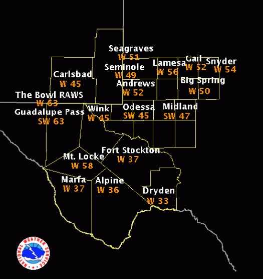
Strong westerly winds will continue across much of west Texas and southeastern New Mexico Thursday afternoon along with minimum relative humidity values generally in the 5-15% range. The very windy conditions and low relative humidities will continue to create very favorable conditions for rapid and explosive fire growth and spread across all of west Texas and southeastern New Mexico this afternoon. Thick smoke from these wild fires will reduce visibilities across area roadways. Motorists are strongly urged to avoid areas where wild fires are burning.
Hazards
Spotter Briefing
Outlook
Current Hazards
Storm Report
Severe Weather
Drought
Storm Prediction Center
Weather Prediction Center
National Hurricane Center
Active Alerts
Winter Weather
Past Weather
Cooperative Observations
Local Climate Data
National Climate
Current Weather
Observations
Satellite
Upper Air
West Texas Mesonet
Radar
Forecasts
Activity Planner
Aviation
Climate Prediction Center
Fire
Forecast Discussion
Graphical
Local
Space Weather Center
Information Center
Weather Trivia
Forecast Models
GIS
International Weather
Glossary
Road Conditions
Water
Hydrology
Precipitation Estimates
Quantitative Precipitation Forecasts
US Dept of Commerce
National Oceanic and Atmospheric Administration
National Weather Service
Midland/Odessa
2500 Challenger Dr.
Midland, TX 79706-2606
(432) 563-5006
Comments? Questions? Please Contact Us.

