
Numerous severe thunderstorms are expected across a broad region from the Ohio Valley to the Mid-Atlantic and Northeast States today into tonight. Swaths of damaging wind gusts are expected and some tornadoes are possible. Bertha is expected to bring tropical storm conditions to portions of the Gulf Coast from the Florida Panhandle westward to southeastern Louisiana later today and Wednesday. Read More >
Midland/Odessa
Weather Forecast Office
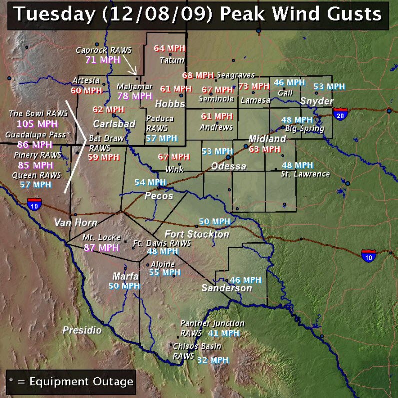
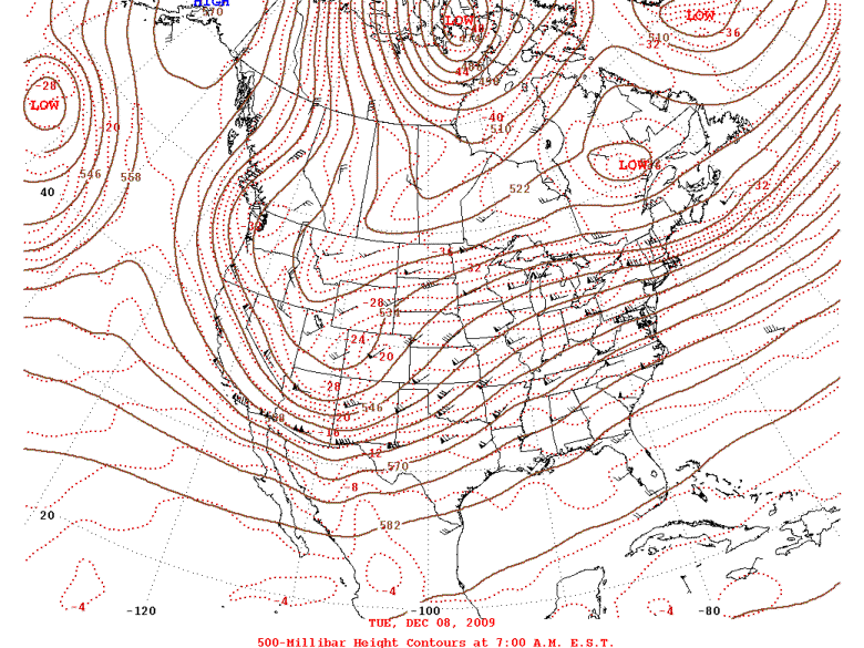
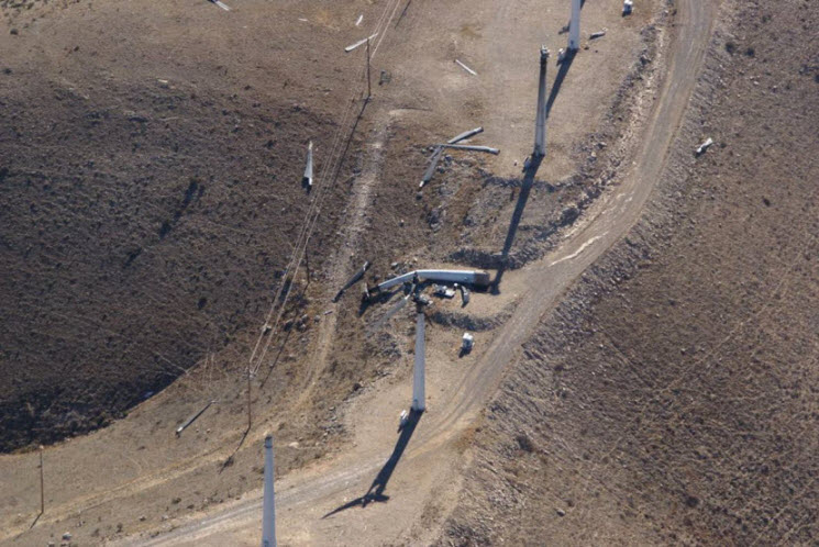
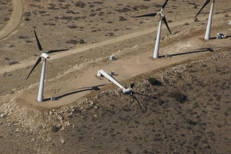
A strong upper level storm system moved across the desert southwest into west Texas and southeast New Mexico on December 8, 2009. Very strong westerly winds accompanied this upper level storm system which resulted in wind gusts over 100 MPH in the highest elevations of the Guadalupe Mountains with near 90 MPH gusts recorded at Mt. Locke in the Davis Mountains. Farther east into the plains of southeast new Mexico and west Texas, wind gusts in the 60 to 70 MPH range were common, especially along and north of Interstate 10.
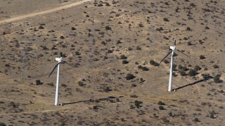
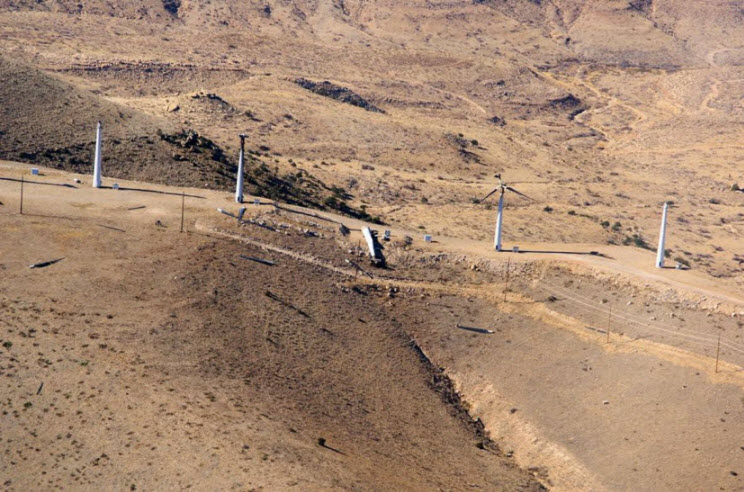
There were reports of damage as a result of these very strong wind gusts. A wind farm in the Delaware Mountains sustained significant damage with several blades ripped off turbines and even an entire wind tower blown down. In nearby Pine Springs, there were reports of roofs blown off houses and broken windows. At least two semi trucks were blown over on U.S. Highway 62/180 near Guadalupe Pass. Across the plains, there were a few reports of roofs blown off houses as well as many reports of downed power poles.

Hazards
Spotter Briefing
Outlook
Current Hazards
Storm Report
Severe Weather
Drought
Storm Prediction Center
Weather Prediction Center
National Hurricane Center
Active Alerts
Winter Weather
Past Weather
Cooperative Observations
Local Climate Data
National Climate
Current Weather
Observations
Satellite
Upper Air
West Texas Mesonet
Radar
Forecasts
Activity Planner
Aviation
Climate Prediction Center
Fire
Forecast Discussion
Graphical
Local
Space Weather Center
Information Center
Weather Trivia
Forecast Models
GIS
International Weather
Glossary
Road Conditions
Water
Hydrology
Precipitation Estimates
Quantitative Precipitation Forecasts
US Dept of Commerce
National Oceanic and Atmospheric Administration
National Weather Service
Midland/Odessa
2500 Challenger Dr.
Midland, TX 79706-2606
(432) 563-5006
Comments? Questions? Please Contact Us.

