
Dangerous and extreme heat will remain across portions of the central U.S. this week, persisting across the mid to lower Mississippi Valley, Gulf Coast, southern Plains and portions of Texas. A heat wave over the Southwest U.S. will peak this weekend. Heavy to excessive rainfall may produce flash flooding from the Delmarva Peninsula north into the Hudson Valley today and tonight. Read More >
Midland/Odessa
Weather Forecast Office
On Sunday, April 8, National Weather Service meteorologists surveyed tornado reports that occured on April 7 along State Highway 163 in southern Mitchell county.
Eyewitness accounts indicated that two tornadoes occurred over Mitchell county. Both tornadoes remained over ranch land adjacent to and west of State Highway 163 and no tornado damage was identified. Based on this information, the tornadoes will be rated as EF-0.
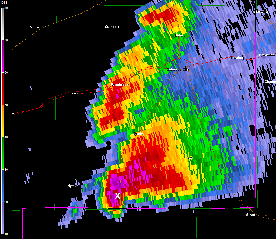
Below is a detailed overview and radar image showing the location of the tornadoes.
Mitchell County tornado #1...
start date April 07 2012
start time 4:23 PM CDT
start location 18 S Westbrook/Mitchell County/TX
start lat/lon 32.11N/ -101.02W
end date April 07 2012
end time 4:27 PM CDT
end location 18 S Westbrook/Mitchell County/TX
end lat/lon 32.09N/ -101.03W
Rating EF-0
Mitchell County tornado #2...
start date April 07 2012
start time 4:38 PM CDT
start location 18 S Westbrook/Mitchell County/TX
start lat/lon 32.09N/ -101.03W
end date April 07 2012
end time 4:48 PM CDT
end location 19 S Westbrook/Mitchell County/TX
end lat/lon 32.09N/ -101.05W
Rating EF-0
Hazards
Spotter Briefing
Outlook
Current Hazards
Storm Report
Severe Weather
Drought
Storm Prediction Center
Weather Prediction Center
National Hurricane Center
Active Alerts
Winter Weather
Past Weather
Cooperative Observations
Local Climate Data
National Climate
Current Weather
Observations
Satellite
Upper Air
West Texas Mesonet
Radar
Forecasts
Activity Planner
Aviation
Climate Prediction Center
Fire
Forecast Discussion
Graphical
Local
Space Weather Center
Information Center
Weather Trivia
Forecast Models
GIS
International Weather
Glossary
Road Conditions
Water
Hydrology
Precipitation Estimates
Quantitative Precipitation Forecasts
US Dept of Commerce
National Oceanic and Atmospheric Administration
National Weather Service
Midland/Odessa
2500 Challenger Dr.
Midland, TX 79706-2606
(432) 563-5006
Comments? Questions? Please Contact Us.

