Missouri Basin, Pleasant Hill
River Forecast Center
Short Term HEFS Graphics
Plots updated by 18Z daily
| Summary Info | |||
| Summary Table of Flood Probabilities - All Forecast Groups |
| Flood Probability Maps | ||||
| Forecast Issuance Stage |
Minor Flood Stage |
Moderate Flood Stage |
Major Flood Stage |
>50% Exceeding Flood Level |
| HEFS Graphics & Summaries | |
|
|
|
|
|
|
|
|
|
|
|
|
|
|
|
|
|
|
|
|
|
|
|
|
|
|
|
|
|
|
|
|
|
|
|
|
|
|
|
|
|
|
|
|
|
|
|
|
|
|
|
|
|
|
|
|
|
|
|
|
|
|
|
|
|
|
|
|
|
|
|
|
|
|
|
|
|
|
|
|
|
Probabilities of exceeding Forecast Issuance Levels next 10 days 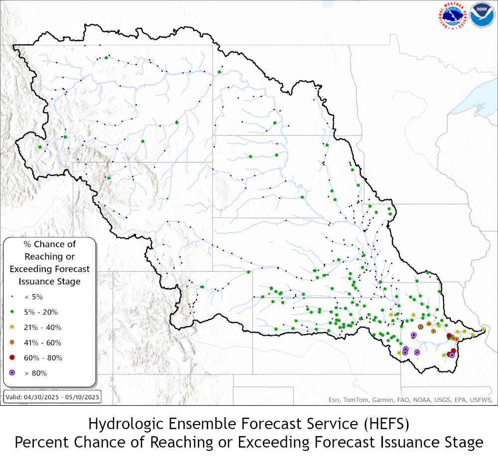
Probabilities of exceeding Minor Flood Levels next 10 days 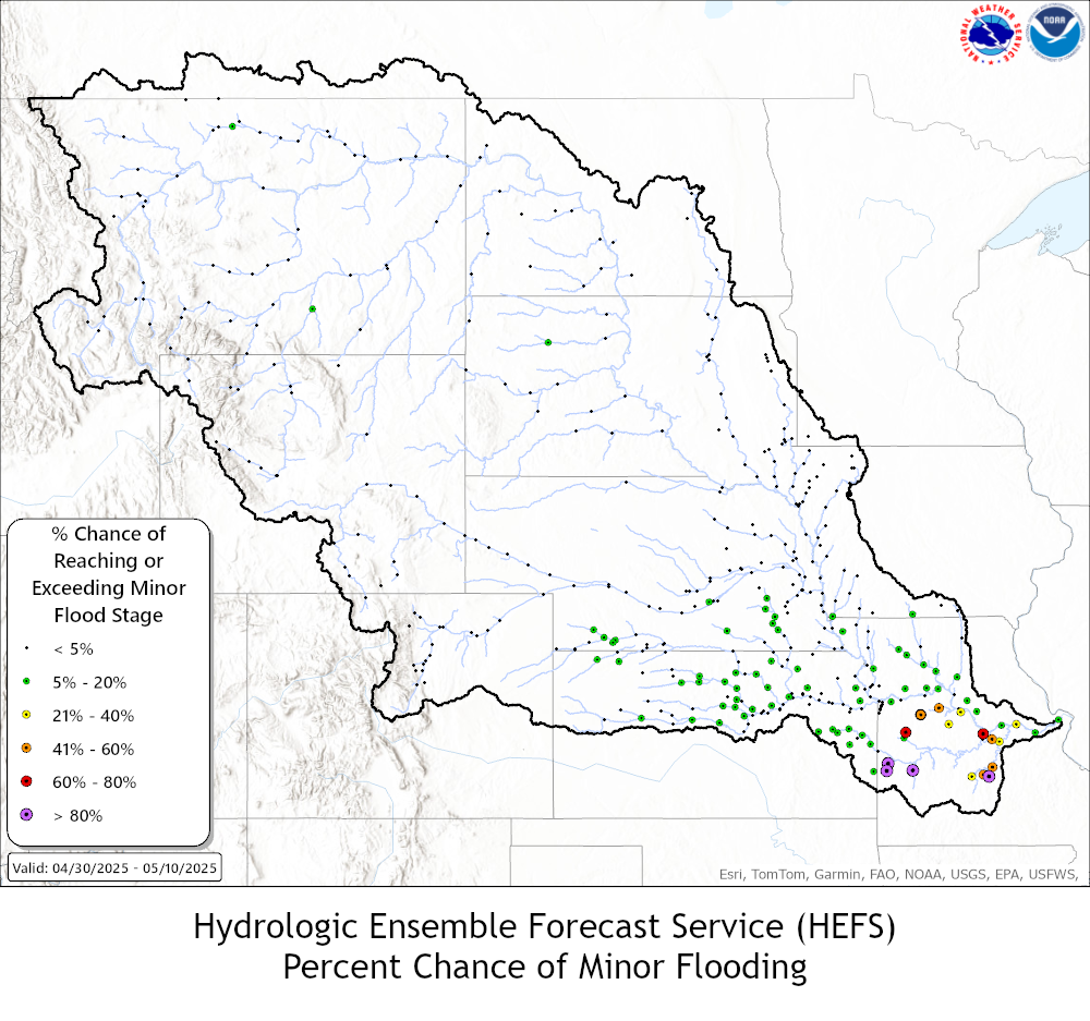
Probabilities of exceeding Moderate Flood Levels next 10 days 
Probabilities of exceeding Major Flood Levels next 10 days 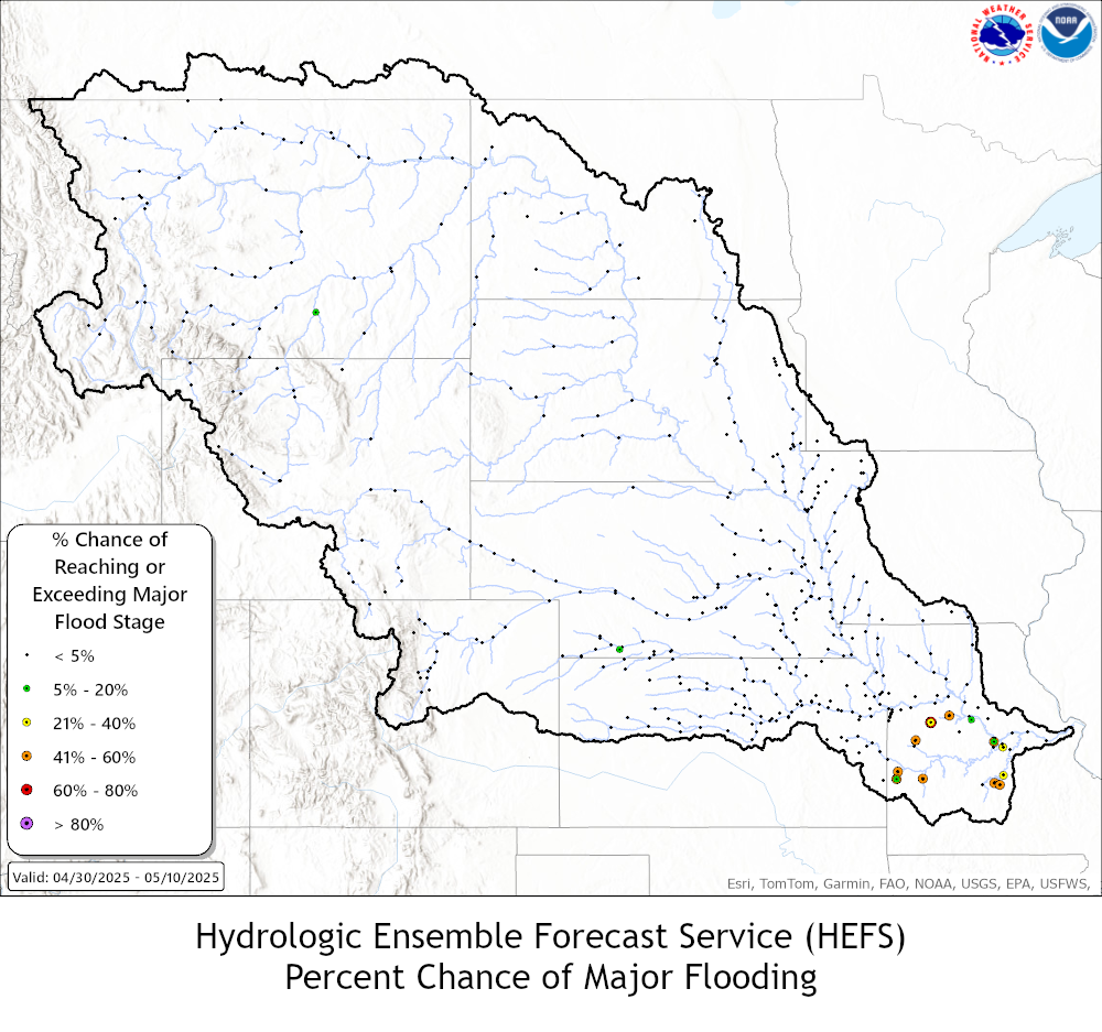
Greater than 50% Probability of Exceeding Flood Levels next 10 days 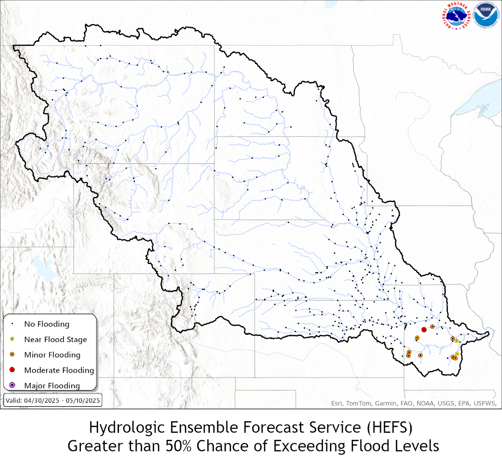
US Dept of Commerce
National Oceanic and Atmospheric Administration
National Weather Service
Missouri Basin, Pleasant Hill
1803 North 7 Highway
Pleasant Hill, MO 64080-9421
Comments? Questions? Please Contact Us.

