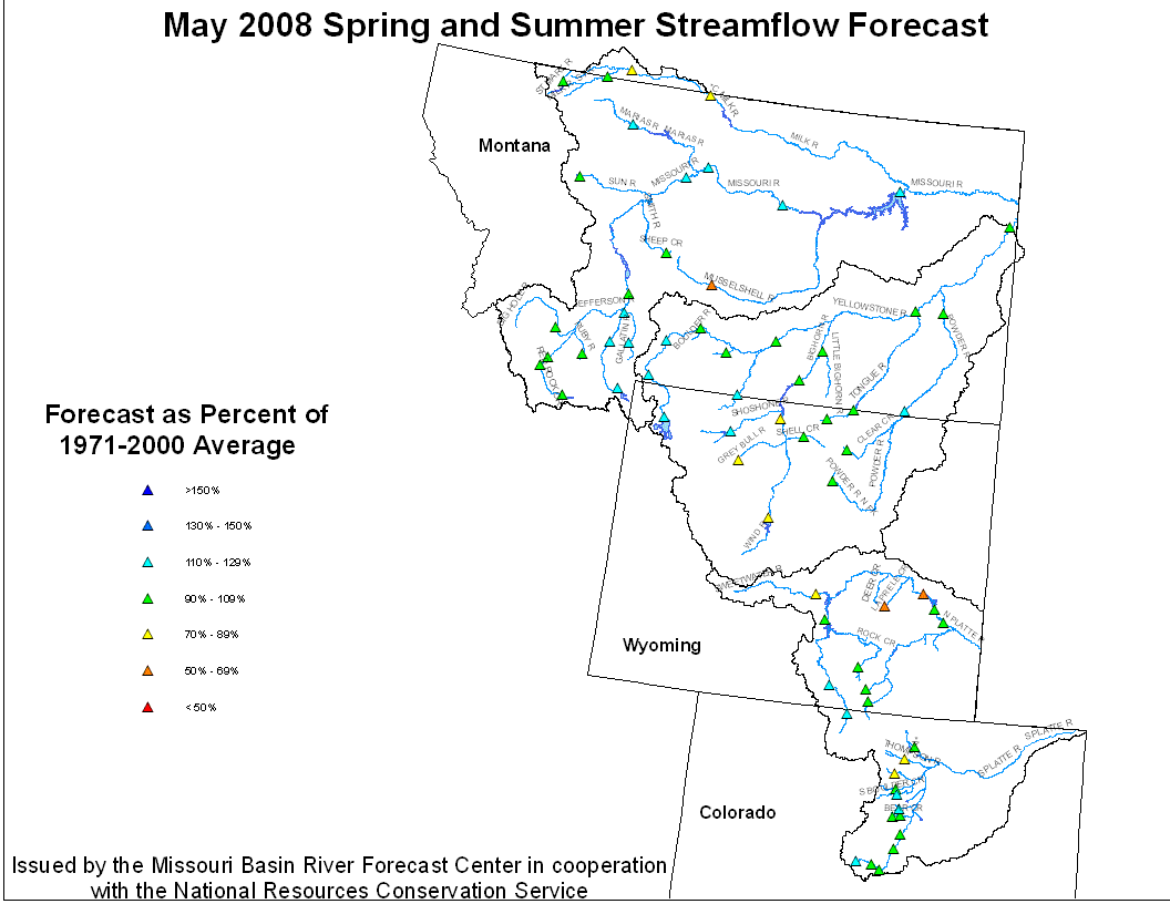
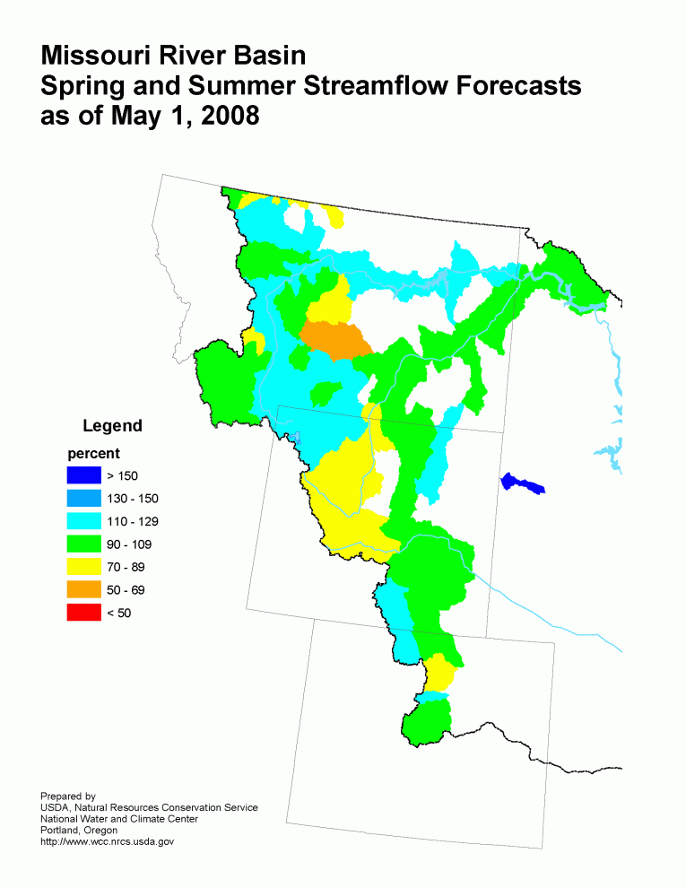
May 1, 2008 Spring and Summer Streamflow Forecasts
Missouri River Basin Streamflow Forecast Missouri River Basin Mountain Snowpack
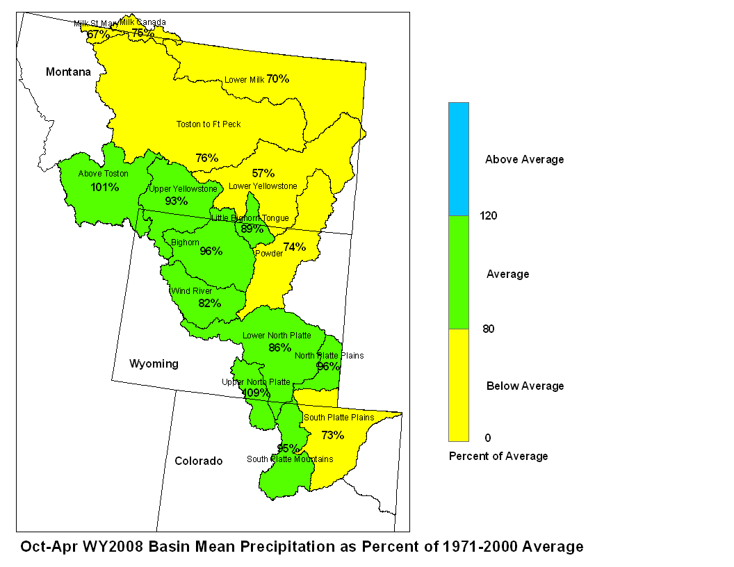
Upper Missouri Basin
The high elevation snow pack in the Upper Missouri Basin as of
May 1 was above average.  The snow pack above Toston,  Montana
was 116 percent of average.  The snow pack between Toston and
Fort Peck, Montana was 114 percent.  The snow pack in the St Mary
and Milk river basins was 120 percent.
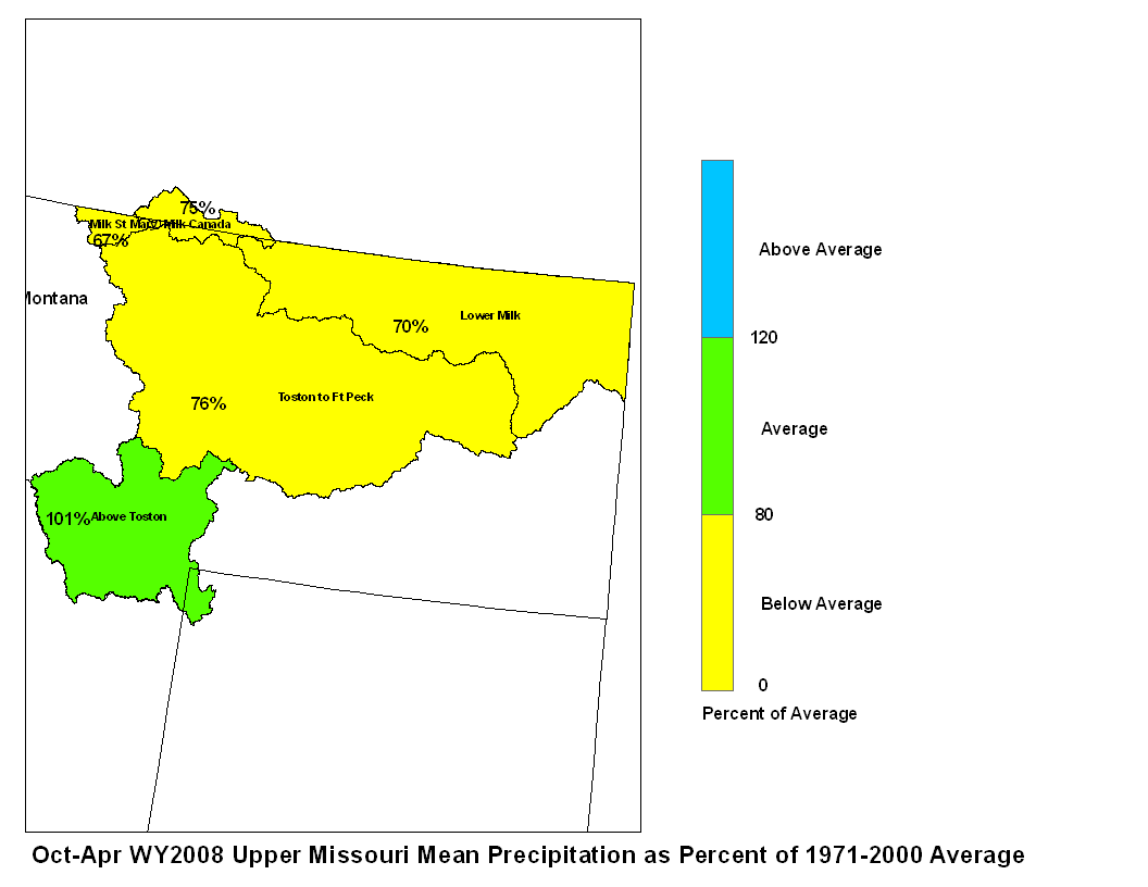
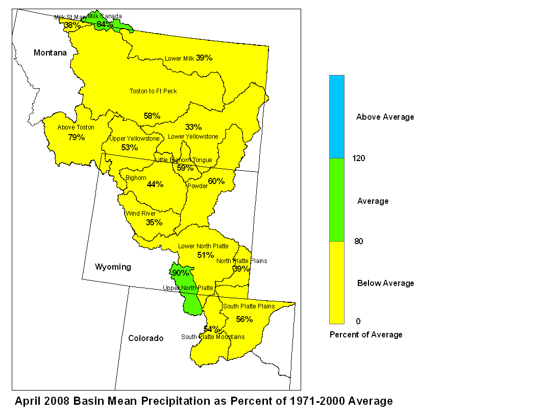
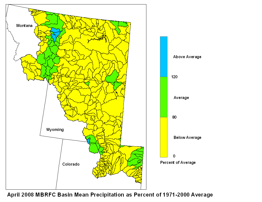
April precipitation was below average across the entire Upper Missouri
Basin. Basin precipitation summaries for the Missouri Basin include:
Milk St. Mary, 38 percent; Milk Canada, 84 percent; Lower Milk, 39
percent; Above Toston, 79 percent; Toston to Ft. Peck, 58 percent.
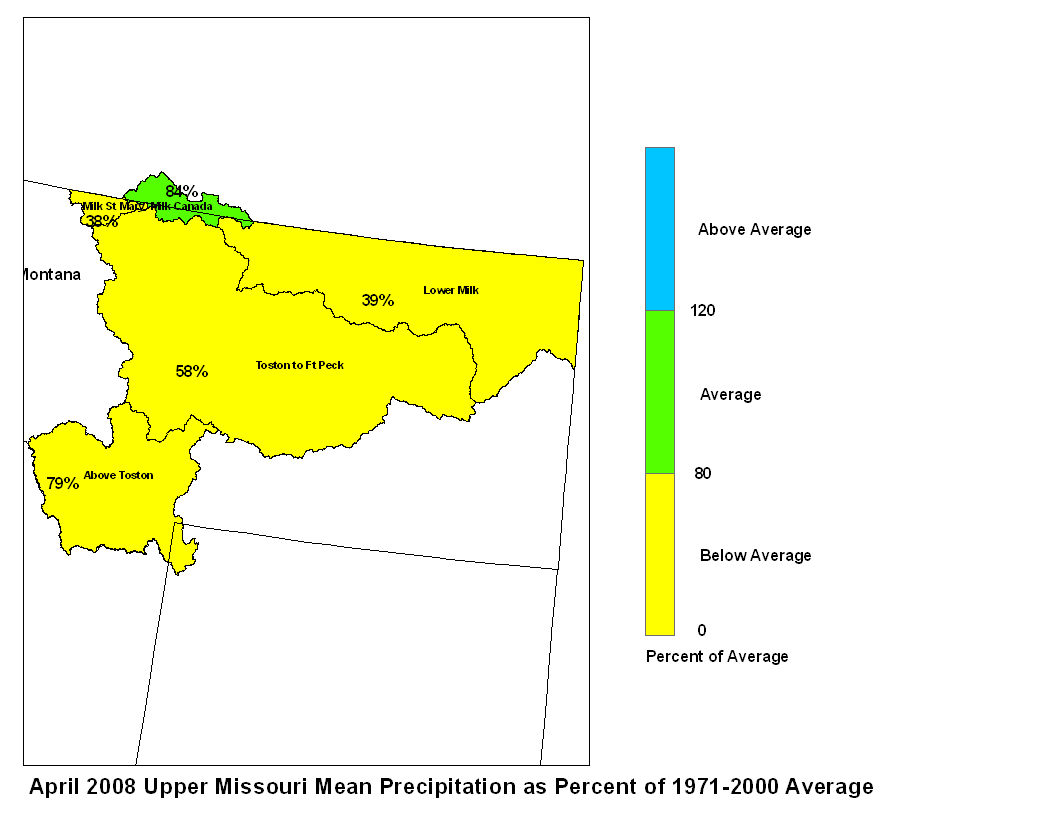
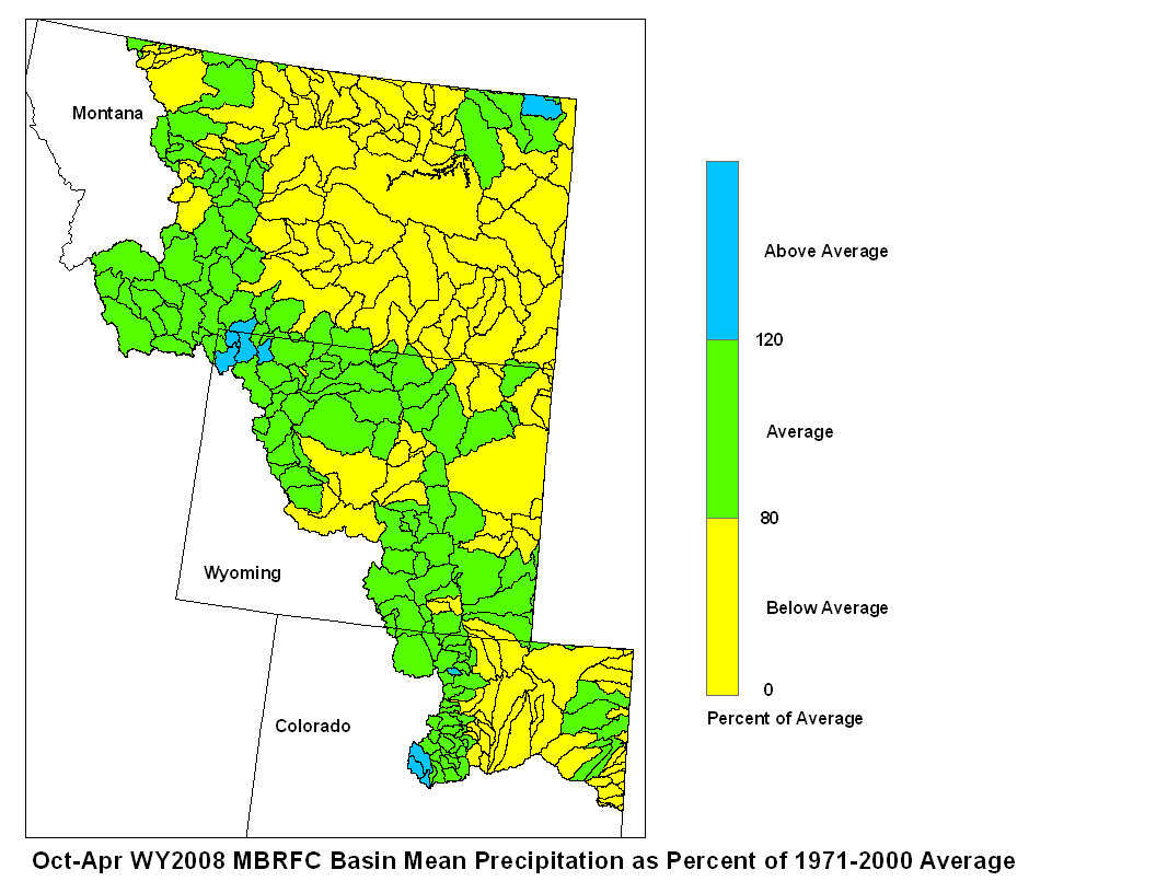
April 2008 Upper Missouri Mean Precip Oct-Apr WY2008 Upper Missouri Mean Precip
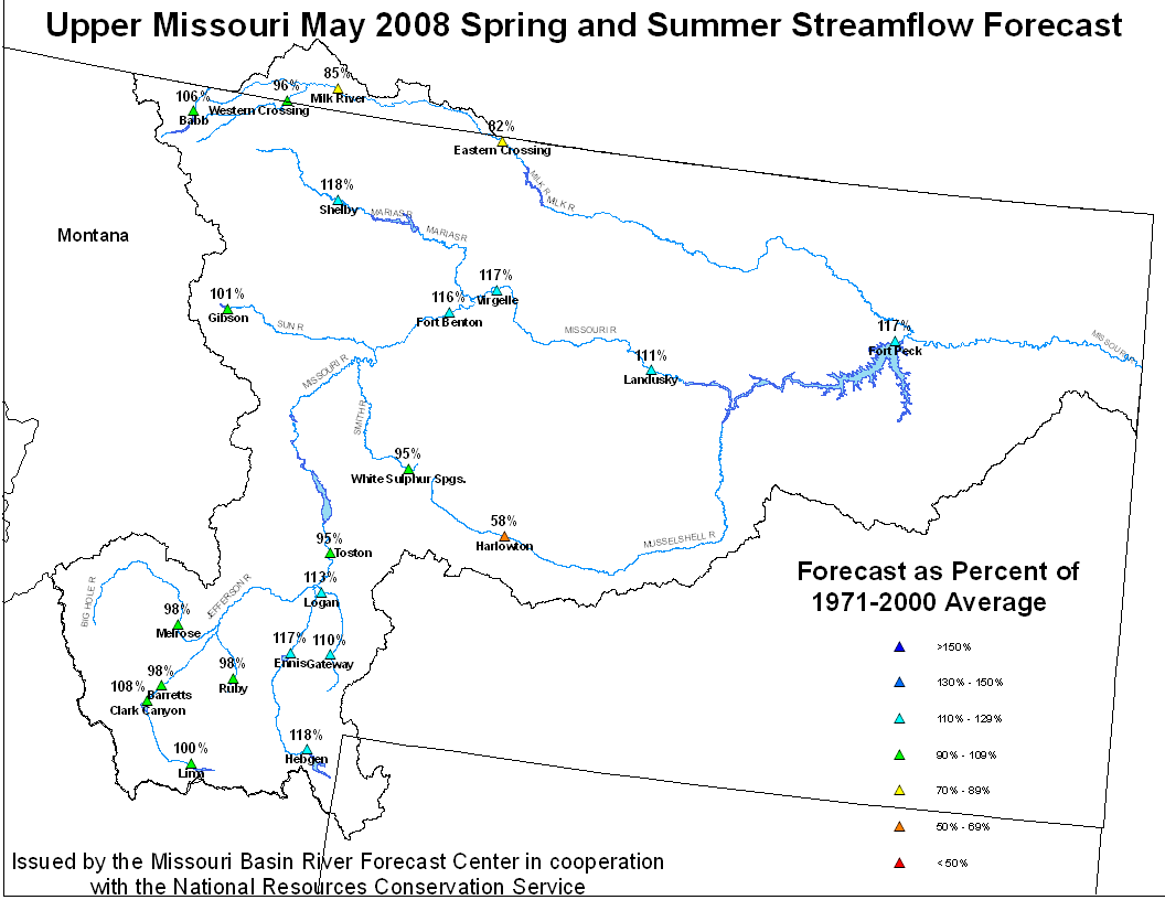
Stream flow in the Upper Missouri Basin is forecast to be near
average during the upcoming spring and summer.  The St. Mary River
is forecast to have 105 percent of average May-September flows.
Runoff is expected to range around 117 percent of average for the
Missouri Basin above Fort Peck, Montana.  Forecasts for the Milk
River Basin call for around 85 percent of average spring summer runoff.
Upper Missouri May 1, 2008 Spring and Summer Streamflow Forecasts
Of the four major irrigation reservoirs in Montana:  Lima Reservoir
had 53 percent average storage, Clark Canyon was holding 76 percent of
average water, Gibson Reservoir had 37 percent of average stored
water, and Fresno Reservoir had 48 percent of average stored water.
The  major  hydroelectric  reservoirs  in  Montana (Canyon  Ferry and
Fort Peck) had monthend storage in the average to  below average
range; 97 and 58 percent of average water, respectively.
As indicated by the U.S. Geological long term gaging stations,
the Marias River near Shelby, Montana had an estimated 33 percent
of average runoff in April.
Yellowstone Basin
The high elevation snow pack in the Yellowstone Basin was mostly
average on May 1.  The snow pack in the Upper Yellowstone Basin
was 113 percent of average. The snow packs in the Wind, Bighorn,
and  Shoshone Basins were 94, 102, and 100  percent of average,
respectively.  The snow packs in the Tongue and Powder basins were
111 and 115 percent of average, respectively.
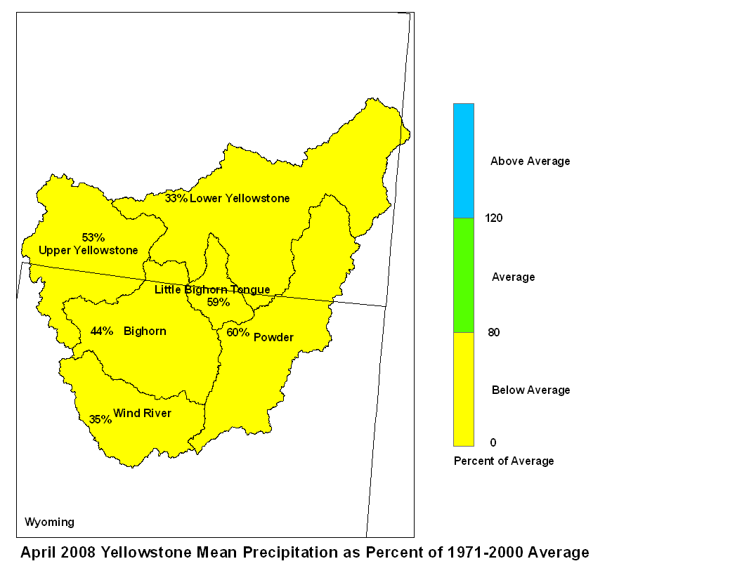
Precipitation was below average in the Yellowstone Basin
during the month of April. Precipitation was about 61 percent
of average in the Wind River Basin above Boysen Reservoir, 35 percent
of average in the Bighorn Basin, and 44 percent of average in the
Little Bighorn Basin. The Powder River Basin received 60 percent
of average April precipitation. April precipitation was 53 percent
of average in the upper Yellowstone Basin (above Billings) and
only 33 percent of average in the Lower Yellowstone Basin.
Stream flow in the Yellowstone Basin is forecast to be mostly about
average during the upcoming spring and summer.  Runoff at
Billings, Montana is expected to be 109 percent of average, with
a probable range between 83 and 136 percent of average.  Stream
flow for the Wind-Bighorn Basin above St. Xavier, Montana is
forecast to be 91 percent of average with a probable range
of 66 to 118 percent of average flow in sub-basins.  Flow in the
Tongue Basin is expected to be 104 percent of average with a
reasonably likely range of 65 to 144 percent of average flow. Flows
in the Powder River are expected to be about 109 percent of average
with a reasonably likely range of 82 to 136 percent.
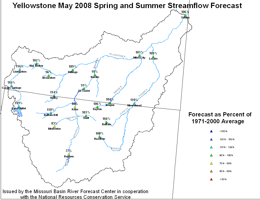
Yellowstone May 1, 2008 Spring and Summer Streamflow Forecasts
End-of-April reservoir storage in Wyoming was 77 percent of
average in Boysen Reservoir and 89 percent of average in Buffalo
Bill Reservoir.  Monthend storage was 98 percent of average in
Bighorn Reservoir on the Wyoming/Montana border.

Runoff during April in the Yellowstone River was estimated to be
67 percent of the 1971 to 2000 average at Corwin Springs and 54
percent of that period`s average at Billings.
Platte Basin
The high elevation  snow pack in the Upper North Platte basin was
103 percent of average on May 1.  The snow pack in the North
Platte Basin below Seminoe  Reservoir was 93 percent of average.
The snow pack in the South Platte Basin was 102 percent of average.
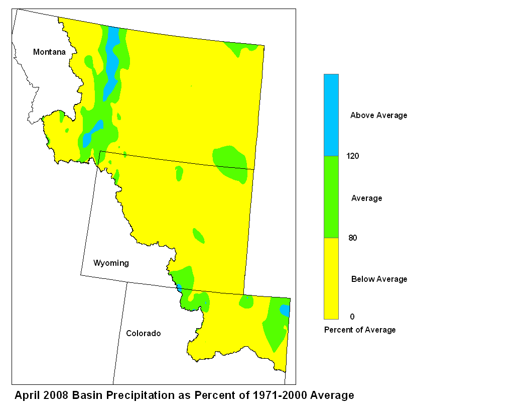
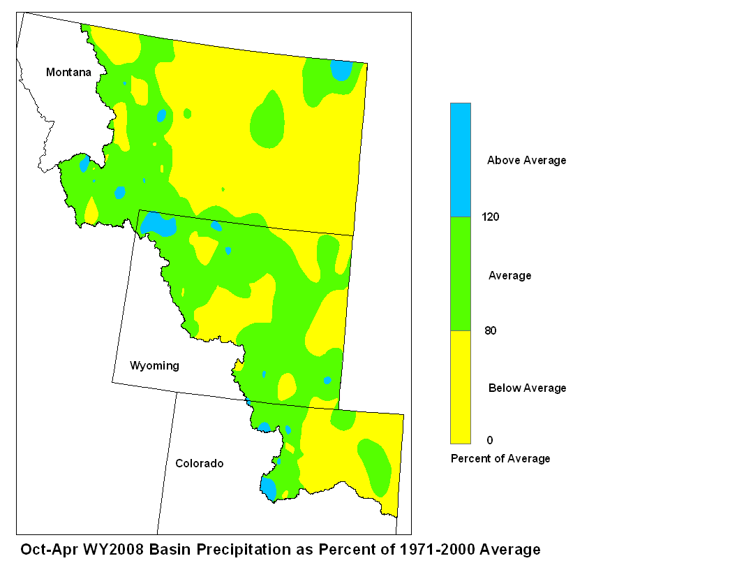
Precipitation during April in the Platte Basin was below average.
April precipitation in the North Platte Basin above Seminoe
Reservoir was 90 percent of average. In the North Platte Basin
between Seminoe Reservoir and Guernsy Reservoir precipitation was
51 percent of average. The North Platte Basin below Guernsy Reservoir
had 39 percent of average precipitation. The high elevations of the
South Platte Basin had 54 percent of average April precipitation
whereas the plains had 56 percent of average precipitation.
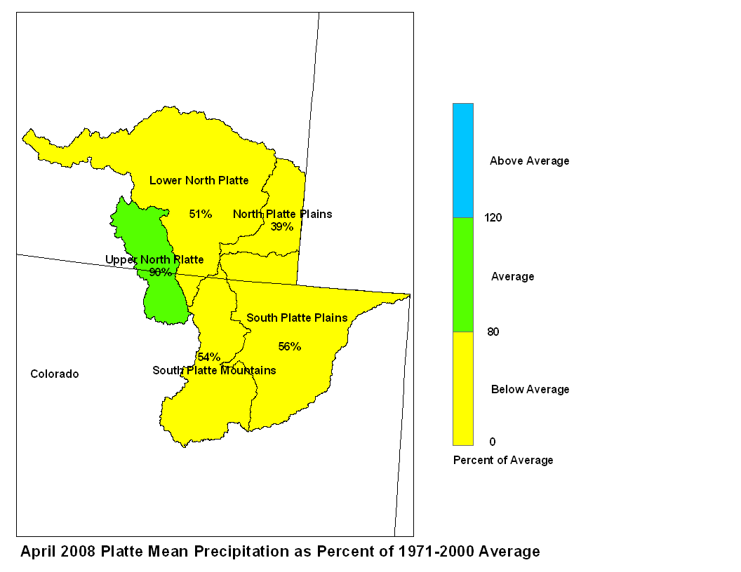
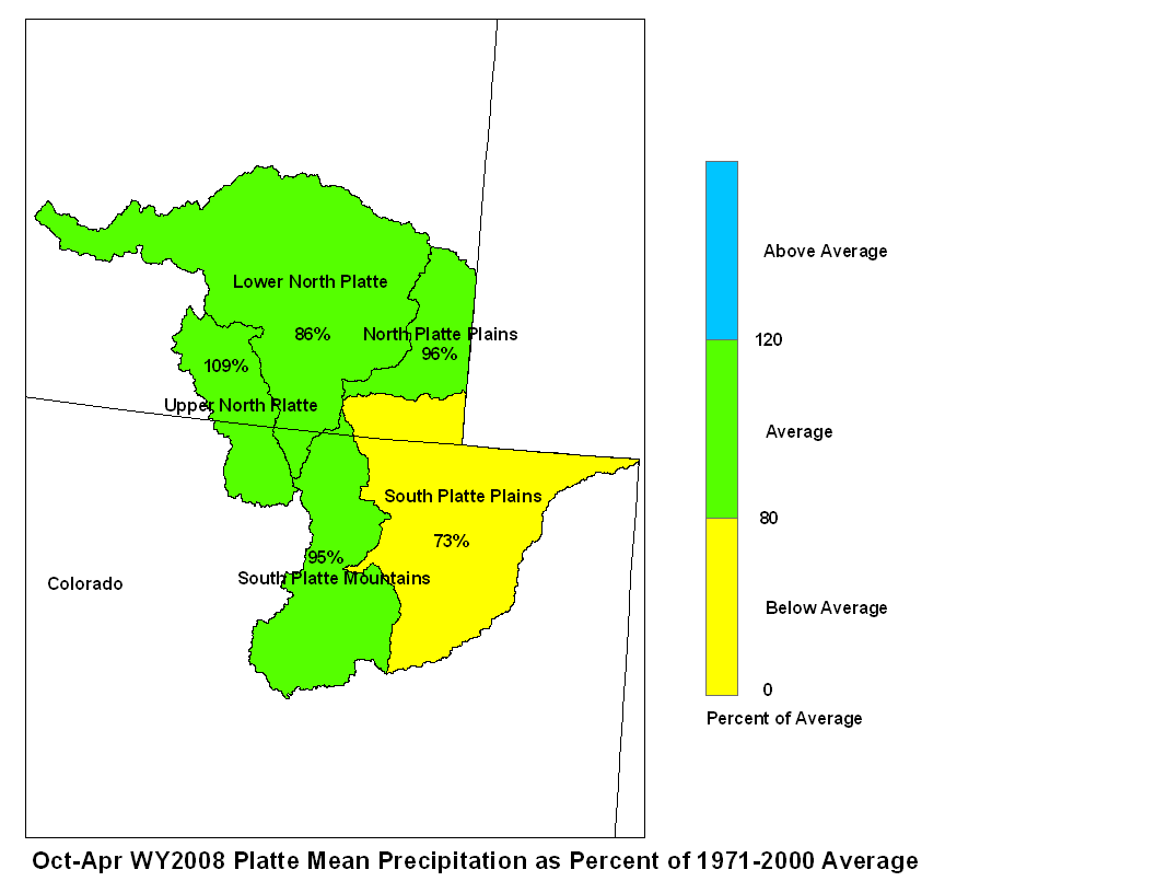
April 2008 Platte Mean Precip Oct-Apr WY2008 Platte Mean Precip
Stream flow in the Platte basin is forecast to range from below
average to above average during the upcoming spring and summer.
Runoff for streams above Seminoe Reservoir are expected to be about
110 to 125 percent of average.  Stream flows for the North  Platte
below Seminoe Reservoir are forecast to be 60 to 110 percent of
average. The South Platte Basin above South Platte, Colorado can
expect about 100 to 110 percent of average flow.  For the remainder
of the South Platte Basin flows are expected to be about 80 to
110 average.
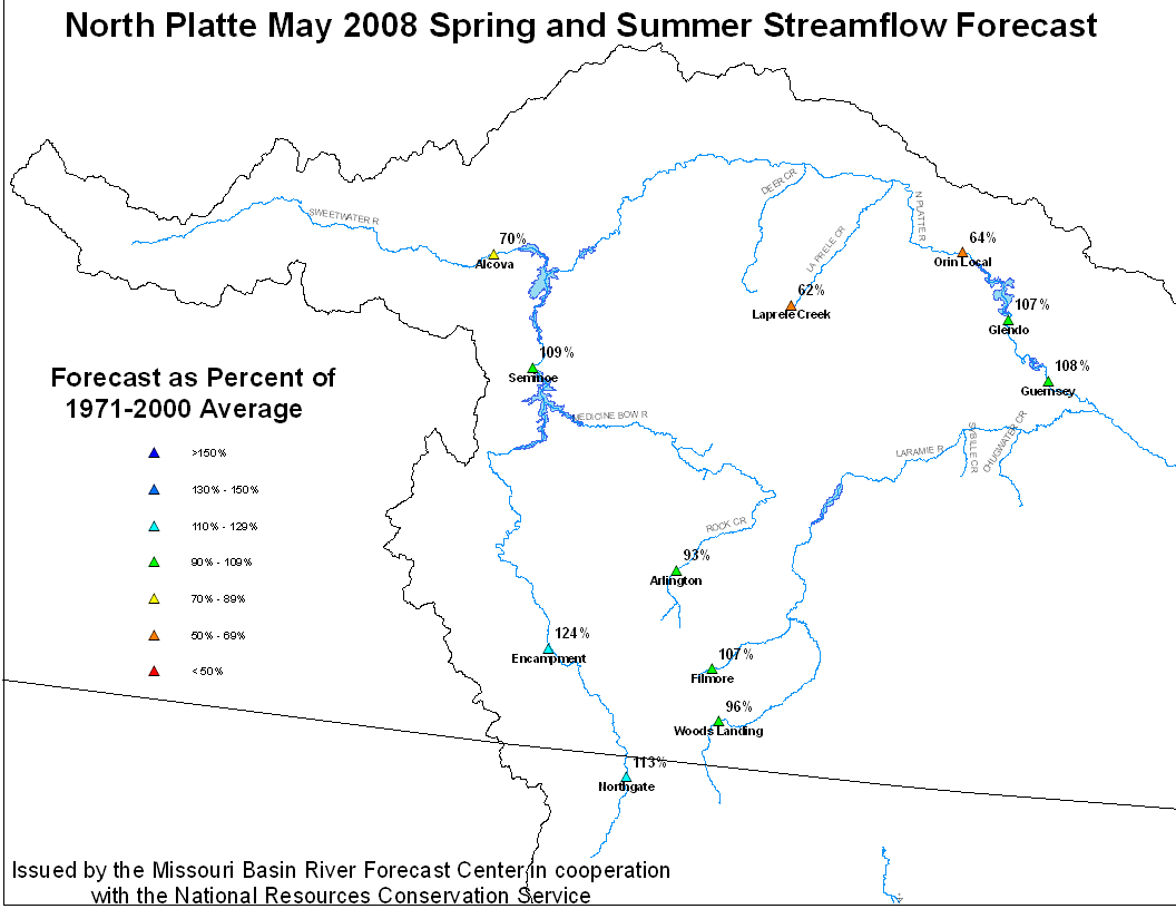
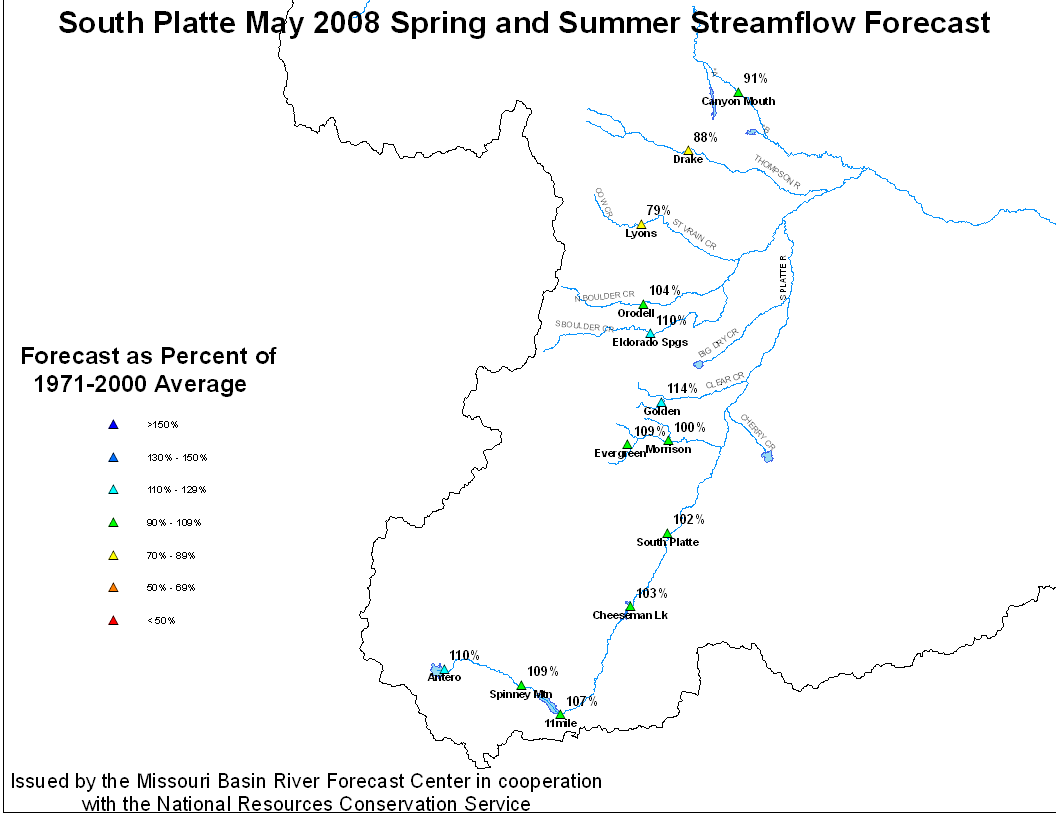
North Platte Streamflow Fcst South Platte Streamflow Fcst
Stored water in the North Platte Basin as of May 1 was 51 percent
of average. In the South Platte basin stored water was 90 percent of
average.

