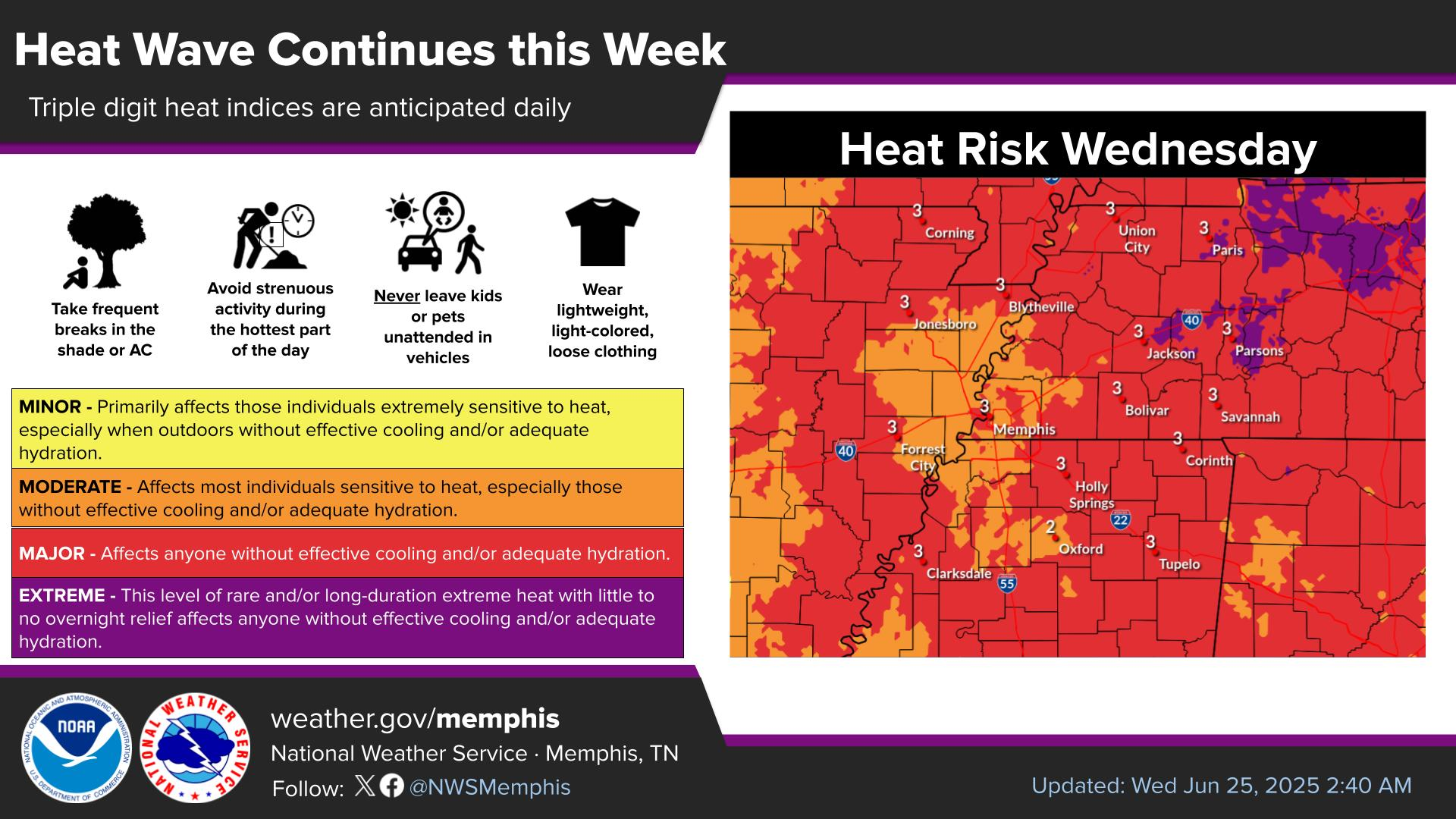
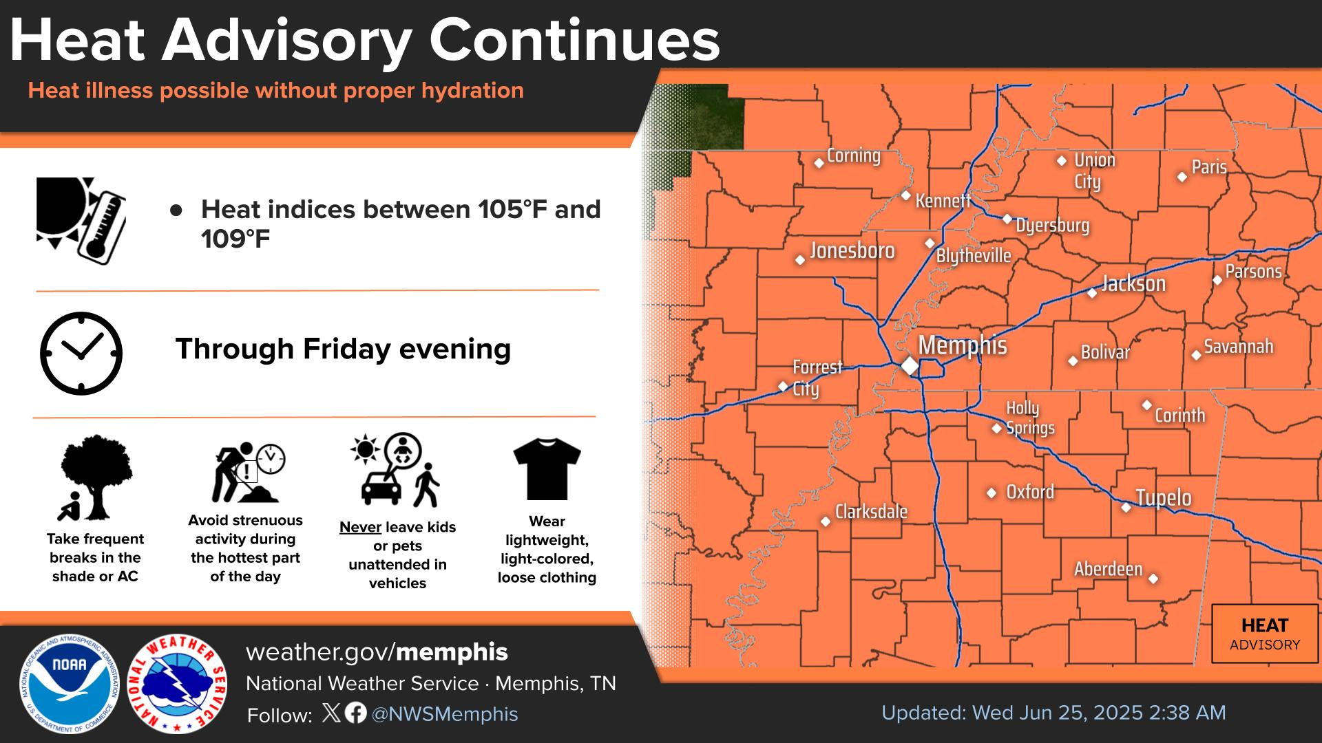
A Heat Advisory is in effect for western portions of the Mid-South through 8PM CDT. Heat index values will range between 105 and 109F. Hot temperatures and high humidity may cause heat illnesses.
Thunderstorm activity will begin to increase once again this afternoon and linge into the late evening. Damaging winds and localized flash flooding will be the main threats.
A Slight risk for severe thunderstorms exists across a large portion of the Mid-South tomorrow. The main hazards will be damaging winds and localized heavy rainfall.
A flood watch has been issued for northern parts of the Mid-South as multiple rounds of rainfall over the coming days may result in localized flash flooding risk.
Note: "N/A" or "MISG" will be displayed if values are not available. In the LOCATION column, click on links for a list of recent observations at sites of interest. In the WIND column, VRB is "variable" and G is "gust". Wind speeds are in MPH. In the BARO (pressure) column, values are in inches. In the REMARKS column, HX is "heat index", WCI is "wind chill index", and VSB is "visibility" (if shown).


 Local Radar
 Weather Map
 Graphical Forecast