A Marginal Risk for strong to severe storms exists today. The primary threat will be damaging winds with a secondary threat of localized heavy rainfall.
A Marginal Risk for strong to severe storms exists tomorrow. The primary threat will be damaging winds with a secondary threat of localized heavy rainfall.
Temperatures will climb into the low to mid 90s next week.
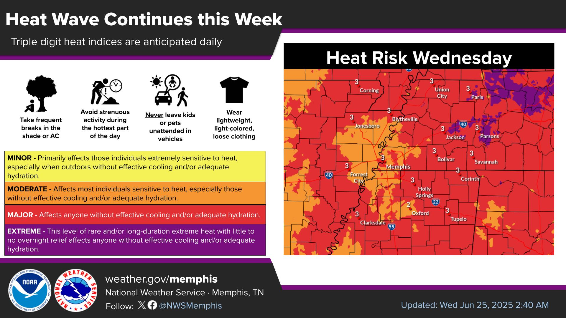
A combination of increased heat and humidity will push heat index values over 100 degrees Tuesday, continuing through at least Friday.
Note: "N/A" or "MISG" will be displayed if values are not available. In the LOCATION column, click on links for a list of recent observations at sites of interest. In the WIND column, VRB is "variable" and G is "gust". Wind speeds are in MPH. In the BARO (pressure) column, values are in inches. In the REMARKS column, HX is "heat index", WCI is "wind chill index", and VSB is "visibility" (if shown).


 Local Radar
 Weather Map
 Graphical Forecast