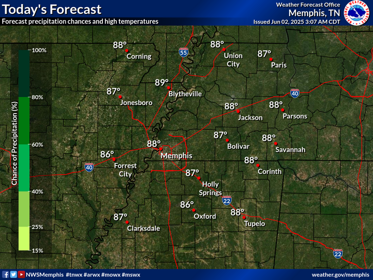
Above normal temperatures will persist into Saturday. High chance for showers and thunderstorms along a cold front on Saturday. The front will provide limited relief from the drought conditions. Much cooler temperatures expected for Sunday through Tuesday, then warming slightly above normal for the remainder of next week.
Marginal risk for severe thunderstorms mainly over North Mississippi Saturday afternoon and evening along a cold front. Damaging winds is the main threat.
Note: "N/A" or "MISG" will be displayed if values are not available. In the LOCATION column, click on links for a list of recent observations at sites of interest. In the WIND column, VRB is "variable" and G is "gust". Wind speeds are in MPH. In the BARO (pressure) column, values are in inches. In the REMARKS column, HX is "heat index", WCI is "wind chill index", and VSB is "visibility" (if shown).


 Local Radar
 Weather Map
 Graphical Forecast