
A cold front lingering over Florida will continue to bring showers and thunderstorms to the state and a flash flooding threat to the east coast over the next couple of days. Fire weather concerns are expected in portions of the Florida panhandle into southeastern Georgia. A Kona Low is expected to bring strong winds, widespread heavy rainfall, and flooding concerns to Hawaii through the weekend. Read More >
|
||||||||||
|
|||||||||||||
| April 2016 May 2016 June 2016 |
|
|
|||||||||||||
| Medford forecast area Radar estimated precipitation |
|
|
|||||||||||||||||||||||||||||||||||||||||||||||||||||||||||||||||||||||||||||||||||||||||||||||||||||||||||||||||||||||||||||


 Precipitation Tracker
 Graphical Hazards Outlook
 RADAR and Satellite
 Forecast Discussion
 Snowfall and Depth With Crater Lake Details
 Avalanche Guidance
 NESDIS Geocolor
 Weather Map
 Marine
 Fire Weather
 Crater Chronicle
 GOES 18 Water Vapor Imagery
 Mountain Pass Forecasts
 Local Climate Data
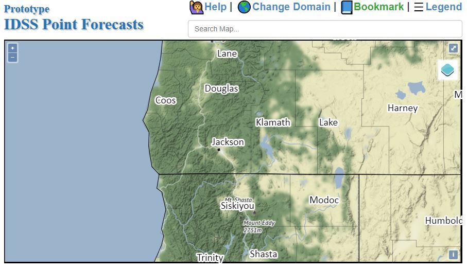 Alternate Point Forecast
 Weather Stats
 Year Charts