
Flash flooding threatens areas from the Tennessee Valley to the Carolinas as storms repeat along a stalled front. Monsoonal storms may trigger flooding in the Southwest. Dangerous heat expands across the Desert Southwest, Plains, mid-Mississippi Valley and Southern Tier. Critical fire weather for interior Pacific Northwest. Cooler, drier air brings brief relief to the Great Lakes and Northeast. Read More >
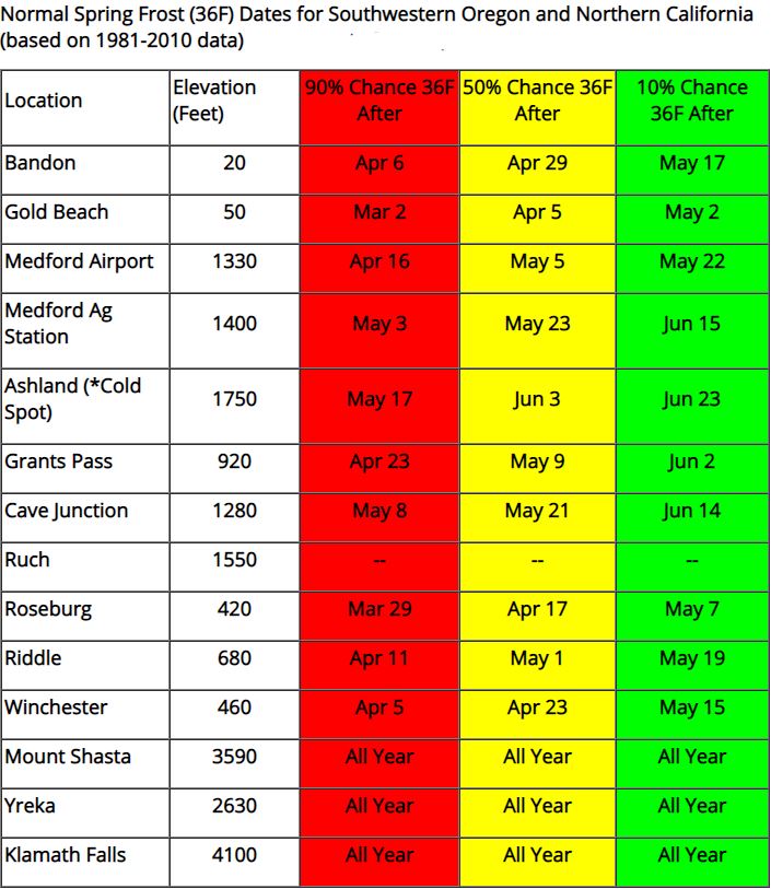
This web page displays normal spring frost and freeze dates based on 1981-2010 climate normals data.
Example of how to read these charts: Let's say you're planning to plant frost-sensitive vegetables in Medford, OR near the airport. If you plant the vegetables on Apr 16, there's a 90 percent chance there will be at least one more morning with temperatures 36 degrees or lower, indicating the potential for frost. If you plant on May 5, there's a 50 percent chance that another frost will occur. So, that's essentially equal chances. Lastly, if you wait until May 22, there's only a 10 percent chance of another frost occurring (temperatures 36F or lower). If you have no risk tolerance for frost, then it's best to wait until the green date of May 22.
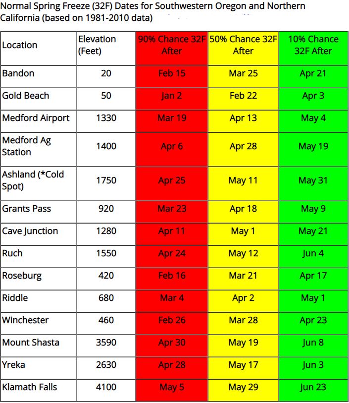
Additionally, some locations can have frost all year round, and these include Yreka, Klamath Falls, and Mount Shasta City. Look below this first chart to get normal last spring freeze dates (32 degrees or lower).


 Precipitation Tracker
 Graphical Hazards Outlook
 RADAR and Satellite
 Wildfire Safety
 Forecast Discussion
 Snowfall and Depth With Crater Lake Details
 Avalanche Guidance
 NESDIS Geocolor
 Weather Map
 Marine
 GOES 18 Water Vapor Imagery
 Local Climate Data
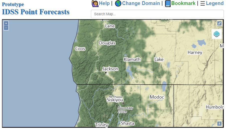 Alternate Point Forecast
 Smoke Forecast
 Weather Stats
 Year Charts
 Fire Weather