Widespread, life-threatening considerable flash flooding is expected in south-central Texas through at least Friday. Catastrophic river flooding and rapid rises on small streams, arroyos, and typically dry washes are expected in the Texas Hill Country. Wildfire smoke is impacting air quality across much of the Great Lakes region into the Northeast U.S. with Air Quality Alerts in effect. Read More >
If you have any pictures of flooding, especially flash flooding, please send them to us with your information and location through the webmaster account at w-mkx.webmaster@noaa.gov. These may be used in our web site story on the event.
Visit our AHPS Page for the very latest information on river flooding.
Jump to River Flooding Information
Jump to Flash Flooding Information
Jump to Heavy Rain Information
Jump to Other Flooding Pictures
The first two weeks in June 2008 featured many days with rain, and a few days with an exceptional amount of rain, across Southern Wisconsin. Between June 1st and June 14th, Madison did not record precipitation on only three days. In the same time span, Milwaukee did not record precipitation on only four days.
However, it was not the extended period of rainy weather that caused flooding problems. Those problems were primarily due to two heavy rainfall events - one on June 7th to June 8th, and one on June 12th. At many locations, over 70% of the rain fell on those three days.
.png)
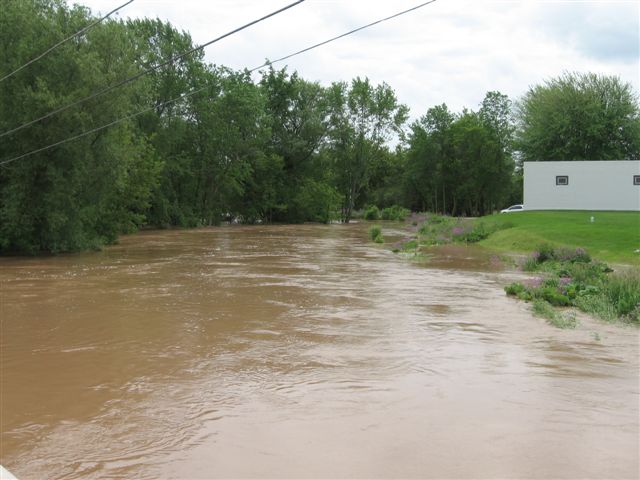
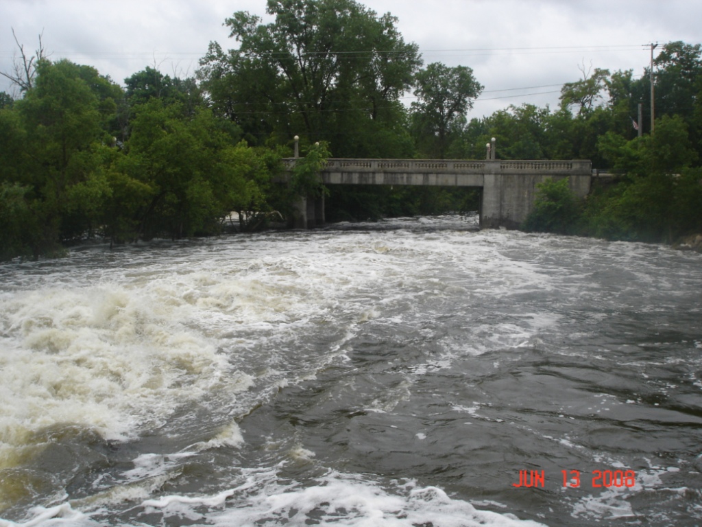
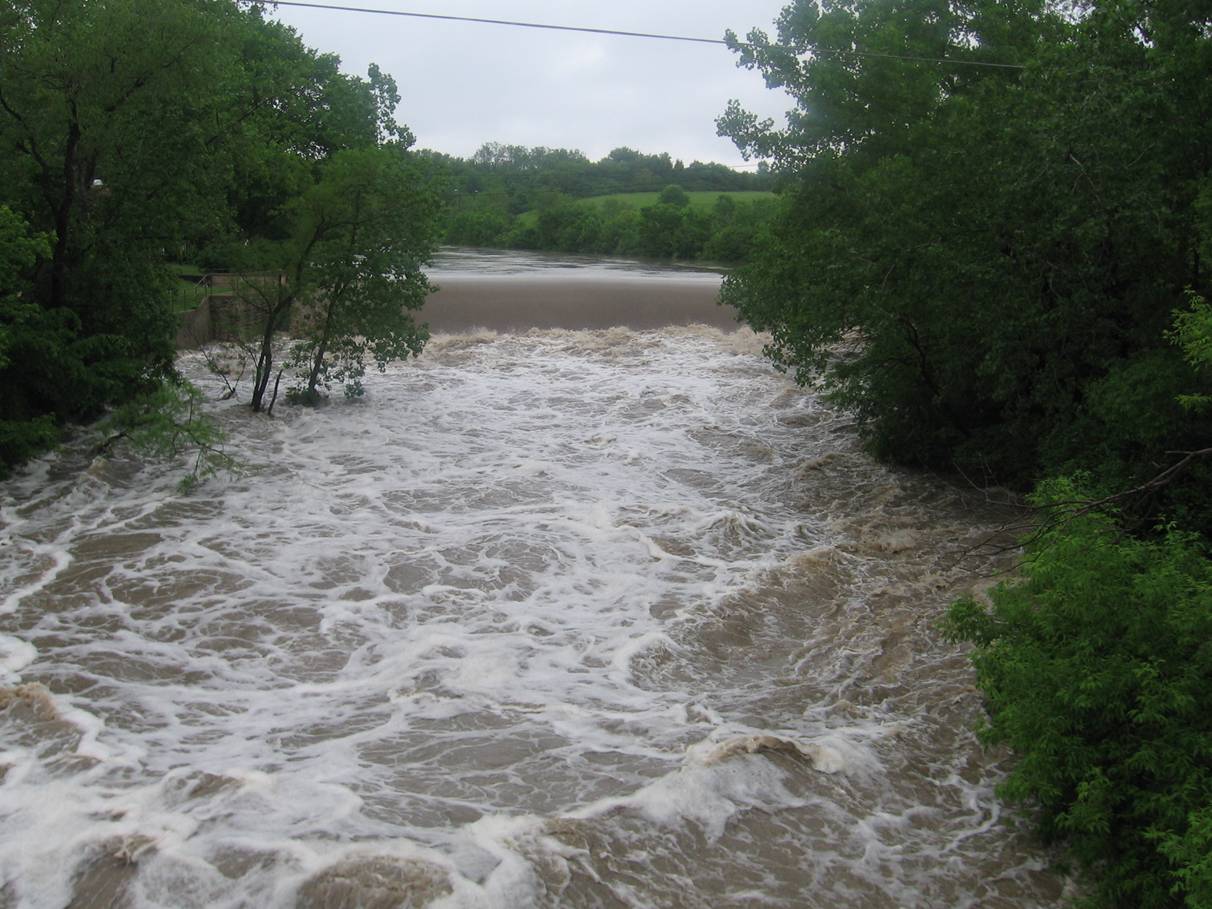
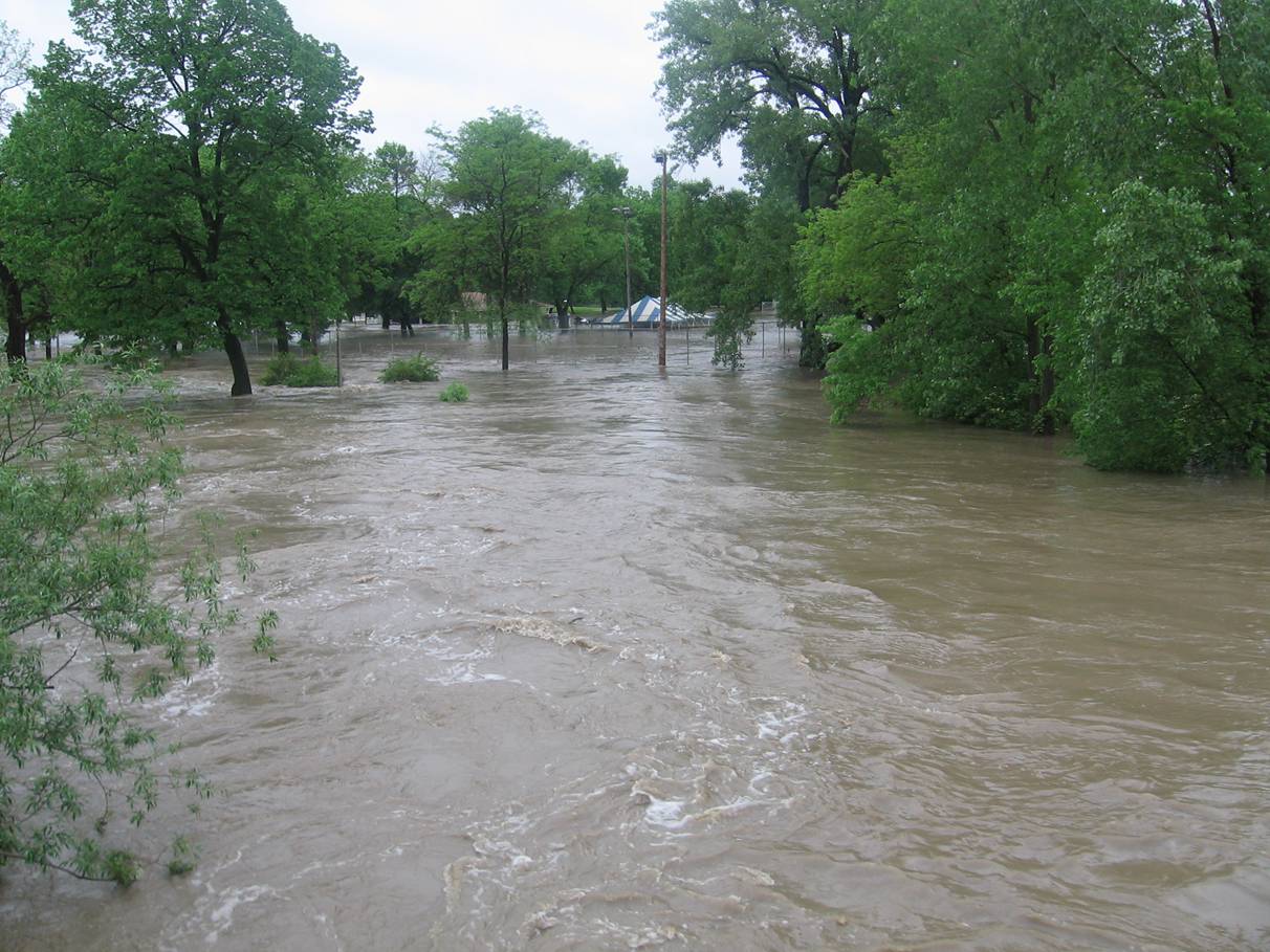
The heavy rainfall produced flash flooding problems across Southern Wisconsin on several days, with severe river flooding throughout the entire period. Both the rainfall and flooding aspects will be discussed in this writeup, with the heavy rainfall just below, and the flooding further down this web page.
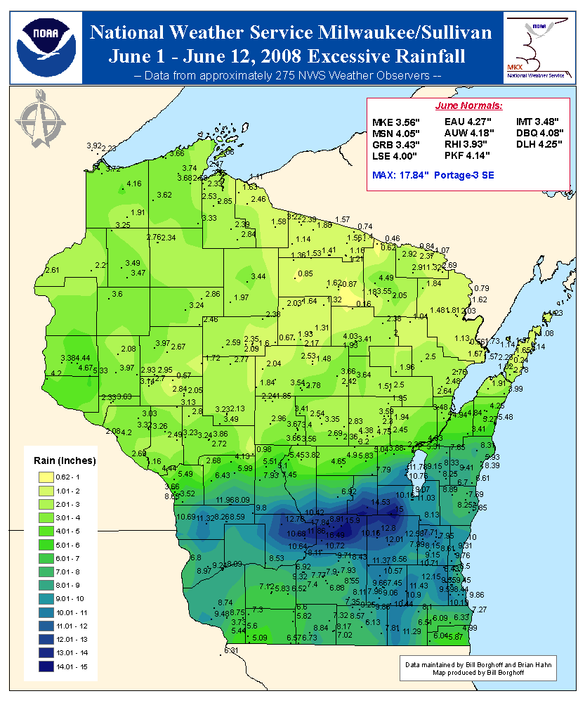
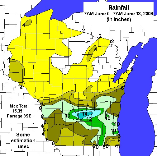
As you can see in these two maps, rainfall totals across Southern Wisconsin during the first couple weeks in June ranged between 6 and 12 inches, with an isolated corridor of 12-16 inches from Northern Sauk County into Northwest Dodge County. Amazingly, these maps look more like a snowfall total map from a winter storm than a rainfall total map from June!
A few rainfall records were broken at Milwaukee. On June 7th, 4.93" of rain broke the old record rainfall for the date which was 2.44" (June 7, 1916). On June 8th, 2.25" of rain broke the old record rainfall for the date which was 1.24" (June 8, 1974). Combined, these two days of rainfall broke the 48-hour all time rainfall record at Milwaukee. The previous record was 6.84", which was recorded on August 5-6, 1986. On June 7-8, 2008, Milwaukee observed 7.18" of rain.
There was also a 24-hour period stretching from June 7th to June 8th where Milwaukee recorded a 24-hour precipitation total of 5.70". This was the 3rd highest 24-hour precipitation total at Milwaukee.
Officially, Milwaukee observed 12.27" of rain for the month of June. This easily breaks the record for highest June rainfall total. The previous record was 10.13", set in 1917.
The 10.13" of rain in June 1917 was also the record for highest rainfall total in any month at Milwaukee all time. Therefore, the 12.27" of rainfall observed at Milwaukee also sets a new record for maximum monthly rainfall.
Madison also broke some rainfall records in June 2008. On June 7th, 2.23" of rain broke the old record rainfall for the date which was 2.01" (June 7, 1993). On June 8th, 4.11" of rain broke the old record rainfall for the date which was 1.40" (June 8, 1874). On June 12th, 2.57" of rain broke the old record rainfall for the date which was 1.20" (June 8, 1877).
Officially, Madison observed 10.93" of rain for the month of June. This easily breaks the record for highest June rainfall total. The previous record was 9.95", set in 1978.
The 10.93" of rain in June 2008 also places 2nd on the list of record highest rainfall totals in any month at Madison all time, tied with the 10.93" of rain that fell in July of 1950. The record is 15.18" of rain, set in August of 2007.
There was also a 24-hour period stretching from June 7th to June 8th where Madison recorded a 24-hour precipitation total of 5.27". This was the 2nd highest 24-hour precipitation total at Madison, and only 0.04" behind the record of 5.31", set on September 7-8, 1941.
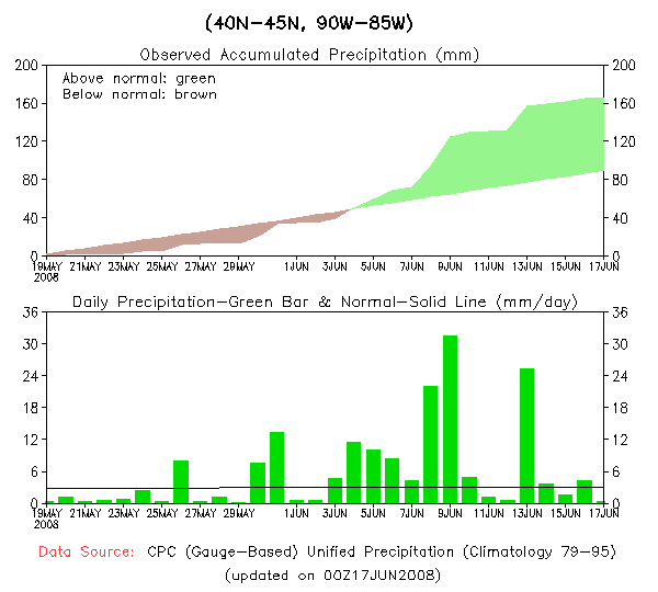
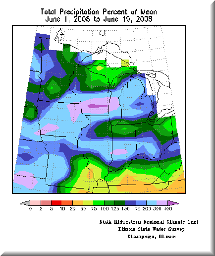
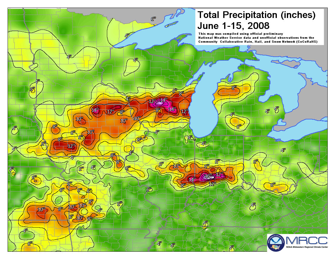
The amount of rainfall over the first half of June put Southern Wisconsin well above normal precipitation totals for that time of year. In fact precipitation for much of the spring and into June was well above normal. According to the Midwest Regional Climate Center graphic above, precipitation amounts from June 1st to June 19th were over 400% of normal values across portions of Southern Wisconsin. In fact, the most anomalously high precipitation values were observed over Southern Wisconsin. The exceptional amount of rainfall in a short period of time allowed for widespread flooding issues to develop.
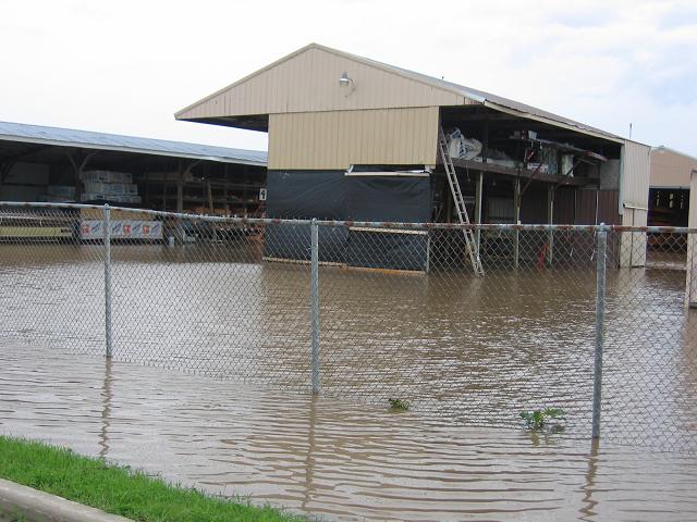
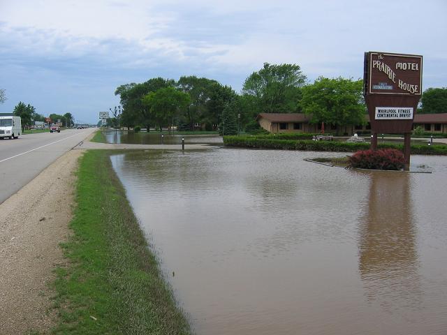
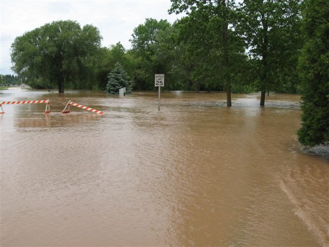
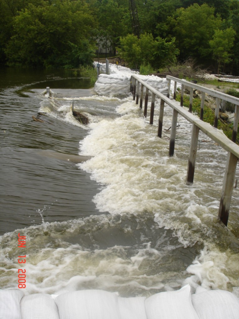
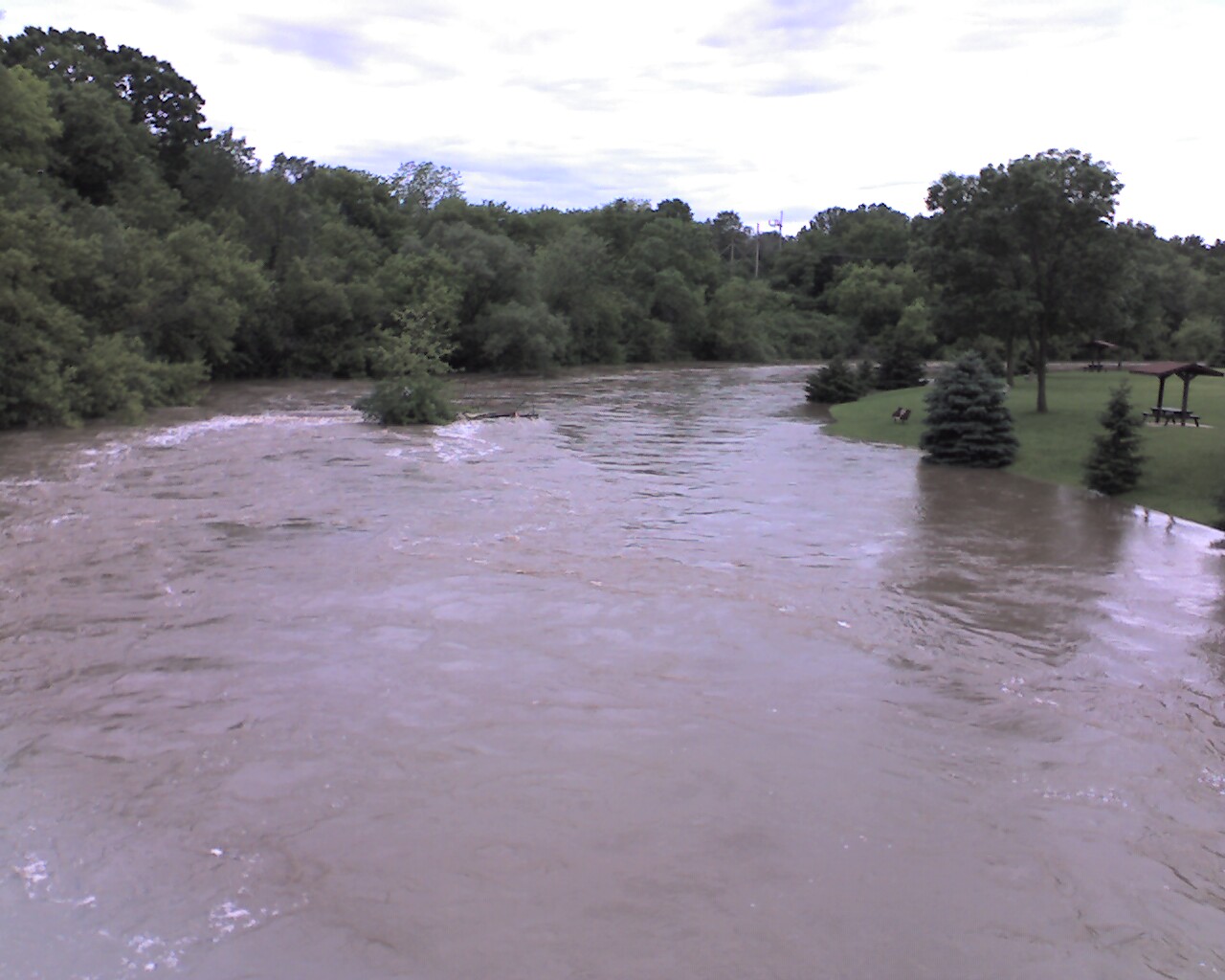
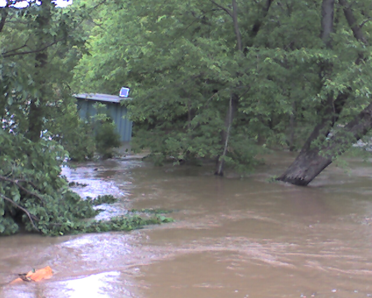
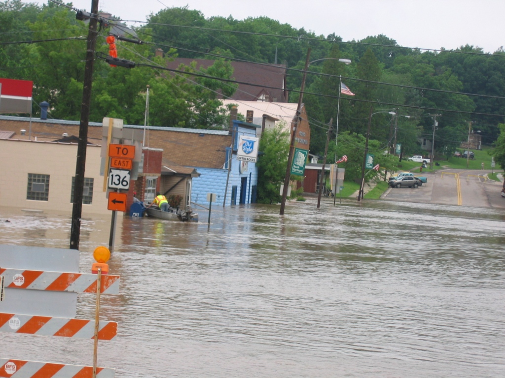
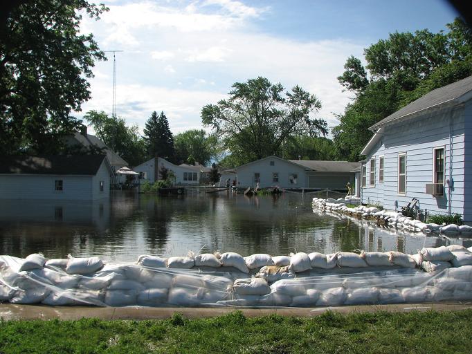
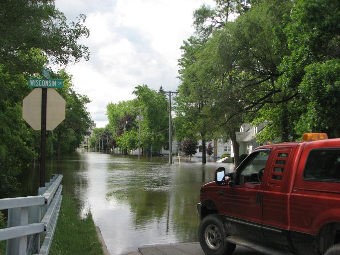
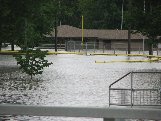
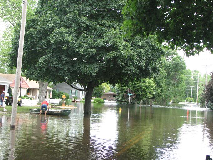
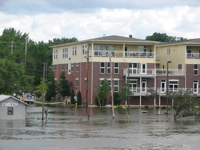
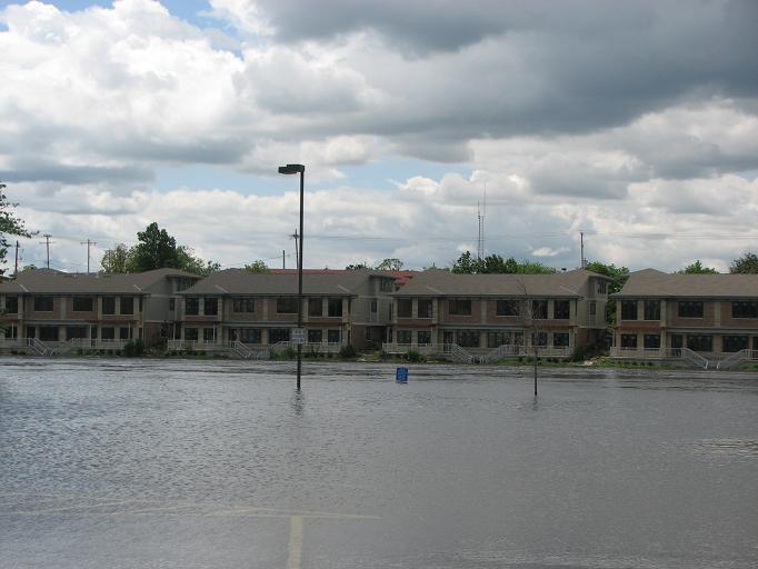
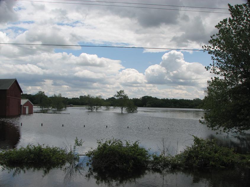
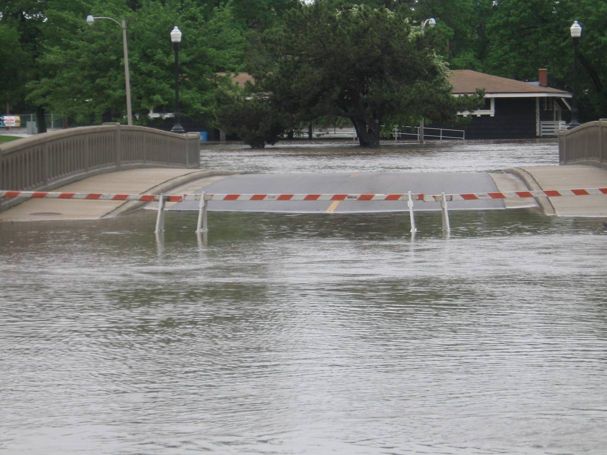
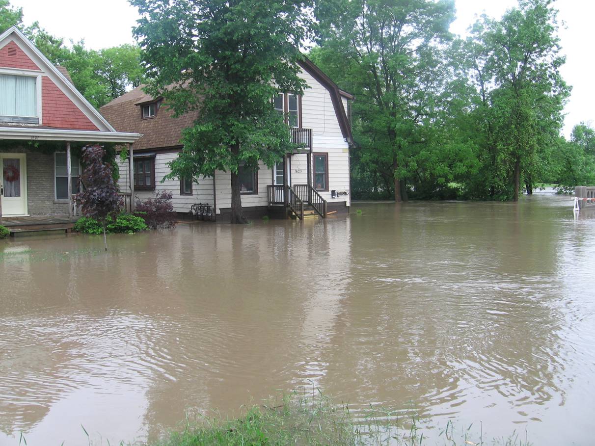
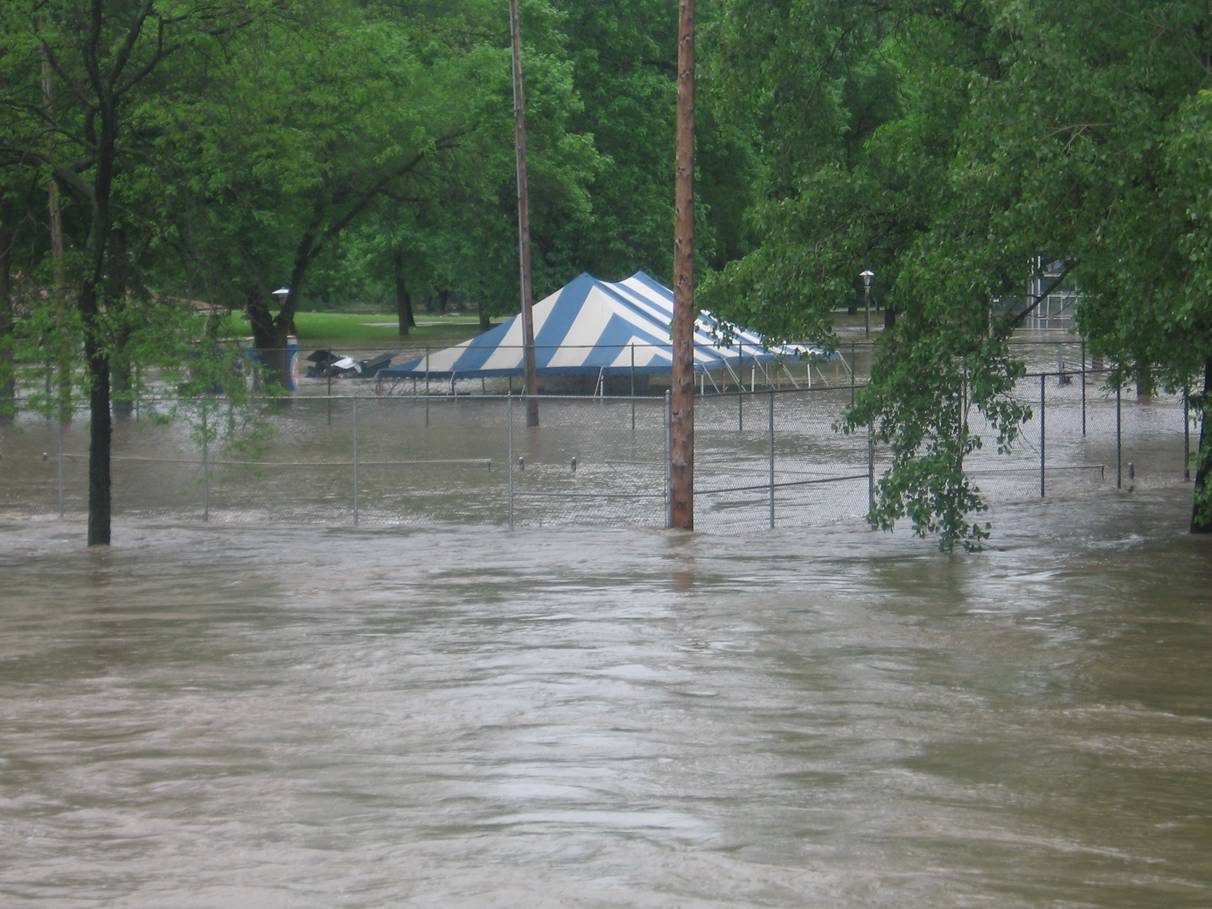
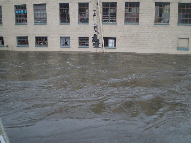
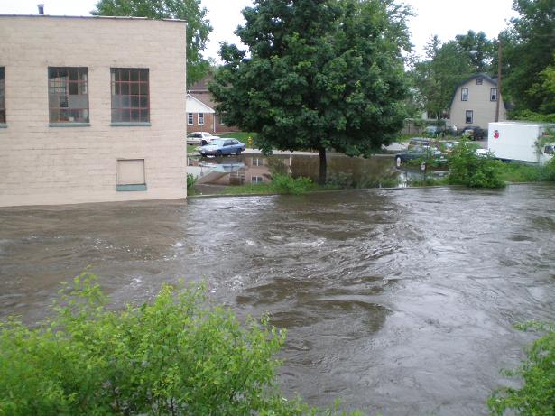
Flash flooding was especially a problem on June 7th and June 8th, when a large portion of the total rainfall during the first two weeks in June 2008 fell. Flash flooding was reported as early as 2:43 PM on June 7th when water was reported to be over Interstate-39 where it met Highway 78 in Columbia County. After that, numerous reports of flash flooding were received from across Southern Wisconsin from June 7th through June 8th. The hardest hit areas by flash flooding appeared to be from Sauk County into Columbia County, and then Waukesha County into Milwaukee County.
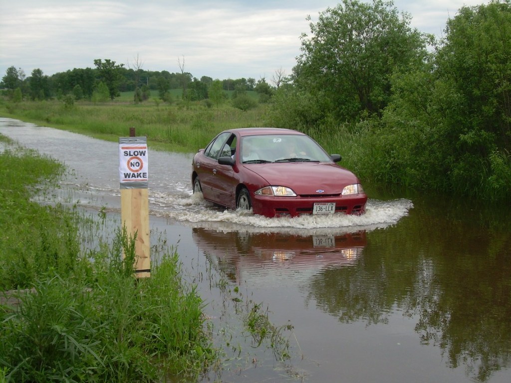
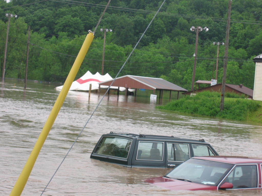
On June 7th, numerous road washouts were reported in Sauk and Columbia Counties. A few bridges were washed away in Sauk County around Reedsburg and La Valle. In Waukesha and Milwaukee Counties, vehicles were stalling and floating in water at some intersections and in some parking lots. Manhole covers were being blown off from water pressure, and a few roads were also washing out. Just west of Downtown Milwaukee, around 2 feet of water was reported, causing damage to buildings and cars were floating in intersections. Some people in Milwaukee County had to abandon their vehicles and swim to safety. At one point, a section of Interstate-894 had to be closed near 27th street due to water over the freeway and on/off ramps. Mitchell International Airport was closed at 8 PM due to major flooding, and the contract observer there reported waist deep water flowing into their building. Also, a state of emergency was declared in Milwaukee.
Outside of those four counties, sporadic reports of flash flooding were received on June 7th. Notably, a spotter 4 miles north-northeast of Sun Prairie (Dane County) received 1.65" of rain in 20 minutes, and then later received another 0.40" of rain in 10 minutes. These extremely heavy rainfall rates were probably typical of what was being observed elsewhere around the area, given the extremely moist air mass in place across the region.
On June 8th, yet another round of heavy rainfall only exacerbated flooding problems by producing more episodes of flash flooding across Southern Wisconsin. Many road closures and washouts were reported from numerous counties. The Kilbourn Tunnel in Milwaukee had to be closed due to the flash flooding.
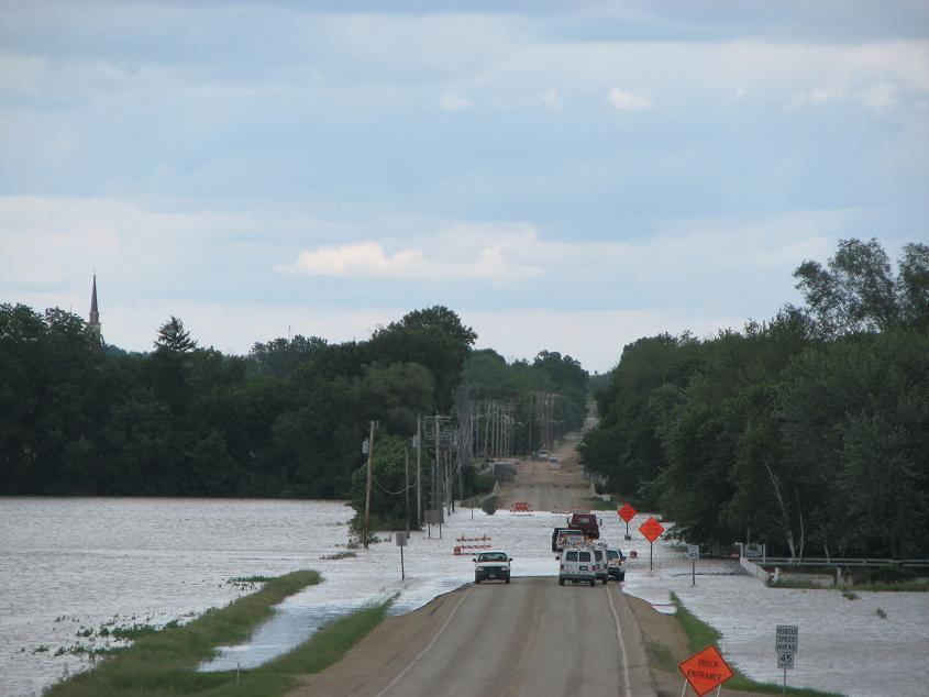
On June 12th, more heavy rainfall caused flash flooding issues, but this time in some areas that had not previously reported severe flash flooding. Fond du Lac County was hit particularly hard. Most city roads in Fond du Lac were reported to be underwater. The Fond du Lac River was over bridges in some places. In Ripon, over half the roads were closed due to flash flooding. 3 to 4 feet of standing water was observed over portions of the southern half of the city. In Columbia County, Interstate 90/94 was closed between mile markers 92 and 106, and numerous roads were washed out across the county. In Dodge County, some residences in Beaver Dam had about 2 feet of water surrounding the homes.
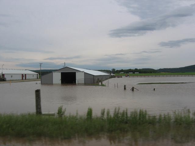
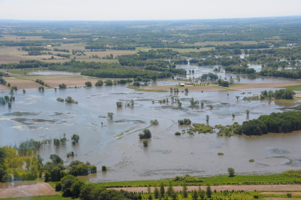
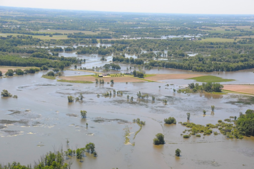
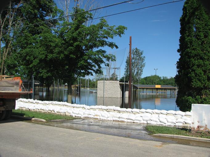
Numerous area rivers hit record levels during a major flooding event over Southern Wisconsin in the early half of June. 25 locations reached record high levels. That represents over half of the 43 river gauges in the NWS Milwaukee/Sullivan hydrologic service area. Most of those that did not reach record levels had crests in the top 5 all time. Some of the data is missing, due to damage to the gauges, communications, and/or loss of power. Therefore, some of these crests may have been higher than the data suggests.
Also, the Cooperative Institute for Satellite Studies at the University of Wisconsin Madison has developed a comparison of satellite images before and after the flooding. To view these images, click here for their blog archive.
Jump to Spring Creek
Jump to the Fox River (North)
Jump to the Rock River
Jump to the Crawfish River
Jump to the Beaver Dam River
Jump to the Bark River
Jump to the Mukwonago River
Jump to the Oak Creek
Jump to the Milwaukee River
Jump to the Root River
Jump to the Fox River (South)
Information for the Baraboo River, including the gages at Rock Springs, West Baraboo and Baraboo is provided below.
|
At Rock Springs
|
|
|
At West Baraboo
|
|
|
At Baraboo
|
|
|
At La Valle
|
|
|
At Lodi
|
|
|
At Berlin
|
|
|
At Waupun
|
|
|
At Horicon
|
|
|
At Watertown
|
|
|
At Jefferson
|
|
|
At Fort Atkinson
|
|

|
At Newville
|
|
|
At Indianford
|
|
|
At Afton
|
|
|
At Milford
|
|
|
At Beaver Dam
|
|
|
At Rome
|
|
|
At Mukwonago
|
|
|
At South Milwaukee
|
|
|
At Cedarburg
|
|
|
At Milwaukee
|
|
|
At Franklin
|
|
|
Canal near Raymond
|
|
|
at Racine
|
|

|
At Waukesha
|
|
|
At Burlington
|
|
|
At New Munster
|
|