
Widespread, life-threatening considerable flash flooding is expected in south-central Texas through at least Friday. Catastrophic river flooding and rapid rises on small streams, arroyos, and typically dry washes are expected in the Texas Hill Country. Wildfire smoke is impacting air quality across much of the Great Lakes region into the Northeast U.S. with Air Quality Alerts in effect. Read More >
Overview
|
A stalled frontal system brought a prolonged period of heavy rain to Wisconsin. The rain began in the early morning hours on September 21, 2016, and persisted through the morning of the 22nd. The western portions of the state were hit the hardest, where upwards of 7 inches fell in some locations. Much of the rain in this area fell during the morning of the 21st, resulting in flash flooding in several locations.
Portions of south central Wisconsin also saw quite a bit of rain, with 4-5 inches falling in the Baraboo River Valley. Fortunately, that rainfall was fairly spread out through the day of the 21st, and very little flash flooding was observed in that area. Herzog |
 A radar loop from midnight, September21 through 10 am September 22. |
Hydrographs
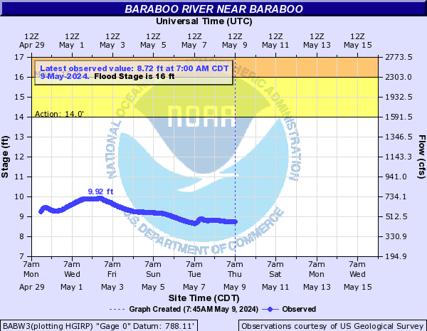
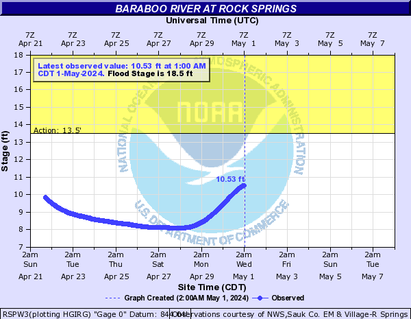
While very little in the way of flash flooding was observed within the Milwaukee/Sullivan forecast area, portions of the Baraboo and Wisconsin river valleys did receive an excessive amount of rain. This resulted in river flooding along both of those rivers. Currently, the Baraboo River has reached or is expected to reach flood stage at Baraboo, Reedsberg, and Rock Springs, and the Wisconsin River is expected to reach flood stage at Portage.
Flooding
 |
 |
 |
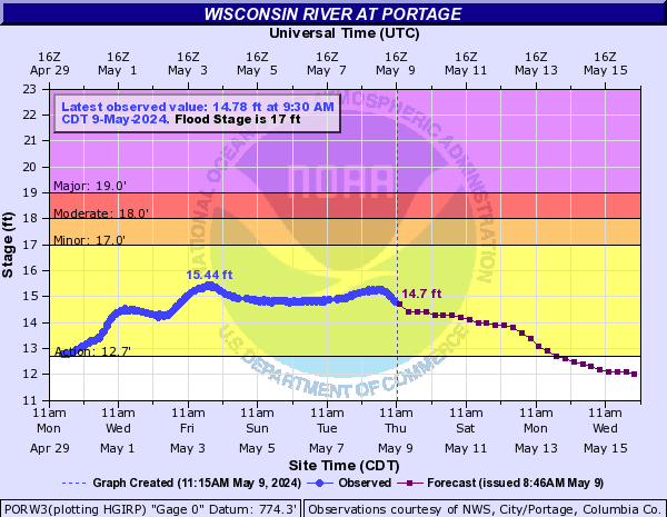 |
| Baraboo River levels at Reedsberg | Baraboo River levels at Baraboo | Baraboo River Levels at Rock Springs | Wisconsin River levels at Portage |
Rain Reports
 |
 |
 |
 |
Media use of NWS Web News Stories is encouraged! Please acknowledge the NWS as the source of any news information accessed from this site. |
|

