
Tropical Depression Two is expected to gradually strengthen and could bring tropical storm conditions to the Florida Panhandle beginning late Monday. Areas of flash flooding will be possible through Thursday along the eastern and central Gulf Coast. Severe thunderstorms will develop and move along a cold front crossing the Upper Midwest Monday, and through the Ohio Valley/Mid-Atlantic on Tuesday. Read More >
...Severe Storms Possible this Afternoon and Evening...
Strong to severe thunderstorms are possible this afternoon and evening across southern Wisconsin.
Main Hazards:
We're expecting thunderstorms to begin developing within the next few hours. Initially, these storms will be relatively weak and isolated, but will gradually intensify and become more widespread as we move into the late afternoon.
Here is the latest video update on the severe potential.
If you get severe weather, send us your report! Key elements: Time - Location - Type of severe weather/damage, etc...
Here is a graphic about reporting severe weather to us:

You can use our Facebook and Twitter pages to send us reports.
Here is our latest Weather Story:

Here is a graphic that lists the thunderstorm risk categories from the Storm Prediction Center:

(Key to interpreting categories/colors)
Here is a zoomed-in look at the (Day 1) Storm Prediction Center Convective Outlook for southern Wisconsin:

Here is that same outlook for a broader region:

Regional Radar Views:
 |
 |
Local Radar:

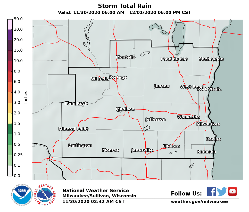
Expected Rainfall Amounts:
 |
 |
Links of interest:
Local Storm Report Graphic
Local Storm Report Text
SPC Local Storm Reports
Submit a Storm Report
Hazardous Weather Outlook
Forecast Discussion
Severe Thunderstorm Warnings
Tornado Warnings
Flash Flood Warnings
Severe Weather Statements
SPC Meso-Analysis Page
Our Severe Weather Page
Wood/SPM
NWS Milwaukee/Sullivan, WI

