National Weather Service United States Department of Commerce

Heavy Rain and Flash Flooding Threat in Montana; Severe Thunderstorms in the Middle Missouri Valley

A low pressure system will bring heavy to excessive rainfall and high winds across Montana this afternoon. Heavy rainfall totals may lead to scattered flash flooding concerns. A line of showers and strong to severe thunderstorms will move into the mid Missouri Valley region this afternoon producing severe winds and isolated large hail with stronger storms. Read More >

Welcome to the National Weather Service Wisconsin Fire Weather Decision Support Services Page!
Forecasts on this page are generally updated once per day by 5:30 AM.
This page is maintained by the National Weather Service Milwaukee/Sullivan, Wisconsin Forecast Office.

Click here for the Wisconsin Fire Weather Dashboard from the
National Weather Service Duluth, Minnesota Forecast Office.

 
Today
Hover over thumbnails below to view larger image.
Min RH
>=0.1"
Fire Wx Risk
>=0.1"
High Temp
>=0.1"
Aftn Wind
>=0.1"
Precip Today
>=0.1"
Precip Tonight
>=0.1"
Transport Wind
>=0.1"
Mixing Height
>=0.1"
Haines
>=4"
Probability Graphic
Tomorrow
Hover over thumbnails below to view larger image.
Min RH
>=0.1"
Fire Wx Risk
>=0.1"
High Temp
>=0.1"
Aftn Wind
>=0.1"
Precipitation
>=0.1"
Precip Tom Ngt
>=0.1"
Transport Wind
>=0.1"
Mixing Height
>=0.1"
Haines
>=4"
Probability Graphic
Day 3
Hover over thumbnails below to view larger image.
Min RH
>=0.1"
Fire Wx Risk
>=0.1"
High Temp
>=0.1"
Aftn Wind
>=0.1"
Precipitation Day
>=0.1"
Precipitation Night
>=0.1"
Transport Wind
>=0.1"
Mixing Height
>=0.1"
Haines
>=4"
Probability Graphic
Day 4
Hover over thumbnails below to view larger image.
Min RH
>=0.1"
Fire Wx Risk
>=0.1"
High Temp
>=0.1"
Aftn Wind
>=0.1"
Precipitation
>=0.1"
Precipitation
>=0.1"
Probability Graphic
Day 5
Hover over thumbnails below to view larger image.
Min RH
>=0.1"
Fire Wx Risk
>=0.1"
High Temp
>=0.1"
Aftn Wind
>=0.1"
Precipitation
>=0.1"
Precipitation
>=0.1"
Probability Graphic
Day 6
Hover over thumbnails below to view larger image.
Min RH
>=0.1"
Fire Wx Risk
>=0.1"
High Temp
>=0.1"
Aftn Wind
>=0.1"
Precipitation
>=0.1"
Precipitation
>=0.1"
Probability Graphic


2024 Wisconsin Fire Weather Annual Operating Plan


Spot Forecast Requests/Monitoring - Official Use Only

Wisconsin Fire Weather Dashboard from the National Weather Service Duluth, Minnesota


Fire Weather Planning Forecasts


NFDRS Point Forecasts

Weather Story Images
(Most Significant Weather In Next 7 Days)
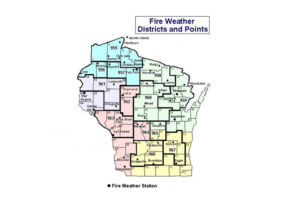

       fire districts map Fire Districts and
NWS Zone Numbers Map


Fire Weather Watches/Red Flag Warnings


Current Watches, Warnings And Advisories For Wisconsin

National Fire Weather Outlooks


Temperature And Precipitation Outlooks


Observations


Regional Radar Imagery


Local Radar Imagery


Satellite Fire Detection


Fuel and Soil Moisture Maps


Related Links

Many of the links on the page are courtesy of the U.S. Forest Service.

Other Fire Weather-related links include: