
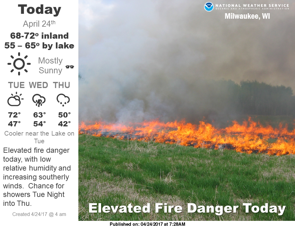
Dangerous heat will expand from the Gulf Coast into the Southern Plains and Desert Southwest through week's end. Additional extreme heat impacting the Pacific Northwest will shift to the northern Plains by the weekend. Tropical Storm Bertha is expected to continue to impact portions of the northern Gulf Coast from the western Florida Panhandle to southeastern Louisiana through tonight. Read More >
|
Sheboygan TAF (Refresh to ensure current TAF is displayed):
		171700
TAF
KSBM 171746Z 1718/1818 23008KT P6SM VCTS BKN035CB
      TEMPO 1718/1722 4SM TSRA BR BKN035CB
     FM172200 17007KT 6SM -TSRA BR OVC045CB
     FM180300 09005KT 3SM -SHRA BR VCTS OVC040CB
     FM180600 03004KT 3SM BR OVC035
     FM180800 VRB03KT 2SM BR OVC025
     FM181500 08007KT 3SM BR OVC035=
|
This is not an official Terminal Aerodrome Forecast (TAF) - it is provided for guidance and information only to assist the FAA during this time of higher traffic volume. |
| Forecast Information | Observed Weather | Severe Weather Info |
|
Point forecast for Sheboygan Airport Hourly forecast for Sheboygan Airport Wisconsin Graphical Forecast (NDFD) Hourly Forecast Graphics for Southern WI |
|
NOTE: this page should be refreshed to display the most recent information. |
|||||||||||||||||||||||||||||||||||||||||
|
|
|
||||||||||||||||||||||||||||||||||||||||


