Click/tap image to enlarge | Rain chances increase tonight, as showers and storms across the waters push onshore. Some of this activity will be capable of producing locally heavy rainfall, mainly along the coast, which may lead to flooding issues along roadways and poor drainage areas.
Click/tap image to enlarge | Rounds of showers will move onshore over the next few days. On the coast, the rain may become heavy at times leading to a localized flooding risk.
Click/tap image to enlarge | A Small Craft Advisory is in effect for the coastal waters of east central Florida. North 15-25 knots, with occasional gusts to 30 knots offshore will combine with a building swell to produce seas up to 12 feet offshore.
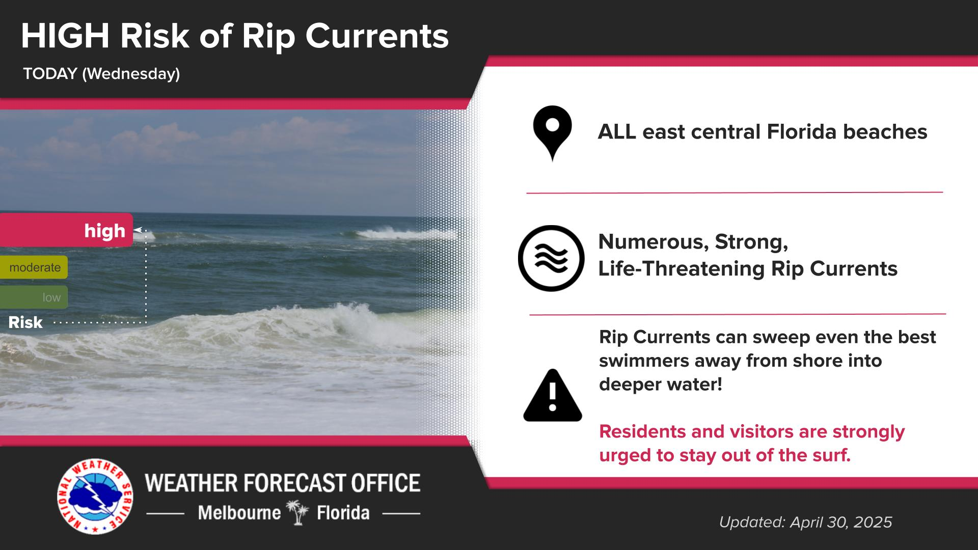
Click/tap image to enlarge | Breaking waves of 6 to 9 feet at local beaches as well as moderate beach and dune erosion are forecast. A High Surf Advisory as well as a high risk of rip currents will exist at all local beaches for the foreseeable future.


 Interactive Radar
 Regional Satellite
 Tropical Weather