Click/tap image to enlarge | Pooling moisture south of a stalled frontal boundary will result in increasing rain chances through the weekend. There is a Marginal Risk for excessive rainfall across all of east central Florida today and Saturday. Multiple rounds of training showers and storms are possible.
Click/tap image to enlarge | Numerous showers and lightning storms are forecast to develop by early afternoon and push east and off the coast by sunset. A few strong storms will produce gusty winds and frequent lightning. Locally heavy rain will cause temporary flooding of some low lying or poor drainage areas. Seasonably hot in the low 90s with peak heat indices 100 to 105.
Click/tap image to enlarge | There is a Marginal Risk for excessive rainfall for east central Florida today through around 8PM. The potential exists for localized rainfall amounts up to 3-5" in slow moving storms. Heavy rainfall will have the potential to lead to flooding of low-lying areas and ponding of water on roadways.
Click/tap image to enlarge | A Moderate Risk for strong rip currents exists at all central Florida Atlantic beaches today. Always swim near a lifeguard and never enter the surf alone.
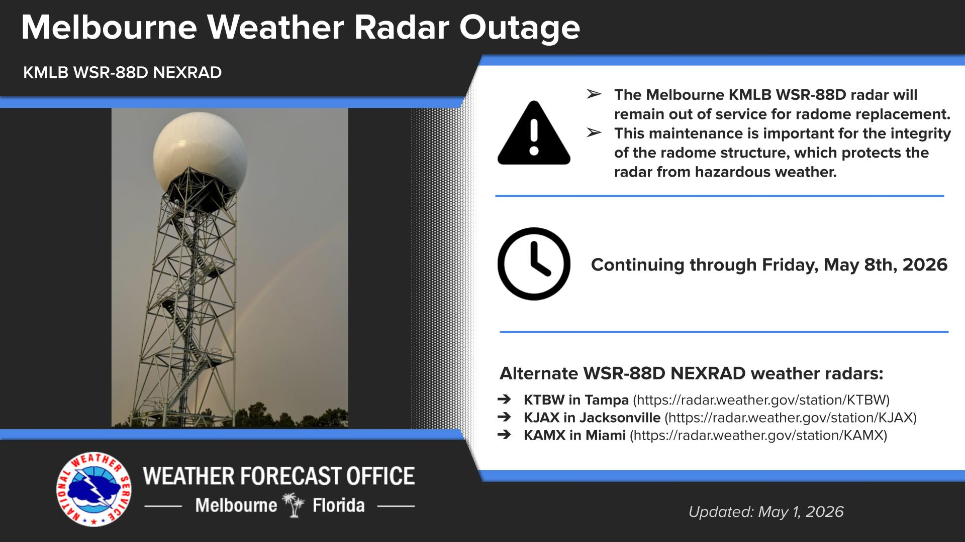


 Interactive Radar
 Regional Satellite
 Tropical Weather