There are no watches, warnings, or advisories at this time.
Today's Locally Heavy Rain
Rain Totals the Next Few Days
Tropical Outlook
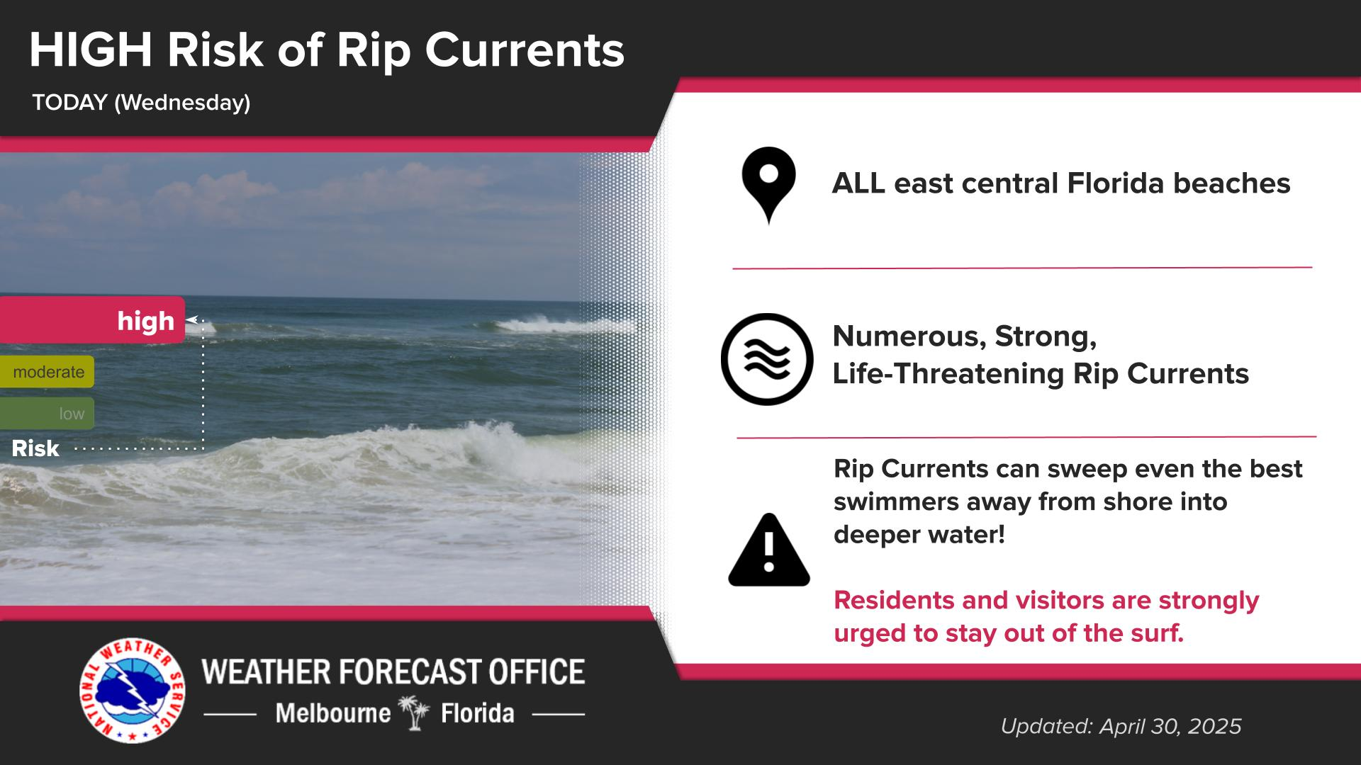
Rip Current Risk
Forecast
Climate
Click/tap image to enlarge | There is the potential (at least 5%) for locally higher amounts of 2-4” where there is a Marginal Risk for excessive rainfall.
Click/tap image to enlarge | Periods of showers and storms are forecast through mid-week with rainfall totals exceeding an inch in many spots. Higher end tallies may lead to some flooding of urban locales.
Click/tap image to enlarge | A disturbance has a Low (10%) chance of slow tropical or subtropical development along the Southeast U.S. coast within the next 7 days. Locally heavy rain is the main local impact.
Click/tap image to enlarge | A Moderate Risk of life-threatening rip currents exists at all central Florida Atlantic beaches today. Always swim near a lifeguard and never enter the water alone!


 Interactive Radar
 Regional Satellite
 Severe Weather