There are no watches, warnings, or advisories at this time.
Tonight
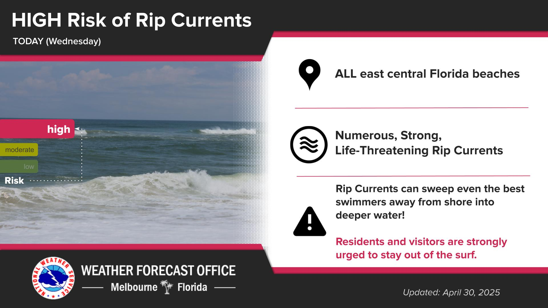
Rip Currents
Near Record Heat
HeatRisk
Drought Update
Forecast
Climate
Dry conditions continue tonight, with patchy fog possible across portions of Lake and Volusia counties. Dry and warm through the remainder of the week and into next week, with above normal highs anticipated across east central Florida.
Building high pressure over Florida will lead to persistent dry and warm conditions locally. Temperatures are anticipated to be above normal, with some spots nearing record temperatures. Heat index values in the 90s to mid 100s will be possible late this week into the weekend, along with a Moderate to Major HeatRisk. Proper hydration and frequent breaks inside of a cooled building and/or the shade will be needed if spending extended periods of time outdoors.
There is a Moderate HeatRisk each afternoon with a Major HeatRisk across portions of the Orlando metro on Monday. A Moderate HeatRisk affects most people sensitive to heat, especially those without effective cooling and/or adequate hydration. A Major HeatRisk affects anyone without effective cooling and/or adequate hydration.
Recent rainfall has brought some relief to the drought across east central FL. However, a hot and drier weather pattern forecast over the next week or two will stall improvement and may lead to drought conditions worsening once again through late May.


 Interactive Radar
 Regional Satellite
 Severe Weather