National Weather Service United States Department of Commerce
Click a location below for detailed forecast.

Last Map Update: Sat, Jul 11, 2026 at 10:50:44 am EDT

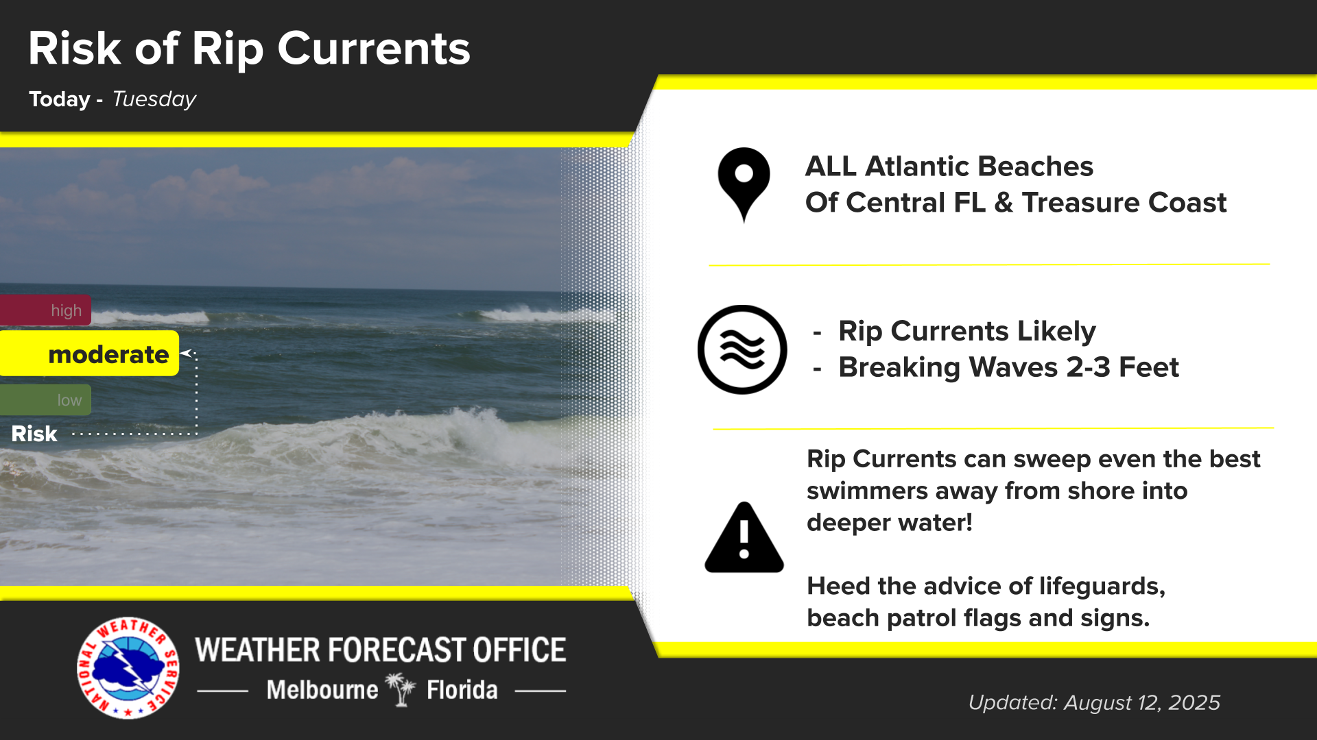
Click/tap image to enlarge | For East Central Florida, Still hot and afternoon storms return. Near normal rain and lightning storm chances 30% to 60%, highest inland in the late evening along the sea breeze collision. Stronger storms will be capable of frequent lightning, gusts to 55 mph, and heavy downpours. Afternoon highs in the mid to upper 90s across much of the area, pushing heat indices up to 110. Another Heat Advisory has been issued today from 11 AM to 7 PM. A Moderate risk of rip currents is forecast at the beaches. Always swim near a lifeguard and never swim alone.
Click/tap image to enlarge | Another Heat Advisory has been issued all of east central Florida for heat index values up to 110°F. The heat advisory is in effect from 11 AM to 7PM today. Remember to practice heat safety!
Click/tap image to enlarge | Above normal heat with highs in the mid to upper 90s for much of the area will continue into early next week. Peak afternoon heat indices in the triple digits will be near advisory criteria, especially this weekend. Widespread Major HeatRisk with areas of Extreme HeatRisk will continue through at least Sunday. Remember to practice heat safety!
Click/tap image to enlarge | A Moderate Risk of rip currents exists at the local Atlantic beaches today. Remember to always swim near a lifeguard and never enter the water alone!
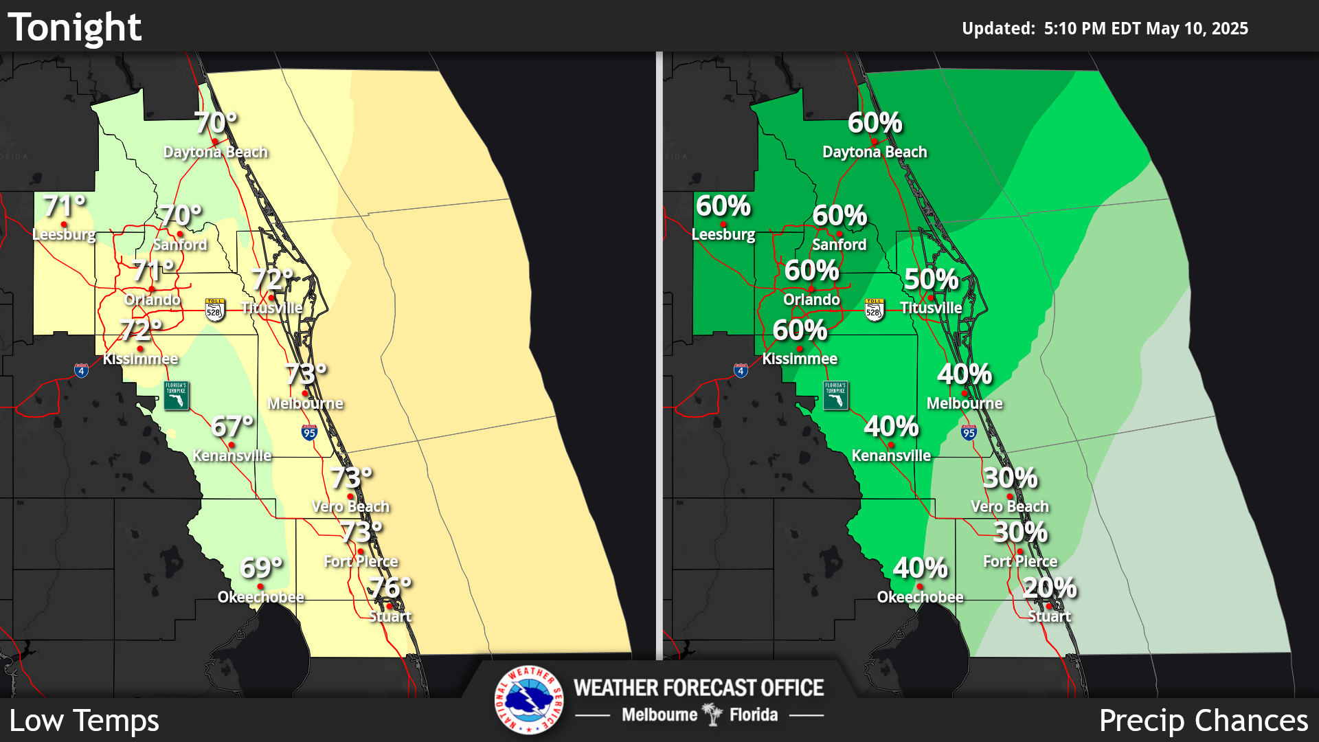
Click/tap image to enlarge | The latest forecast for East Central Florida.
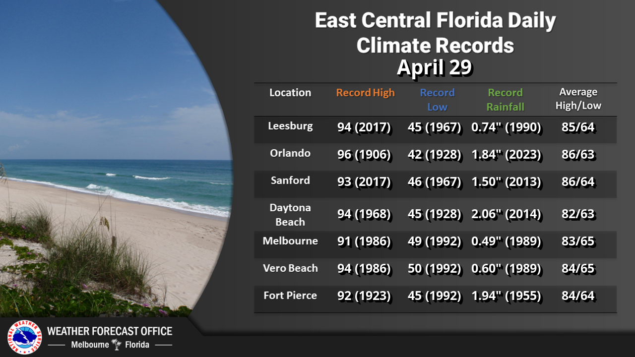
Climate information for today.

 
radar icon obs icon analysis icon hazards icon graphics icon text icon
Local Radar Observations Local Analysis Graphical Hazards Graphical Forecast Text Products
tropical icon beach icon climate icon report icon report icon
Storm Report


                                                                    Text Product Selector