There are no watches, warnings, or advisories at this time.
Upcoming Coastal Hazards
Major Hurricane Erin
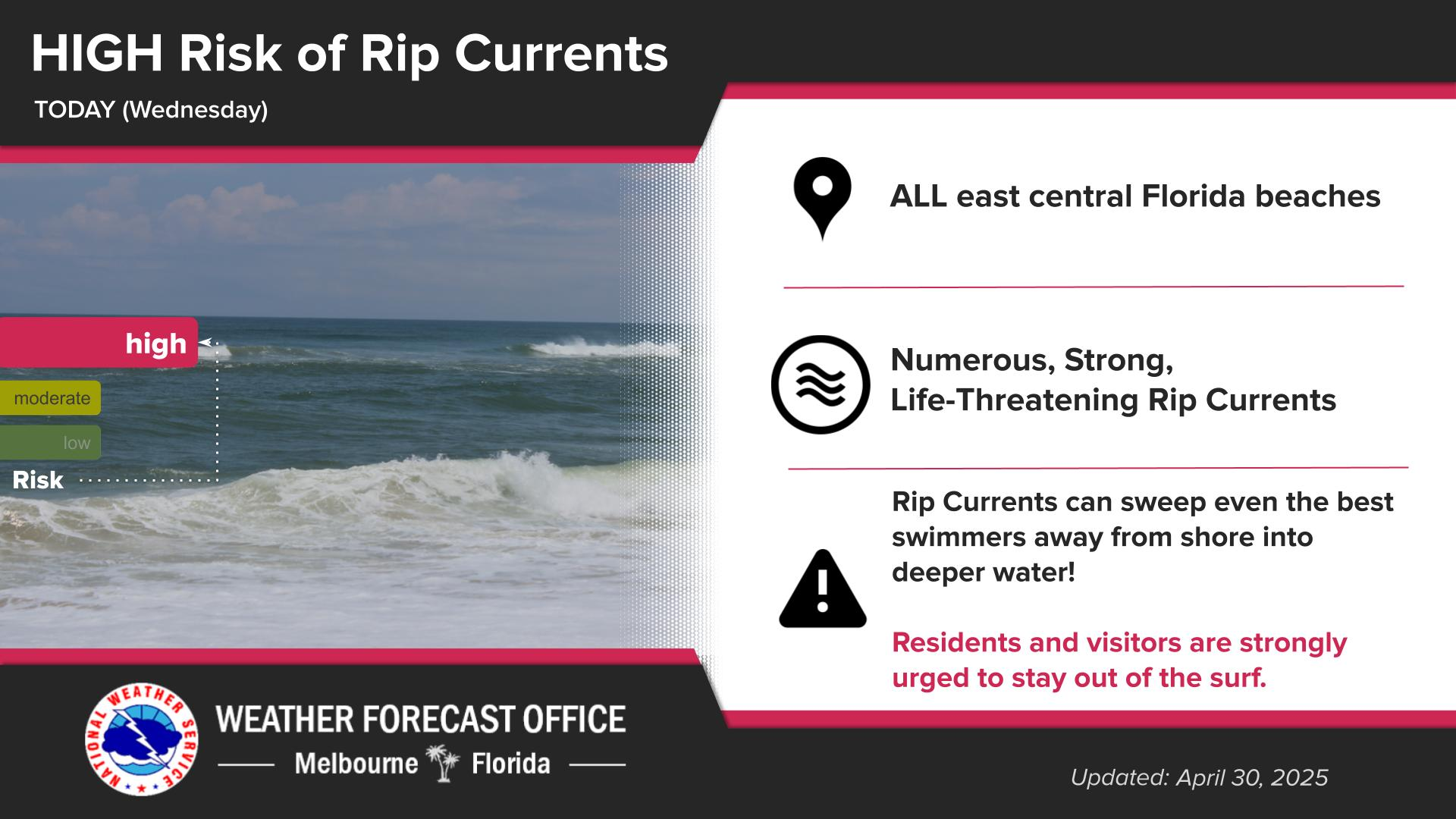
Today's Rip Risk
Forecast
Climate
Click/tap Image to Enlarge | Incoming large swells from Major Hurricane Erin are forecast to deliver multiple hazards for coastal and boating interests beginning Monday, including a HIGH risk for deadly rip currents. Very hazardous boating conditions will develop near inlets by midweek.
Click/tap image to enlarge | Erin remains a Major Hurricane. The forecast cone takes the storm well east of Florida, but coastal impacts are forecast next week. Surf, rip current, and boating impacts reach our coast starting Monday and will peak Tuesday-Thursday.
Click/tap Image to Enlarge | There is a moderate risk of dangerous rip currents at all Central Florida Atlantic beaches today. Always swim near a lifeguard!


 Interactive Radar
 Regional Satellite
 Tropical Weather