Click/tap image to enlarge | Multiple weather hazards persist over east central Florida as moisture interacts with strong onshore breezes through early this week.
Click/tap image to enlarge | Instances of minor coastal flooding are expected at high tide through early next week as onshore winds persist and astronomical tides increase.
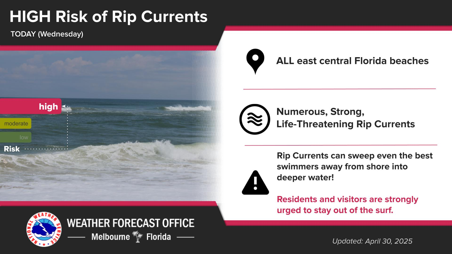
Click/tap image to enlarge | Breaking waves of 5 to 8 feet at local beaches as well as moderate beach and dune erosion are forecast. A High Surf Advisory as well as a high risk of rip currents will exist at all local beaches through early next week.
Click/tap image to enlarge | A Small Craft Advisory is in effect for the coastal waters of east central Florida. East winds 15-25 knots will combine with a long period swell to produce seas up to 11 feet offshore.


 Interactive Radar
 Regional Satellite
 Tropical Weather