
Dangerous heat will expand from the Gulf Coast into the Southern Plains and Desert Southwest through week's end. Additional extreme heat impacting the Pacific Northwest will shift to the northern Plains by the weekend. Tropical Storm Bertha is expected to continue to impact portions of the northern Gulf Coast from the western Florida Panhandle to southeastern Louisiana through tonight. Read More >
Overview ***Preliminary***
During the late afternoon and evening of June 11, 2018, thunderstorms developed near the surface low pressure system over Dodge county and ahead of a cold front that moved through in eastern Nebraska and a warm front that trailed southeast into western Iowa. In-between these fronts, there appeared to be a pre-frontal boundary that was northeast of Lincoln and west of Plattsmouth. Six confirmed tornadoes, large hail to baseball size and damaging winds accompanied the storms.
Tornadoes:
|
Tornado #1 Near Louisville
Track Map 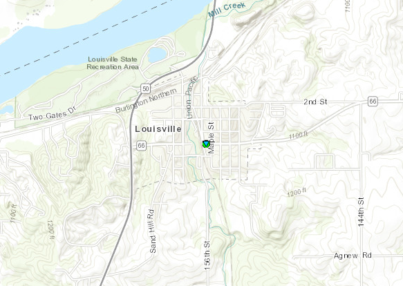  |
||||||||||||||||
|
Tornado #2 Between Louisville/Murray North
Track Map 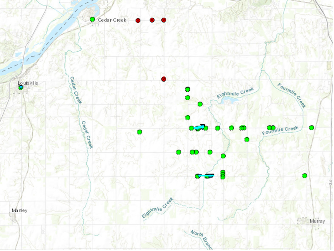 |
||||||||||||||||
|
Tornado #3 Between Louisville/Murray South
Track Map |
||||||||||||||||
|
Tornado #4 McPaul/West of Thurman
Track Map .PNG) |
||||||||||||||||
|
Tornado #5 Elk Creek
Track Map 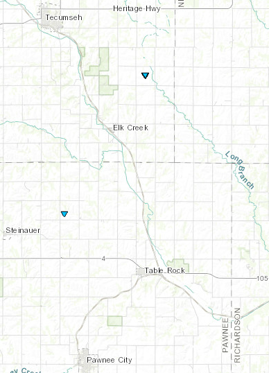 |
||||||||||||||||
|
Tornado #6 Near Steinauer/Table Rock
Track Map |
||||||||||||||||
The Enhanced Fujita (EF) Scale classifies tornadoes into the following categories:
| EF0 Weak 65-85 mph |
EF1 Moderate 86-110 mph |
EF2 Significant 111-135 mph |
EF3 Severe 136-165 mph |
EF4 Extreme 166-200 mph |
EF5 Catastrophic 200+ mph |
 |
|||||
 |
Media use of NWS Web News Stories is encouraged! Please acknowledge the NWS as the source of any news information accessed from this site. |
|

