
A Pacific storm will bring rain and high elevation snow from the Pacific Northwest into the Northern Rockies. A series of storms are expected to move through the Bering Sea bringing strong winds, heavy precipitation, and elevated water levels from the West Coast to northern Alaska. Read More >
Omaha/Valley, NE
Weather Forecast Office
New page available: https://www.weather.gov/oax/oaxdss
|
Current Conditions and Seven Day Forecast |
|
 |
 |
|
|
|
|
Choose a forecast product type (temperature, wind, cloud cover, etc) and desired time from the menu/slider bars at the top of the map. The map will update automatically. Use your mouse to zoom into/pan around on the map.
 |
 |
| 8-14 Day Temperature Outlook (CPC) |
8-14 Day Precipitation Outlook (CPC) |
 |
 |
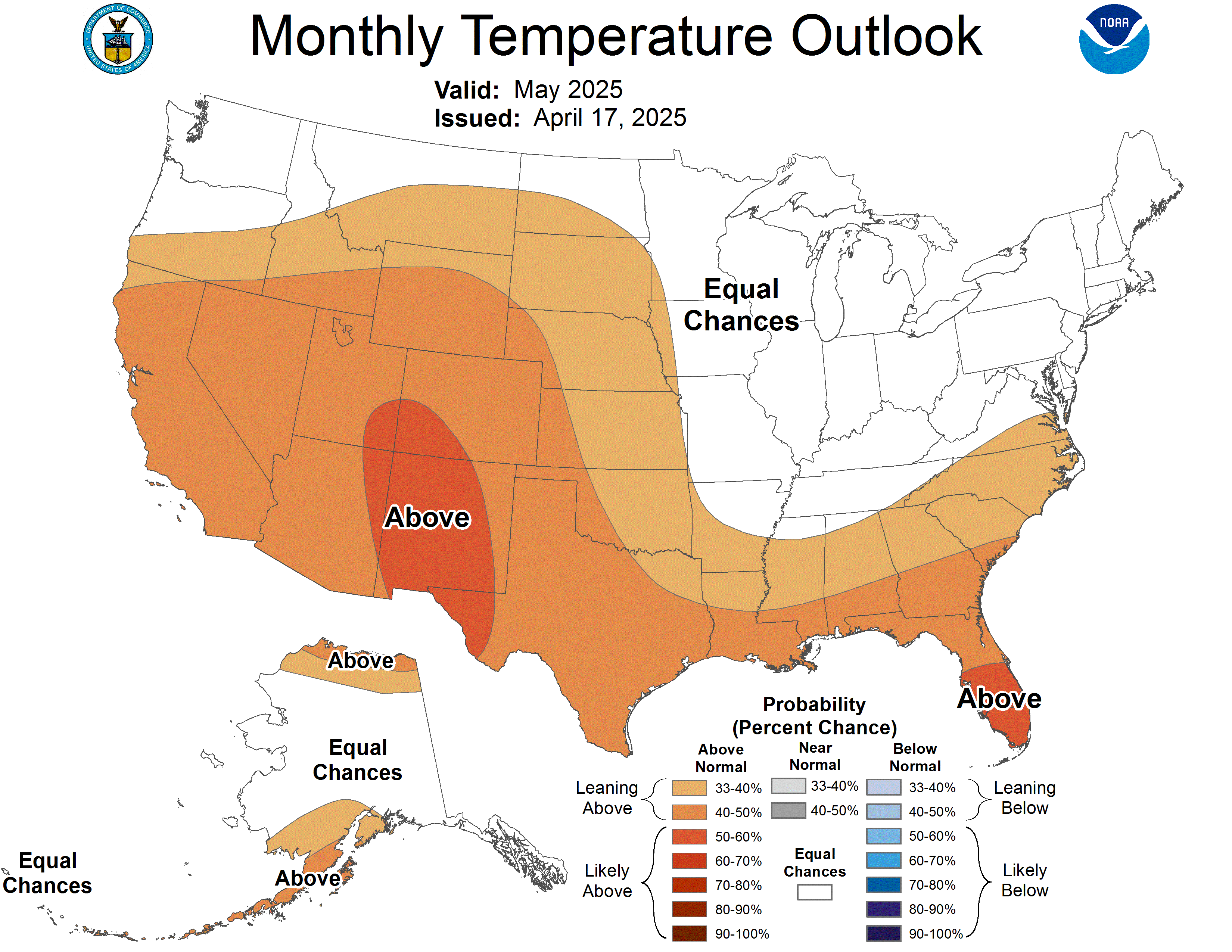
| One Month Temperature Outlook (CPC) |
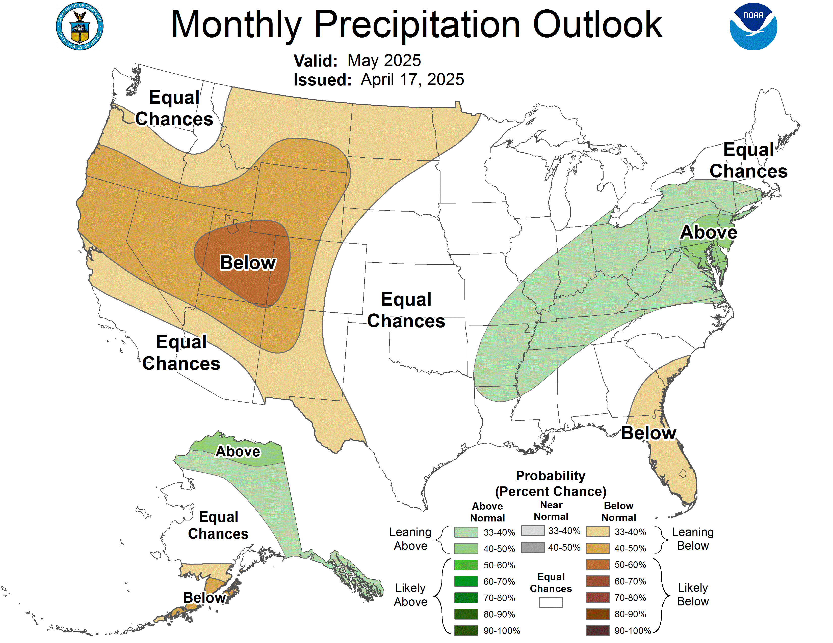
One Month Precipitation Outlook (CPC) |
Warnings/Hazards
Forecast Discussion
Winter Weather
Severe Weather
Fire Weather
Drought
Storm Prediction Center
SubmitReport
Rivers And Lakes
River Forecasts
Missouri River Overview
Platte River Overview
Elkhorn River Overview
Ice Jam Risk
Local Information
Latest Briefing Packet
Weather Monitor
Winter Monitor
Preparedness
Storm Spotters
About Us
Other Useful Links

US Dept of Commerce
National Oceanic and Atmospheric Administration
National Weather Service
Omaha/Valley, NE
6707 North 288th Street
Valley, NE 68064-9443
402-359-5166
Comments? Questions? Please Contact Us.


 Follow us on X
 Follow us on Facebook
 Follow us on YouTube
 OAX RSS Feed