National Weather Service United States Department of Commerce

Severe Thunderstorms Possible in the South Central U.S.; Wildfire Smoke Impacts in the North Central U.S.; Severe Space Weather

Scattered severe thunderstorms may bring large hail and isolated damaging winds this weekend over parts of the south central U.S. Smoke from Canadian wildfires will bring air quality issues to parts of the north central U.S. this weekend. Moderate to Severe geomagnetic storm conditions will remain possible into early Monday following a strong coronal mass ejection from the sun. Read More >

Click a location below for detailed forecast.

Last Map Update: Sun, Jun 1, 2025 at 7:14:12 am PDT

There are no watches, warnings, or advisories at this time.

On Sunday northwest winds of 10-20 MPH with gusts up to 30 MPH will occur across Central Washington (Methow and Okanogan Valleys, Wenatchee area, Waterville Plateau, and Moses Lake area). These winds combined with low relative humidity will lead to elevated fire weather conditions with fire spread of any new or existing fires.
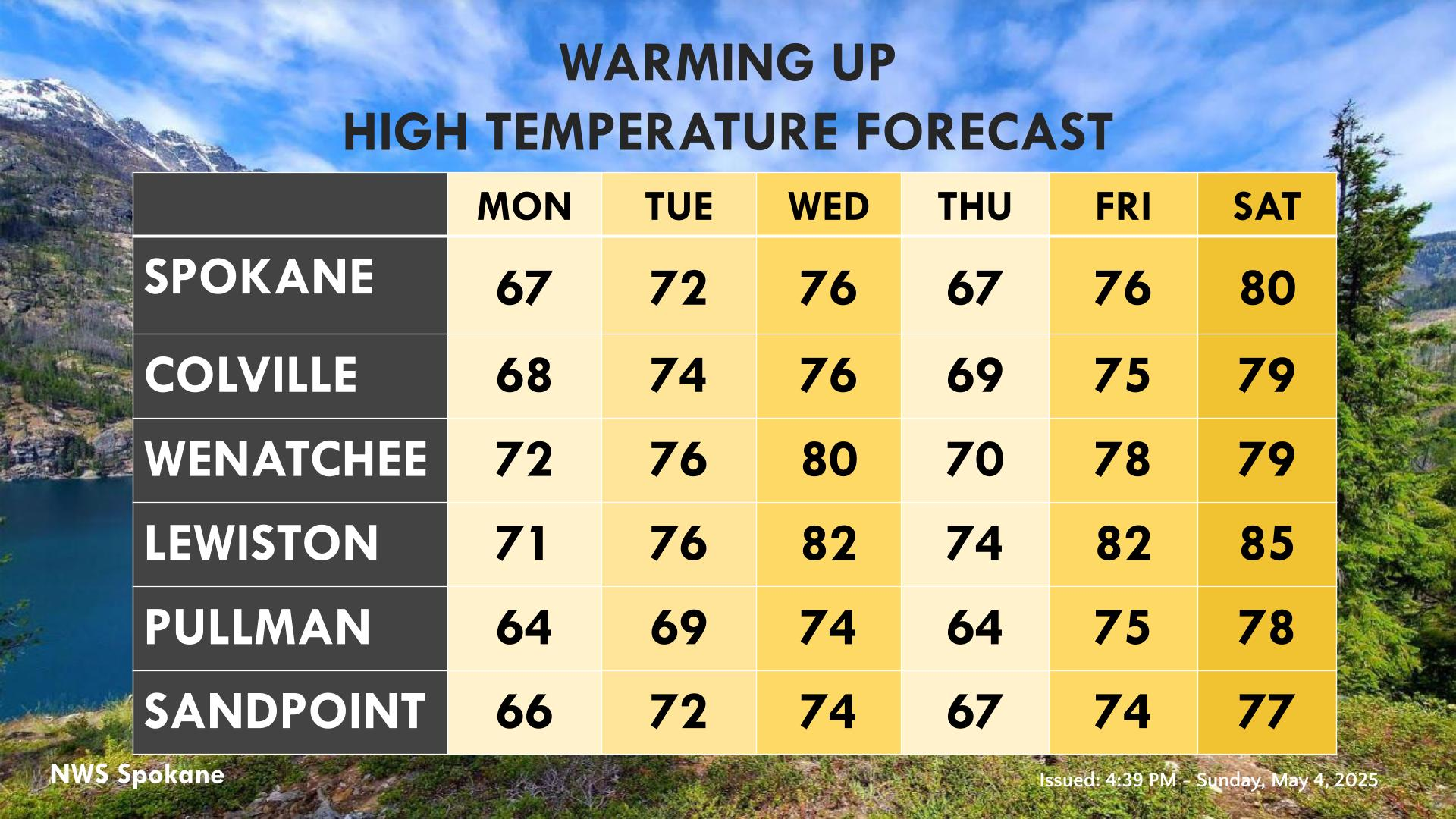
Temperatures will gradually warm this week starting on Tuesday after a cooldown for Sunday and Monday.
The latest outlook issued from the Climate Prediction Center for the month of June show elevated chances of warmer and drier than normal conditions.

Text Product Selector (Selected product opens in current window)