Summary | La Nina Conditions | Temperature Outlook | Precipitation Outlook | Drought Outlook
SYNOPSIS: Forecasters at NOAA's Climate Prediction Center released the U.S. Winter (December 2017-February 2018) Outlook on Thursday, October 19, 2017. La Nina conditions are favored to develop late this fall through the winter. Above normal precipitation is favored across all of Wyoming this winter. Above normal temperatures are favored across southern Wyoming.
| VIDEO: NOAA's Mike Halpert explains the Winter Outlook for 2017-18 (NOAA) |
 |
|
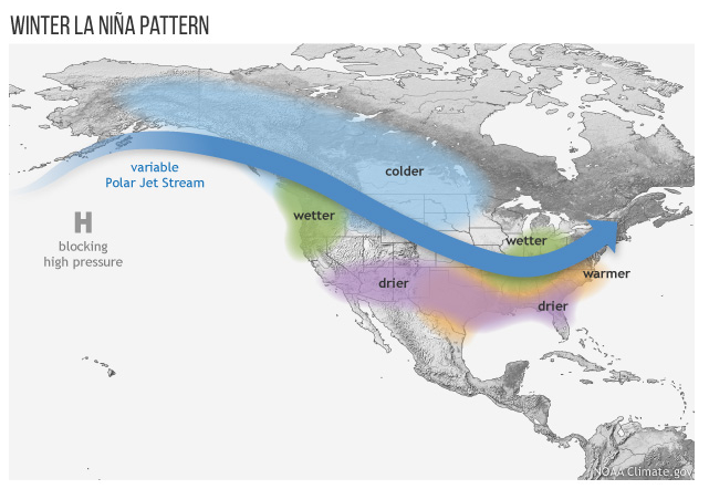
La Nina conditions are favored (55 to 65-percent chance) during the fall and winter of 2017-18. The map illustrates the typical impacts of La Nina on U.S. winter weather. The Pacific jet stream often meanders high into the North Pacific and is less reliable across the southern tier of the U.S. The Pacific Northwest tends to be cooler and wetter than average, and the southern tier of the U.S. tends to be warmer and drier than average. However, this does not mean that all of these impacts happen during every episode. Every event is somewhat different, and the influence on La Ninas and El Ninos on U.S. winter climate is a matter of probability, not certainty. |
 |
|
Click Image To Enlarge |
 |
|
Click Image To Enlarge |
| More Information: |
 |
Learn more about the National Weather Service's efforts to build a Weather-Ready Nation! |