
A heat wave over the Southwest will intensify this week, peaking and expanding into the Intermountain West and northern High Plains this weekend. Critical to extremely critical fire weather conditions are forecast from the Northwest and the northern Great Basin this weekend. Particularly Dangerous Situation Red Flag Warnings have been issued. Read More >
Temperature Graphs |Precipitation Graphs| Snowfall Amounts And Ranks
Time range of data used for temperature: October 1st to June 1st
Daily Temperature Data For Riverton Town

It started off slightly warmer than normal in October, but by November temperatures began dropping slightly below normal. From December through March temperatures were well below normal, with several record or near record low temperatures.
Daily Temperature Data For Lander Area
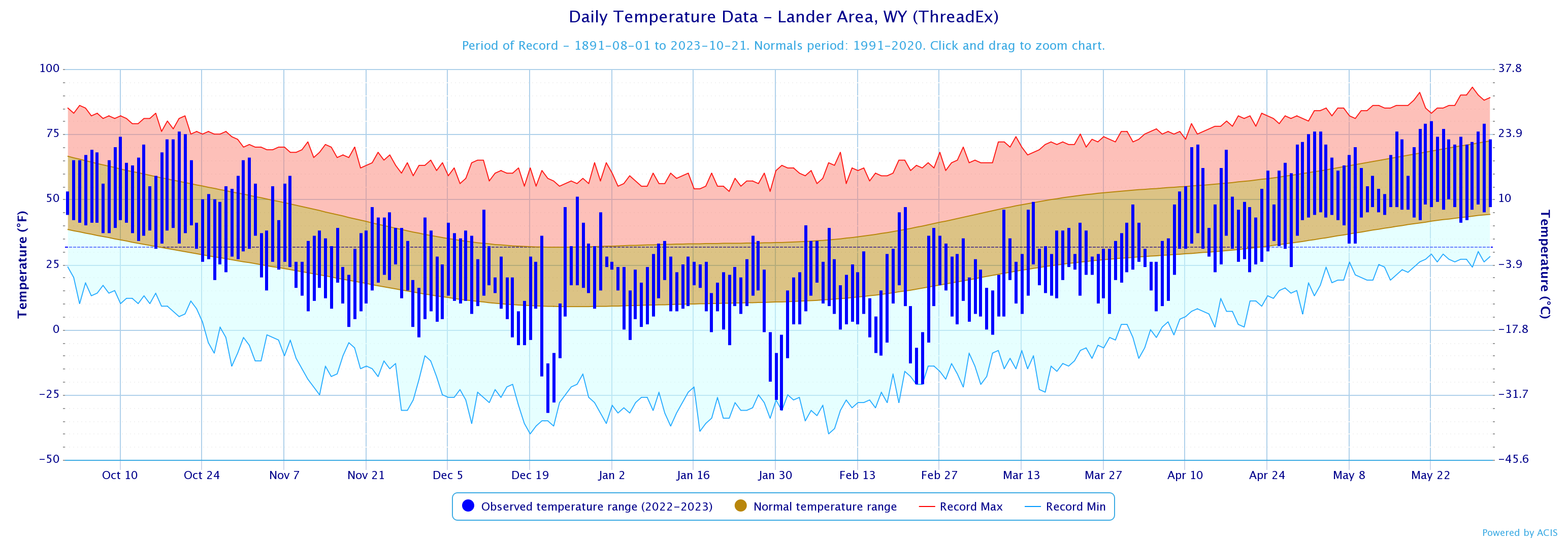
It started off slightly warmer than normal in October, but by November temperatures began dropping slightly below normal. From December through March temperatures were well below normal, with several record or near record low temperatures.
Daily Temperature Data For Casper Area
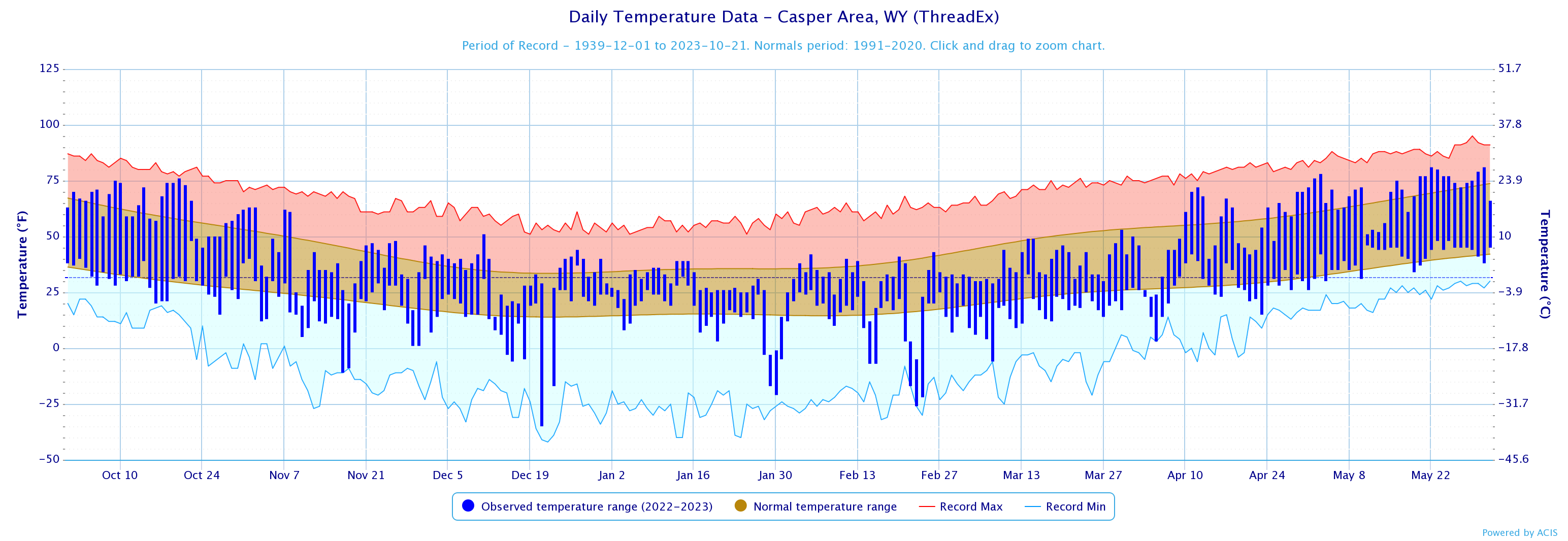
It started off slightly warmer than normal in October, but by November temperatures began dropping slightly below normal. From December through March temperatures were well below normal, with several record or near record low temperatures.
Time range of data used for precipitation: October 1st to June 1st
Accumulated Precipitation Data For Riverton Town
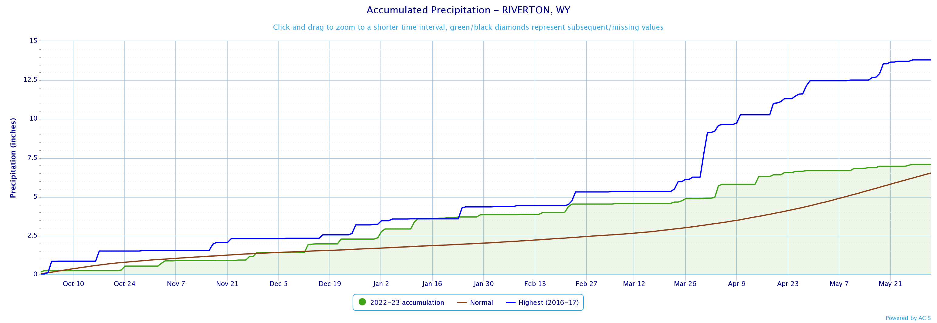
Precipitation started off just below normal for October into November, but that quickly changed heading into December. From about the second week of December and on precipitation exceeded normal values and in the middle of January Riverton was on pace to break seasonal precipitation records, but a drier period in April and May stymied that. Later on we’ll take a look at how this compares to snowfall.
Accumulated Precipitation Data For Lander Area
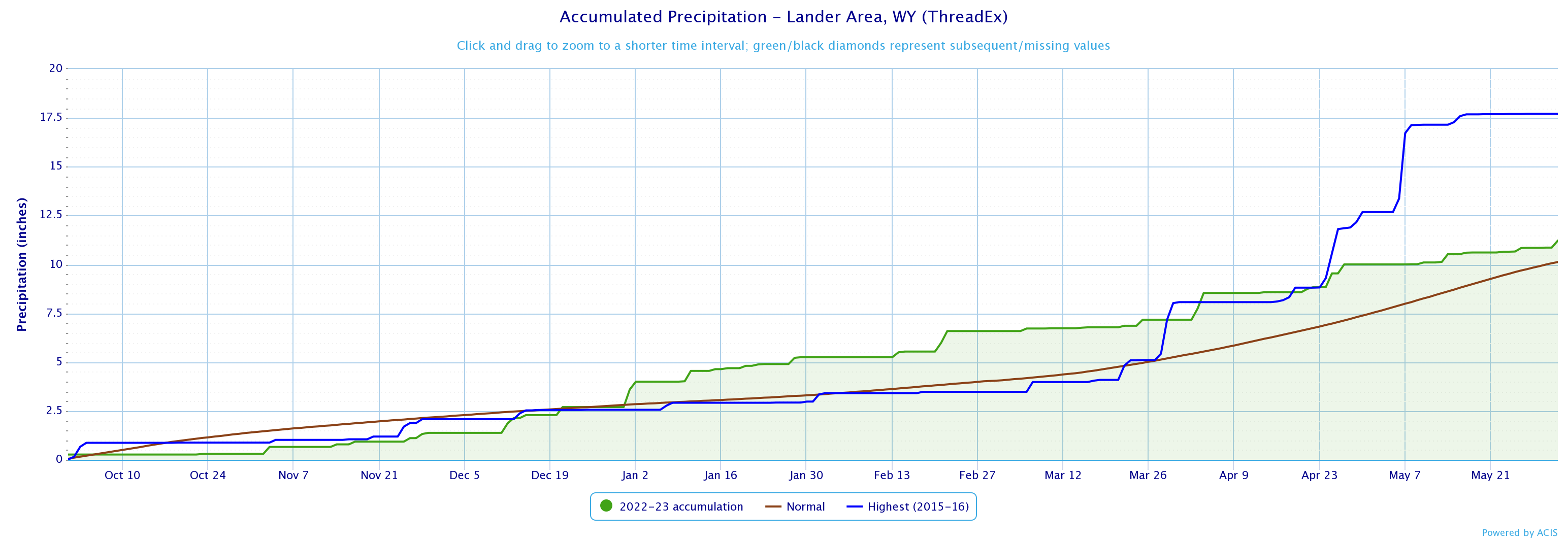
October through November was well below normal for precipitation as the weather pattern was not favorable for Lander to receive much precipitation. By the middle of December this changed as winter storms brought snow to the Wind River Basin. By early January Lander had gone well above normal and stayed that way through the rest of the season, but ended up well below the record for the season.
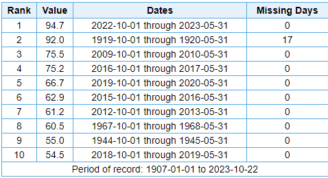
Accumulated Precipitation Data For Casper Area
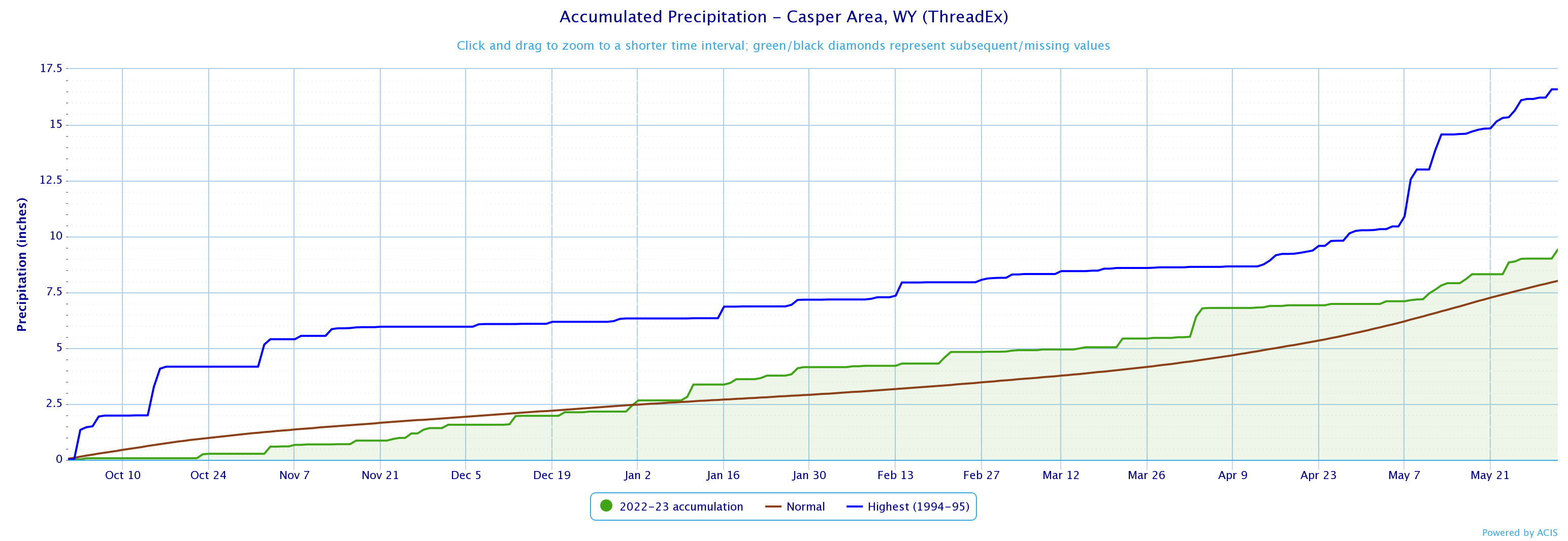
Similar to Lander Casper precipitation was below normal until December, but really didn’t start rising above normal until the middle of January. From that point on Casper’s precipitation remained well above normal, but still well below record values.
Time range of data used for snowfall: October 1st through May 31st
Total Snowfall Values Riverton Town
Records date back to 1907
This was Riverton’s snowiest winter on record.
The snow was one of the most consequential reasons why temperatures were so low for such a long period of time.
The deep snow cover buried the ground and vegetation, which prevented the sun from warming things.
At night the snow cover insulated the ground and allowed for all the heat to rise and create strong temperature inversions. This resulted in very cold low temperatures many nights.
Total Snowfall Values Casper Area

Records date back to 1940
This was the third snowiest winter on record for Casper.
The winter storm that dropped over 3 feet of snow in April 3-5 pushed Casper from the 6th snowiest to the 1st snowiest for a period of time.
That storm also broke single day and storm total snow records.
Not to mention the wind created 6 to 8 foot drifts throughout the city of Casper.
Total Snowfall Values Buffalo
Records date back to 1899
This was the snowiest winter on record in Buffalo.
It was also a windy winter, which led to to frequent blowing and drifting snow.
There were 2 Blizzard Warnings issued during the winter of 2022-2023, which is a rare occurrence.
Total Snowfall Values Midwest
Records date back to 1939
This was the snowiest winter on record in Midwest.
There were several significant snowstorms that impacted Midwest this past winter.
I-25 and local roads around the town of Midwest were frequently closed, which caused major travel issues.
Total Snowfall Values Bedford
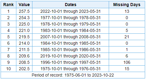
Records date back to 1976
This was the snowiest winter on record in Bedford.
257 inches is over 21 feet of snow that Bedford received this past winter.
The pattern favored the Star Valley, and Salt River and Wyoming Ranges.
SNOTELS in the Salt River and Wyoming Ranges were well above normal for most of the Spring season.
Total Snowfall Values Afton
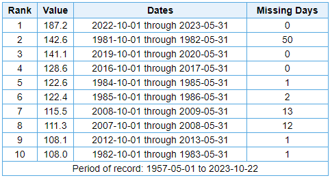
Records date back to 1964
This was the snowiest winter on record in Afton.
187 inches is over 15 feet of snow.
This is over 40 inches more snow than the next closest year.
Again, this was an area favored by the pattern during the 2022-2023 winter season.
Total Snowfall Values Farson
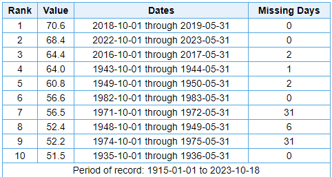
Records date back to 1915
This was the second snowiest winter on record in Farson by just over 2 inches.
This year was just short of the previous record from 2018/2019 of 70.6 inches.
For reference the average snowfall is 40 inches, so it was well above average, but didn't completely blow away records.
Number of Winter Weather Advisory Events
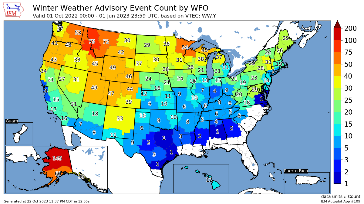
Data Range: 2005-2023
Number of Winter Storm Warning Events
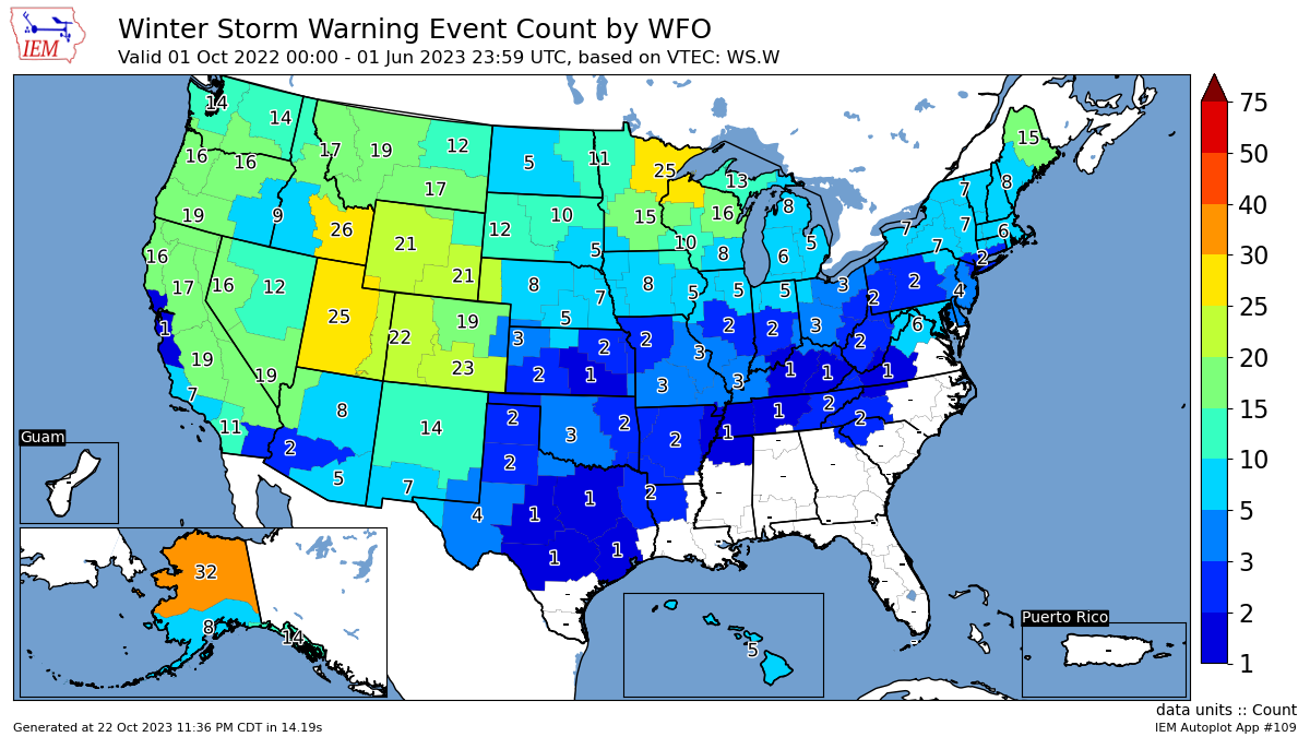
Data Range: 2005-2023
Number of Blizzard Warning Events
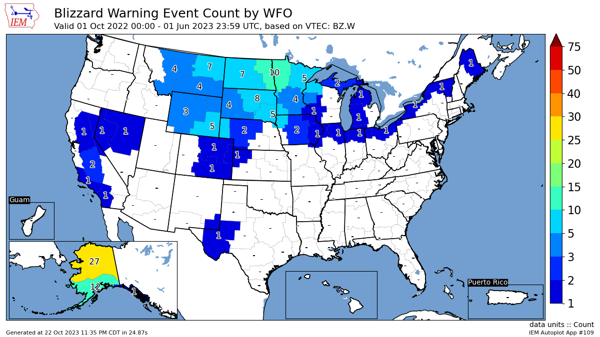
Data Range: 2005-2023
Total Number Of All Highlight Types Events

Data Range: 2005-2023

Number Of Winter Weather Advisory Events Vs Normal
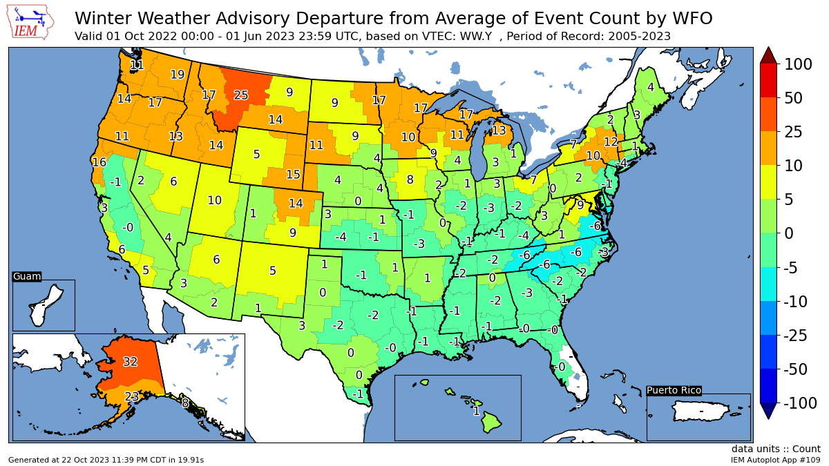
Data Range: 2005-2023
Number Of Winter Winter Storm Warning Events Vs Normal
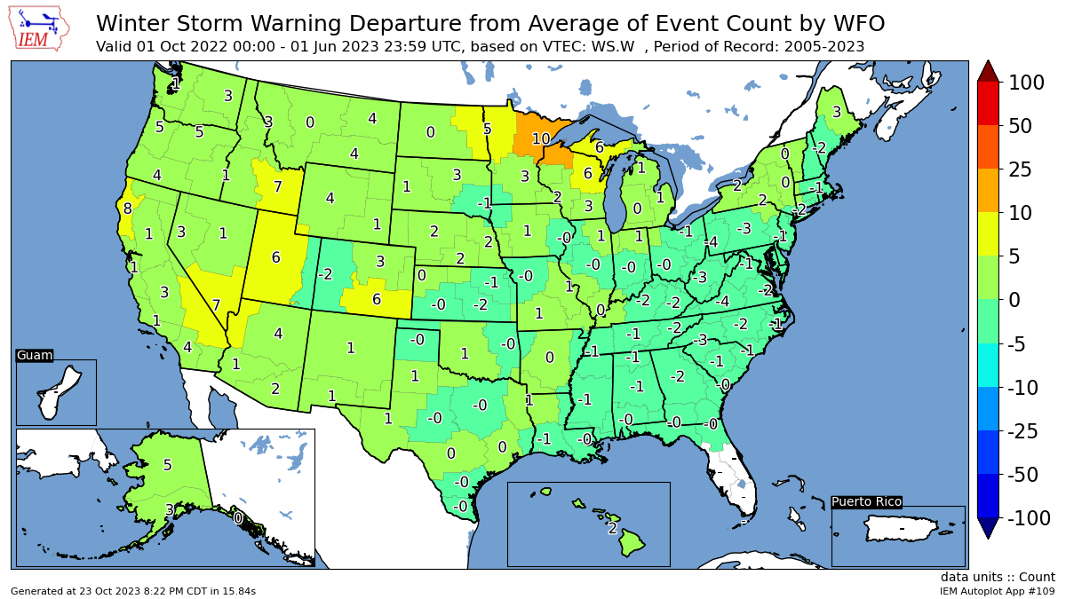
Data Range: 2005-2023
Number Of Winter Blizzard Warning Events Vs Normal
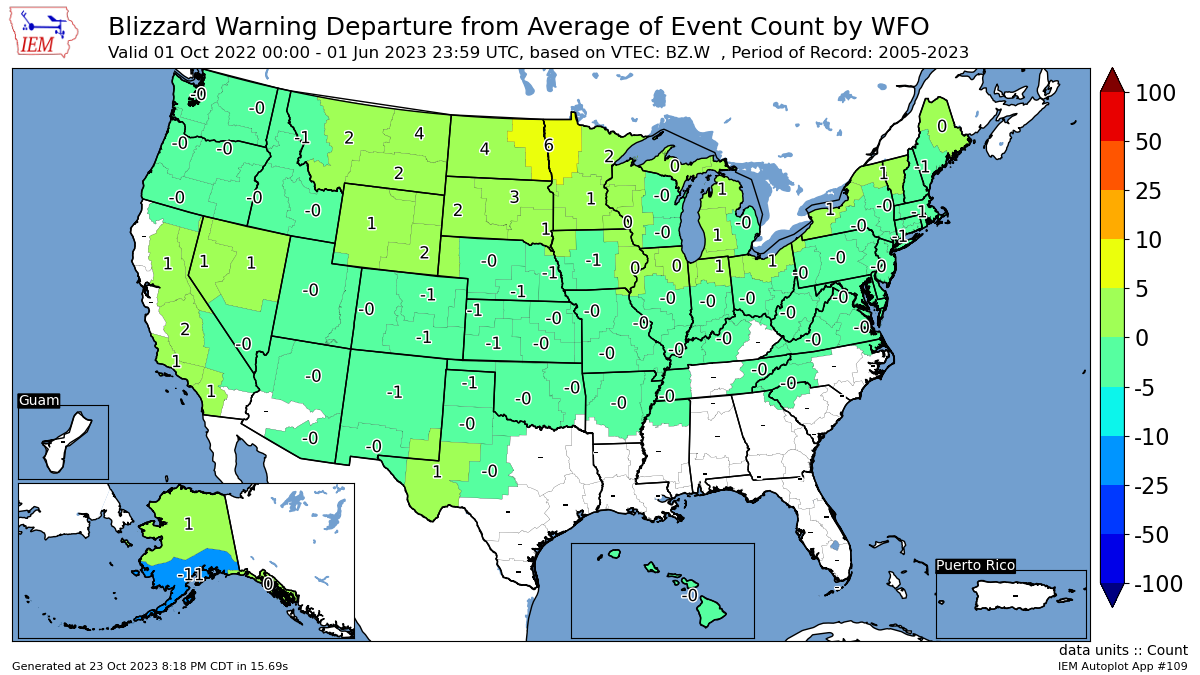
Data Range: 2005-2023
Total Number Of All Highlight Types Events Vs Normal
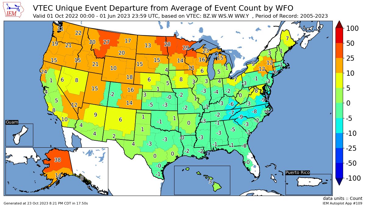
Data Range: 2005-2023

 |
Learn more about the National Weather Service's efforts to build a Weather-Ready Nation! |

