
Heat expands across the Desert Southwest, Plains, Mississippi Valley and Midwest into Monday. Fire weather concerns continue for portions of the Intermountain West. Active monsoonal moisture fuels thunderstorms over the Southwest with possible flash flooding. Tropical cyclone Fausto in the Pacific, should weaken as it approaches Hawaii; Dangerous surf, swells and rip currents are expected. Read More >
Overview
A spring storm swept east across Wyoming, Friday, April 26th resulting in various weather conditions. Showers and a few thunderstorms pushed east into western Wyoming during the predawn hours Friday. Heavy snow occurred above 9000 feet with this activity, and Togwotee Pass became slick and snowpacked early Friday morning. The showers and a few thunderstorms then gradually shifted to areas east of the Continental Divide Friday morning. Isolated to locally scattered thunderstorms continued Friday afternoon with most of the thunderstorm activity generally along and south of a Jackson to Casper line.
A weak thunderstorm pushing east off the Wyoming Range into the Upper Green River Basin spawned a weak tornado that impacted Marbleton, Wyoming around 1230 PM.
Strong winds (45+ mph) were observed across much of western and central Wyoming Friday afternoon and evening from a combination of winds associated with thunderstorms, a tight pressure gradient, and a strong cold front.
Please click on the tabs below for more information about this event.|
Marbleton Tornado Video (courtesy of Tobi Holt) |
Tornadoes:
|
Tornado - LOCATION
Track Map 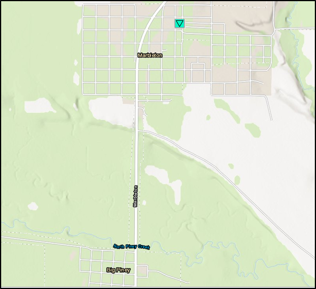 
|
||||||||||||||||
The Enhanced Fujita (EF) Scale classifies tornadoes into the following categories:
| EF0 Weak 65-85 mph |
EF1 Moderate 86-110 mph |
EF2 Significant 111-135 mph |
EF3 Severe 136-165 mph |
EF4 Extreme 166-200 mph |
EF5 Catastrophic 200+ mph |
 |
|||||
Photos:
 |
") |
 |
| Marbleton damage (Source: Nikki Williston) |
Marbleton damage (Source: Nikki Williston) |
Roof partially blown off (Source: Kayla Moore) |
Radar:
 |
 |
 |
| 1227 PM Composite Reflectivity | 1231 PM Composite Reflectivity | 1235 PM Composite Reflectivity |
Peak Wind Gusts:
 |
| Peak Wind Gusts on Friday |
 |
Media use of NWS Web News Stories is encouraged! Please acknowledge the NWS as the source of any news information accessed from this site. |
|

