A heat wave over the Southwest will intensify this week, peaking and expanding into the Intermountain West and northern High Plains this weekend. Critical to extremely critical fire weather conditions are forecast from the Northwest and the northern Great Basin this weekend. Particularly Dangerous Situation Red Flag Warnings have been issued. Read More >
Overview
|
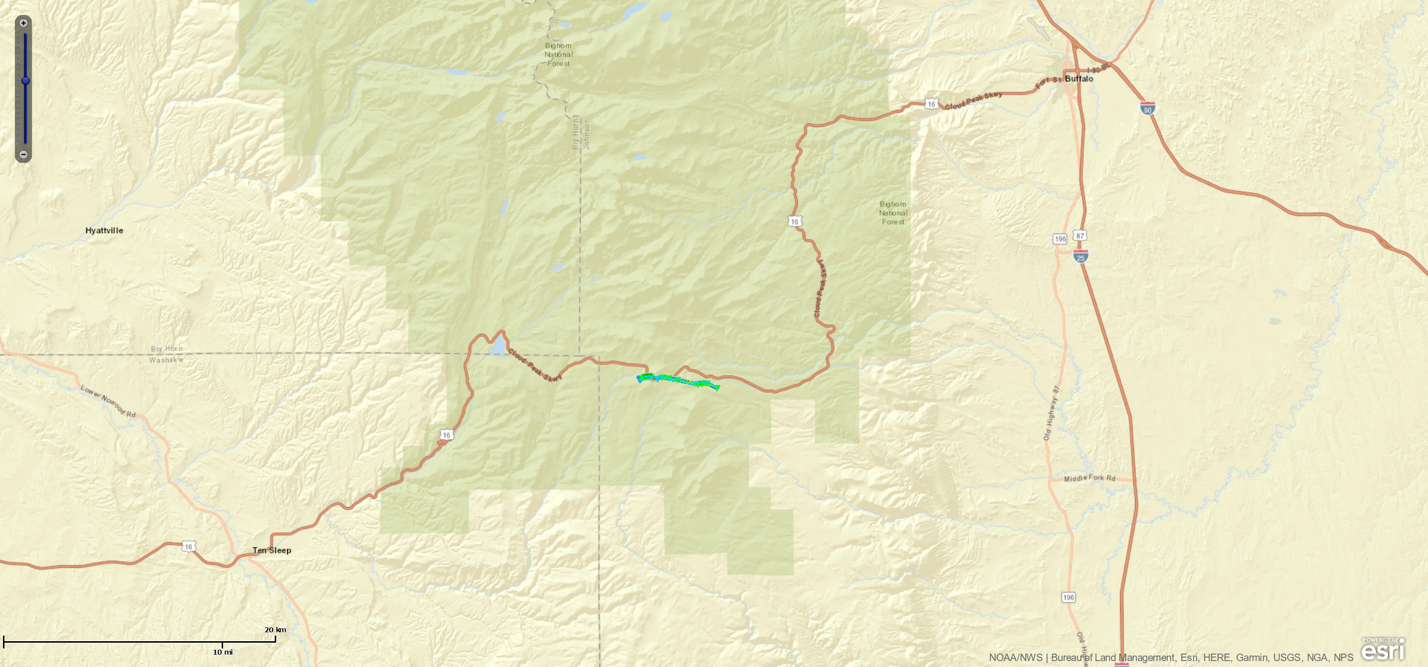
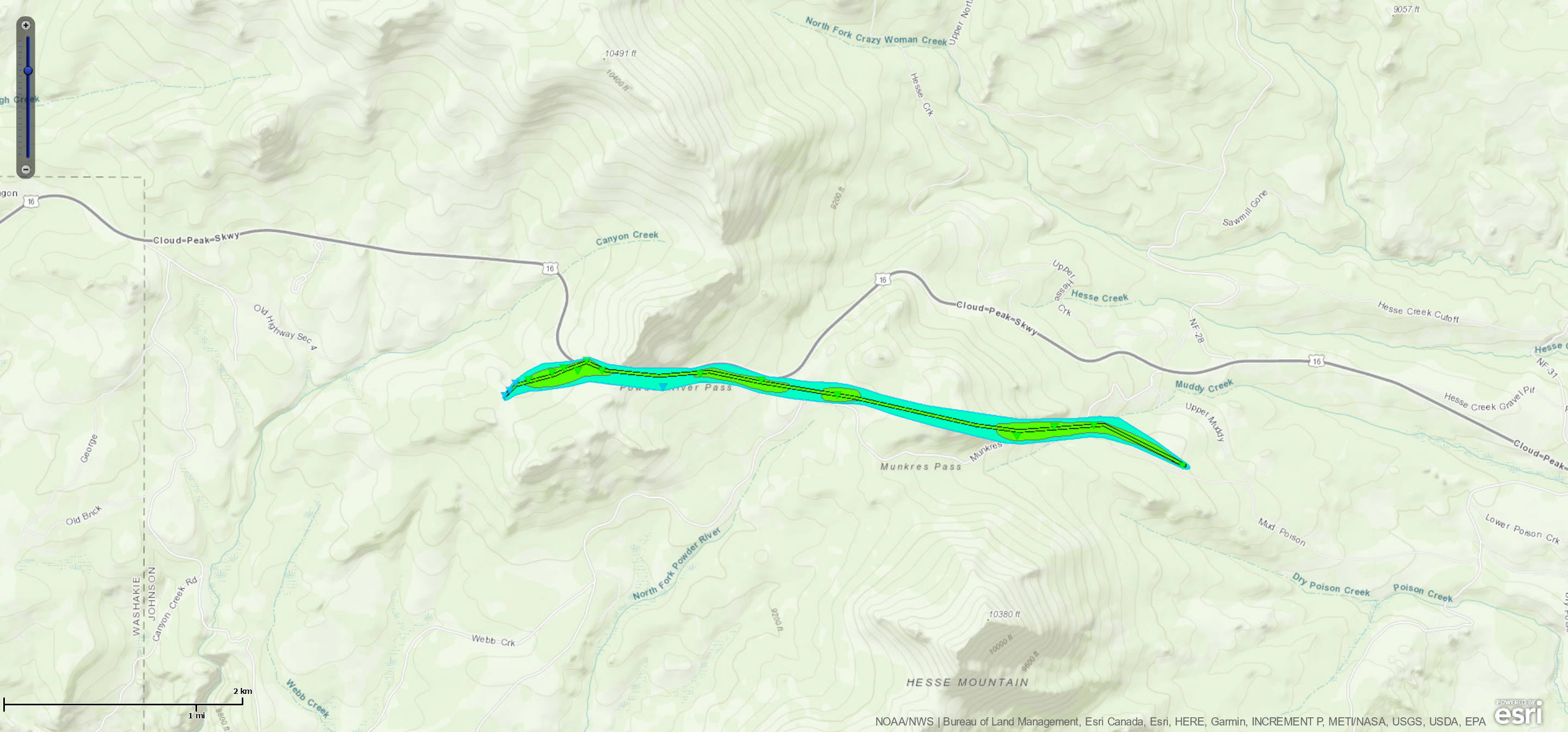
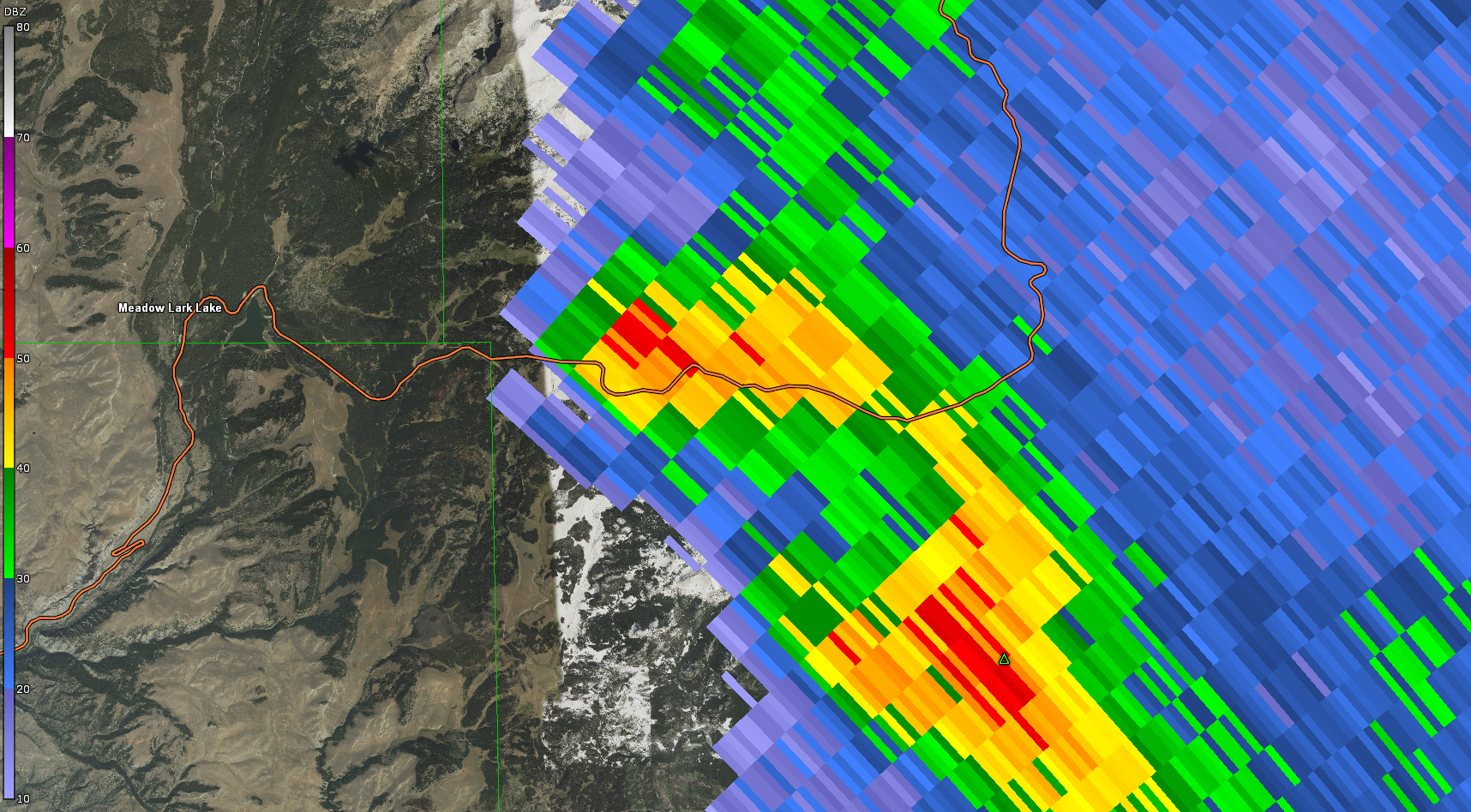
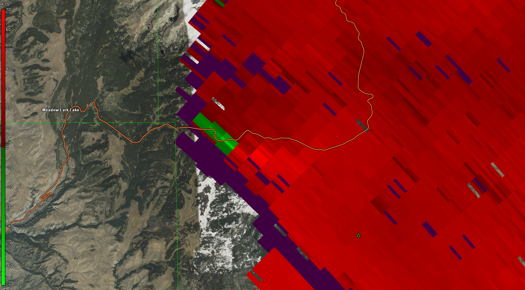
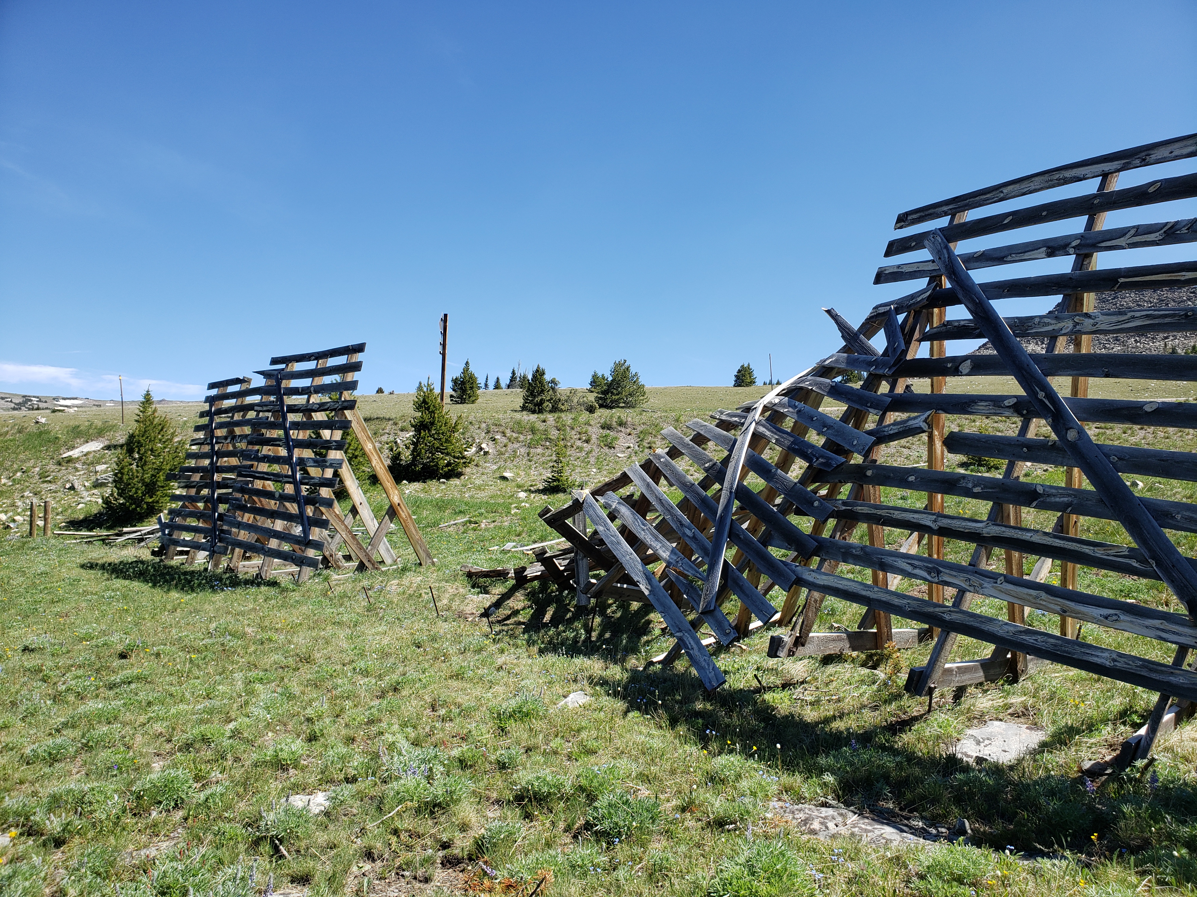
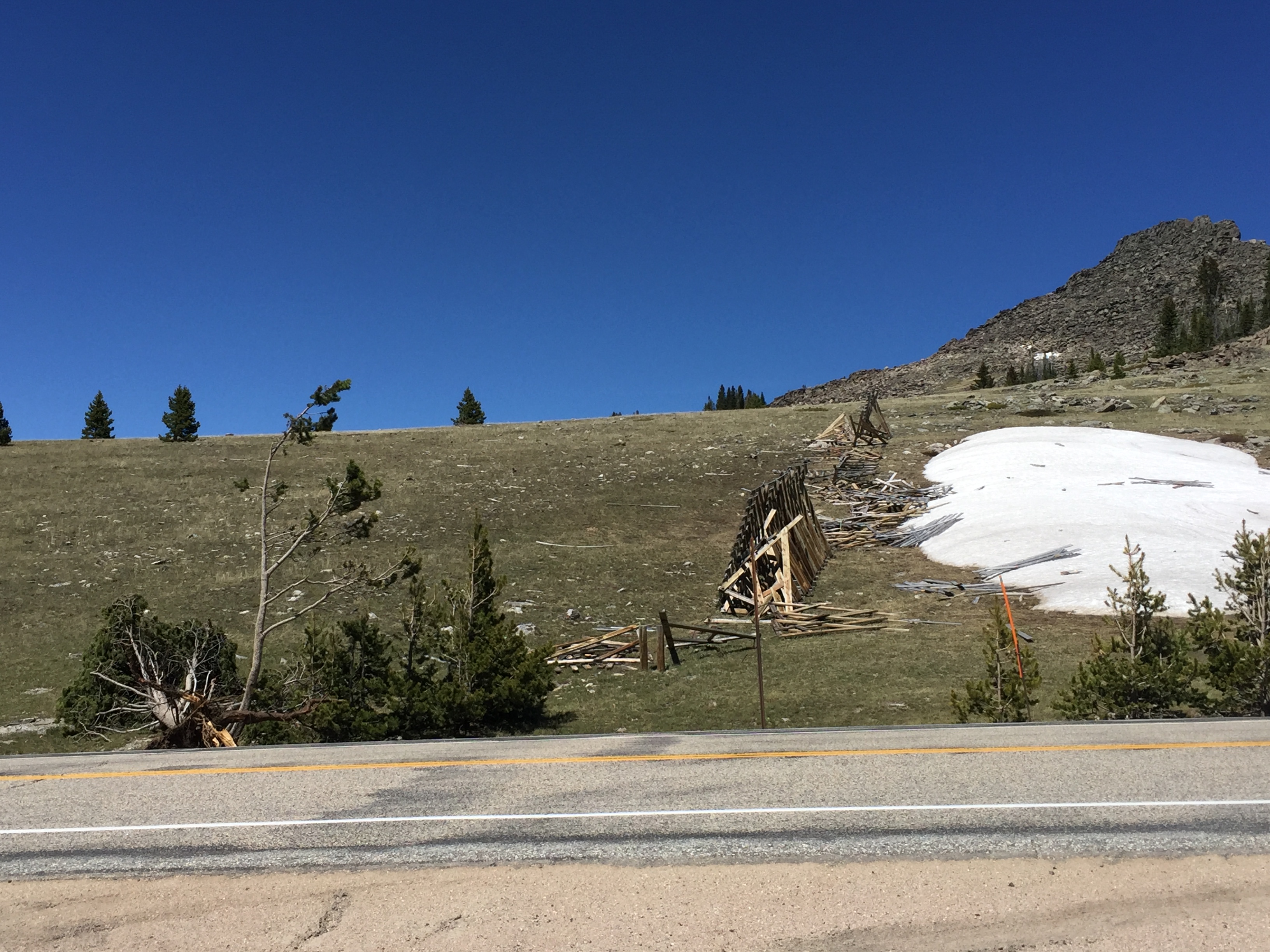
On Wednesday, June 19, 2019 a thunderstorm began to develop on the border of Park and Big Horn counties around 5 PM. As this storm moved east it strengthened and reached its peak intensity in extreme southeastern Big Horn County. The storm crossed into Johnson County and produced a tornado on Powder River Pass in the Bighorn Mountains just before 7 PM. Considerable tree damage occurred along and near US Highway 16 as the tornado moved east along its 3.7 mile path. Hundreds of conifer trees were uprooted or snapped at their trunks. Additionally, several large wooden snow fences were torn apart, with fencing debris thrown in all directions. This tornado was unusual in that it occurred at a high elevation of just under 10,000 ft along its western path. The damage produced by this storm was consistent with an EF-1 tornado, with estimated peak winds of 110 mph. The time of the tornado was estimated by comparing the location of the damage with radar imagery. |
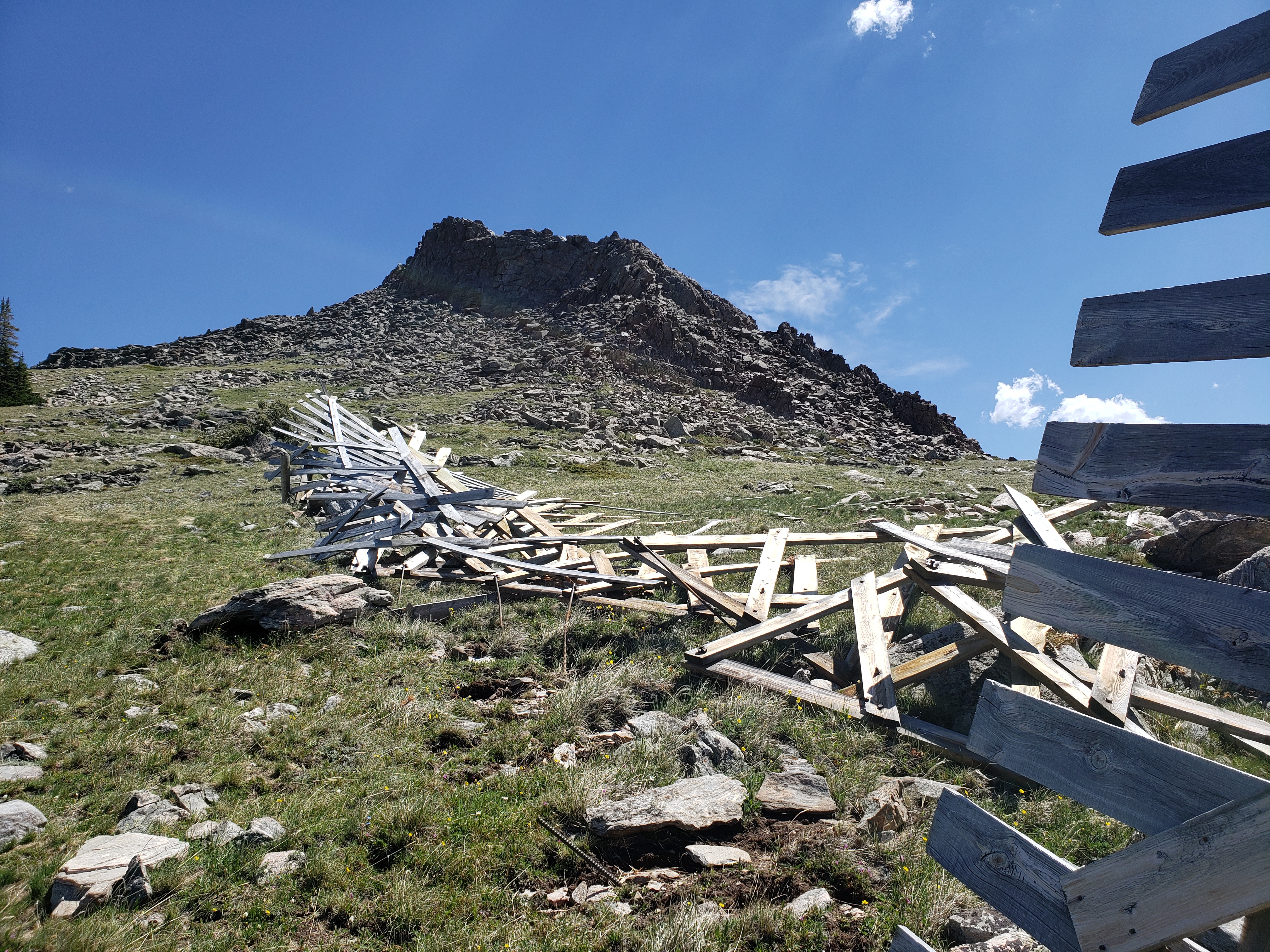 A destroyed snow fence on the north side of US Highway 16 |
Tornadoes:
|
Tornado - Powder River Pass
Track Map 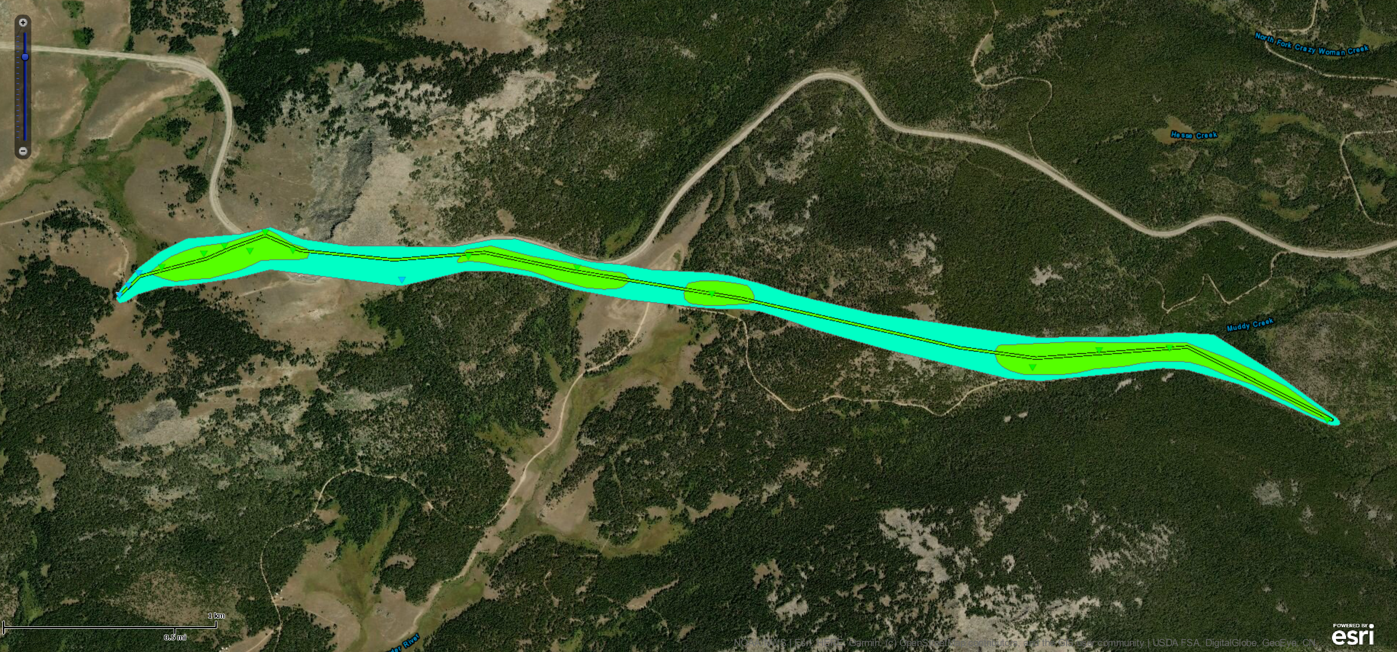 
|
||||||||||||||||
|
||||||||||||||||
The Enhanced Fujita (EF) Scale classifies tornadoes into the following categories:
| EF0 Weak 65-85 mph |
EF1 Moderate 86-110 mph |
EF2 Significant 111-135 mph |
EF3 Severe 136-165 mph |
EF4 Extreme 166-200 mph |
EF5 Catastrophic 200+ mph |
 |
|||||
Photos
 |
 |
 |
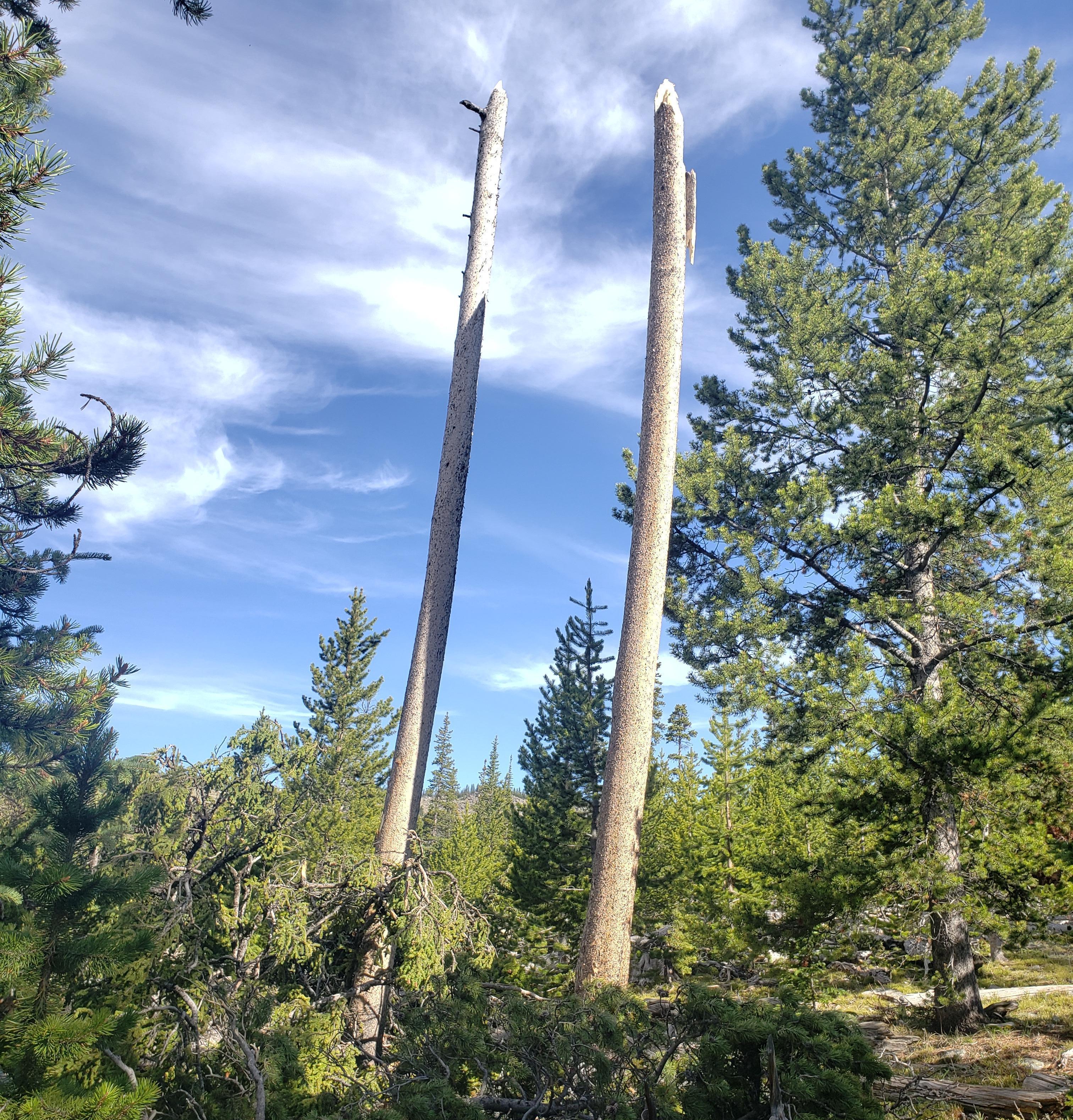 |
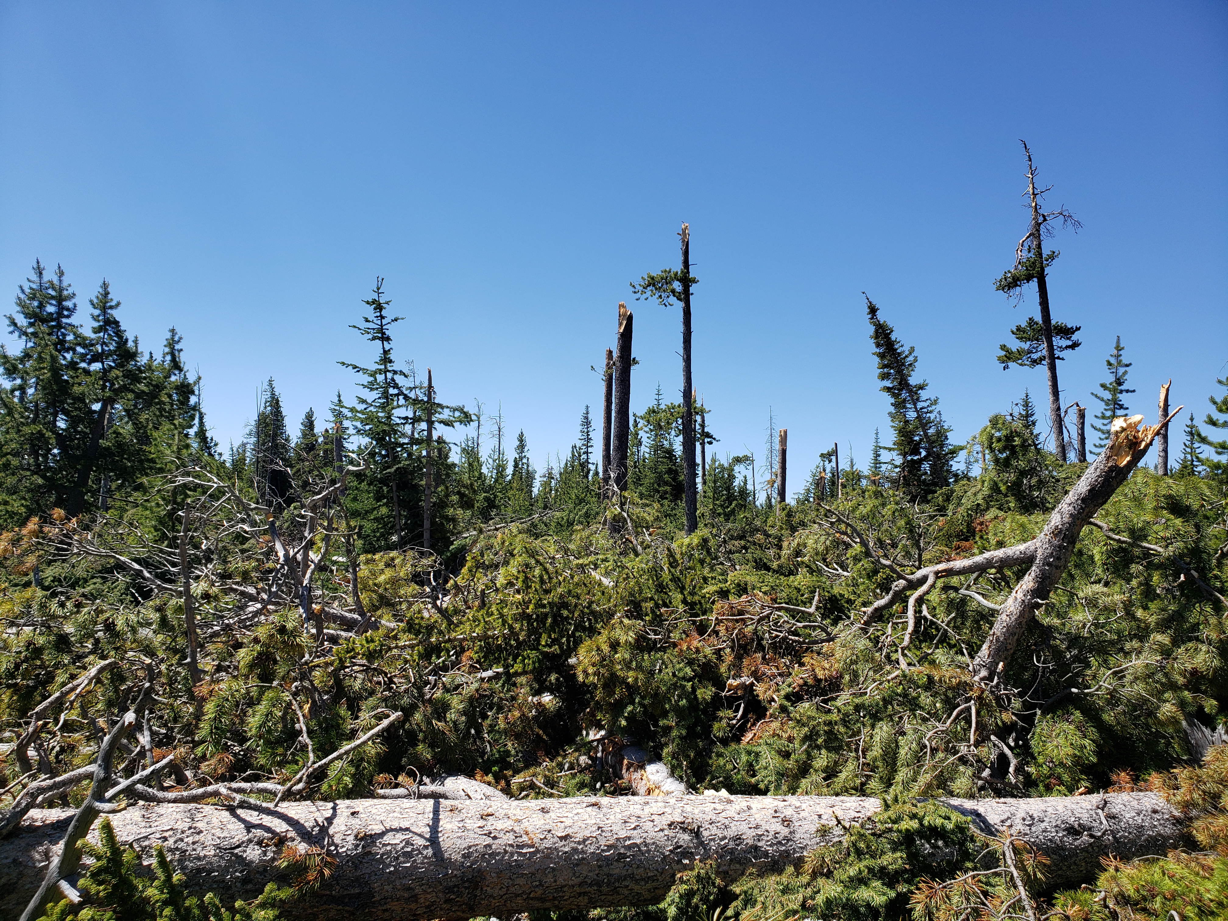
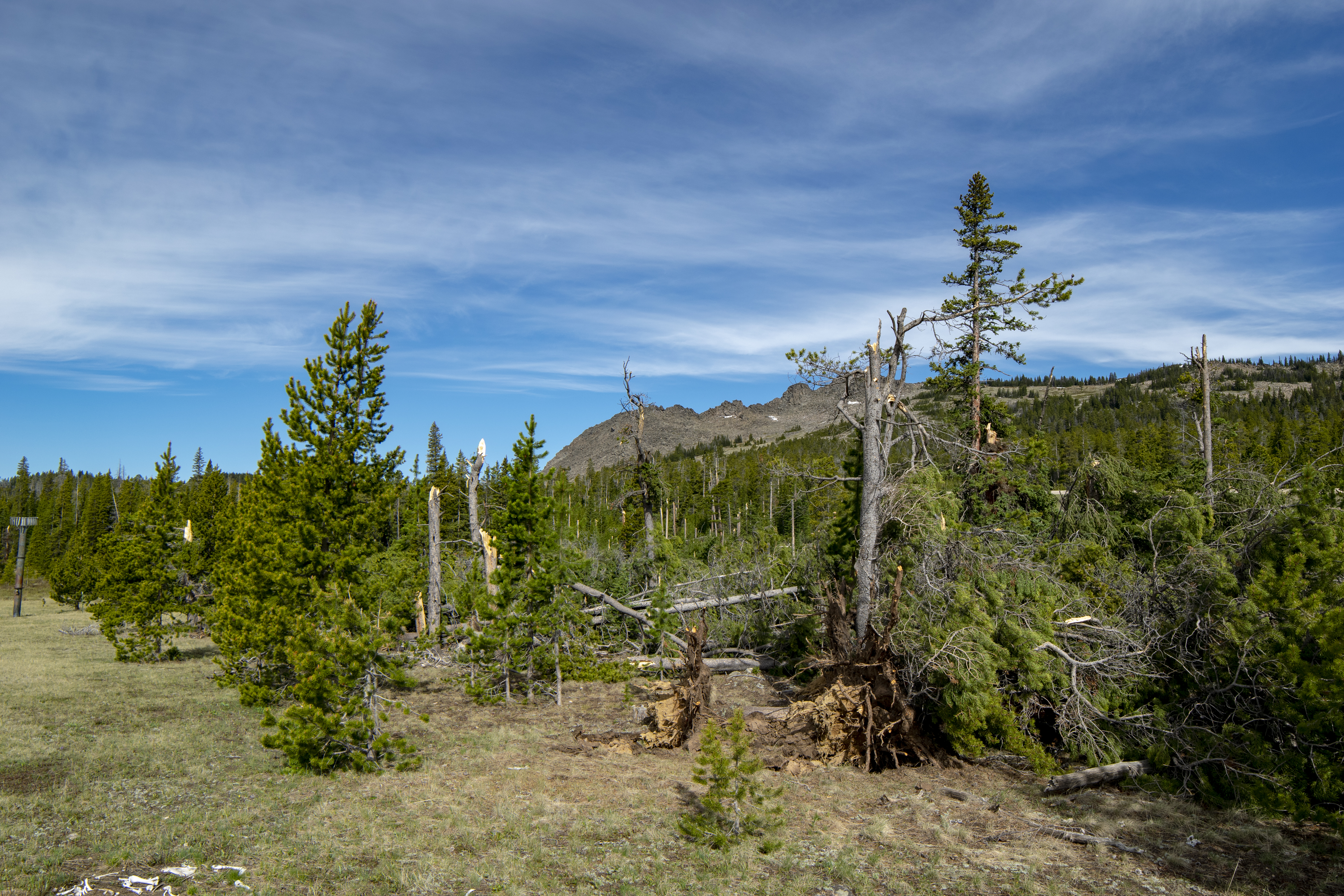
| Snapped and uprooted trees on the south side of US Highway 16 (NWS Survey) |
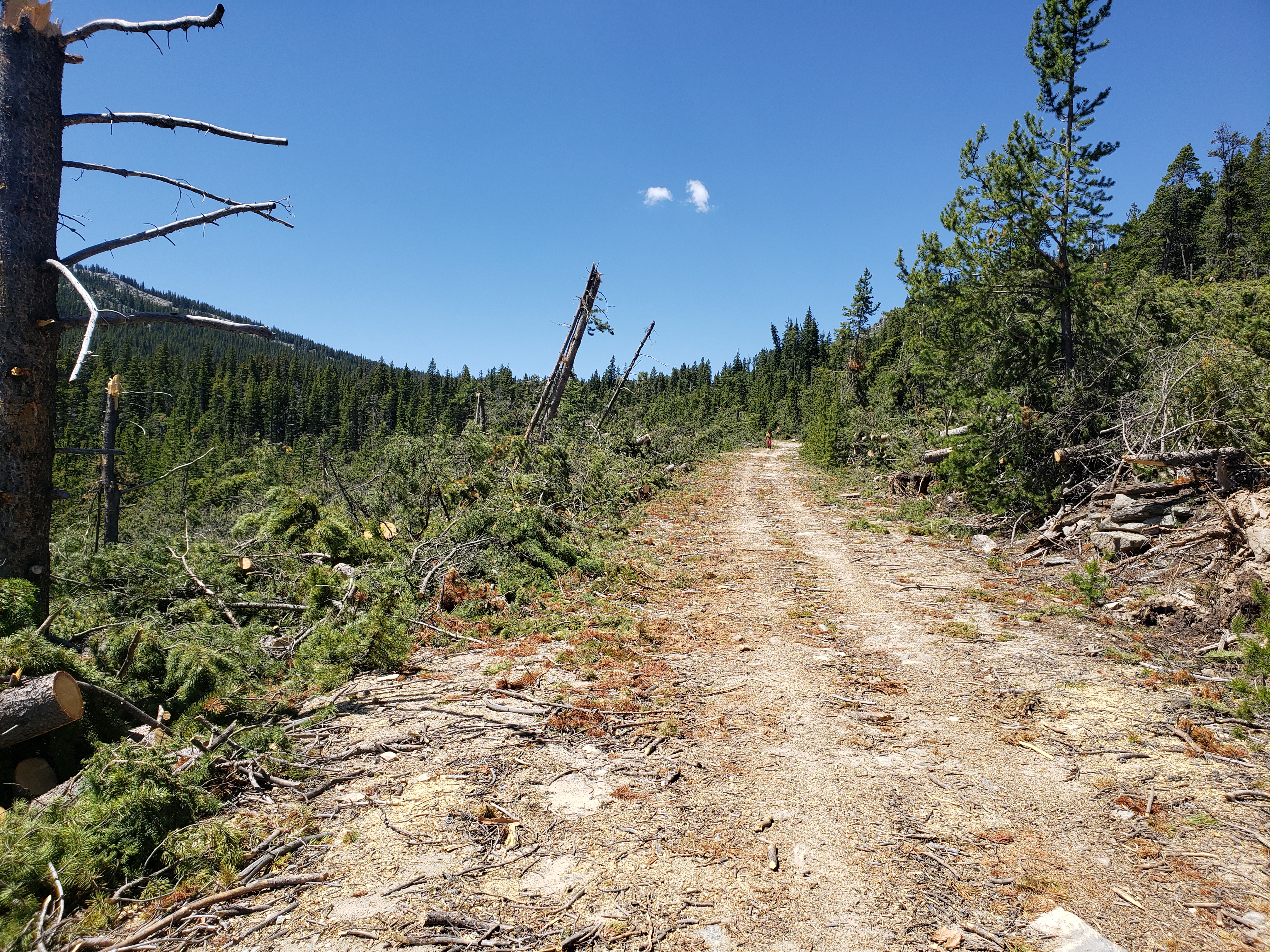
Damaged trees along Forest Road 448 south of US Highway 16 (NWS Survey) |
Damaged trees south of US Highway 16 (NWS Survey) |
Snapped and delimbed trees south of US Highway 16 (NWS Survey) |
 |
 |
 |
 |
| Snapped and uprooted trees on the south side of US Highway 16 (NWS Survey) |
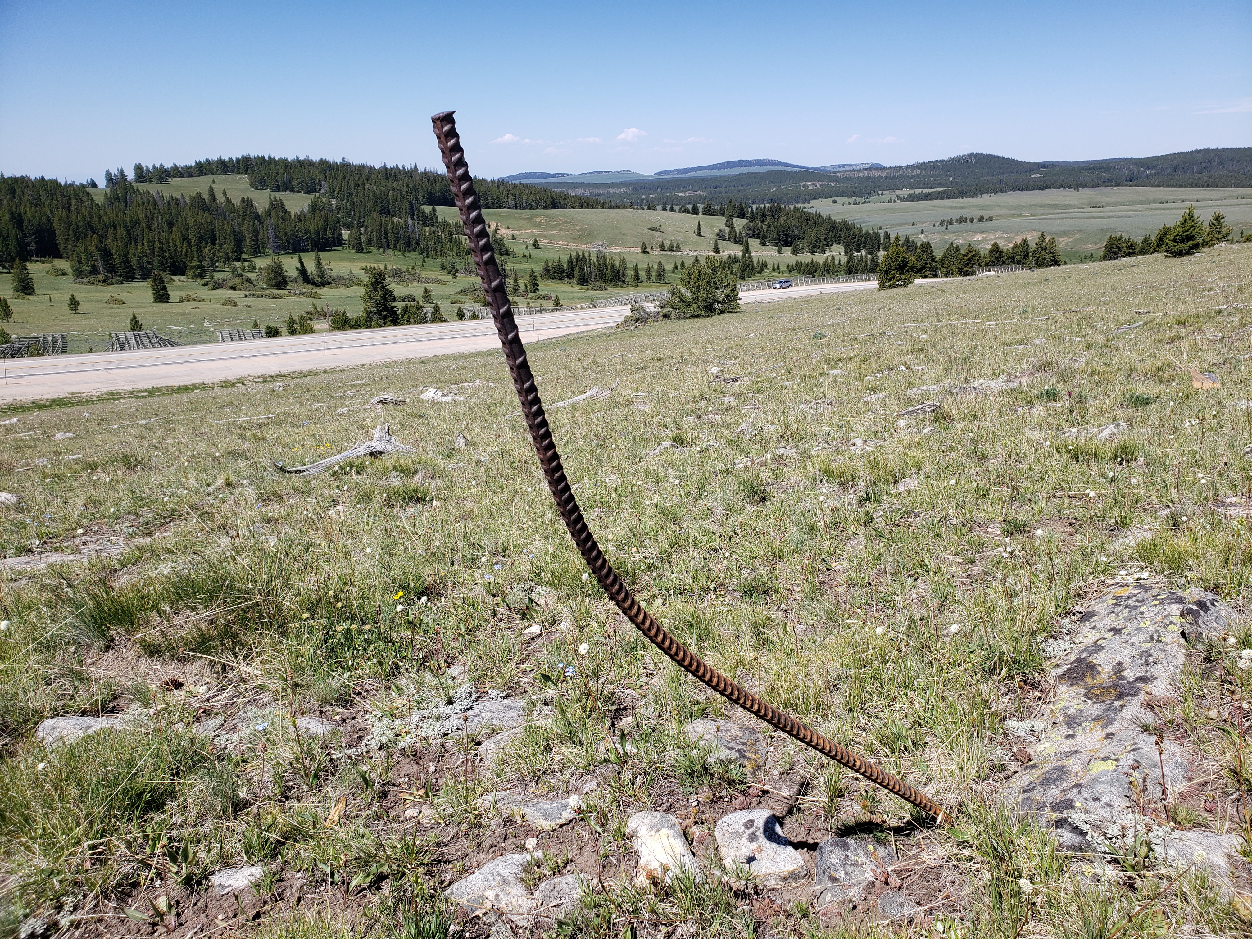
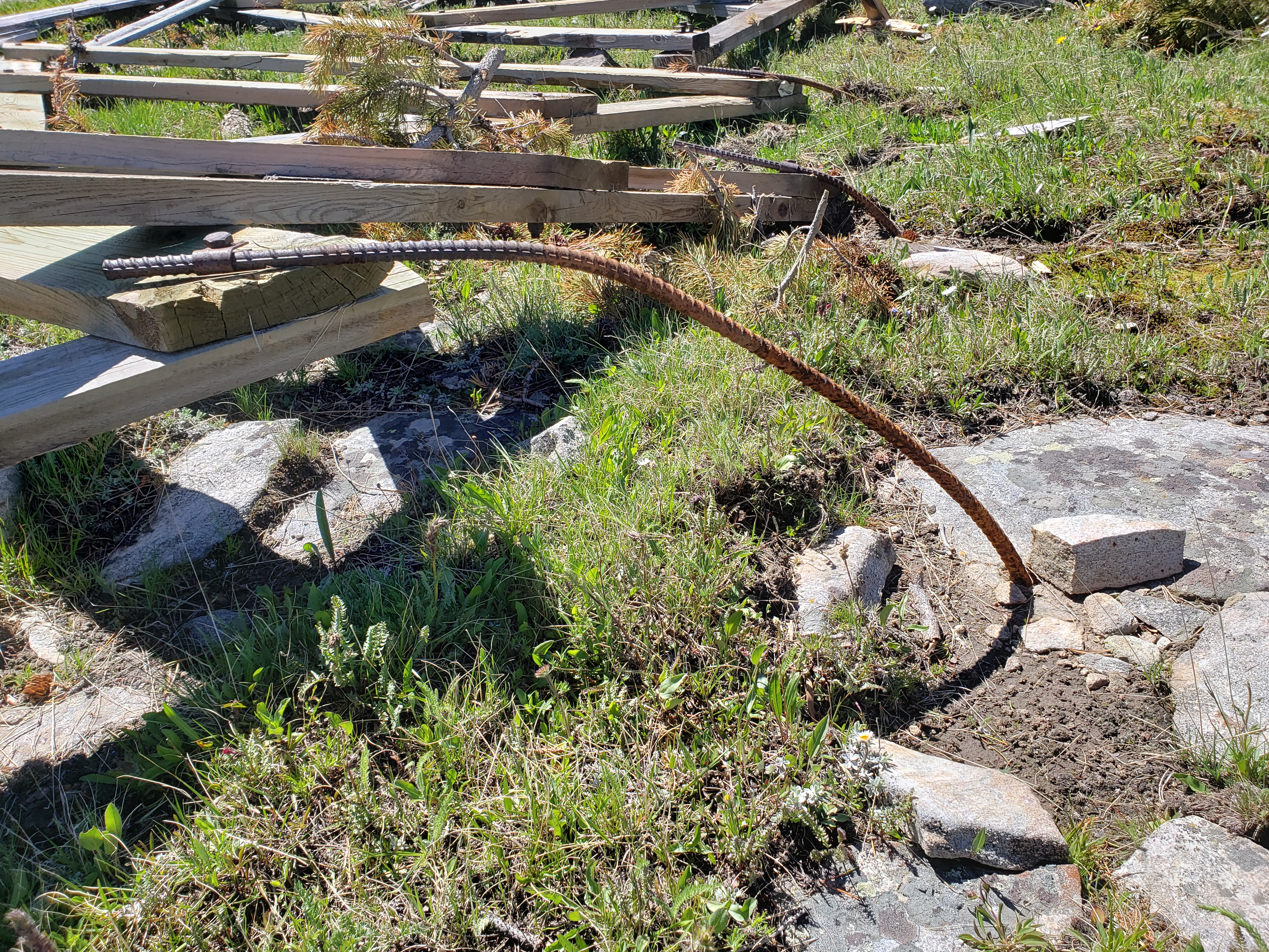
Rebar from snow fencing was tossed and stuck into the ground on the north side of US Highway 16 (NWS Survey) |
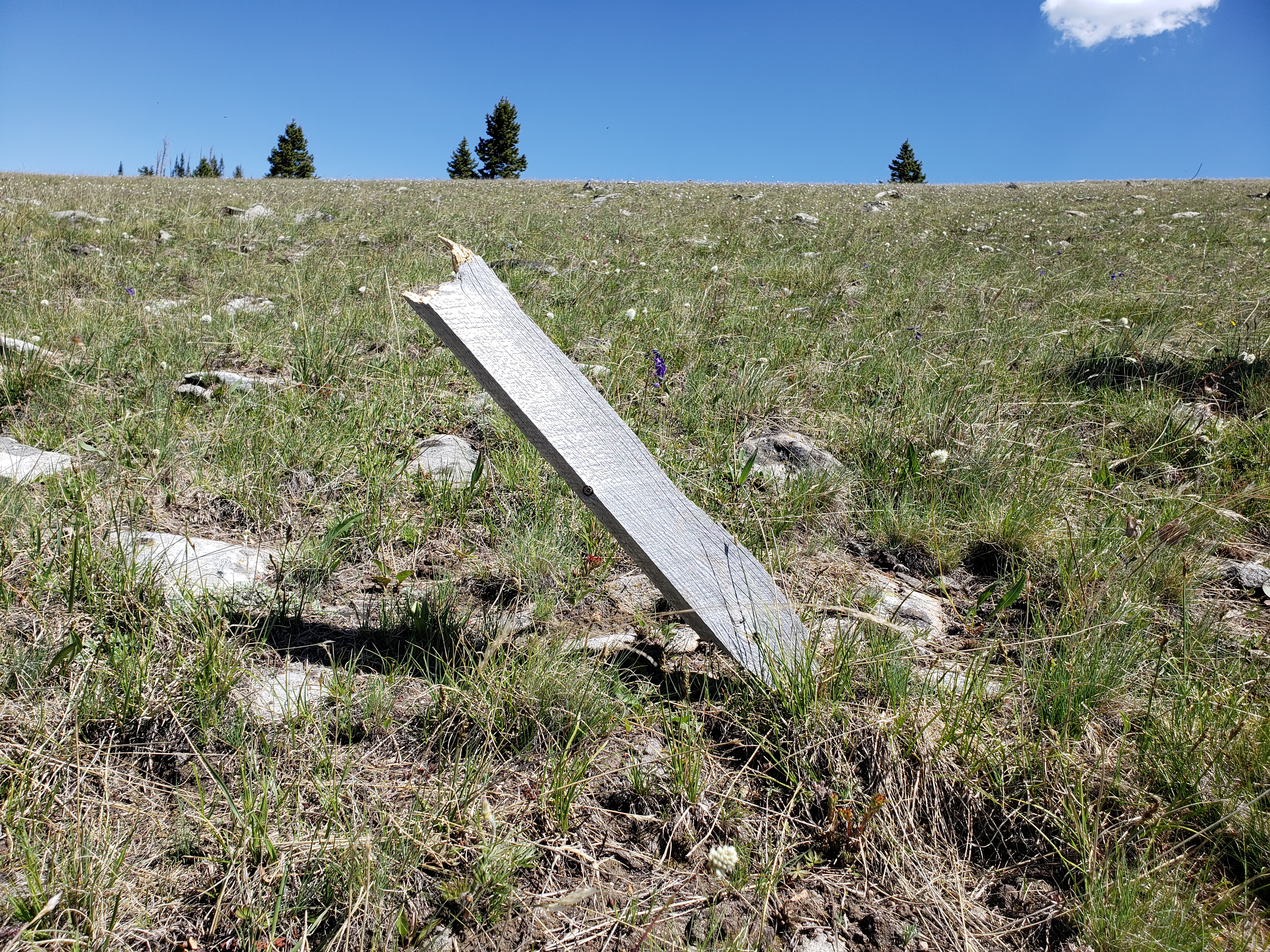
Snow fencing debris was tossed and stuck into the ground on the north side of US Highway 16 (NWS Survey) |
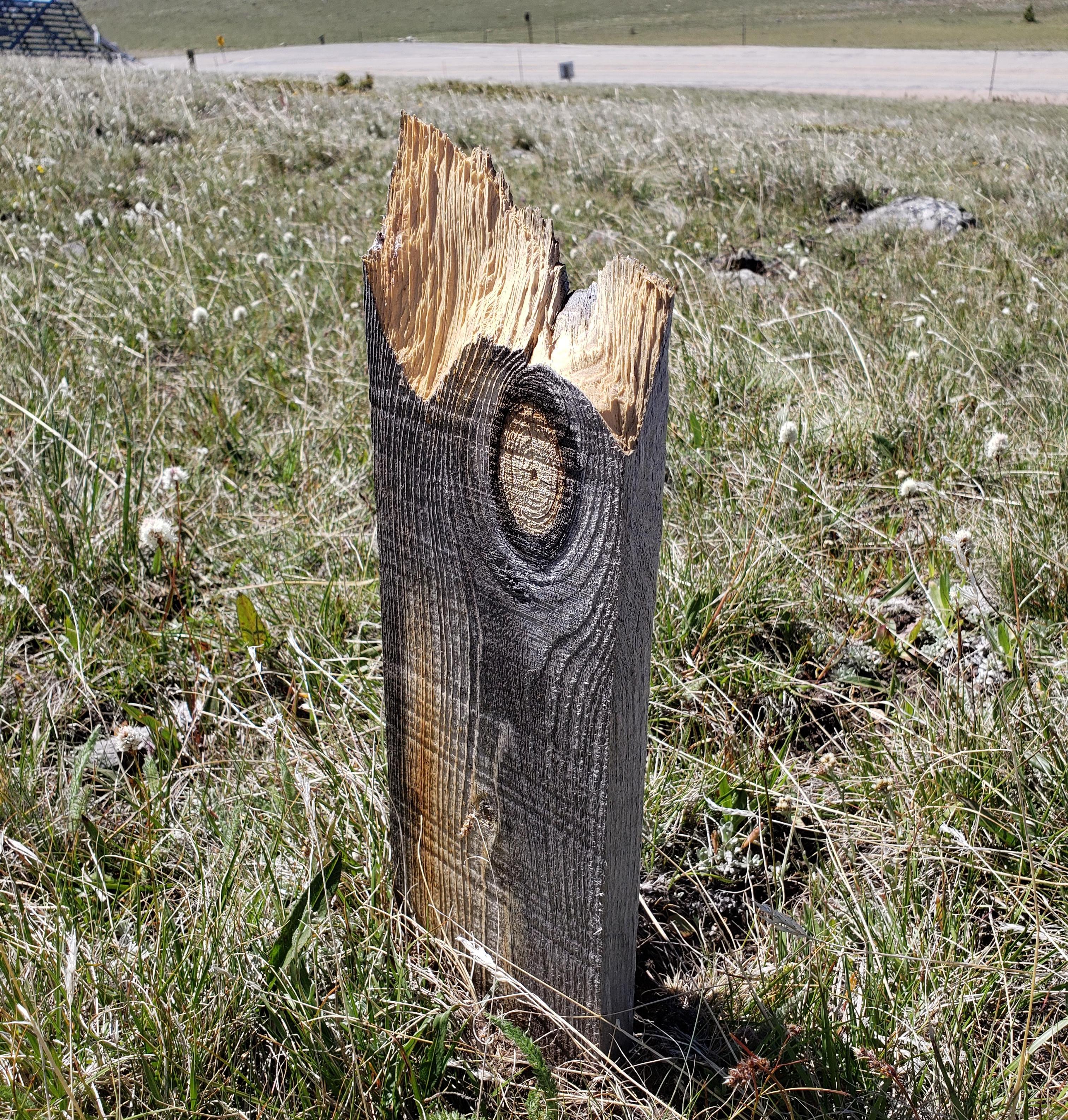
Damaged snow fence on the south side of US Highway 16 on Powder River Pass (NWS Survey) |
 |
 |
 |
 |
| Destroyed snow fence on the south side of US Highway 16 on Powder River Pass (NWS Survey) |
Damaged snow fence on the north side of US Highway 16 on Powder River Pass (Johnson County Planner) |
Bent rebar anchoring a snow fence on the south side of US Highway 16 on Powder River Pass (NWS Survey) |
Snow fencing debris was tossed and stuck into the ground on the north side of US Highway 16 (NWS Survey) |
 |
Media use of NWS Web News Stories is encouraged! Please acknowledge the NWS as the source of any news information accessed from this site. |
|