Dangerous and extreme heat will remain across portions of the southern U.S. this week. Heavy rainfall may bring significant flash flooding across portions of the Mid-Atlantic and Northeast through the night, and additional flash flooding concerns across New England on Wednesday. Monsoonal thunderstorms will bring a flash flood risk to the Four Corners region, especially in burn scar areas Read More >
Links | Map | Warnings, Radar, & Satellite | Fire & Thunder Forecasts
Outlooks and Climate| Fuels and Fire Danger Maps
 |
||
|
||
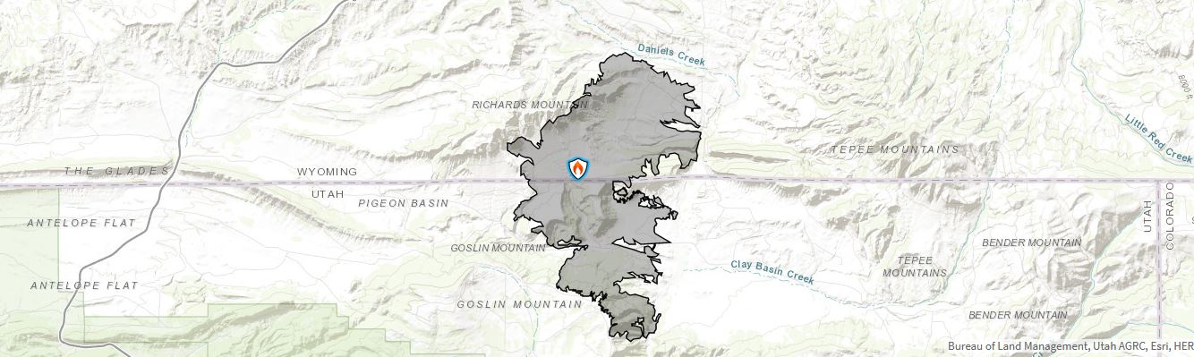
| Richard Mountain Inciweb Page | ||
| WFO Riverton Fire Weather Page | ||
| Fire Weather Planning Forecast For Zone 279 (Wyoming) | ||
| Fire Weather Planning Forecast For Zone 485 (Utah) | ||
| Facebook Richard Mountain Fire Information | ||
| Click Boxes to Expand Product on Page | ||
|
||
Current Warnings, Radar, and Satellite
(Click thumbnails to expand Images)
 |
|
|
|
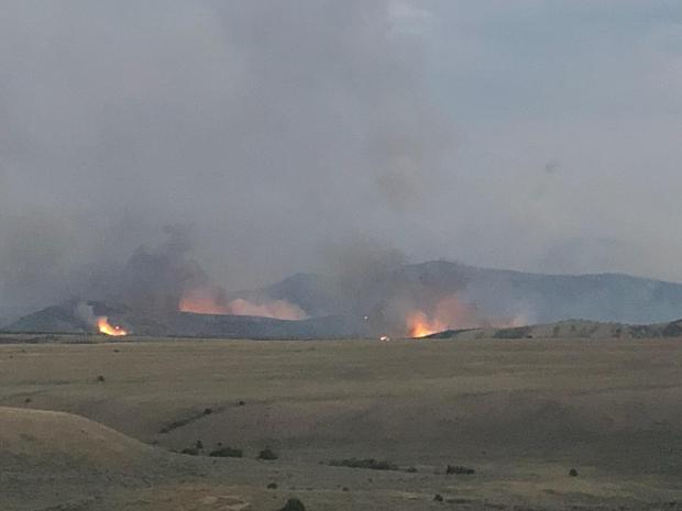
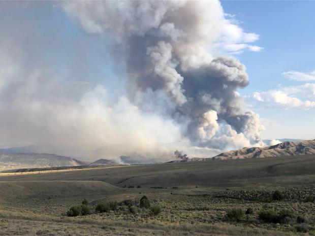
| Pictures from the Richard Mountain Fire | ||
 |
 |
|
|
Photo from InciWeb.com |
Photo from InciWeb.com |
|
<
|
|
|
|
|

|

|

|
 |
|
|
|
|
|
|
Storm Prediction Center Critical Fire Areas and Thunderstorm Forecasts
(Click thumbnails to expand Images)
|
|
|
|
 |
 |
 |
|
|
Day 2 Categorical | Day 3 Categorical |
 |
 |
 |
|
|
|
|
|
|
 |

|
 |
 |
 |
|
|
|
|
|
|
 |

|
 |
 |
 |
Weather Outlook and Climate Information
(Click thumbnails to expand Images)
| Local Precipitation, Wind, and Humidity Information (NWS) |
|
|
|
|
|
 |
 |
 |
 |
|
|
|
|
|
 |
 |
 |
 |
|
|
|
|
|
|
|
 |
 |
 |
 |
|
|
|
|
|
 |
 |
 |
 |
USFS Fire Danger Graphics and Fuels
(Click thumbnails to expand Images)
|
|
|
|
 |
 |
 |
|
|
|
|
|
 |
 |
 |
 |
|
|
|
|
|
 |
 |
 |
 |
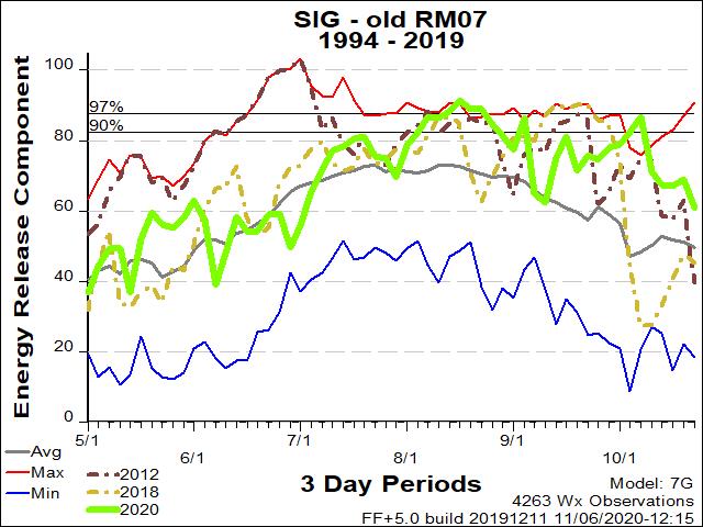
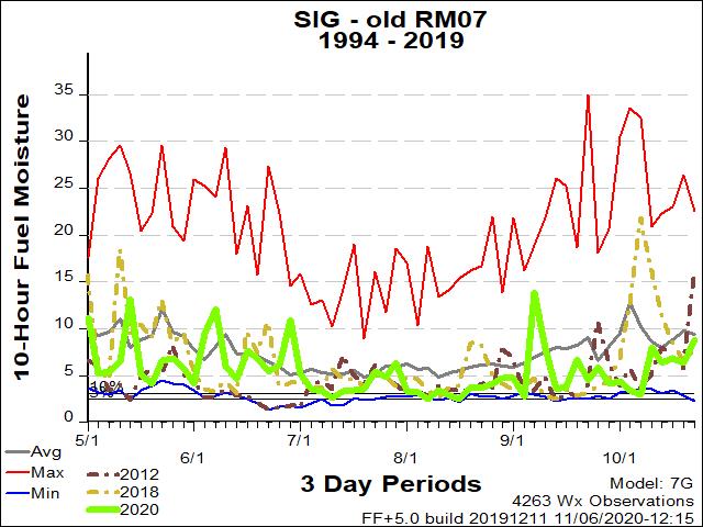
| RM07 ERC Fuels Graph |
|
|
 |
 |
 |
Return to NWS Riverton Homepage
 |
Building a Weather-Ready Nation |