
Tropical storm conditions, storm surge flooding and coastal flooding continue today across the Outer Banks and portions of the Mid-Atlantic coast. Life-threatening rip currents and high surf continue to impact much of the East Coast through the end of the week. Hazardous, record heat will continue across the Western U.S. through the weekend. Read More >
Links | Map | Warnings, Radar, & Satellite | Fire & Thunder Forecasts
Outlooks and Climate| Fuels and Fire Danger Maps
 |
||||||
|
||||||
| Roosevelt Inciweb Page | ||||||
| WFO Riverton Fire Weather Page | ||||||
| Fire Weather Planning Forecast For Zone 414 | ||||||
| Sublette County Sheriff's Office Facebook Page | ||||||
| Sublette County Emergency Management Facebook Page | ||||||
| U.S. Forest Service Bridger-Teton National Forest Facebook Page | ||||||
| Click Boxes to Expand Product on Page | ||||||
|
||||||
|
||||||
Current Warnings, Radar, and Satellite
(Click thumbnails to expand Images)
 |
|
|
|
| Pictures from the Roosevelt Fire | ||
 |
 |
|
|
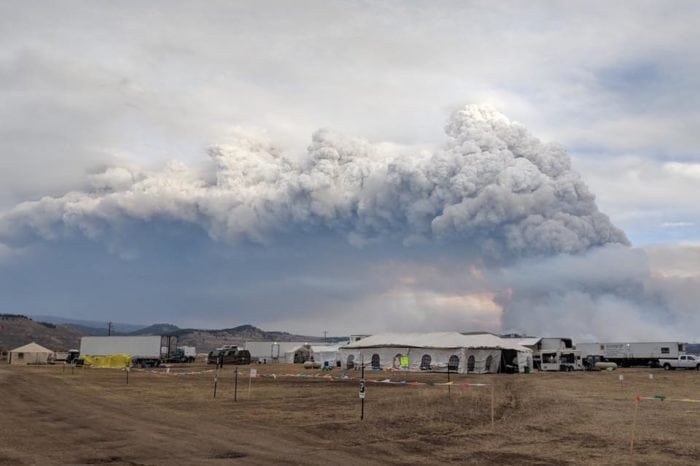
Roosevelt Fire Incident Command Post |
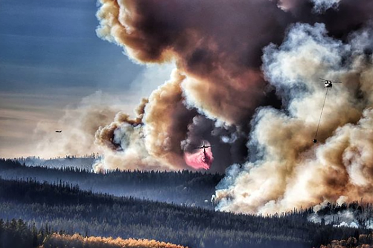
Fighting the Roosevelt Fire from the Air on 9/26 |
|
 |
 |
|
| Roosevelt Fire on 9/27 Photo from BTNF Facebook Page |
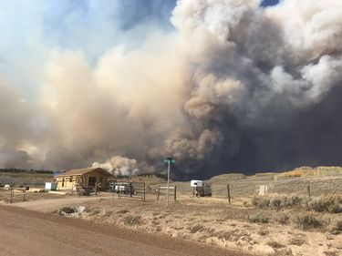
Roosevelt Fire on 9/18 |
|
|
|
|
|
|

|

|

|
 |
|
|
|
|
|
|
Storm Prediction Center Critical Fire Areas and Thunderstorm Forecasts
(Click thumbnails to expand Images)
|
|
|
|
 |
 |
 |
|
|
Day 2 Categorical | Day 3 Categorical |
 |
 |
 |
|
|
|
|
|
|
 |

|
 |
 |
 |
|
|
|
|
|
|
 |

|
 |
 |
 |
Weather Outlook and Climate Information
(Click thumbnails to expand Images)
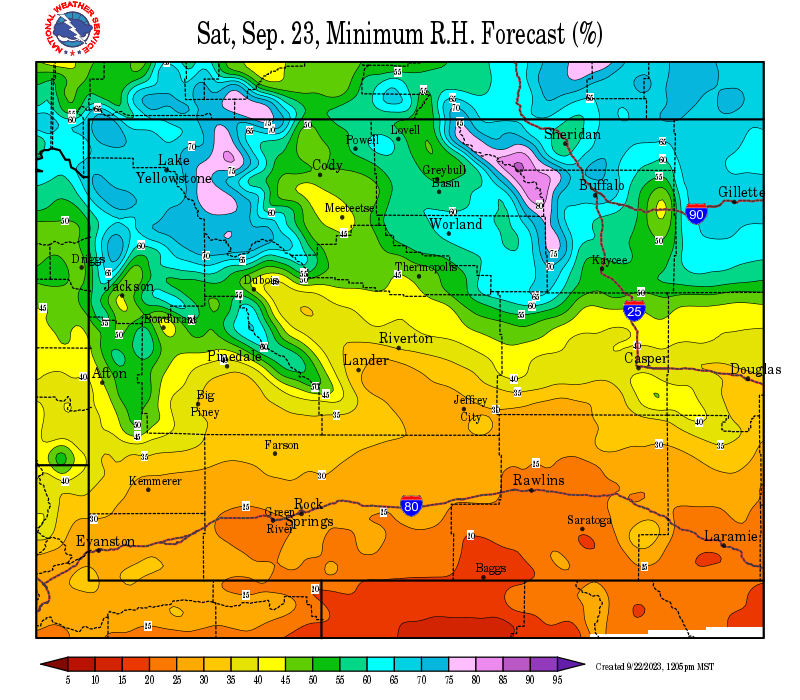
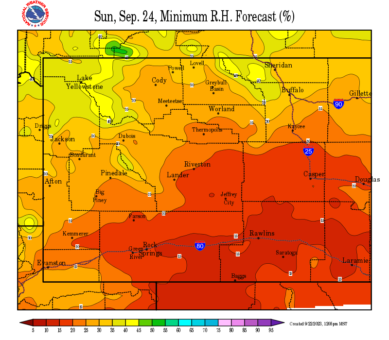
| Local Precipitation, Wind, and Humidity Information (NWS) |
|
|
|
|
|
 |
 |
 |
 |
|
|
|
|
|
 |
 |
 |
 |
|
|
|
|
|
|
|
 |
 |
 |
 |
|
|
|
|
|
 |
 |
 |
 |
USFS Fire Danger Graphics and Fuels
(Click thumbnails to expand Images)
|
|
|
|
 |
 |
 |
|
|
|
|
|
 |
 |
 |
 |
|
|
|
|
|
 |
 |
 |
 |
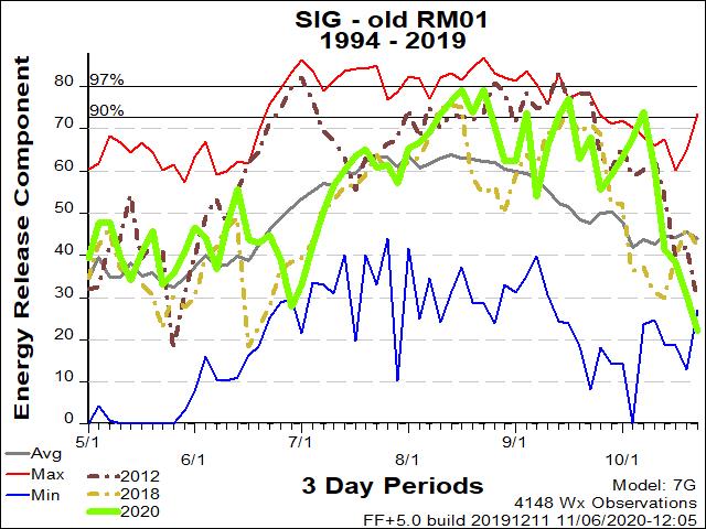
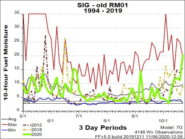
| RM01 ERC Fuels Graph |
|
|
 |
 |
 |
|
Select the ERC, 10-hr fuel moisture and pocket card graphics closest to the wildfire. Change headers, then DELETE this cell.
Pocket Cards Found Here: https://famit.nwcg.gov/applications/WIMS/PocketCards/PocketCards |
||
Return to NWS Riverton Homepage
 |
Building a Weather-Ready Nation |


