Widespread, life-threatening considerable flash flooding is expected in south-central Texas through at least Friday. Catastrophic river flooding and rapid rises on small streams, arroyos, and typically dry washes are expected in the Texas Hill Country. Wildfire smoke is impacting air quality across much of the Great Lakes region into the Northeast U.S. with Air Quality Alerts in effect. Read More >
Map | Warnings, Radar, & Satellite | Fire & Thunder Forecasts
Outlooks and Climate| Fuels and Fire Danger Maps
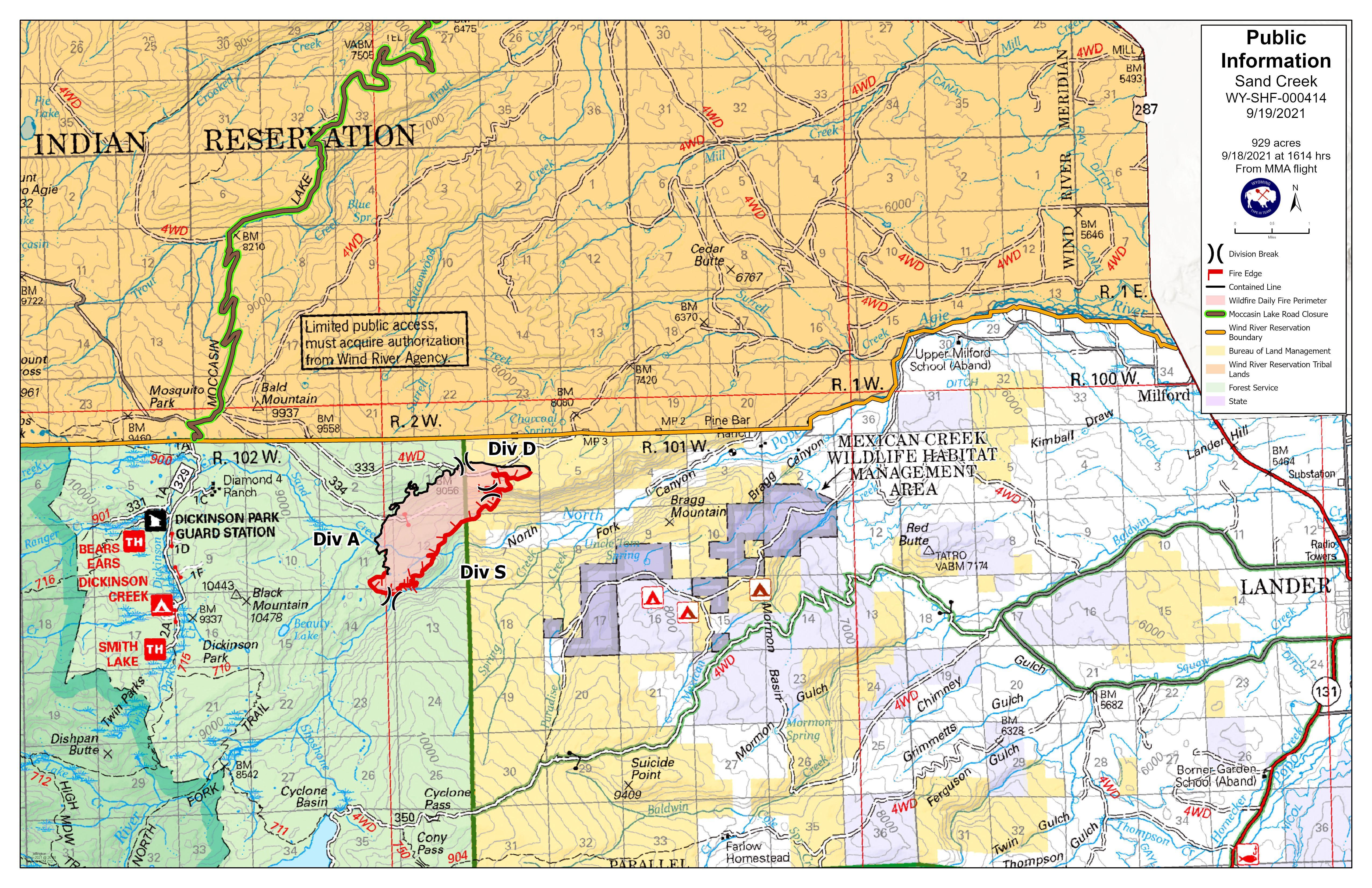
| Sand Creek Wildfire Updates (Inciweb) | ||
| WFO Riverton Fire Weather Page | ||
| Fire Weather Planning Forecast For Zone 288 | ||
| Shoshone and Arapaho Fish and Game | ||
| Shoshone National Forest | ||
| U.S. Forest Service Shoshone National Forest Facebook Page | ||
| Click Boxes to Expand Product on Page | ||
|
||
Current Warnings, Radar, and Satellite
 |
|
|
(Click thumbnails to expand Images)
|
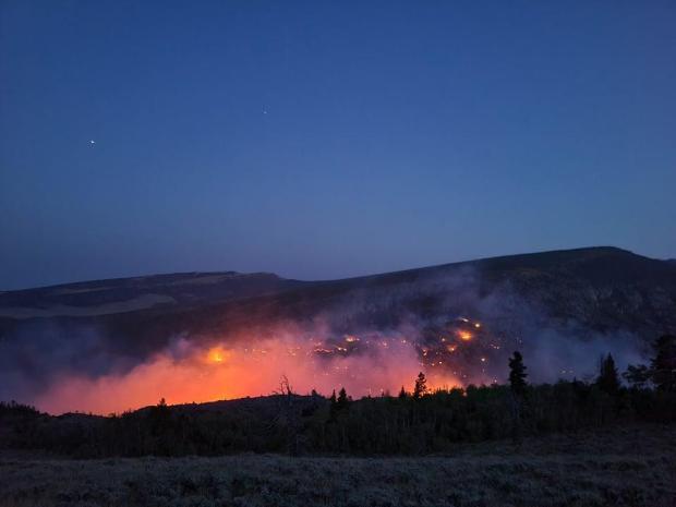
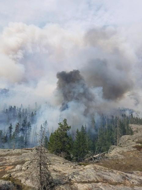
| Pictures from the Sand Creek Wildfire | |
 |
 |
|
Sand Creek Wildfire picture |
Sand Creek Wildfire picture |
|
|
|
|
|

|

|

|
 |
|
|
|
|
|
|
Storm Prediction Center Critical Fire Areas and Thunderstorm Forecasts
(Click thumbnails to expand Images)
|
|
|
|
 |
 |
 |
|
|
Day 2 Categorical | Day 3 Categorical |
 |
 |
 |
|
|
|
|
|
|
 |

|
 |
 |
 |
|
|
|
|
|
|
 |

|
 |
 |
 |
Weather Outlook and Climate Information
(Click thumbnails to expand Images)
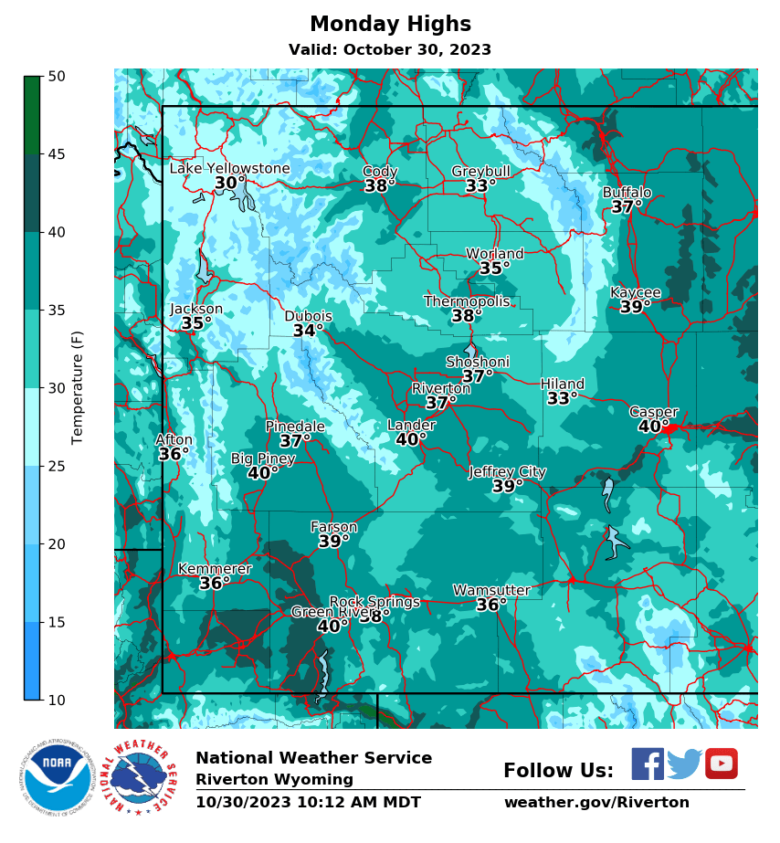
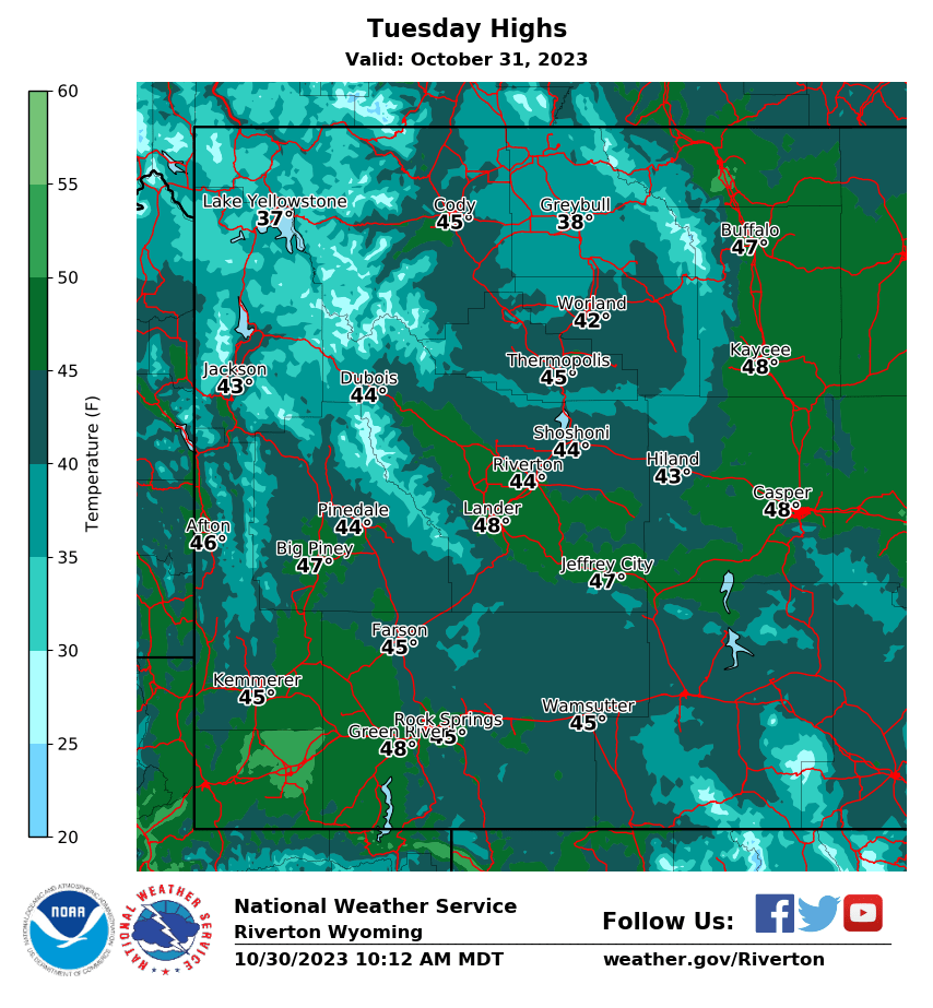
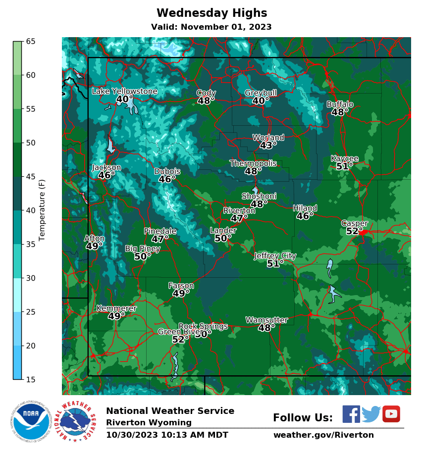
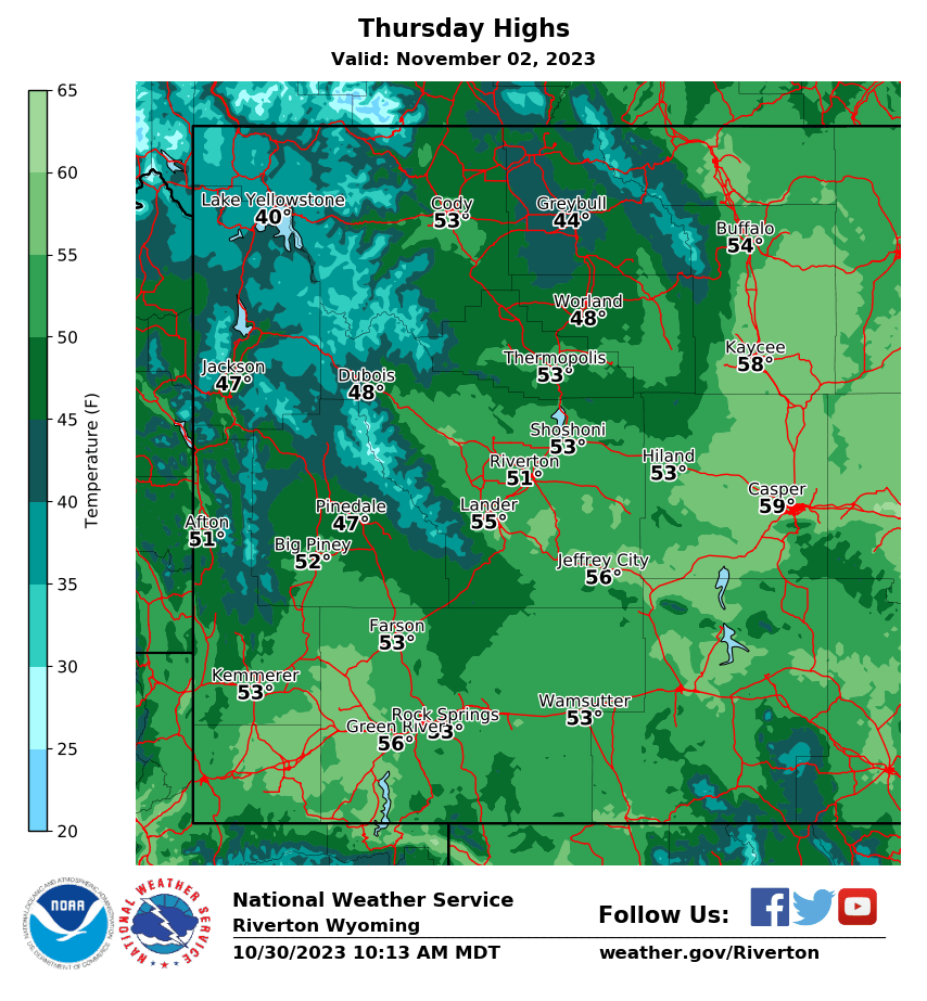
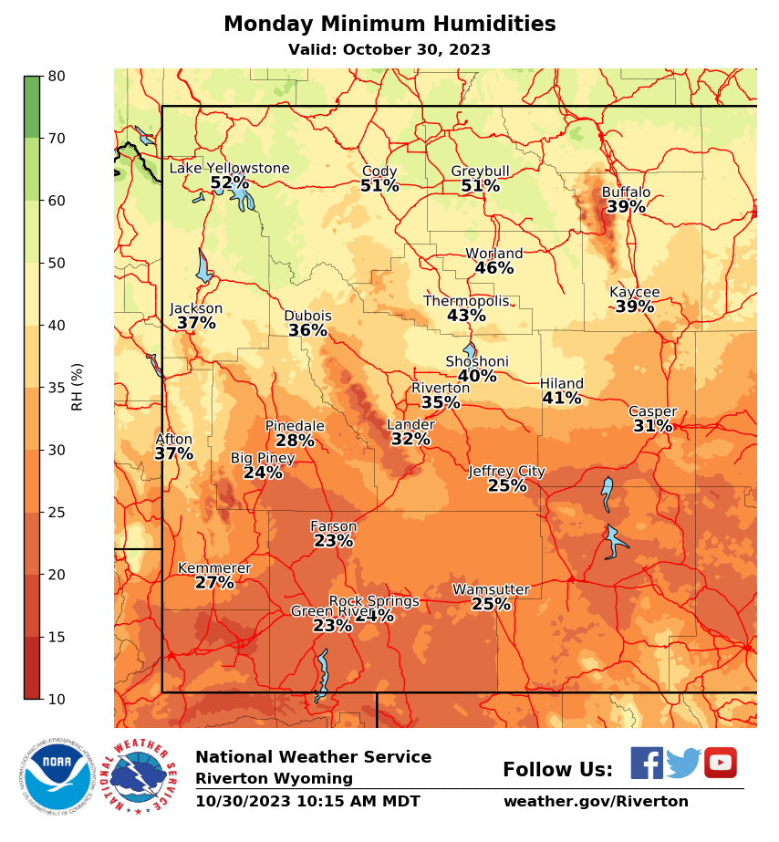
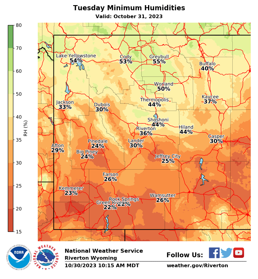
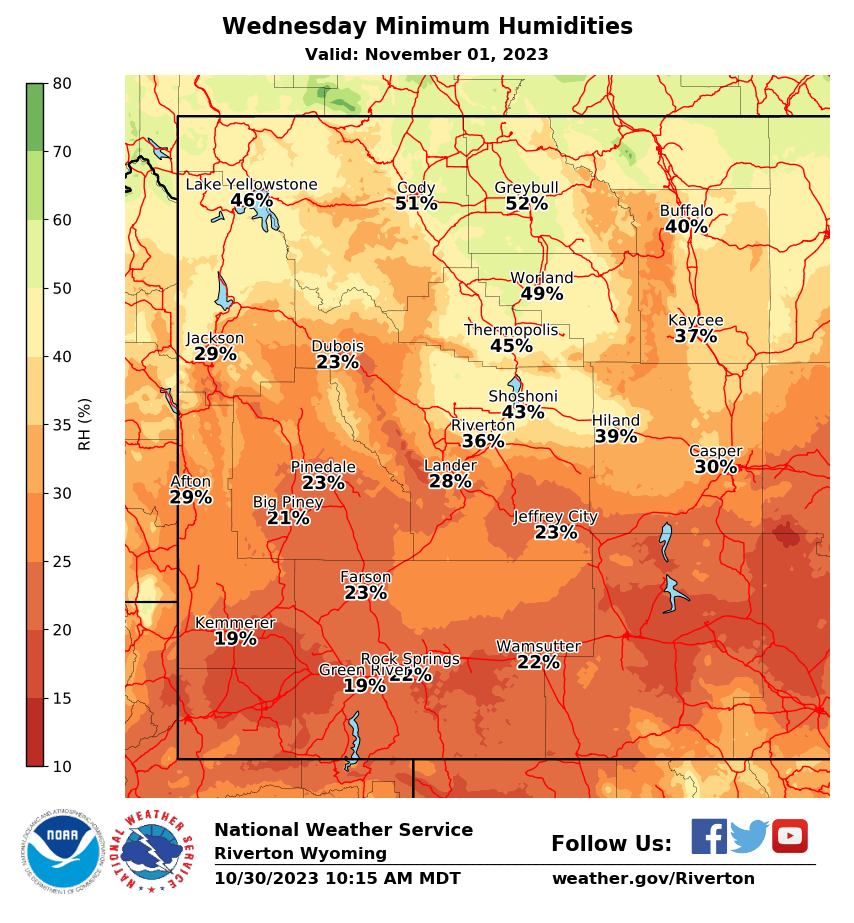
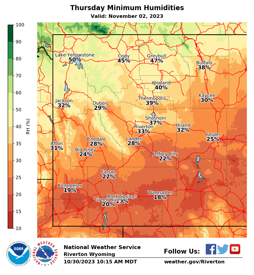
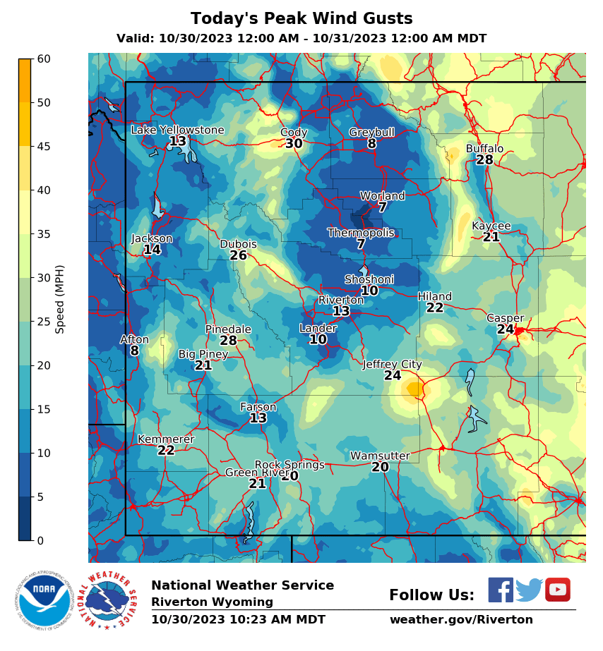
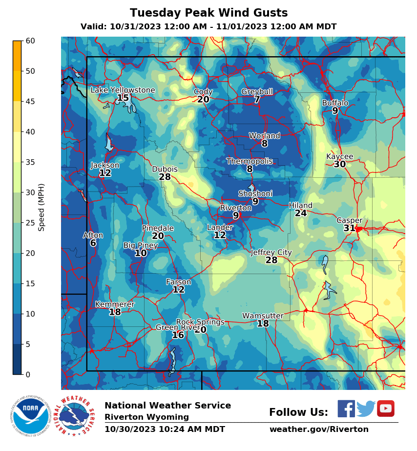
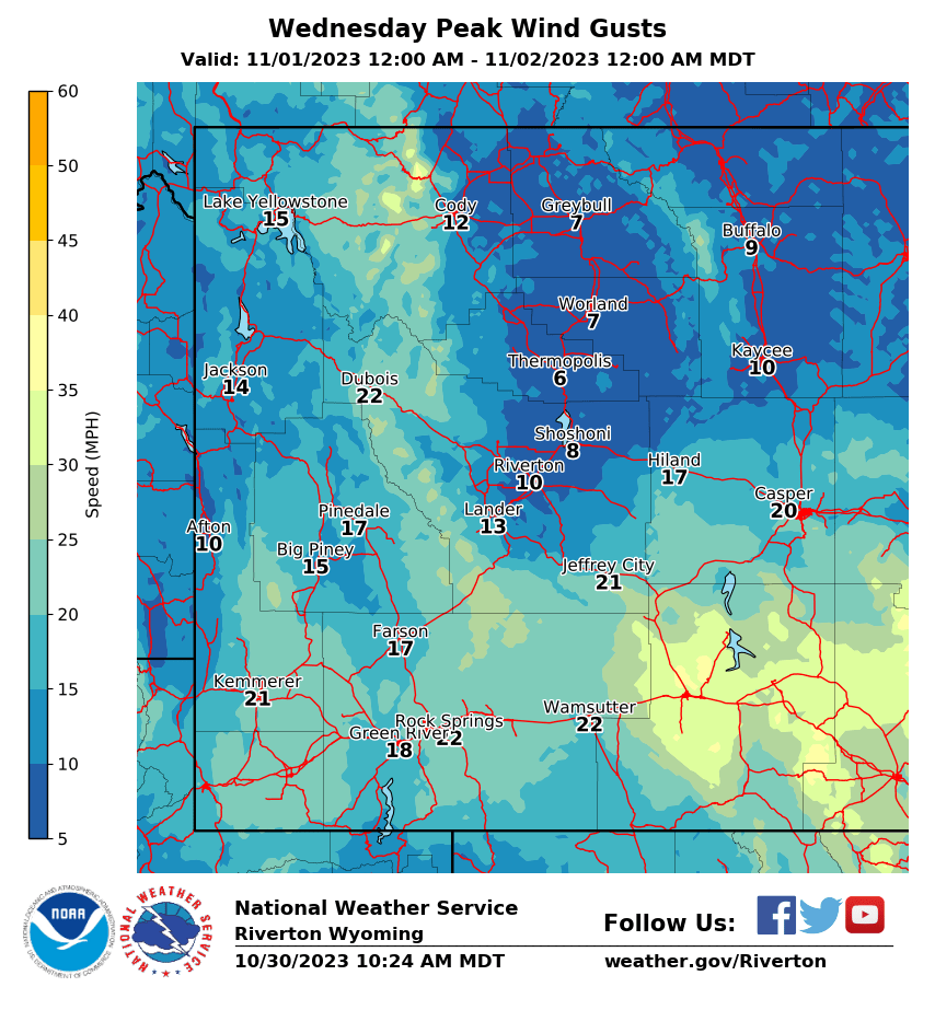
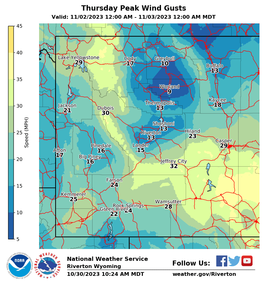
| Local Highs, Minimum RH, Peak Wind Gusts, and Precipitation (NWS) |
|
|
|
|
|
 |
 |
 |
 |
|
|
|
|
|
 |
 |
 |
 |
|
|
|
|
|
 |
 |
 |
 |
|
|
|
|
|
 |
 |
 |
 |
|
|
|
|
|
|
|
 |
 |
 |
 |
|
|
|
|
|
 |
 |
 |
 |
USFS Fire Danger Graphics and Fuels
(Click thumbnails to expand Images)
|
|
|
 |
 |
|
|
|
|
 |
 |
 |
| RM07 ERC Fuels Graph |
|
|
|
|
 |
|
|
|
||
Return to NWS Riverton Homepage
 |
Building a Weather-Ready Nation |