
Dangerous, prolonged heat is expected across portions of the Central and Southeast U.S. through July. Scattered severe thunderstorms are expected over parts of the northern Plains into the upper Mississippi Valley Tuesday, with damaging winds and large hail as the primary threats. Heavy rainfall could lead to areas of flooding across the northern Plains, Upper Midwest, Southeast and Southwest. Read More >
Links | Map | Current Warnings, Radar, and Satellite |Weather Outlook & Climate | SPC Fire and Thunder Forecasts
| Fuels and Fire Danger Maps
 |
||||||
|
||||||
| WFO Riverton Fire Weather Page | ||||||
| Fire Weather Planning Forecast for Fire Weather Zone 282 | ||||||
| Click Boxes to Expand Product on Page | ||||||
|
||||||
|
||||||
Current Warnings, Radar, and Satellite
 |
|
|
|
|
|
|
|

|

|
 |
|
|
|
|
|
|
Weather Outlook and Climate Information
(Click thumbnails to expand Images)
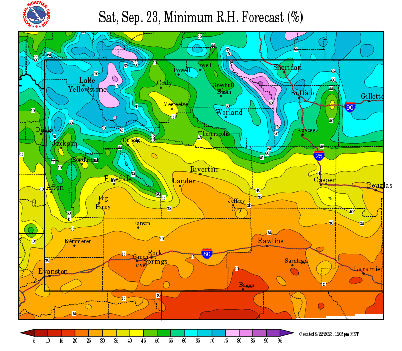
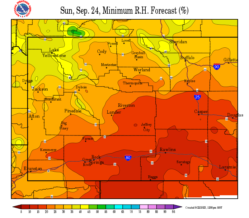
| Local Precipitation, Wind, and Humidity Information (NWS) |
|
|
|
|
 |
 |
 |
|
|
|
|
 |
 |
 |
|
|
|
|
|
|
|
 |
 |
 |
 |
|
|
|
|
|
 |
 |
 |
 |
Storm Prediction Center Critical Fire Areas and Thunderstorm Forecasts
|
|
|
|
 |
 |
 |
|
|
|
|
 |
 |

|
|
|
|
|
 |
 |
 |
|
|
|
|
|
|

|

|

|

|

|
|
|
|
|
|
|
 |

|
 |
 |
 |
|
|
|
|
|
|
 |

|
 |
 |
 |
USFS Fire Danger Graphics and Fuels
|
|
|
|
 |
 |
 |
|
|
|
|
|
 |
 |
 |
 |
|
|
|
|
|
 |
 |
 |
 |
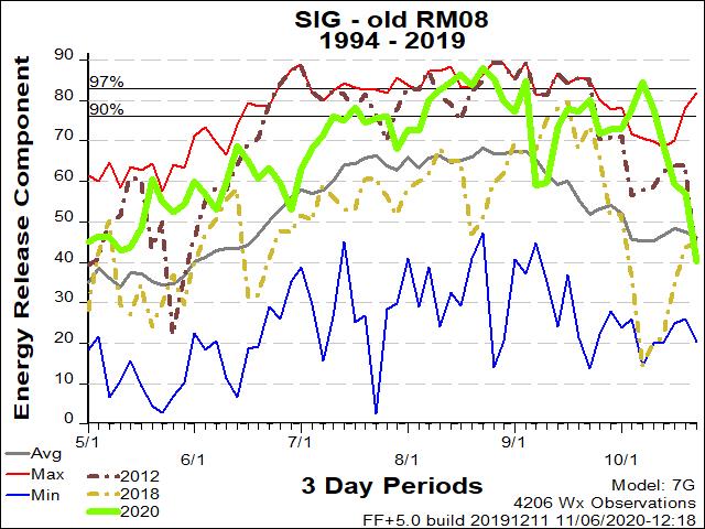
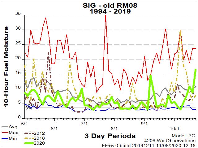
| Rocky Mountain Sec. 8 ERC Fuels Graph |
|
 |
 |
Return to NWS Riverton Homepage
 |
Building a Weather-Ready Nation |


