
Dangerous and extreme heat will remain across portions of the Central U.S. this week, persisting across the Mid to Lower Mississippi Valleys, Gulf Coast, Southern Plains and portions of Texas. A heat wave over the Southwest will intensify late this week. Severe thunderstorms and flash flooding will spread from the Great Lakes/Ohio Valley to the Mid-Atlantic and Northeast the next few days. Read More >
Overview
|
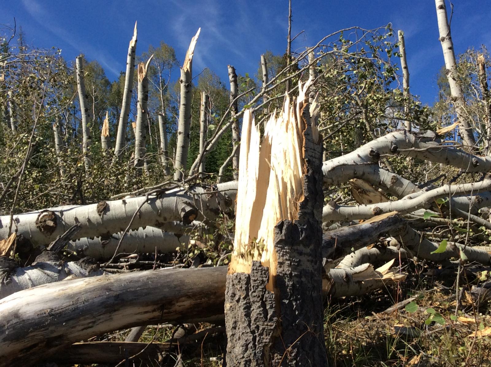
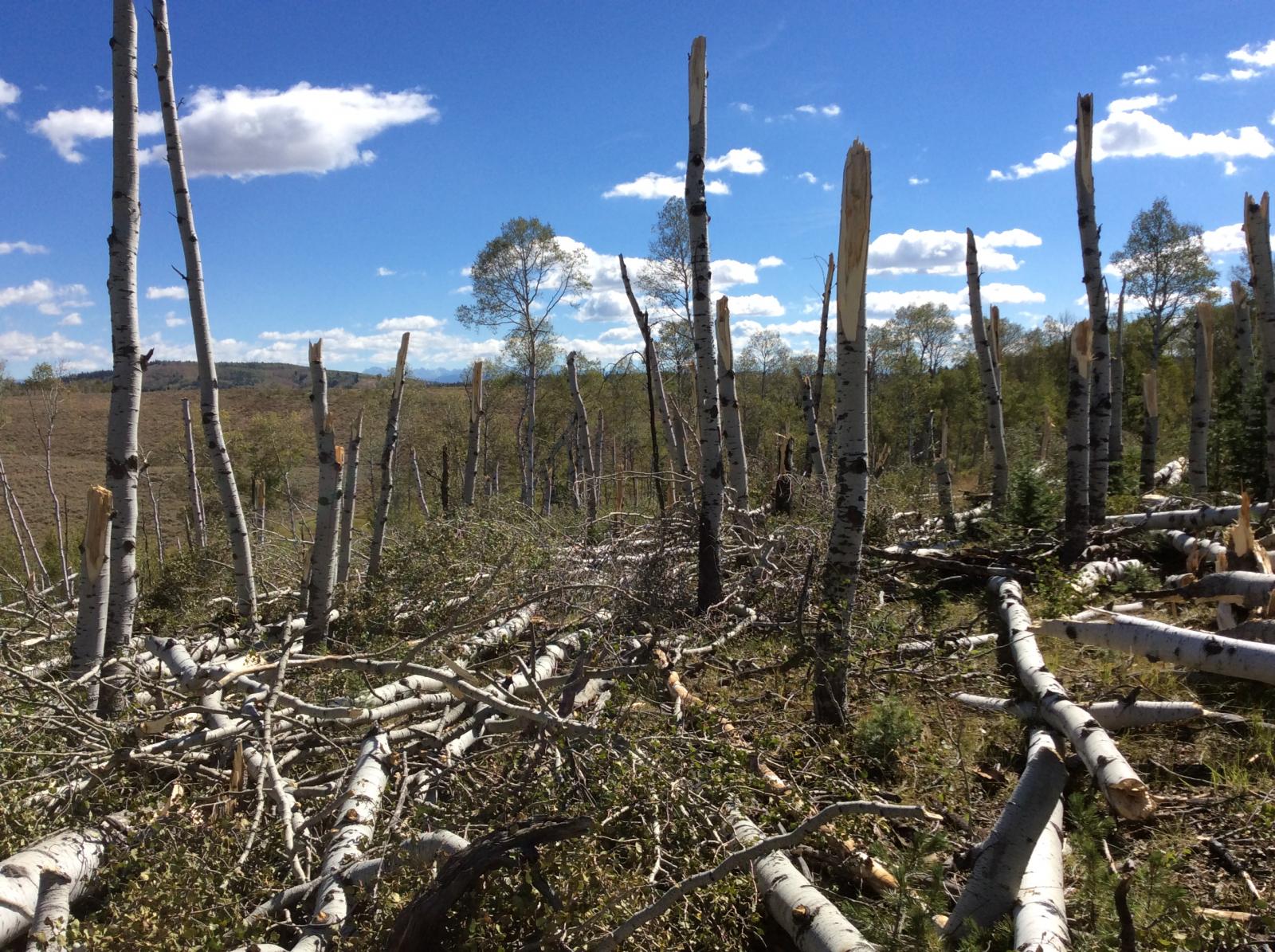
A thunderstorm rapidly developed near Merna, Wyoming, on the afternoon of Sunday, September 4, 2016. The storm strengthened and moved north across several private ranches and spawned a funnel cloud. The funnel eventually touched down as a tornado and caused areas of considerable tree damage just below The Rim, between Merna and Hoback Ranches. Large, old growth aspen trees of 12 to 15 inches in diameter were snapped in half, and other trees were topped, twisted, and/or uprooted. Hail up to the size of ping pong balls also fell near The Rim during the height of the thunderstorm. The tornado was photographed by many people from various angles and locations. The time of the tornado was estimated by comparing the location of the damage with radar imagery. Several photos of the tornado and funnel cloud can be found by visiting If you have photos, please send them to the NWS at nws.riverton@noaa.gov and include the time and location of where your photo was taken, and which direction you were looking. Each piece of information is helpful in establishing if the tornado may have been on the ground before or after what is already known. |
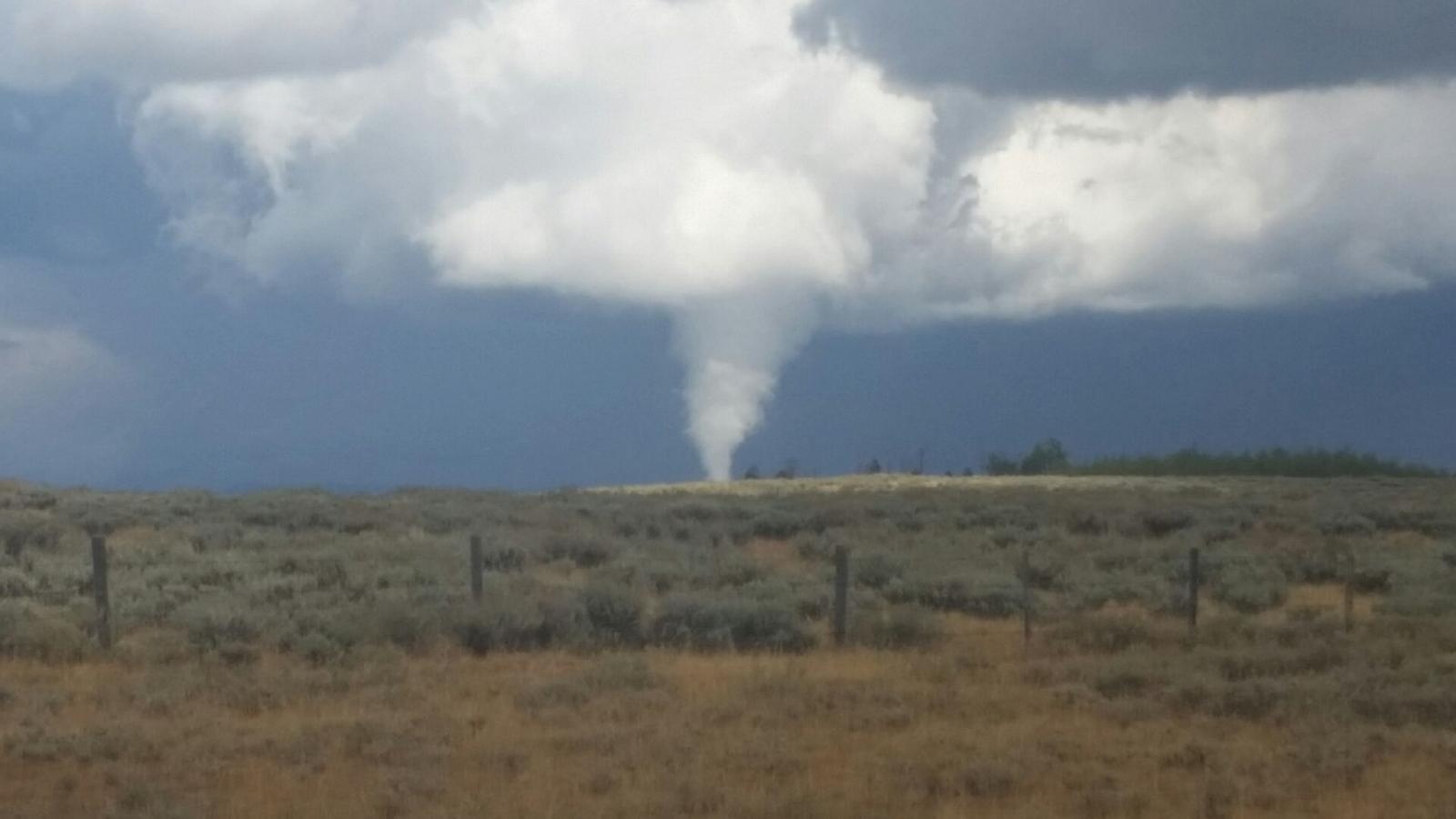 Sublette County Tornado as seen from north of Merna, Wyoming, looking northeast around 12:50 pm MDT Sunday, September 4, 2016. (Photo Courtesy of Randy Foster) |
Tornadoes:
|
Tornado - LOCATION
Track Map  
|
||||||||||||||||
The Enhanced Fujita (EF) Scale classifies tornadoes into the following categories:
| EF0 Weak 65-85 mph |
EF1 Moderate 86-110 mph |
EF2 Significant 111-135 mph |
EF3 Severe 136-165 mph |
EF4 Extreme 166-200 mph |
EF5 Catastrophic 200+ mph |
 |
|||||
Damage Photos:
Damage Photographs - Storm Survey on Wednesday, September 7, 2016
 |
 |
 |
 |
| Trees, some 12-15" in diameter, where snapped mid-trunk by 100-110 mph tornado winds. (NWS Photo) |
Wide view looking east at the worst of the tree damage. (NWS Photo) |
The tornado took out a large number of old growth trees. (NWS Photo) |
Location of the tornado relative to other towns and landmarks in Sublette County. (NWS Photo) |
 |
Media use of NWS Web News Stories is encouraged! Please acknowledge the NWS as the source of any news information accessed from this site. |
|

