Links | Map | Warnings, Radar, & Satellite | Fire & Thunder Forecasts
Outlooks and Climate| Fuels and Fire Danger Maps
 |
||
|
||
| Fire Name Inciweb Page (Info located at: https://inciweb.nwcg.gov/state/52/) | ||
| WFO Riverton Fire Weather Page | ||
| Fire Weather Planning Forecast For Zone ??? (Change link to correct Zone) | ||
| Click Boxes to Expand Product on Page | ||
|
||
Current Warnings, Radar, and Satellite
(Click thumbnails to expand Images)
 |
 |
|
|
Click Image to Enlarge Webcam image if one is near the fire - WYDOT If nothing close, delete this column. |
|
|
|
|
|
 |
 |
 |
|
|
|
|
|
|
Storm Prediction Center Critical Fire Areas and Thunderstorm Forecasts
(Click thumbnails to expand Images)
|
|
|
|
 |
 |
 |
|
|
|
|
 |
 |
 |
|
|
|
|
 |
 |
 |
|
|
|
|
|
|
 |
 |
 |
 |
 |
|
|
|
|
|
|
 |

|
 |
 |
 |
|
|
|
|
|
|
 |

|
 |
 |
 |
Weather Outlook and Climate Information
(Click thumbnails to expand Images)
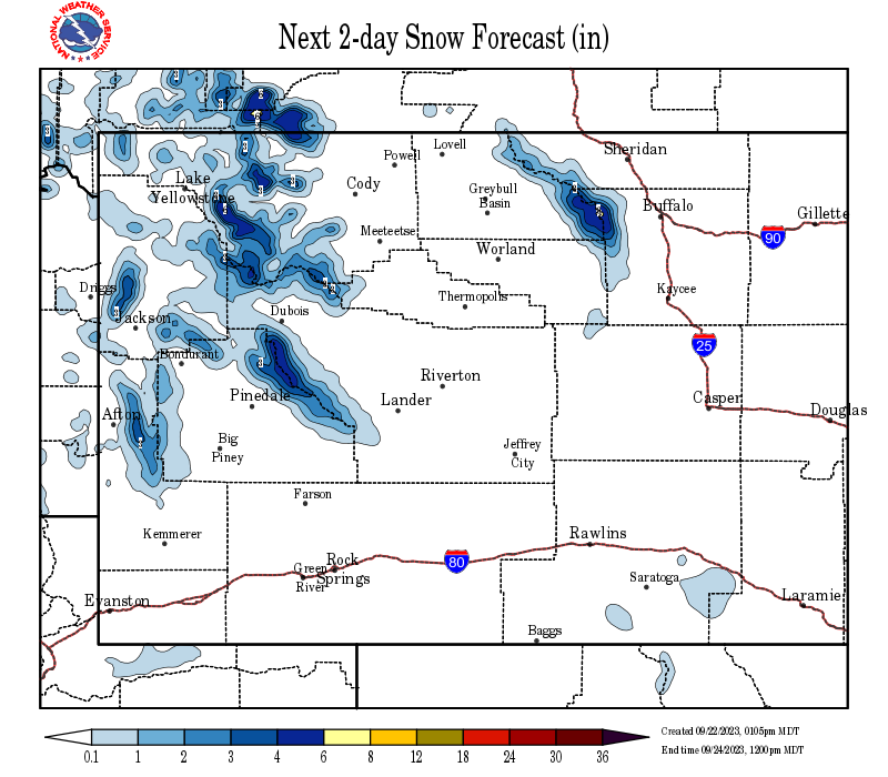
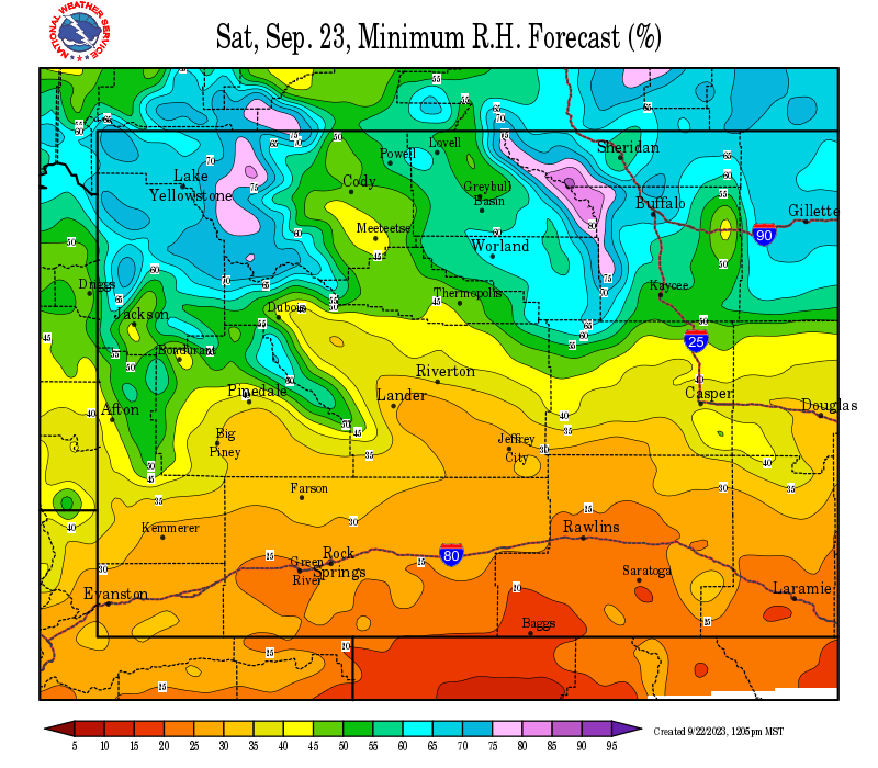
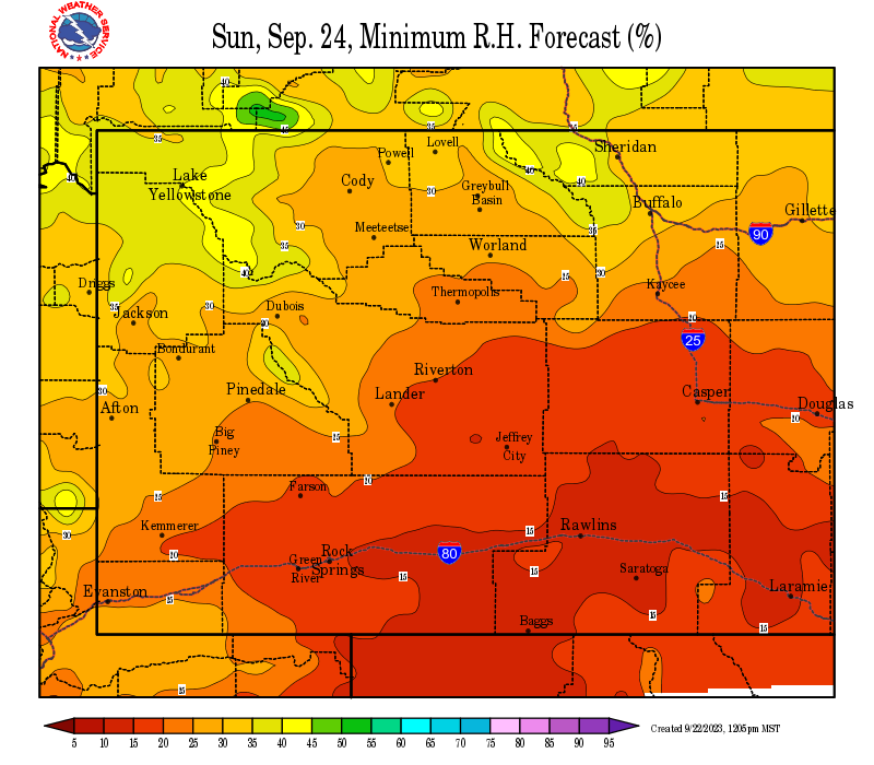
| Local Precipitation, Wind, and Humidity Information (NWS) |
|
|
|
|
|
 |
 |
 |
 |
|
|
|
|
|
 |
 |
 |
 |
|
|
|
|
|
|
|
 |
 |
 |
 |
|
|
|
|
|
 |
 |
 |
 |
USFS Fire Danger Graphics and Fuels
(Click thumbnails to expand Images)
|
|
|
|
 |
 |
 |
|
|
|
|
|
 |
 |
 |
 |
|
|
|
|
|
 |
 |
 |
 |
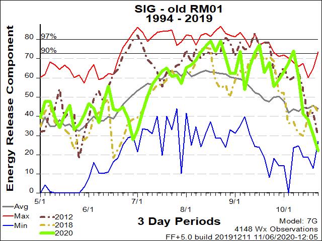
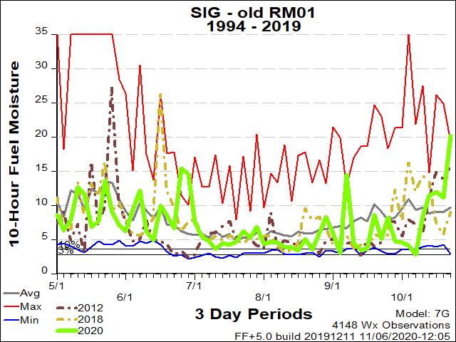
| RM01 ERC Fuels Graph |
|
|
 |
 |
 |
|
Select the ERC, 10-hr fuel moisture and pocket card graphics closest to the wildfire. Change headers, then DELETE this cell.
Pocket Cards Found Here: https://famit.nwcg.gov/applications/WIMS/PocketCards/PocketCards |
||
Return to NWS Riverton Homepage
 |
Building a Weather-Ready Nation |


