
Flash flooding threatens areas from the Tennessee Valley to the Carolinas as storms repeat along a stalled front. Monsoonal storms may trigger flooding in the Southwest. Dangerous heat expands across the Desert Southwest, Plains, mid-Mississippi Valley and Southern Tier. Critical fire weather for interior Pacific Northwest. Cooler, drier air brings brief relief to the Great Lakes and Northeast. Read More >

Map | Warnings, Radar, & Satellite | Fire & Thunder Forecasts
Outlooks and Climate| Fuels and Fire Danger Maps
| Washakie Wildfire Information (source: Inciweb) | ||
| WFO Riverton Fire Weather Page | ||
| Fire Weather Planning Forecast For Zone 288 | ||
| Shoshone and Arapaho Fish and Game | ||
| Shoshone National Forest | ||
| U.S. Forest Service Shoshone National Forest Facebook Page | ||
| Click Boxes to Expand Product on Page | ||
|
||
Current Warnings, Radar, and Satellite
 |
|
|
(Click thumbnails to expand Images)
|
| Pictures from the Washakie Park Wildfire | ||
|
|
 |
 |
|
Photo Credit: Kay Underwood |
Photo Credit: JoAnn Friday |
Photo Credit: Kay Underwood |
|
|
|
|
|

|

|

|
 |
|
|
|
|
|
|
|
|
|
Storm Prediction Center Critical Fire Areas and Thunderstorm Forecasts
(Click thumbnails to expand Images)
|
|
|
|
 |
 |
 |
|
|
Day 2 Categorical | Day 3 Categorical |
 |
 |
 |
|
|
|
|
|
|
 |

|
 |
 |
 |
|
|
|
|
|
|
 |

|
 |
 |
 |
Weather Outlook and Climate Information
(Click thumbnails to expand Images)
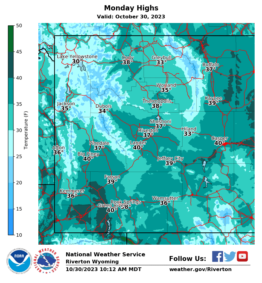
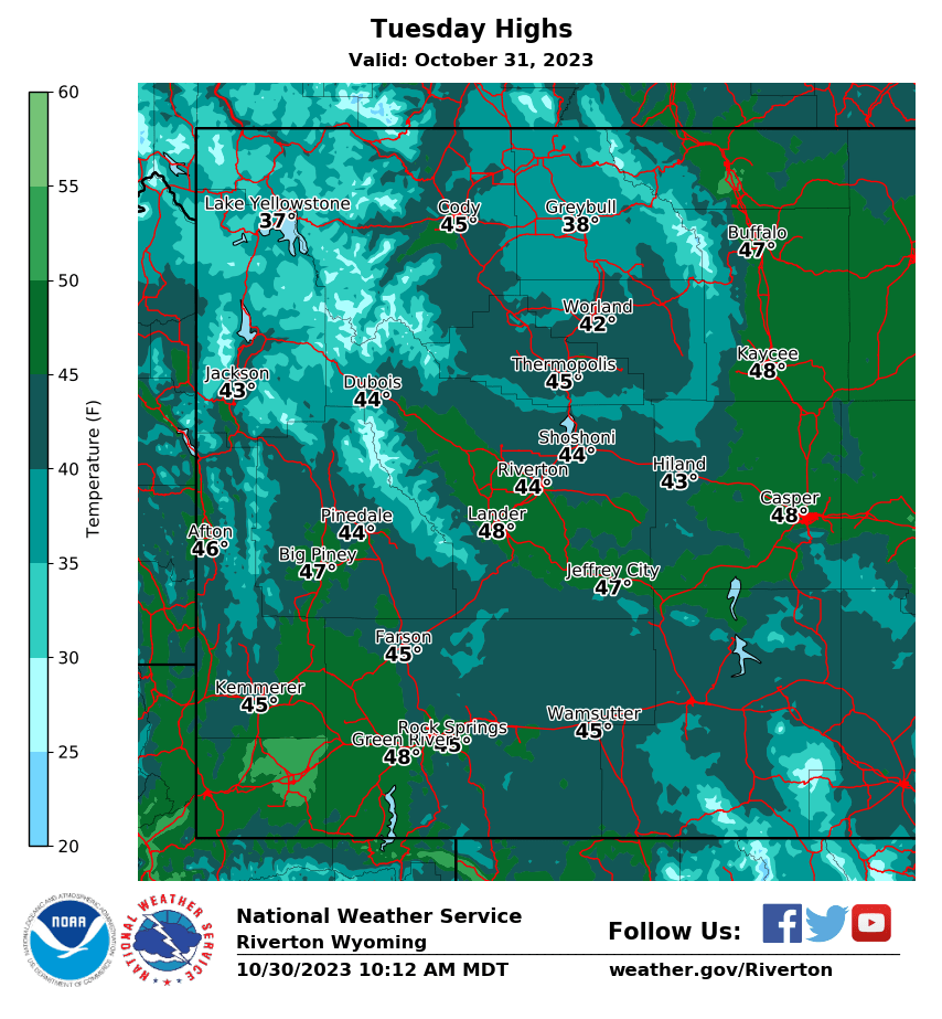
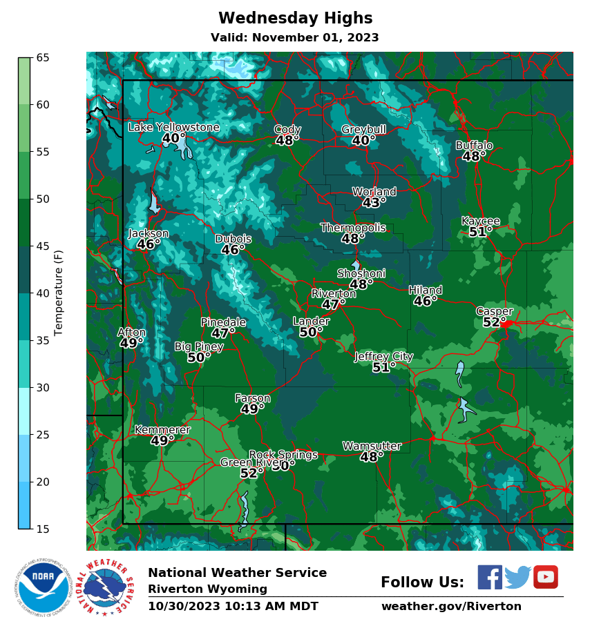
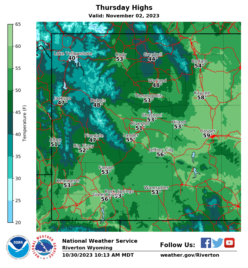
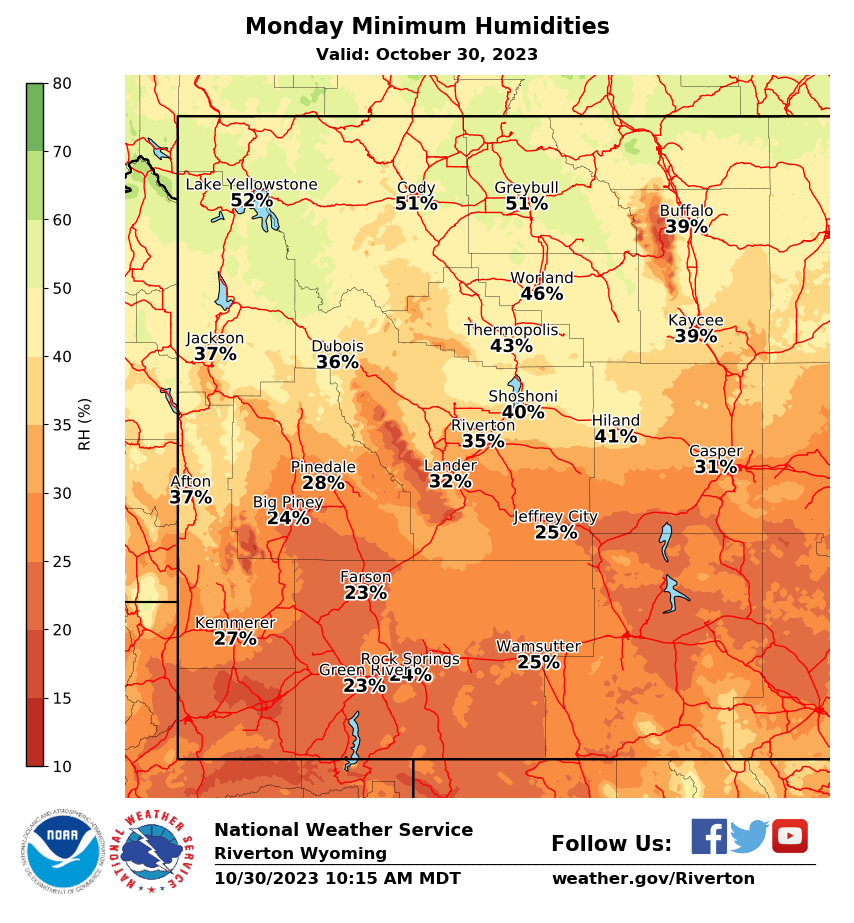
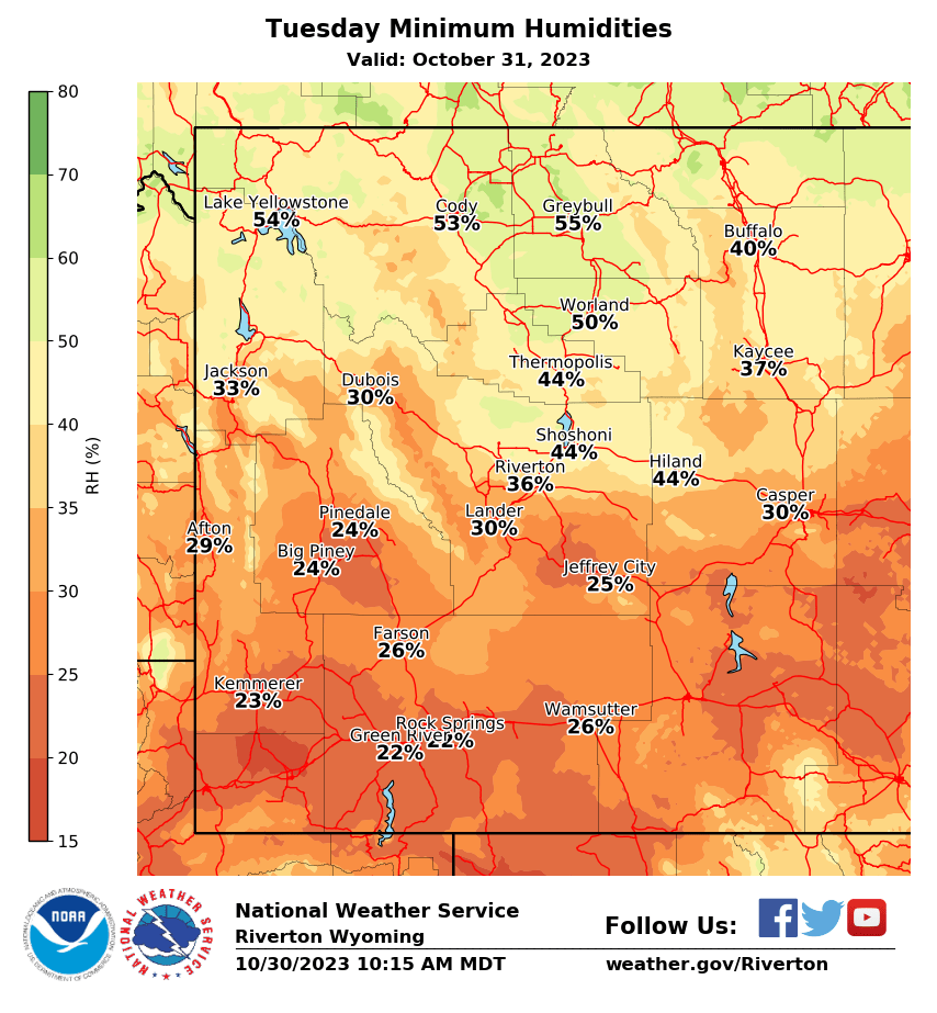
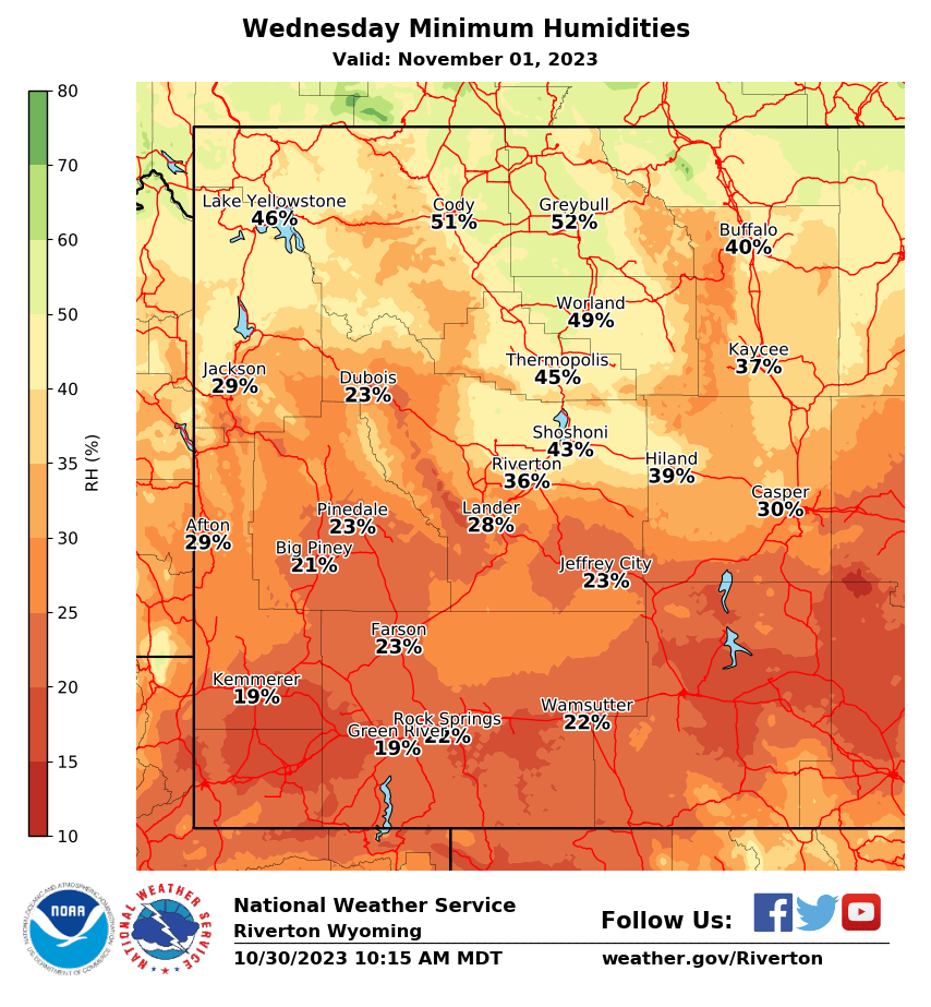
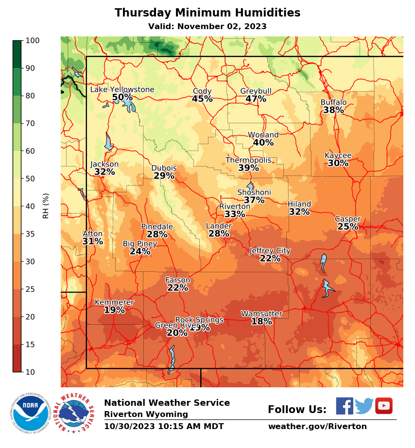
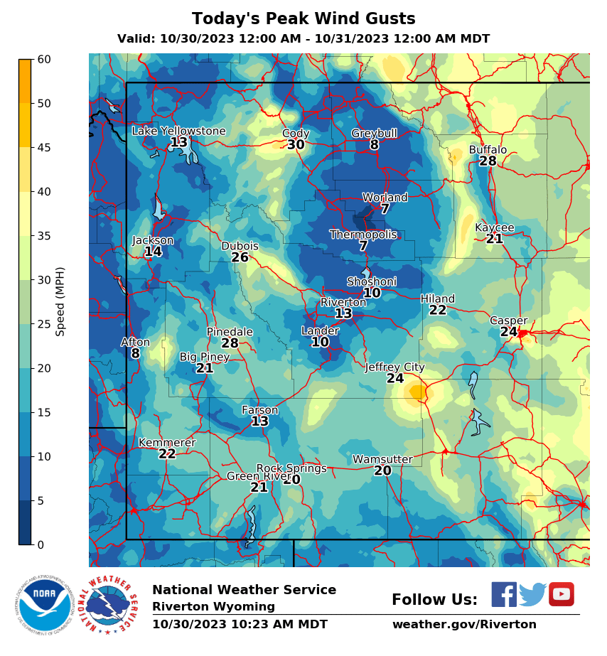
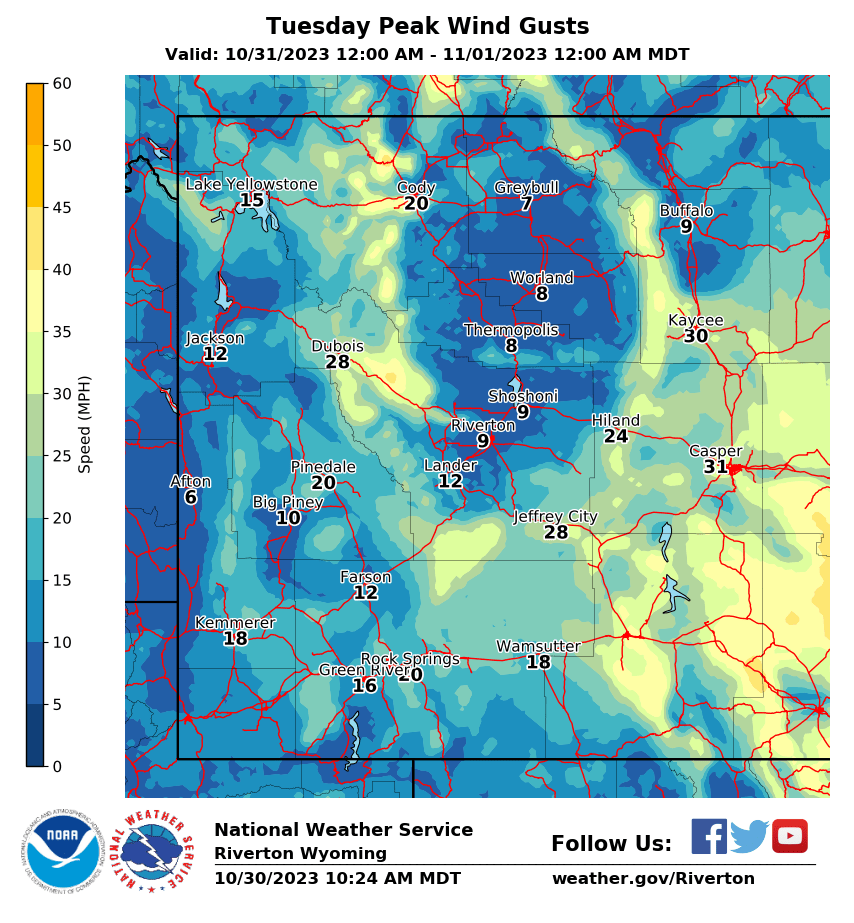
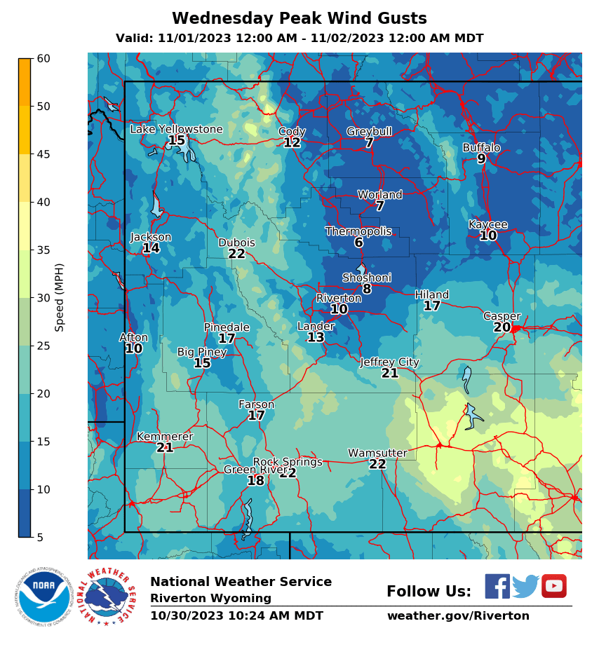
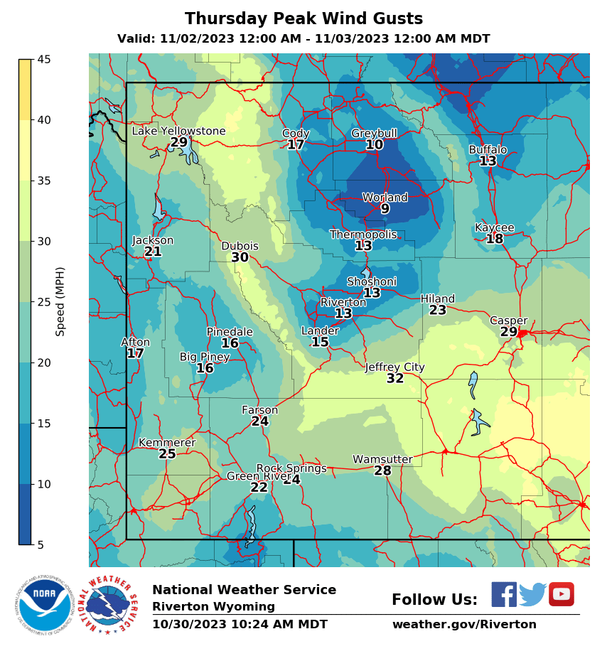
| Local Highs, Minimum RH, Peak Wind Gusts, and Precipitation (NWS) |
|
|
|
|
|
 |
 |
 |
 |
|
|
|
|
|
 |
 |
 |
 |
|
|
|
|
|
 |
 |
 |
 |
|
|
|
|
|
 |
 |
 |
 |
|
|
|
|
|
|
|
 |
 |
 |
 |
|
|
|
|
|
 |
 |
 |
 |
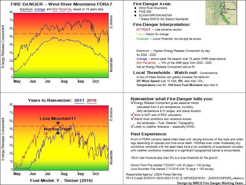
USFS Fire Danger Graphics and Fuels
(Click thumbnails to expand Images)
|
|
|
 |
 |
|
|
|
|
 |
 |
 |
| RM07 ERC Fuels Graph |
|
|
|
|
 |
|
|
|
||
Return to NWS Riverton Homepage
 |
Building a Weather-Ready Nation |


