
Tropical Storm Podul (16W) will bring heavy rain and gusty winds to Agrihan, Pagan and Alamagan in the Northern Mariana Islands though Saturday. Severe thunderstorms may produce a few tornadoes, large hail, severe winds and heavy rain across the Northern Plains through the night and the threat will shift to the Upper Midwest Friday. Hot temperatures and fire weather conditions continue in the West Read More >

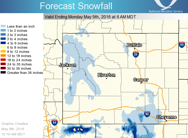
* Light to Moderate Rain & Snow to continue through Sunday Evening *
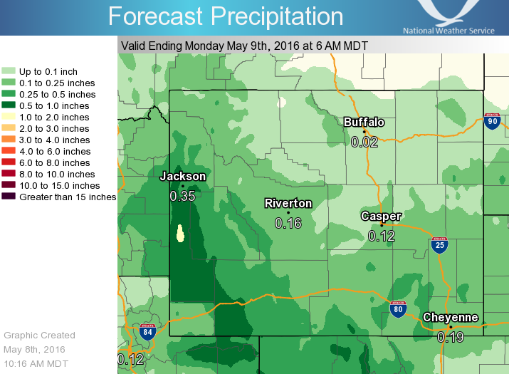
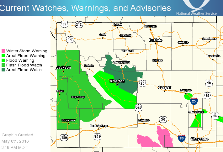
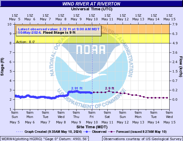
Heavy Rain / Potential Flooding: Heavy rainfall has already fallen since Friday night. Here is a comprehensive list of 2-day totals through Sunday morning along with a revised list of CoCoRaHS observer reports over the same time frame . Flood and flash flood watches remain in effect for many portions of central and south-central Wyoming through late Sunday afternoon. Additional rainfall of 0.25 inches is possible in central Wyoming Sunday. Portions of western & southwest Wyoming may see 0.5 to 1.5 inches of precipitation by early Monday morning. Some rivers in central Wyoming are in flood stage Sunday morning. Other small streams and creeks have the potential to flood and there will be an increased threat for rock and mudslides in area canyons. Travelers can keep up-to-date with current road conditions by visiting wyoroad.info.
General Impacts
 |
Heavy rains may cover roadways, causing travel difficulties. Travelers are encouraged to remember to "Turn Around Don't Drown!" Mountain passes may become snow-covered and slick. Significant rainfall may also cause rock or mudslides in canyons. The Wind River Canyon will be especially susceptible to rock and mudslides. |
 |
Significant rainfall will result in street flooding across the area, and land grading may result in some water coming into susceptible buildings and houses. |
 |
Those with outdoor plans will want to prepare for soggy conditions, or snowfall over the higher elevations. Most cases of hypothermia occur in the warm season when people are outdoors and exposed to wet and cold conditions. |

Here are the latest graphics dealing with rain and snow through Sunday. (click for a larger view):
 |
 |
|
|
12 pm Sunday thru 6 am Monday |
 |
 |
|
6 am Monday, May 9 |
as of 2 pm Sunday, May 8 |
 |
 |
|
for WInd River at Riverton |
for Little Wind River near Riverton |

Want to track the storm? Here are the local and regional radar loops:
 |
  |

Latest WYDOT Road Information Map
| Social Media:Tweets by @NWSRiverton | |
|
Twitter: www.twitter.com/NWSRiverton Facebook: www.facebook.com/NWSRiverton |
Here are some additional links to help monitor the weather situation:

