National Weather Service United States Department of Commerce

Areas of Severe Thunderstorms and Excessive Rainfall through This Weekend

Several rounds of severe thunderstorms are ongoing and expected from the central and southern High Plains to the Southeast U.S. through Sunday. Large hail, damaging winds, and a few tornadoes will be possible. Thunderstorms may also bring areas of excessive rainfall which could bring flooding to parts of the aforementioned areas through Sunday. Read More >

  Overview

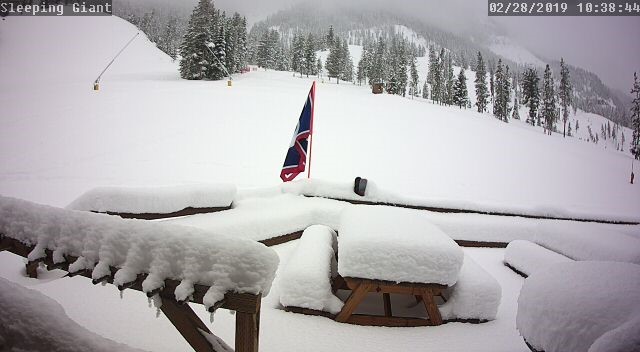
Between February 23rd and February 27th, multiple winter storms impacted western and into portions of central Wyoming, bringing significant snow across the west, high winds, and multiple long duration road closures.

Some roads were closed and reopened several times through the entire event due to winter conditions, and multiple roads closures lasted more than 24 hours to several days. Several car accidents were reported and numerous roads were closed in Teton county due to the significant and long term heavy snowfall.

The Bridger-Teton Avalanche Center issued avalanche watches and then avalanche warnings from Monday (2/25) through Thursday (2/28) afternoon. Multiple avalanches are known to have happened since Monday (2/25).

A total of 60 local, state, and federal agencies collaborated together ahead of and during the multi-day events from February 23-28th.


Image
WY22 Jackson - the ID state line 2/25/19
Image Image Image
Teton Pass 2.28.19 11:00 AM Brooks Lodge, tunnel to the door, 2.28.19 11:00 AM Sleeping Giant Ski Areas in Pahaska


nws logo

Media use of NWS Web News Stories is encouraged!
Please acknowledge the NWS as the source of any news information accessed from this site.
nws logo