
Tropical system in the Gulf expected to gradually strengthen the next couple of days off the Florida Panhandle and Alabama coasts. Instances of flash flooding will be possible through Thursday along the eastern and central Gulf Coast. Severe thunderstorms will develop and move along a cold front crossing the Upper Midwest, and through the Ohio Valley/Mid-Atlantic on Tuesday. Read More >
 |
Building a Weather-Ready Nation |
 |
|
Click Image To See A Water Vapor Loop! Two airmasses will collide over the Intermountain West this weekend. Click on the picture to see a pretty impressive loop! |
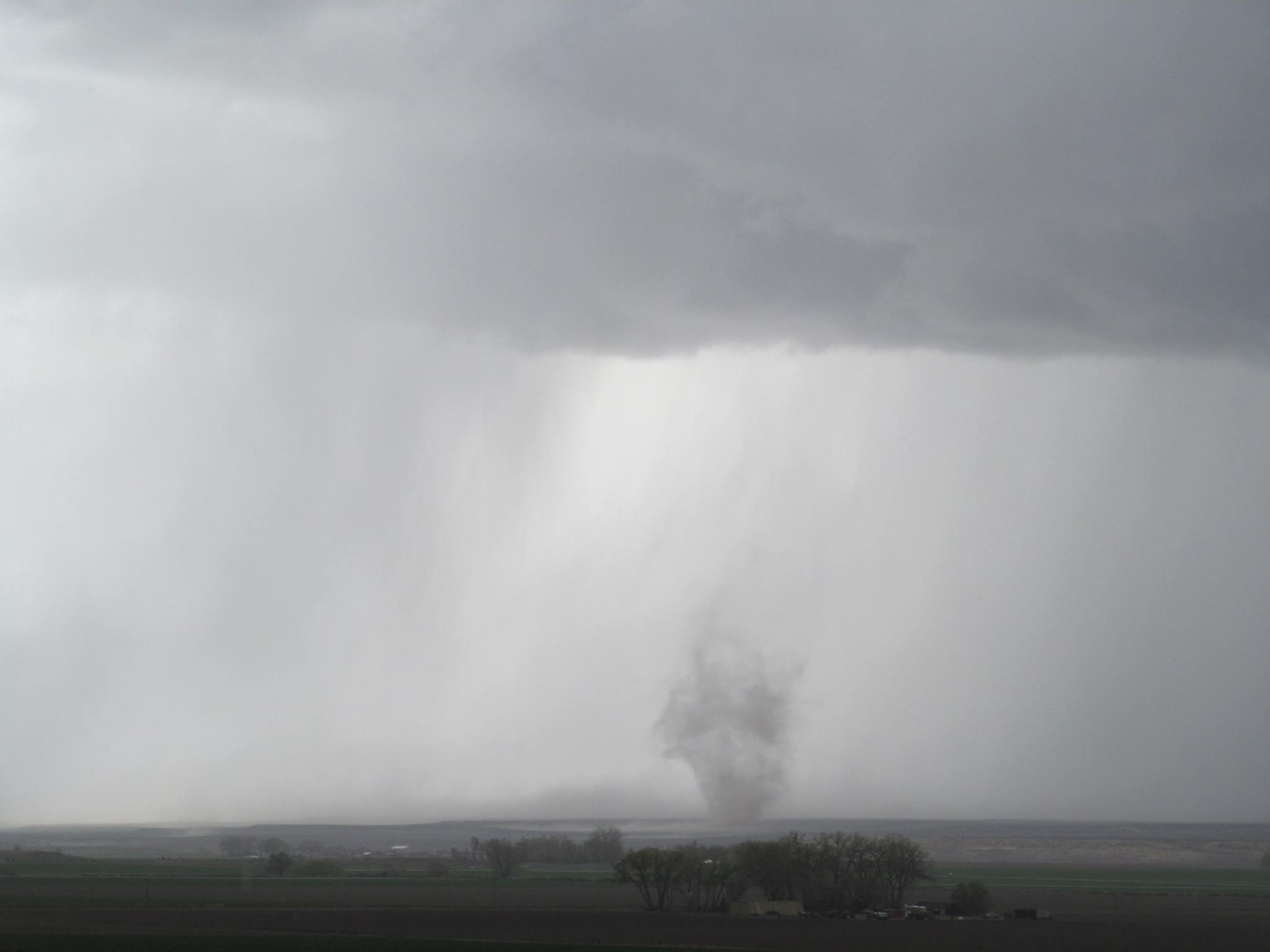
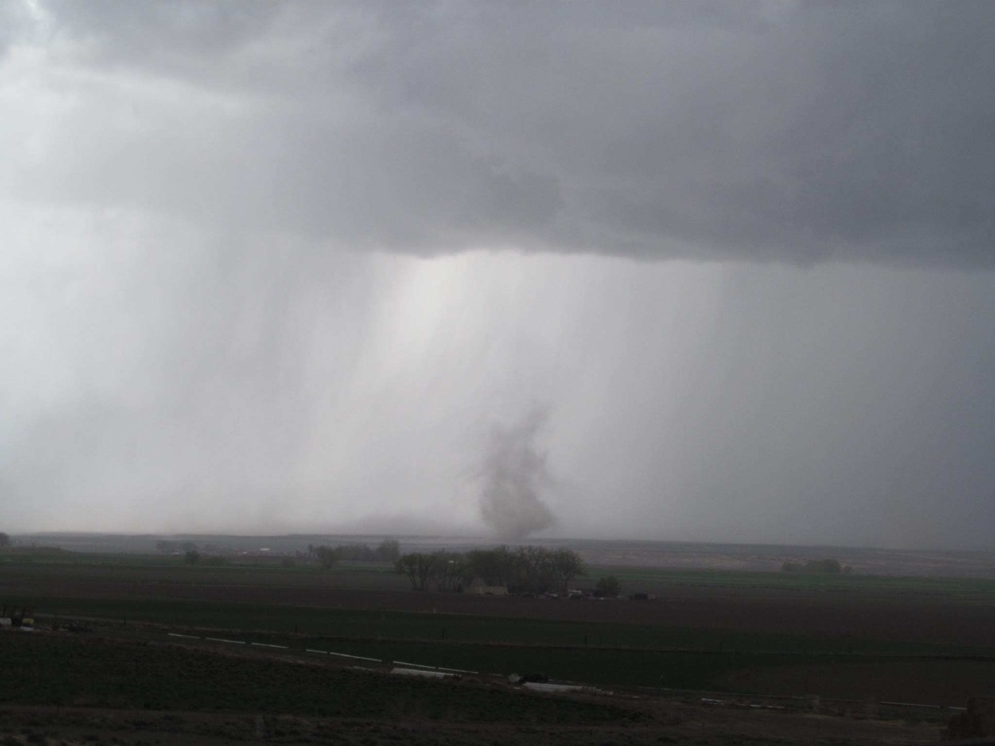
An early spring storm impacted central Wyoming during the afternoon hours of May 6th 2014. A trough sliding through the area moved a cold front across central Wyoming. This system decreased the stability of the air across central Wyoming, allowing thunderstorms to develop.
In general, thunderstorms began to develop around 1pm, with stronger storms developing close to 2 pm. Some storms were quite strong, with one storm producing two tornadoes, and another producing large hail.
The Tornado
A strengthening thunderstorm was noted across Fremont county around 2 pm. Radar images began to show classic signatures demonstrating tornadic activity at around 2:05 pm. The first notification confirming a visual sighting of the tornado arrived around 2:10 pm, with another phone call received within 15 minutes for the same tornado. Overall two tornadoes touch downed west of the Boysen Reservoir. The tornadoes were rated an EF0 and an EF1, with several power poles toppled. One spotter was able to obtain both still images, and a video of the tornado as it moved across Fremont county.
|
|
|
|
|
|
|
|

|
|
|
 |
On average, the state experiences about 12 tornadoes a year. 2014 was a slightly above average tornado year for Wyoming, with a preliminary total of 13 tornadoes being reported. Make sure you stay up to date on the latest forecasts especially during the severe weather season. Click here for Wyoming severe weather safety tips and information.
 |
Monitor our Severe Weather Summary Page for current Warnings, Watches, and Advisories. What's the difference? |
 |
Check the latest Weather Story graphic for an overview of the area forecast. |
 |
Check out what's on the radar. Riverton | Pocatello | Cheyenne | Billings | Salt Lake City | Rapid City | Mosaic |
| Submit storm reports/images and keep up to date with us on Facebook! | |
 |
Submit storm reports/images and keep up to date with us on Twitter! |
 |
Other reporting methods include eSpotter, email (cr.wxriw@noaa.gov), or by phone at 1-800-211-1448. |
 |
Check the latest Public Information Statement for the latest storm reports. |
| Monitor current road conditions by visiting the Wyoming Dept. of Transportation (WYDOT) or by calling 5-1-1. |
|
Learn more about the National Weather Service's efforts to build a Weather-Ready Nation! |


