
A wet Memorial Day weekend is in store for the East, with widespread rainfall of 1 to more than 2 inches expected from the Gulf Coast to southern New England. Well above normal temperatures are forecast to build across the northern Plains. Another round of heavy to excessive rainfall is expected to impact the western Gulf Coast this weekend with Flood Watches in effect. Read More >
***While this page highlights the burn scar associated with the Roosevelt Fire, these impacts can occur down slope and/or downstream of any burn area, big or small. Please contact local officials if you are unsure of your risk.***
|
Greatest Risk Area
Creeks / Streams Impacted
Other Impacted Areas
|
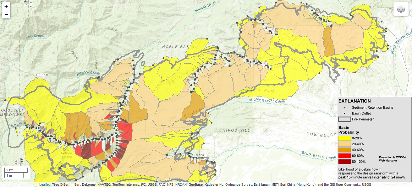
Click map above for close-up picture. Visit this link for a complete What should people who live near burn areas do to protect themselves from potential Flash Flooding and Debris Flows?
|

