National Weather Service United States Department of Commerce

Heavy Rain in the Appalachians and Central Gulf Coast; Heat Continues in the West; Monitoring the Tropics

Heavy to excessive rainfall over the southern Appalachians and portions of the central Gulf Coast may bring areas of flooding today. Hot temperatures are in place through today across much of the western U.S. and New England. Tropical Storm Erin is forecast to become a Major Hurricane this weekend as it moves across the central Atlantic Ocean. Monitor future forecasts for any East Coast impacts. Read More >

SYNOPSIS


  • Early April snowpack and/or SWEs were above average (105 to 115% of median) across almost all major basins in Wyoming.
  • Above average snow depths across far western Wyoming.
  • Average soil moisture percentages across basins in northeastern Wyoming and portions of the Wind River Basin; Below average soil moisture percentages across southern Wyoming.
  • Widespread pine bark beetle damage (2010 to 2018) across the Upper North Platte, Little Snake, Laramie, and Wind River Basins.
  • No significant precipitation trends during the spring runoff season (May – July). Above average temperatures are expected across central to western Wyoming during the runoff season.


HIGHLIGHTS


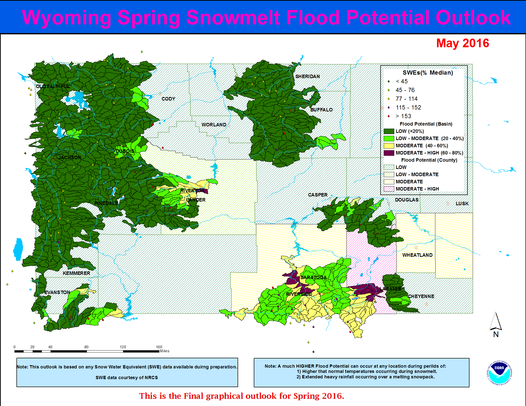
  • Low to Moderate potential for flooding due to spring snowmelt runoff across portions of the Salt River Basin (far western Wyoming) and portions of the Little Laramie River Basin.  All other headwater basins will generally have a Low potential for snowmelt runoff flooding.

Latest Wyoming Spring Flood Potential graphic: