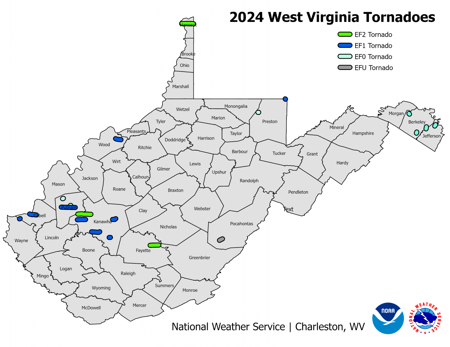
An tornado of unknown intensity (due to lack of damage) occurred in Pocahontas County on September 25, 2024. This brings the number of documented tornadoes across West Virginia in 2024 to 20, setting a new record for the most tornadoes in a calendar year for the state. Here's a look at the tornadoes that have been documented:
 |
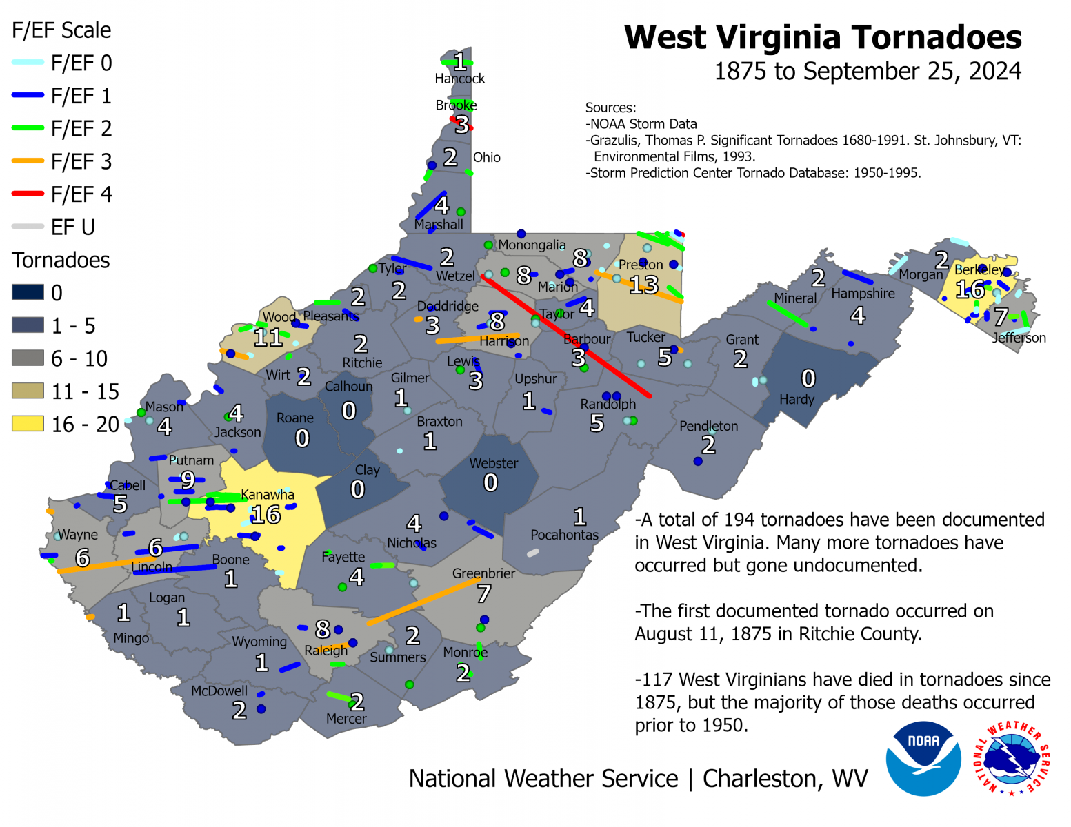
The first tornado to be documented since West Virginia became a state occurred in 1875 in Ritchie County. Since then 192 tornadoes have been documented across the state. The most active year up until 2024 was 1998 when 14 tornadoes occurred. Nine tornadoes were documented in 2014 and eight occurred in 2016.

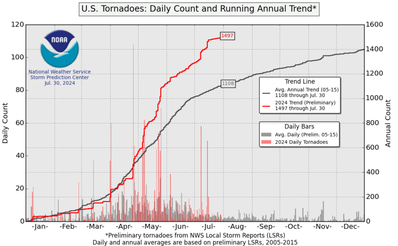
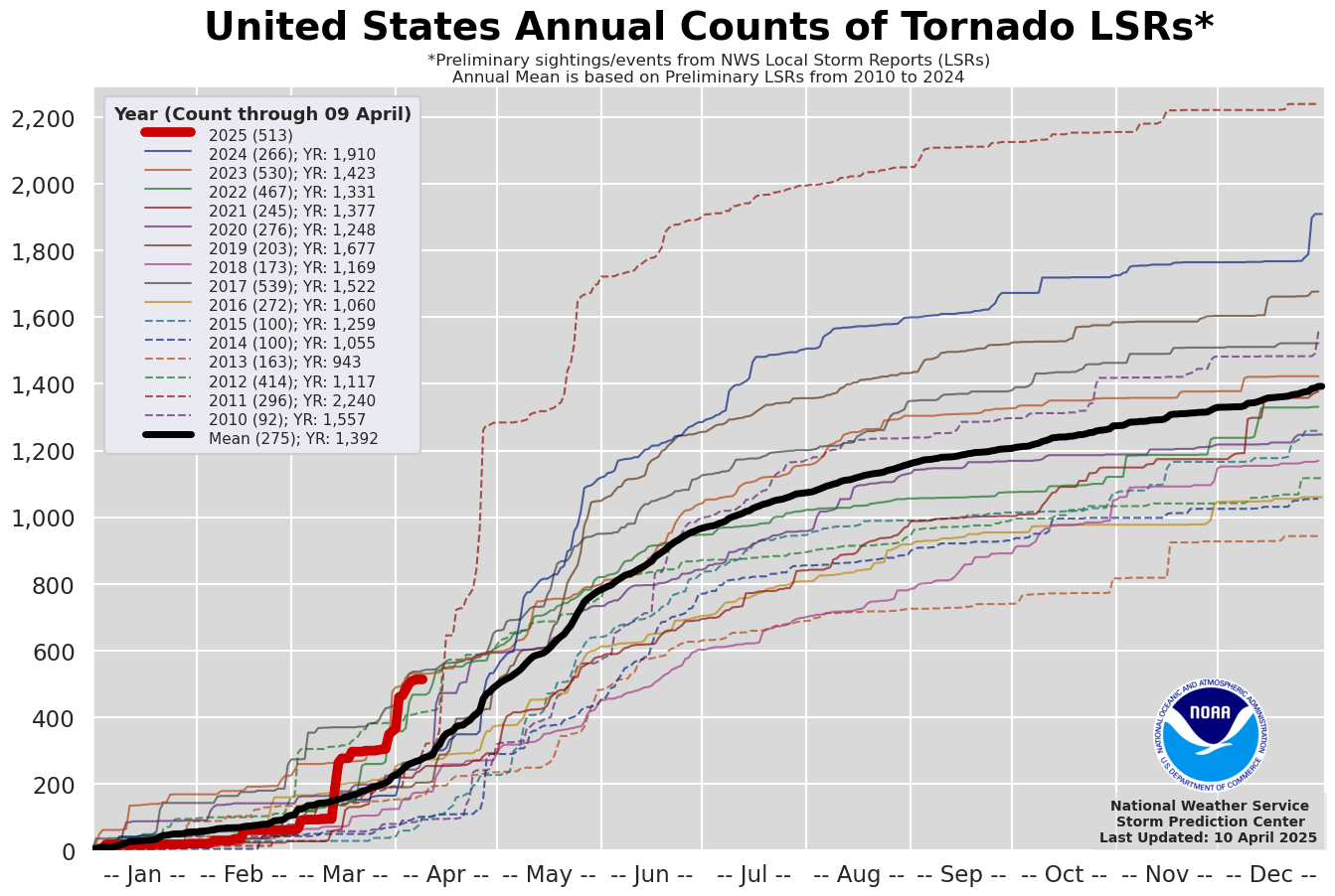
We are not alone in West Virginia as this has been an active year for tornadoes across the United States. Below are charts showing the preliminary tornado counts across the United States updated daily by the Storm Prediction Center.
 |
 |
You may be wondering what is causing this increase in the number of tornadoes? This may be nothing abnormal at all! The numbers have increased in large part due to the fact that we are just finding more of the weaker EF0 and EF1 tornadoes. Due to the prevalence of security cameras, cell phones and social media, many more of these tornadoes are being recorded now than was possible in the past.
Drones have also improved our ability to diagnose tornado damage vs. straight-line wind damage. It can be rather challenging sometimes figuring out whether damage was caused by a weak tornado or straight-line winds. This is especially true in hard to access areas or where there's not very many damage indicators. Before drones became commonplace, NWS survey teams were limited to what they could see from the road since aerial reconnaissance had to be done by costly fixed-wing planes or helicopters. Drones can now give us a complete picture of the damage, even in hard to access areas, and they have allowed us to be more accurate in what we call tornado vs. straight-line wind damage.