
A Flood Watch remains in effect overnight for much of the area southeast of the Ohio River. The areas of greatest concern for flash flooding are east of I-79 and south of I-64. Please keep updated on the latest forecast and have a way to receive warnings. Read More >
A new software upgrade has been installed at the Charleston, WV, (KRLX) WSR-88D radar that will enable the radar to obtain low level scans more frequently in severe weather events. The software change will allow the WSR-88D radar to obtain the lowest level radar scan more frequently during severe weather events. Previously, the WSR-88D scanned the atmosphere at progressively higher angles to create a 3D profile of a storm. These scans would begin at 0.5 degrees above the horizon (the lowest angle possible) and end at a maximum angle of 19.5 degrees. These scans form what is known as a Volume Coverage Pattern, or VCP. This maximum angle can vary depending on the distance the storms are from the radar. Last year, a feature called AVSET (Automatic Volume Scan Elevation Termination) was installed that allows the radar to automatically restart a VCP if the radar beam travels above the storms.
With this latest upgrade, a new feature called SAILS (Supplemental Adaptive Intra-Volume Low Level Scan) will enable the radar to insert an additional 0.5 degree scan in the middle of a VCP.
See the illustrations below for more details.
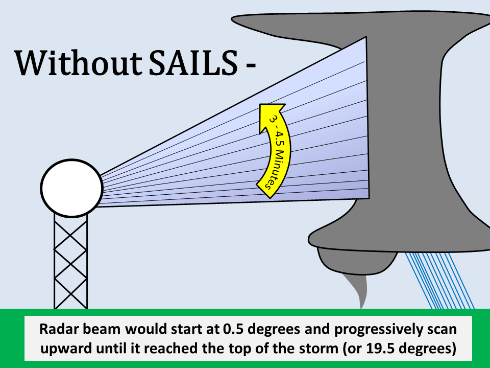
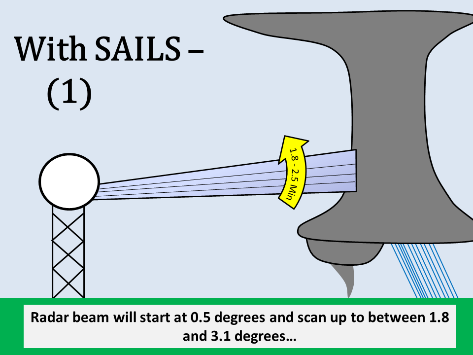
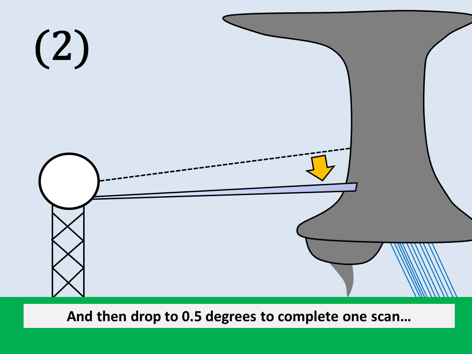
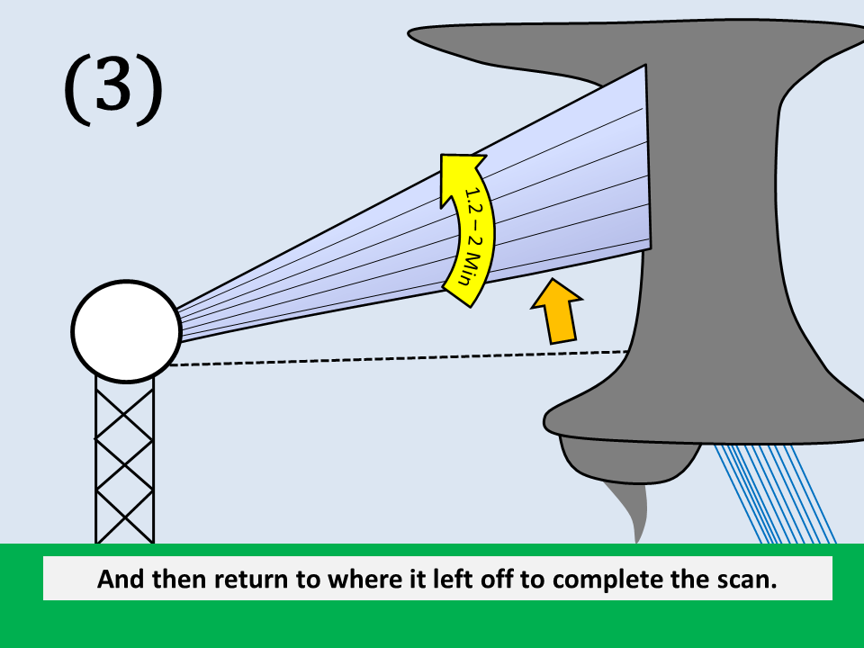
When it comes to severe weather, frequent low-level radar scans are crucial to observe the development of tornadoes, which can form in a matter of seconds. Thus, with SAILS the NWS to be able to observe rapidly changing weather phenomenon with a greater degree of precision and issue more timely severe weather warnings. Currently, the WSR-88D radar completes its lowest scan in 3 to 4.5 minutes (during severe weather), depending on the range of the storms from the radar (AVSET). With SAILS, the radar will now perform this low-level scan every 1.8 to 2.5 minutes, giving us low-level data almost twice as fast as before.
This upgrade will also bring several new enhancements besides SAILS. One new addition will be a radial noise filter, which will greatly reduce the "spikes" seen on the radar image at sunrise and sunset (see example from the Minneapolis radar below). Another new feature will enable the radar to automatically determine the best settings for viewing velocity data for the strongest storms in the radar's coverage area.
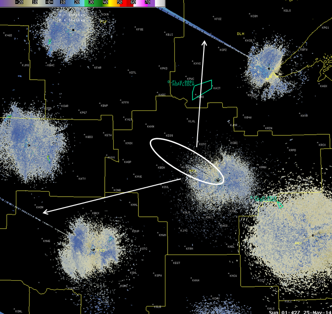
A "sun spike" removed from the Minneapolis radar while radars to the north and south (which had not been upgraded yet) still contain these spikes.
(Courtesy of the Minneapolis NWS)
The Warning Decision Training Branch (WDTB) has created a training resource available online – RDA/RPG Build 14.0/RPG Build 14.1 training.

