CoCoRaHS (pronounced KO-ko-rozz) is a grassroots volunteer network of backyard weather observers of all ages and backgrounds working together to measure and map precipitation (rain, hail and snow) in their local communities. By using low-cost measurement tools, stressing training and education, and utilizing an interactive website, the goal is to provide the highest quality data for natural resource, education and research applications.
Why do you need to know how much precipitation fell in my backyard?
Even in the day and age in which we live with Doppler Radar scanning the skies and automated weather observing equipment in many communities, we still need humans manually measuring the precipitation in their backyards. These manual observations serve as ground truth for the precipitation estimates we get from Doppler Radar and automated station measurements. Manual observations also fill in gaps where automated equipment doesn’t exist. Plus, there are no automated instruments in our region that measure the snow. So, we rely heavily on manual human observations to know how much snow fell.
Here’s an example from a few years ago showing how significantly rainfall can vary across a small distance, such as the “Metro Valley” between Huntington and Charleston.
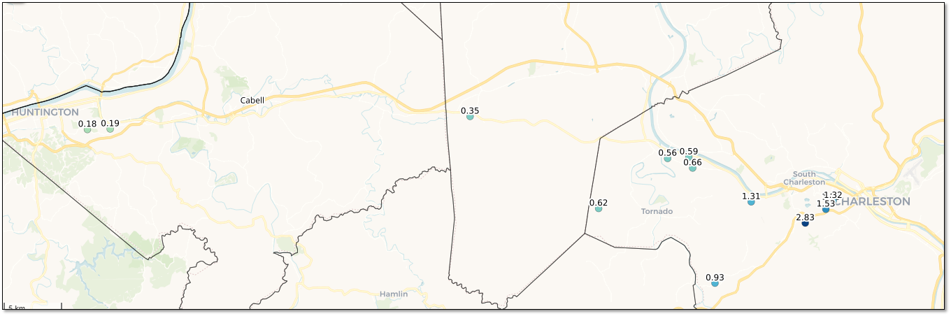
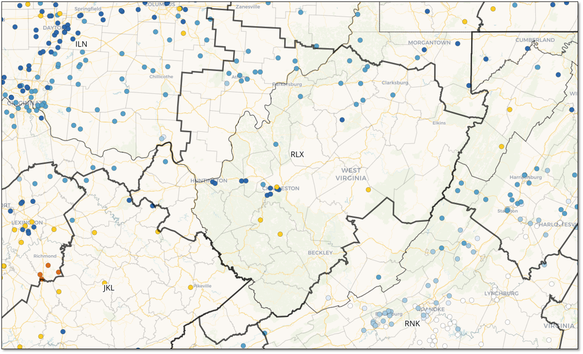
Even though we have several CoCoRaHS observers in this heavily populated area, even more are needed to accurately map the rainfall. In the more rural counties in our County Warning Area (RLX), we often have no observers at all, as can be seen below in an example of observations from a recent morning. Filling in these large empty regions with no observers is very important and we would love your help to do so!
How do I become a CoCoRaHS observer?
Contributing your precipitation measurements each day takes less than 5 minutes (there’s even an app for that!) and it’s a fun way to learn about the wonderful natural resource that falls from the sky. Here’s how to join and start sharing your precipitation measurements:
Have additional questions or want to learn more?
This April there will be a virtual training webinar available with more information about everything CoCoRaHS! If you would like to learn more about CoCoRaHS, we highly encourage you to attend this webinar. Please utilize the link below to register for this free training!
NWS Wilmington, OH: Wednesday, April 8th - 7 to 8 PM https://register.gotowebinar.com/#register/1931812696651104608
If you are unable to attend this webinar, the CoCoRaHS website is a great resource to visit in order to learn more about the network and to look at precipitation measurements being collected right now across our region. Training is available on the website on the left-hand side under the 'Resources' tab - you can click either 'Training Slide-Shows' or 'Videos'. Additionally, each state has coordinators that can also help answer any questions you may have. Links to these contacts are included below:

