Overview
A cold front moved through the tri-state region on the afternoon of February 15, 2021. Several tornado warnings were issued, along with many severe thunderstorm warnings. The main feature that made this event significant was a single storm that traveled onshore in Bay County, FL. The storm persisted for over 2 hours as it traveled quickly northeast into southwestern Georgia. Along its path, several severe thunderstorm warnings were issued along with at least 5 tornado warnings. In total, there were 3 confirmed tornadoes from this storm, with the strongest being an EF-2 that impacted Damascus, GA.
Images on this site can be magnified. Click in a image to magnify it, and then click it again to return it to its normal size.
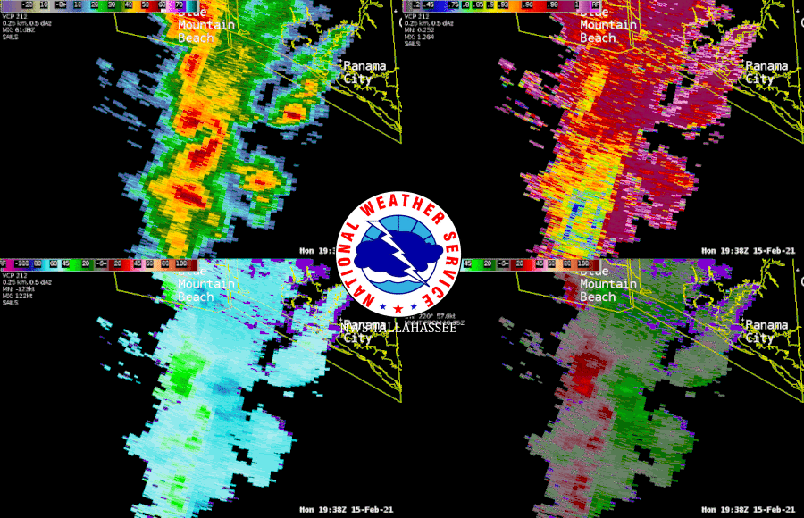 |
| Radar imagery from the storm as it developed offshore of Bay county. It continue to cycle as it moved northeast. It would produce three tornadoes, including the EF-2 tornado that impacted Damascus, GA. |
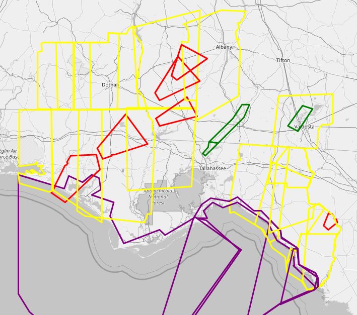 |
| Regional overview of the warnings our office issued during this severe weather event. Red boxes are tornado warnings, yellow are severe thunderstorm warnings, and purple are special marine warnings. |
Storm Information
|
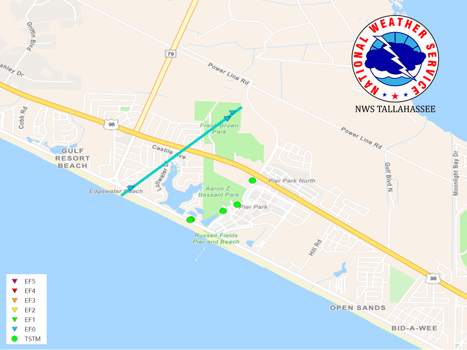
Tornado - Panama City Beach, Bay County
Track Map
|
||||||||||||||||
|
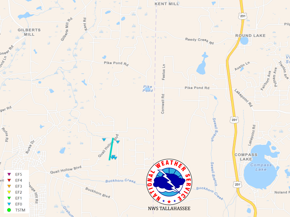
Tornado - Washington County
Track Map
|
||||||||||||||||
|
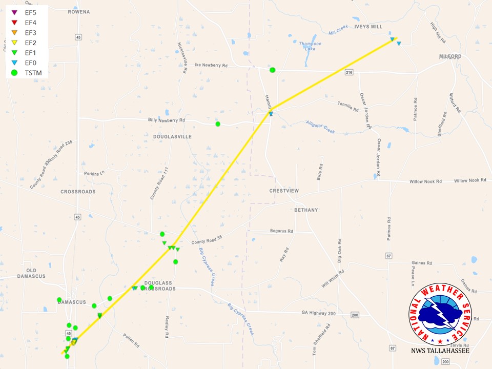
Tornado - Damascus, GA - Early/Baker County
Track Map
|
||||||||||||||||
The Enhanced Fujita (EF) Scale classifies tornadoes into the following categories:
| EF0 Weak 65-85 mph |
EF1 Moderate 86-110 mph |
EF2 Significant 111-135 mph |
EF3 Severe 136-165 mph |
EF4 Extreme 166-200 mph |
EF5 Catastrophic 200+ mph |
 |
|||||
Photos & Video
Damascus, GA Tornado
|
EF-2 damage at the tornado's strongest intensity. Photo: NWS Survey |
Winds drove a metal pole into a tree. It would not come out when we attempted to pull it out. Photo: NWS Survey |
EF-2 damage at the tornado's strongest intensity. Photo: NWS Survey |
EF-2 damage at the tornado's strongest intensity. Photo: NWS Survey |
|
EF-2 damage at the tornado's strongest intensity. Photo: NWS Survey |
EF-2 damage at the tornado's strongest intensity. Photo: NWS Survey |
EF-1 damage at the edge of the tornado's path. Photo: NWS Survey |
EF-1 Damage just northeast of the tornado's start point. Photo: NWS Survey |
|
EF-1 damage northeast of Damascus. Photo: NWS Survey |
EF-1 damage northeast of Damascus Photo: NWS Survey |
EF-0 damage nearing the end of the tornado's path well northeast of Damascus. Photo: NWS Survey |
EF-0 damage at the end if the tornado's path just west of Milford. Photo: NWS Survey |
A .KMZ file including several more photos of the Damascus survey can be found by clicking here.
 |
Media use of NWS Web News Stories is encouraged! Please acknowledge the NWS as the source of any news information accessed from this site. |
|