Overview
A surface low developed on Sunday, moving across the middle Mississippi Valley with a cold front stretching across the Lower Mississippi Valley. By Sunday night, the upper level wave and the surface low lifted into the Tennessee and Ohio Valleys, with the surface front strengthening and pushing into the southeast. While a few storms developed ahead of a main line of storms, the severe storms were confined to a line of storms that moved into southeast Alabama Sunday night, pushed through the remainder of the forecast area and weakened in the far southeast portion of the Big Bend. This front stalled across the southeast Big Bend and brought a few days of perturbed weather to the forecast area.
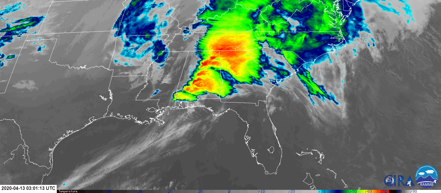 |
| Satellite imagery of the April 12-13 severe weather event. |
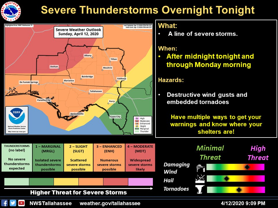
This severe weather outbreak was highlighted by the Storm Prediction Center well in advance of the event with a Day 5 outlook. They continued to highlight the area and within 24 hours of the event, a portion of the area was upgraded to a moderate risk.
 |
 |
| Day 5 outlook from the Storm Prediction Center. | Day 1 moderate outlook from the Storm Prediction Center. |
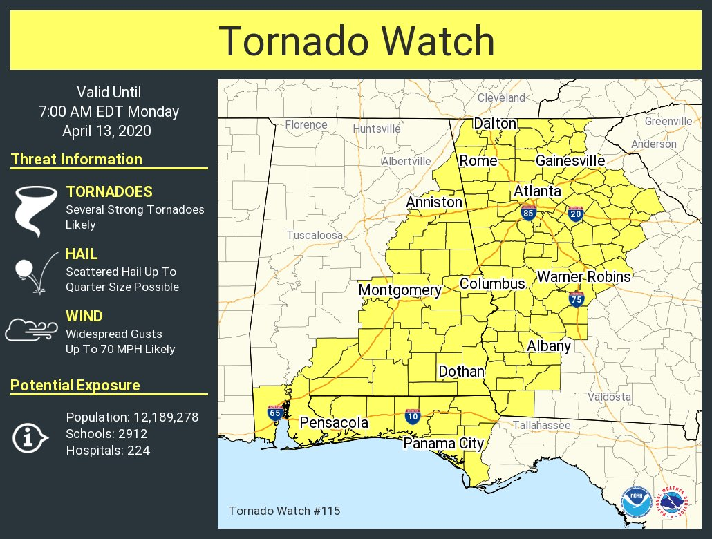
As the event unfolded Sunday night, a tornado watch was issued for the western half of the forecast area and a watch was later extended eastward.
 |
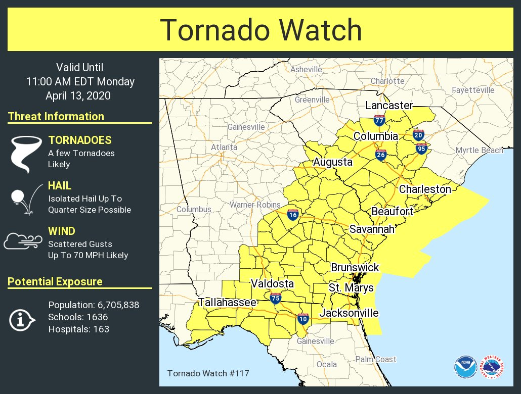 |
| Initial tornado watch. | Additional tornado watch. |
As the line of storms moved through the area, strong winds caused numerous reports of trees down, with more sporadic reports of power lines down, resulting in some power outages. In addition, one tornado developed within the line of storms in Irwin County.
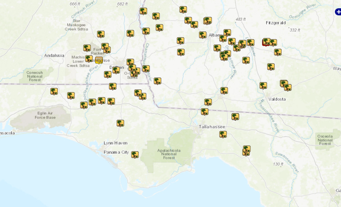 |
| Local storm report map |
Storm Information
|
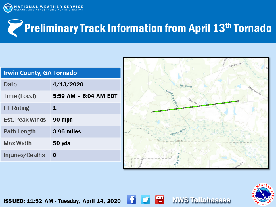
Tornado - Irwin County, GA
Track Map
|
||||||||||||||||
|
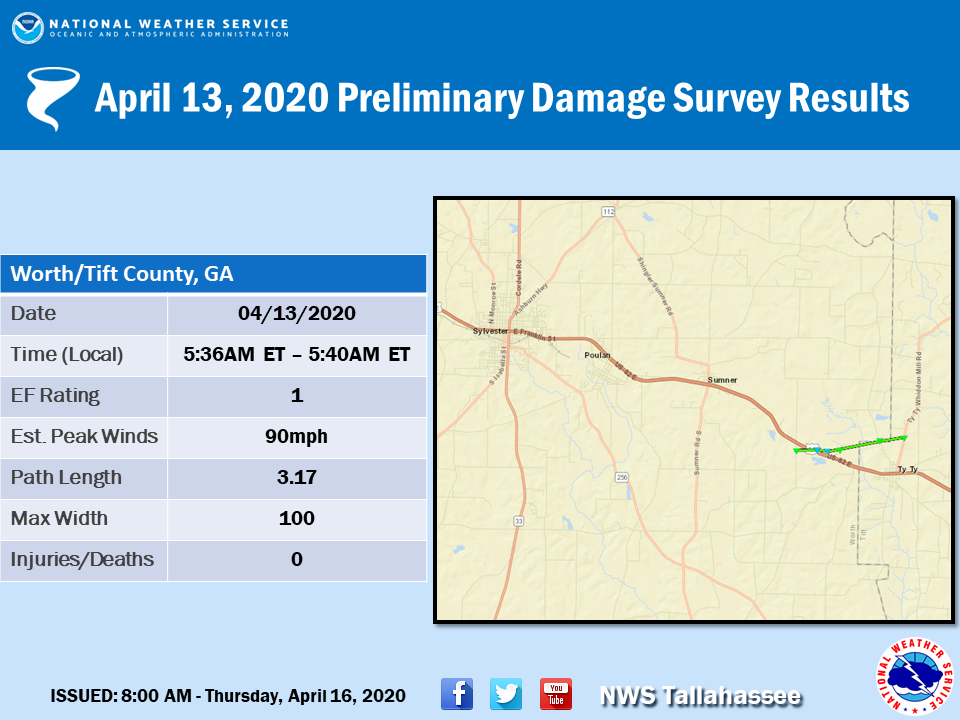
Tornado - Worth/Tift, GA
Track Map
|
||||||||||||||||
The Enhanced Fujita (EF) Scale classifies tornadoes into the following categories:
| EF0 Weak 65-85 mph |
EF1 Moderate 86-110 mph |
EF2 Significant 111-135 mph |
EF3 Severe 136-165 mph |
EF4 Extreme 166-200 mph |
EF5 Catastrophic 200+ mph |
 |
|||||
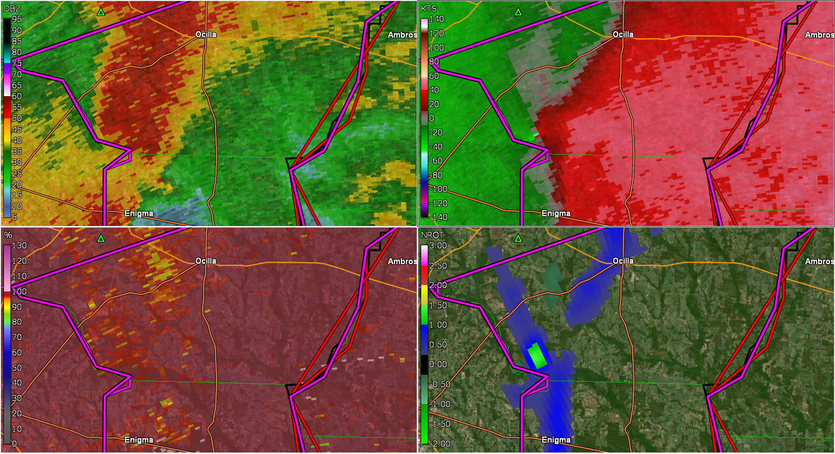
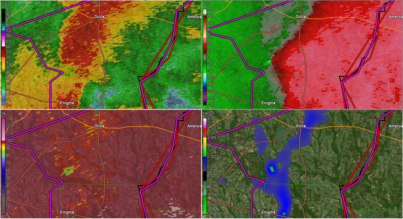
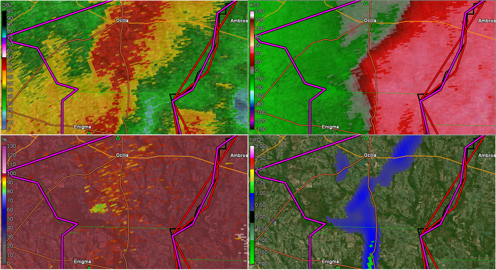
Radar Imagery
Irwin County, GA Tornado - Radar Imagery
 |
 |
 |
| Radar image near the time the tornado touched down. (VAX 959Z) | First indication of a Tornadic Debris Signature where lower correlation coefficient values can be seen in the lower left portion of the image. (VAX 1001Z) |
Radar image as the tornado began to weaken and lift. (VAX 1004Z). |
 |
Media use of NWS Web News Stories is encouraged! Please acknowledge the NWS as the source of any news information accessed from this site. |
|