Impacts from Hurricane Nate Felt Across the Florida Panhandle and Southeast Alabama
Hurricane Nate developed as a depression initially in the southwest Caribbean on Wednesday, October 4, 2017. The next day, the storm made its first landfall in Nicaragua, impacting the country as a tropical storm and bringing flooding rain to Central America. After the storm moved northward from Honduras, Tropical Storm Watches were issued for a portion of the NWS Tallahassee forecast area from the Okaloosa/Walton County line to Indian Pass on Friday, October 6 – the Tropical Storm Watch included coastal Gulf, Bay, Walton, Washington, Holmes, Geneva, Coffee and Dale counties.
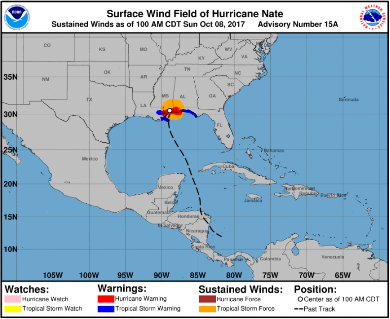
The storm continued to travel north-northwest with the center tracking between Cuba and Mexico and eventually into the southern Gulf of America late on Friday. Hurricane Nate tracked across the Gulf of America becoming the fastest moving Hurricane in the Gulf over a 12 hour period. During this time period, Tropical Storm Watches across the Florida Panhandle and southeast Alabama were upgraded to Tropical Storm Warnings. As the Hurricane neared the southeast Louisiana coast, it began to move more northward due to the ridge of high pressure centered to the west of the system. Hurricane Nate made its first U.S. landfall at the mouth of the Mississippi River on Saturday, October 7 with winds of 85 mph and then later that night made a second U.S. landfall near Biloxi, Mississippi. The storm eventually turned northeast and tracked across Alabama.
 |
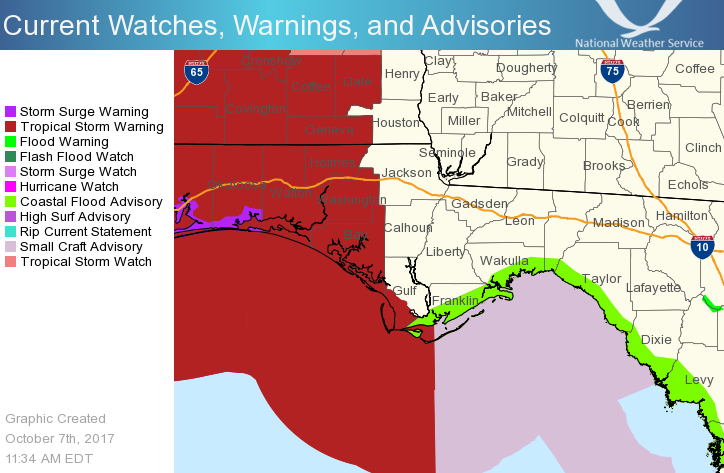 |
| Past track of Hurricane Nate as of 1AM CDT Sunday, October 8 | Map of Tropical Storm Warnings |
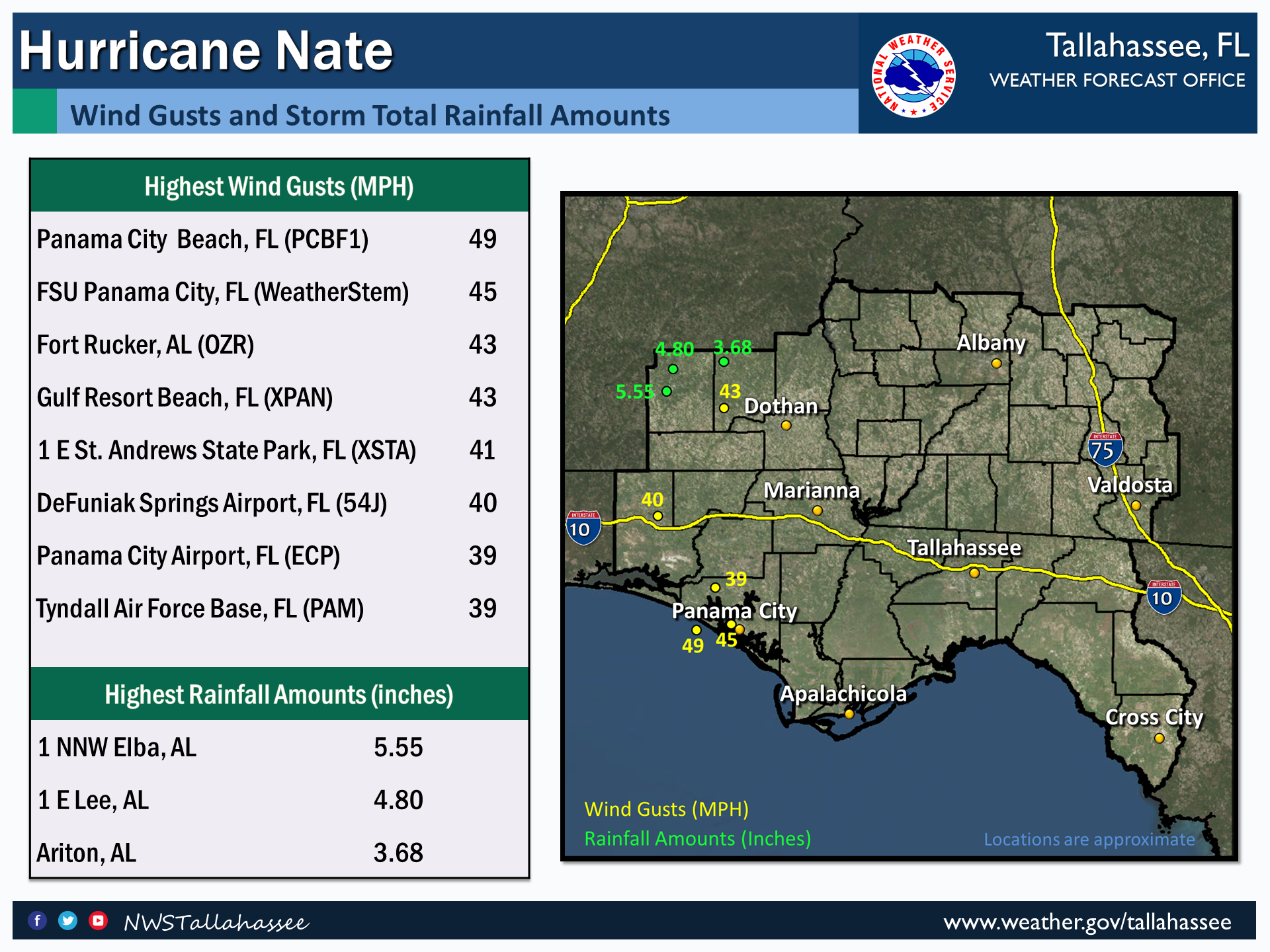
Impacts to the Florida Panhandle and southeast Alabama, in the NWS Tallahassee County Warning Area, began Saturday afternoon and lasted into Sunday. Trees and power lines were downed resulting in power outages across many of the counties in the Tropical Storm Warning. In addition, rainfall amounts of 4-5 inches (up to 5.55 near Elba, AL) resulted in flash flooding across Coffee County with water covering Highway 189, Highway 203 North and Troy Highway. During the flash flood event, water came close to entering a residence near Elba. Another impact from Hurricane Nate was coastal flooding across the Panhandle and Big Bend coast with around 2-3 feet of inundation at the coast that resulted in minor to moderate coastal erosion. In Gulf county erosion was observed on west facing properties on Cape San Blas. Wave action was responsible for the damage which included beach erosion and destruction of a few stairs from structures down to the beach level. In Wakulla County, a few roads and a dock had water over them with a few inches of water entering two businesses. In Gulf County, storm surge damaged the Mexico Beach pier and flooded the campground at St. Andrews Bay Lagoon. In Walton County minor flooding occurred at the boat ramps at Santa Rosa Beach on the Choctawhatchee Bay side.
 |

