Hurricane Irma 2017
For a detailed meteorological synopsis, click here.
Hurricane Irma brought numerous impacts to the Florida Big Bend, southwest Georgia and southeast Alabama including widespread downed trees and powerlines, roads blocked by trees, power outages, and trees on homes. Two people died during the event - one due to a car crash (Liberty County) and another that had a heart attack (Worth County). Two indirect deaths occurred due to carbon monoxide from a generator (Taylor County).
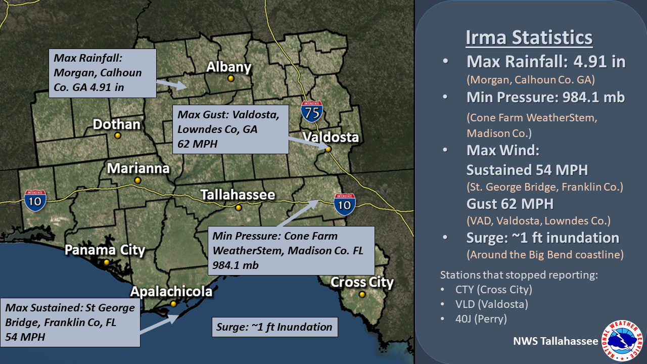
Maximum Rainfall, Wind and Surge Values and Minimum Pressure Observed During Irma
Hurricane Irma was a long lived storm - it formed just west of the Cape Verde islands, tracked across the Atlantic with the eye sliding just north of Puerto Rico, causing catastrophic damage to the northeastward Leeward Islands, then along the Cuban coast and finally made a northerly turn toward Florida on Sunday, September 10. Hurricane Irma had maximum sustained winds of 185 MPH at its peak in the Atlantic Ocean, which it maintained for over 35 hours, making it one of the strongest storms on record in the Atlantic basin as well as the longest lived storm of that intensity anywhere in the satellite era.Hurricane Irma’s first continental U.S. landfall occurred at Cudjoe Key in the Florida Keys with maximum sustained winds of 130 MPH (category 4) at 9:10 AM EDT on Sunday September 10, the climatological peak of the Atlantic hurricane season. At 3:35 PM EDT that same day, Irma made its second continental U.S. landfall over Marco Island, FL with maximum sustained winds of 115 MPH (category 3).1,3 A peak wind gust of 142 MPH was reported at Naples Municipal Airport (KAPF) during Irma’s eyewall passage. After making its second continental U.S. landfall, Irma slowly weakened as it continued north-northwestward across north Florida and southwest Georgia through Monday September 11. Irma had decayed to a tropical storm by 11 AM EDT September 11 but had a very large wind field, with tropical storm force winds extending up to 415 miles from the center of the storm. That is roughly the distance from the Alabama-Mississippi state line to north Florida’s Atlantic coastline!
 |
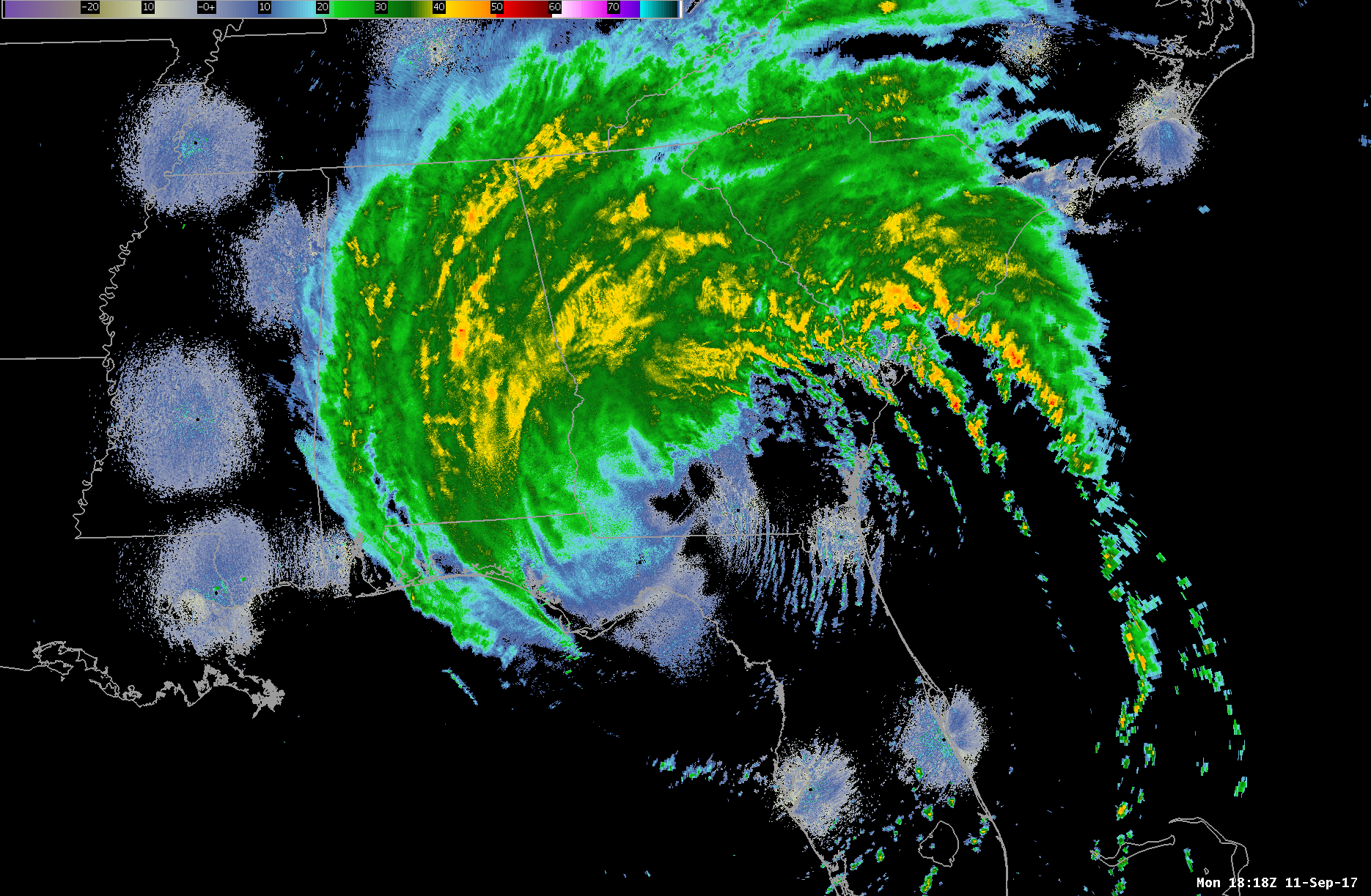 |
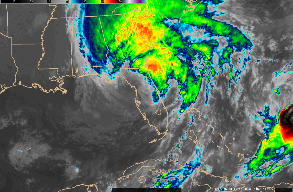
| Satellite IR Imagery of Irma | Radar Imagery from Irma |
Irma’s extensive size and slow movement made for several hours of tropical storm force winds, which resulted in widespread tree and power line damage across the area. Trees fell on roofs and cars, damaging property, and sadly taking a life in southwest Georgia. While many counties across the Florida Big Bend and southwest Georgia were impacted, the greatest impacts were across the eastern portion of the area near the I-75 corridor. There were over 6.5 million customers without power in Florida, over 930,000 customers without power in Georgia, and over 45,000 customers without power in Alabama.
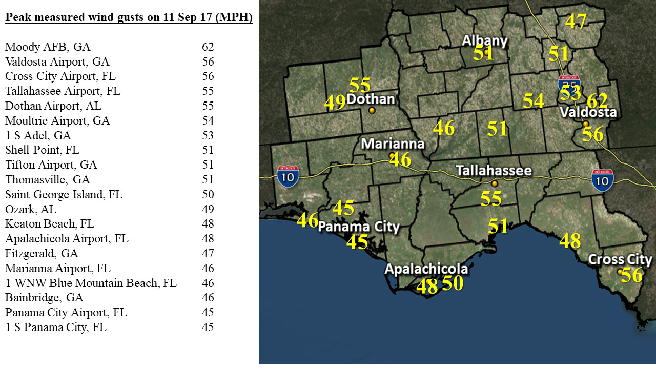 |
| Peak Wind Gusts |
In addition to wind impacts, Irma produced flooding across parts of Florida, Georgia, and South Carolina from storm surge and heavy rainfall. The heaviest rain fell just east of our area - in the rainfall totals graphic, a sharp line can be seen between the NWS Tallahassee and Jacksonville area of responsibilities. The highest rainfall total recorded in the tri-state area was 4.91 inches in Morgan, GA (Calhoun County).
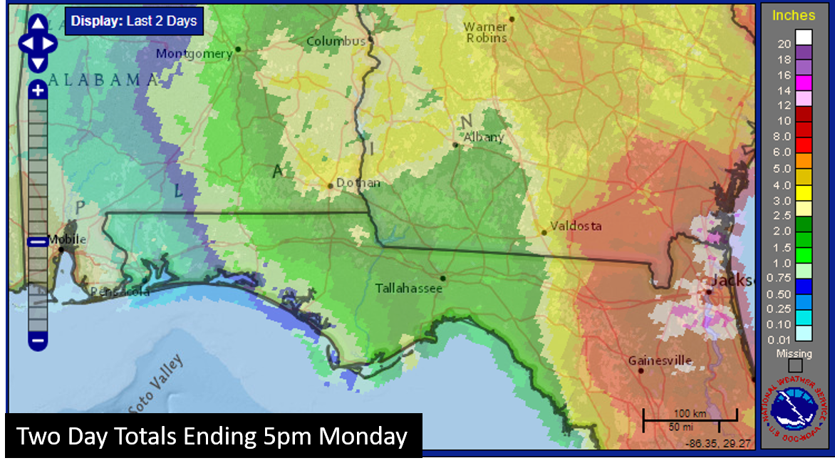 |
| Rainfall Totals from Irma |
In addition to the heavy rainfall, our sister office to the east, experience record storm surge. On the St. John’s River in downtown Jacksonville, there was 5.57 ft of storm surge flooding, exceeding the all-time record of 4.1 ft in 1964 from Hurricane Dora. Further south, a NOAA tide gauge in Naples, FL measured an 8 ft level increase in 2 hours as Irma’s eye passed over. Locally, we saw the opposite of storm surge- ocean and bay waters receded tens of feet after days of persistent north-northeast winds. As Irma passed to our north and winds became more southerly, the waters returned at a steep pace with rises over a foot per hour for over 8 hours at Cedar Key.
Event Photos
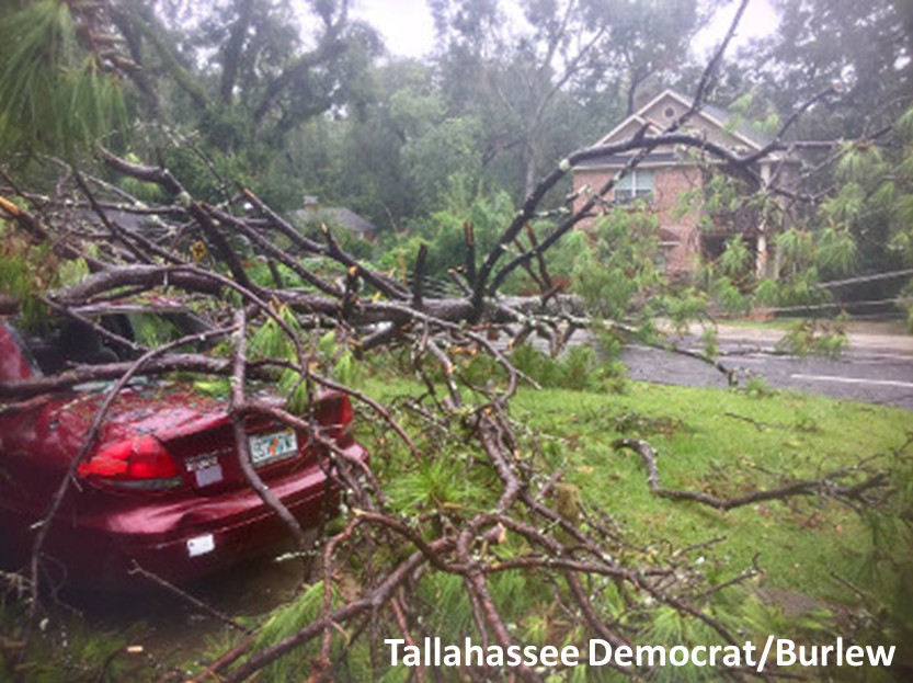 |
 |
| Tree on Car (Tallahassee) | Tree on House (Tallahassee) |
 |
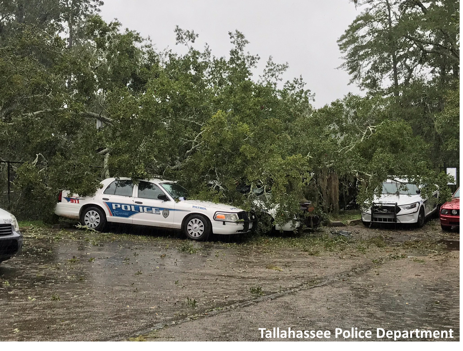 |
| Tree on on Mahan Road (Tallahassee) | Tree on Police Car (Tallahassee) |
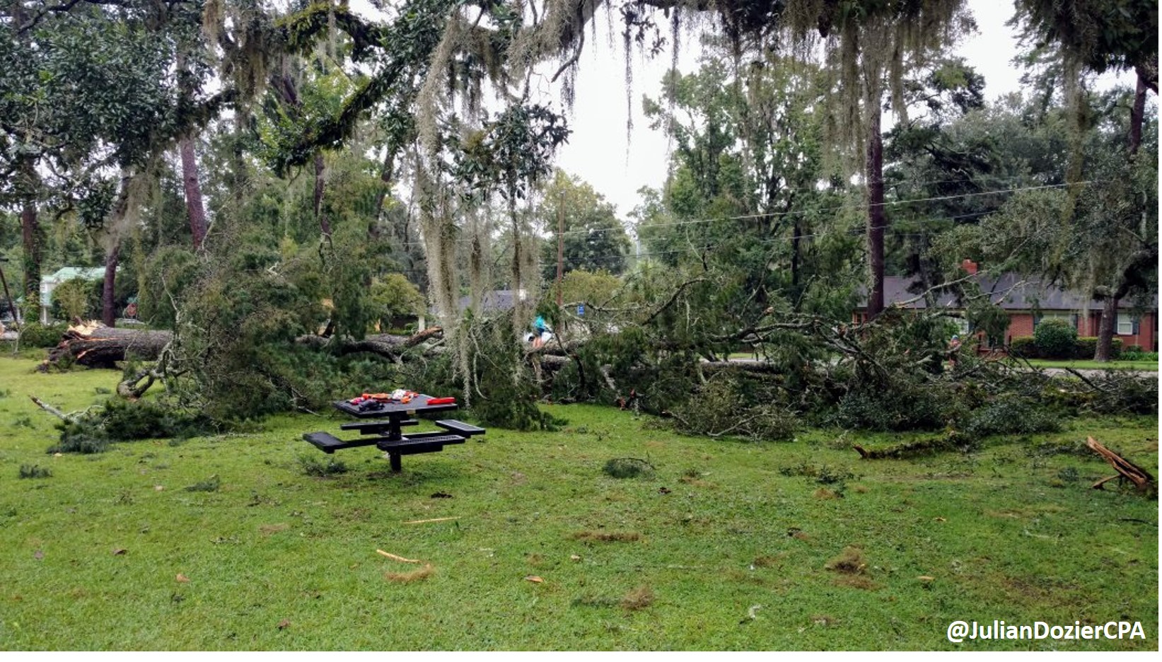 |
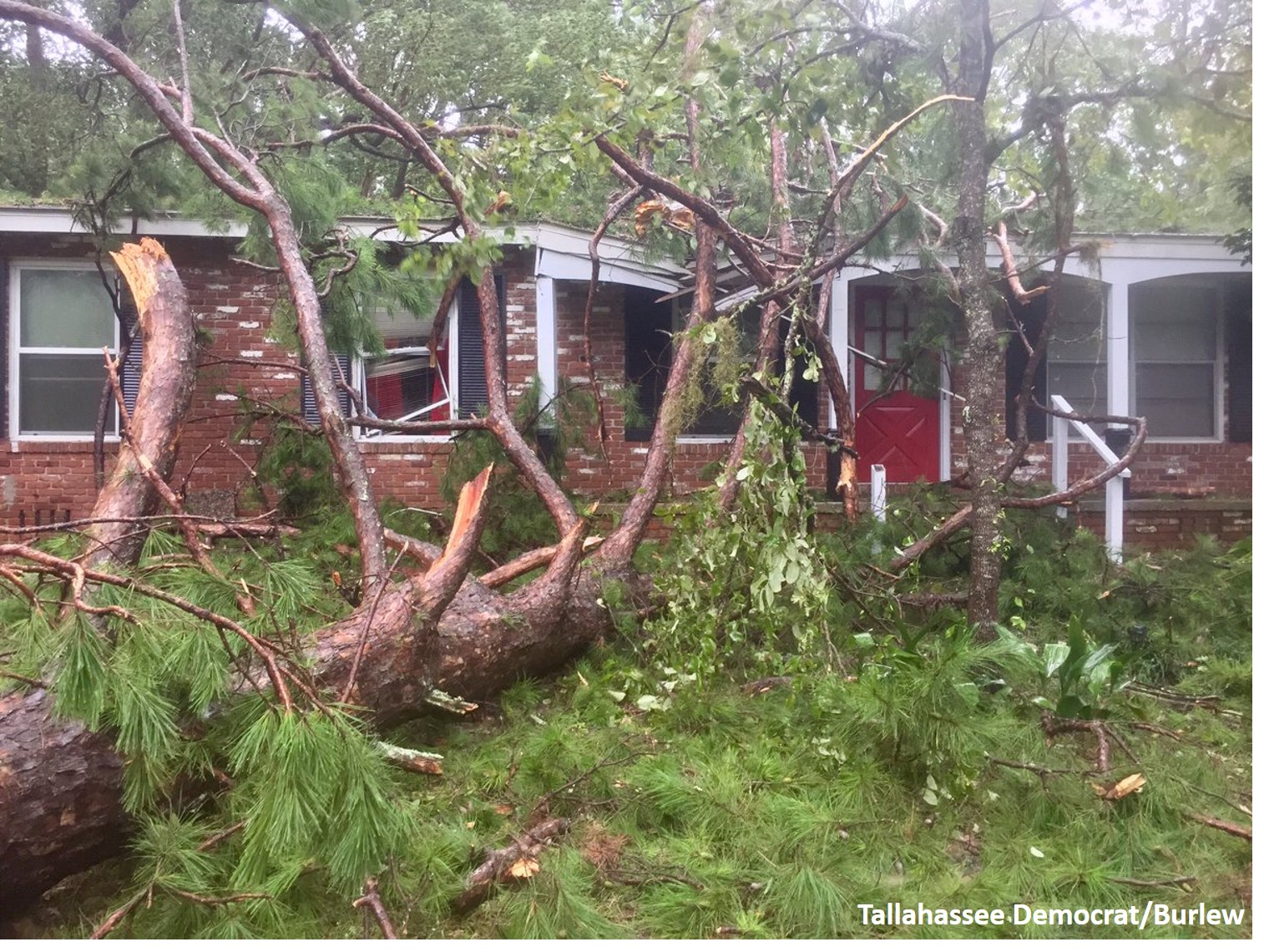
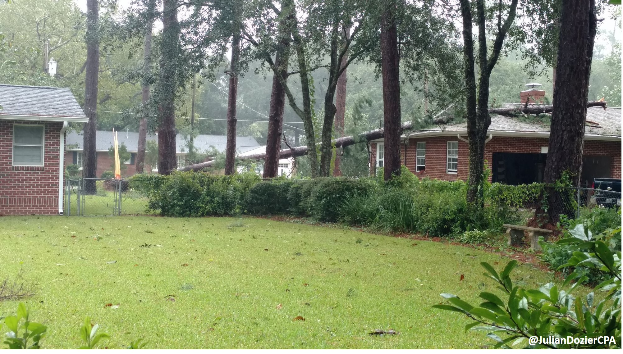 |
| Tree Down at City Park (Tallahassee) | Tree Down on House (Tallahassee) |
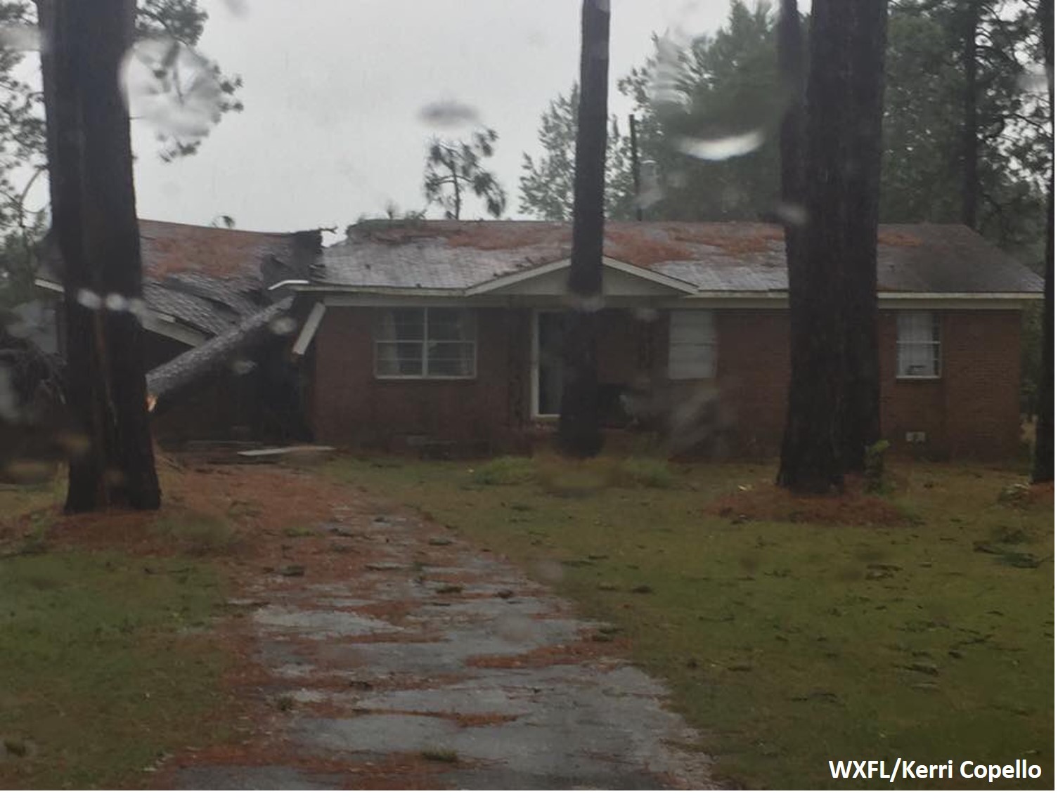 |
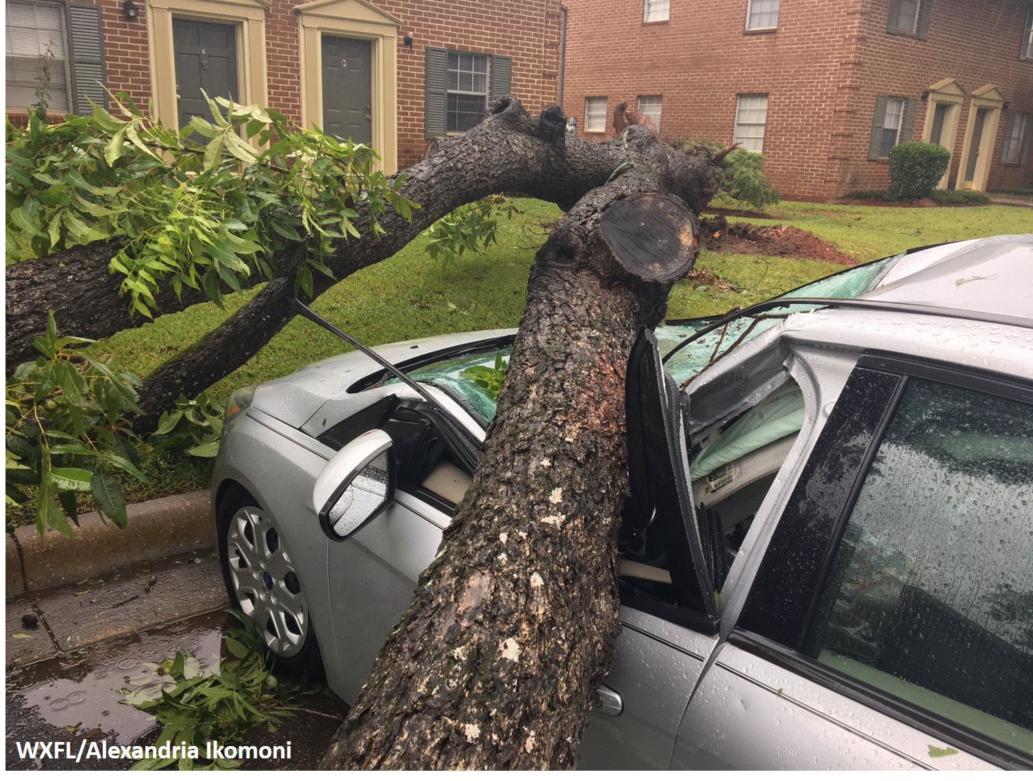 |
| Tree on House (Turner County, GA) | Tree on Car (Albany, GA) |

