Overview
A cold front moved through the tri-state region on the morning of Wednesday January 27, 2021. While this severe weather event was on the lower end of the spectrum for severity, it was strong enough to produce several tornado-warned storms. In total, 5 tornado warnings and 8 severe-thunderstorm warnings were issued for this event. Thankfully, despite there being two tornadoes, there were no injuries directly related to the tornadoes. There was, however, sporadic damage at the airport and across southern portions of the county.
Images on this site can be magnified. Click in a image to magnify it, and then click it again to return it to its normal size.
 |
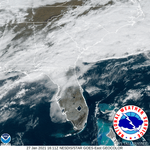 |
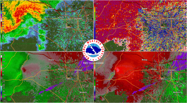
| Radar imagery from the storm as it developed across western portions of the county, and then moved over the Tallahassee airport and radar. This storm produced two low-end EF-1 tornadoes. One near Fort Braden and another over southern portions of Tallahassee. The radar was not damaged from the tornado. | Satellite imagery of the frontal system around the time the tornado moved over the airport. |
 |
|
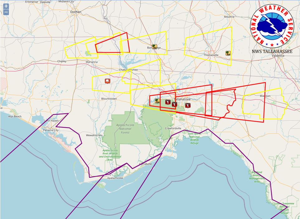
| Regional overview of the warnings our office issued during this severe weather event. Red boxes are tornado warnings, yellow are severe thunderstorm warnings, and purple are special marine warnings. Icons indicated are local storm reports. | |
Storm Information
|
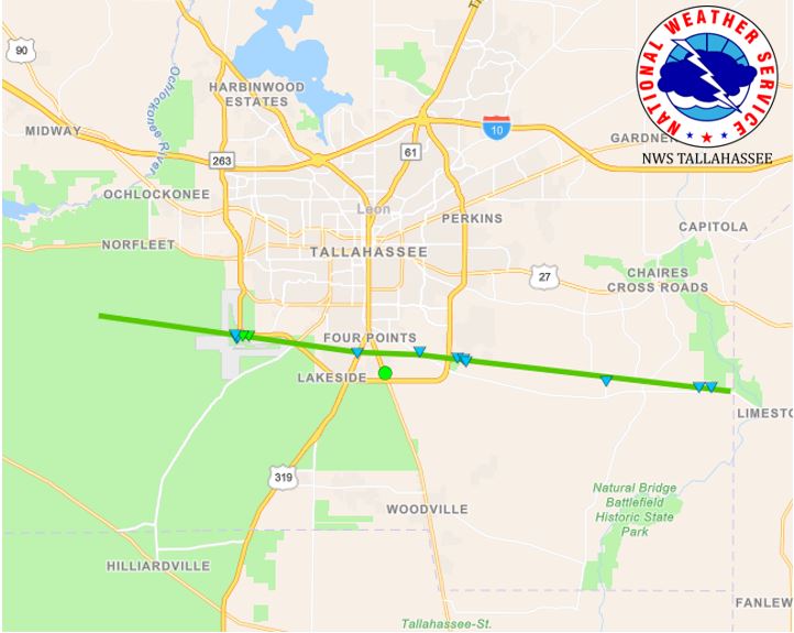
Tornado - Tallahassee, Leon County
Track Map
|
||||||||||||||||
|
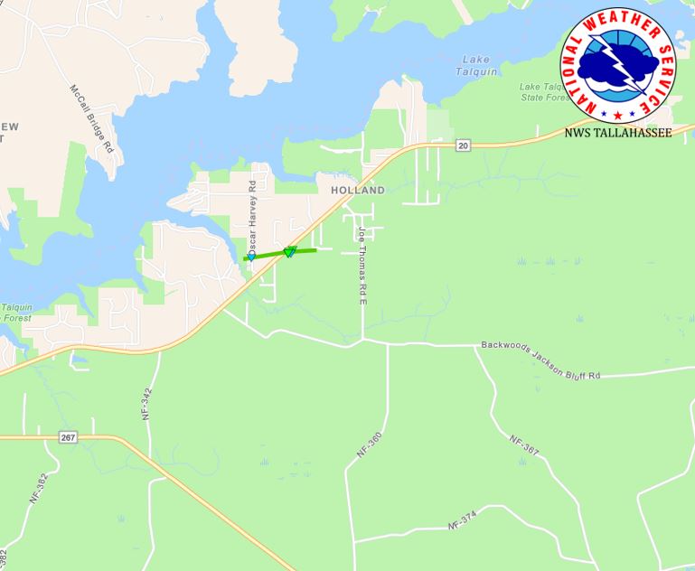
Tornado - Fort Braden, Leon County
Track Map
|
||||||||||||||||
The Enhanced Fujita (EF) Scale classifies tornadoes into the following categories:
| EF0 Weak 65-85 mph |
EF1 Moderate 86-110 mph |
EF2 Significant 111-135 mph |
EF3 Severe 136-165 mph |
EF4 Extreme 166-200 mph |
EF5 Catastrophic 200+ mph |
 |
|||||
Photos & Video
Tallahassee, FL Tornado
 |
 |
 |
|
|
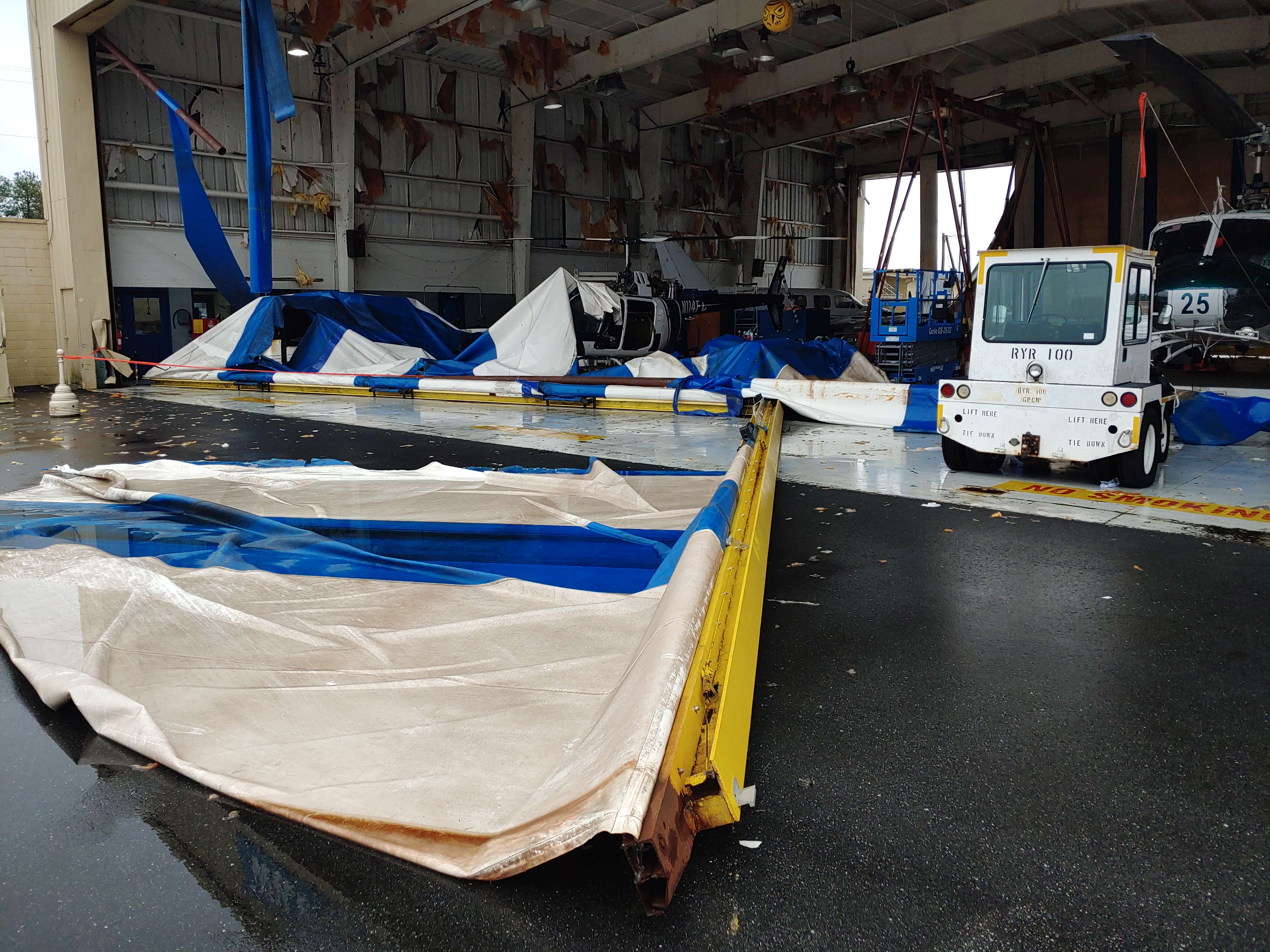
Damage at a hanger at the Tallahassee International Airport Photo: NWS Survey |
Damage at a hanger at the Tallahassee International Airport Photo: NWS Survey |
Airplane flipped due to tornado. Photo: NWS Survey |
EF-1 damage on airport grounds. Photo: NWS Survey |
|
Tree damage east of the airport near Crawfordville Rd. Photo: NWS Survey |
Damage along Tram Rd near Capital Circle in Tallahassee. Photo: NWS Survey |
Damage at the Florida Division for Emergency Management. Photo: NWS Survey |
Damage east of the Florida Division of Emergency Management. Photo: NWS Survey |
Fort Braden, FL Tornado
|
EF-1 damage just east of Blountstown Highway. Photo: NWS Survey |
Damage to a barn just east of Blountstown Highway Photo: NWS Survey |
Damage to a barn just east of Blountstown Highway Photo: NWS Survey |
Tree Damage near Blounstown Highway Photo: NWS Survey |
 |
Media use of NWS Web News Stories is encouraged! Please acknowledge the NWS as the source of any news information accessed from this site. |
|