Alberto Impacts the Tri-state Region Prior to the Start of Hurricane Season
Subtropical Storm Alberto was one of the earliest subtropical or tropical systems to develop and move into the Gulf of America in recorded history. Alberto is the fourth May storm to make landfall along the Florida Gulf Coast since 1953, and the first May land-falling tropical cyclone in the state of Florida since Tropical Storm Beryl in 2012. According to NOAA's Historical Hurricane Tracks database, thirteen other tropical or subtropical systems have developed and tracked into the Gulf of America prior to June 1st. The others to make landfall along the Florida Panhandle or Big Bend were Alice in 1953 (highlighted below), Alpha in 1972, and an unnamed system in 1976.

Alberto was also historic in several other ways. Named for 6 days, it is the 2nd longest named May storm in history behind Alice (1953), which was named for 9 days. With a peak intensity of 990mb with sustained winds at 65 mph, Alberto is the third most intense tropical or subtropical cyclone in the Atlantic Basin during the month of May, behind only category 1 Hurricane Able (1951) and category 2 Unnamed Hurricane (1908). Alberto is also the second most southern forming Atlantic subtropical storm on record, behind Olga (2007), which initially developed as a subtropical storm before gaining tropical storm attributes.
Alberto originated from a broad area of low pressure and disorganized convection that slowly drifted northward over the Yucatan Peninsula from Wednesday, May 23 through Thursday, May 24. The National Hurricane Center gradually increased the probabilities that a subtropical cyclone would develop by the weekend throughout this period as the system gradually became better organized and by Thursday afternoon, it had a 90 percent chance of development.
The area of low pressure became organized enough to be declared a Subtropical Storm on Friday morning, so Alberto was named as of 11 AM ET on May 25. The system was named a Subtropical Storm, rather than a Tropical Storm. While there are some differences structurally between a Tropical Storm and a Subtropical Storm, the main difference impact wise are the stronger winds in the Subtropical Storm will be more spread out from the center of the storm, which in a Tropical Storm, they are stronger near the center.
The initial forecast from the National Hurricane Center suggested the storm would make landfall anywhere from Louisiana to the Florida Panhandle but as the system moved northward the focus became the eastern portion of the initial forecast cone. Subtropical Storm Alberto made landfall near Laguna Beach, Florida, approximately 15 miles west of Panama City, FL, on Monday, May 28 with winds near 45 mph. While the system quickly weakened to a subtropical depression, the evening of May 28, it continued to track northward and transitioned to a tropical depression near Nashville during the evening on Tuesday, May 29 and eventually to a post-tropical cyclone near Michigan on Thursday, May 31.
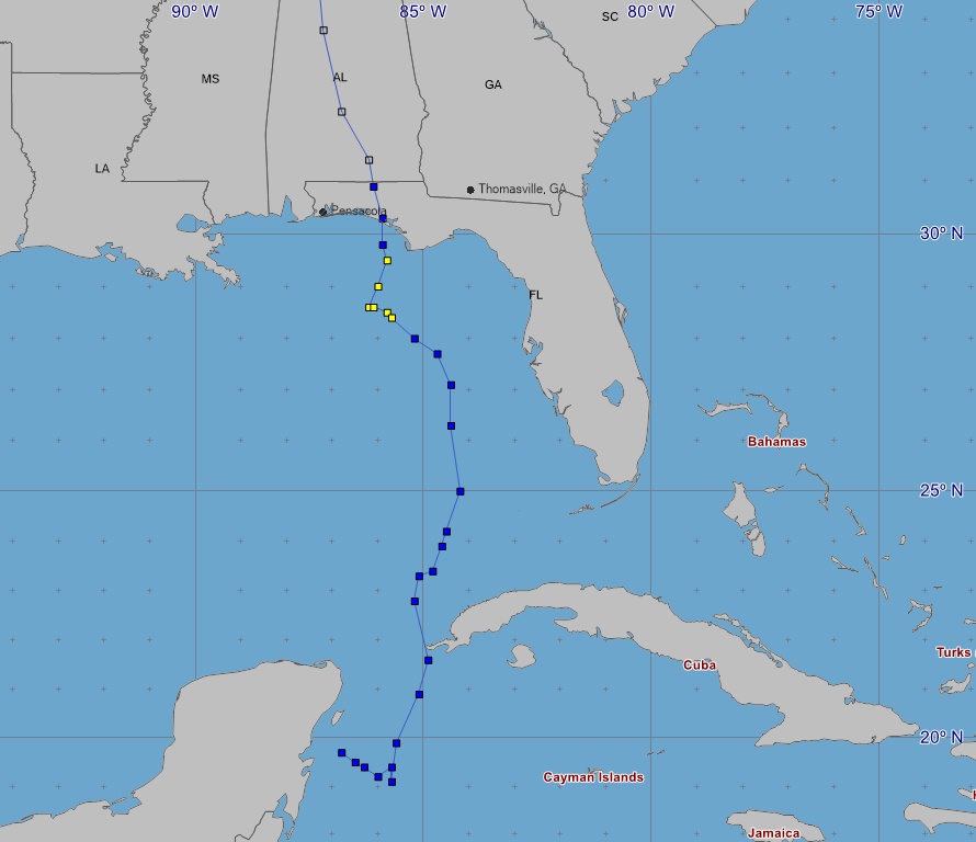 |
| Observed Track of Alberto |
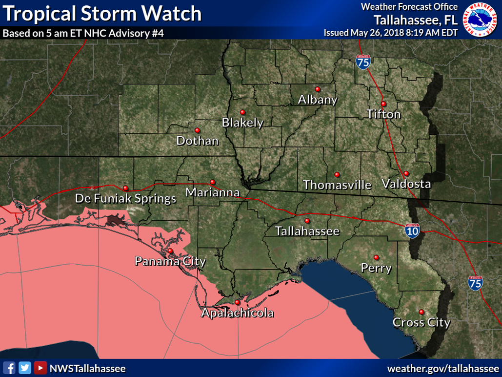
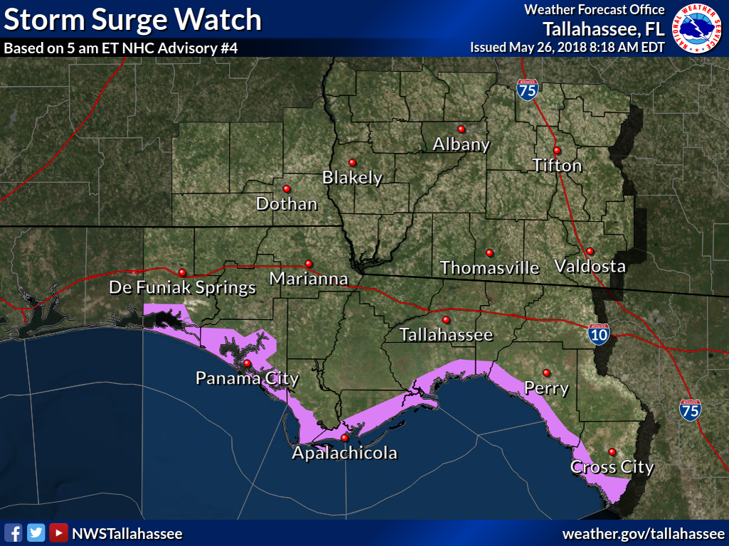
With impacts expected across the forecast area from Subtropical Storm Alberto, watches and warnings were issued ahead of the system. While Tropical Storm Watches were initially issued for coastal areas from Walton County eastward through Franklin County, these eventually became Tropical Storm Warnings that were expanded to include the Florida Panhandle, the Big Bend coastal areas and southeast Alabama. In addition, storm surge watches were issued for the Florida Big Bend and Panhandle coast. This was eventually transitioned to a Coastal Flood Advisory for Walton and Bay Counties. With heavy rain expected and training possible from Alberto's rainbands, a flash flood watch was also in effect.
 |
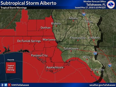 |
| Initial Tropical Storm Watch | Upgrade and expansion to Tropical Storm Warning |
 |
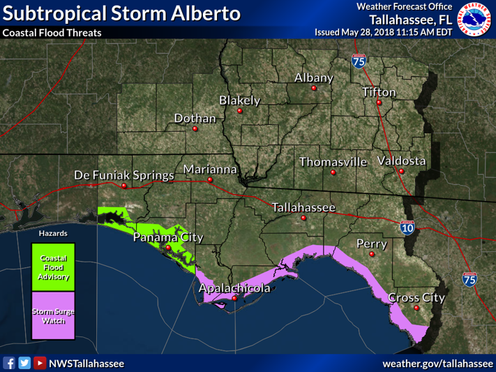 |
| Storm Surge Watch | Transition to Coastal Flood Watch and Storm Surge Watch |
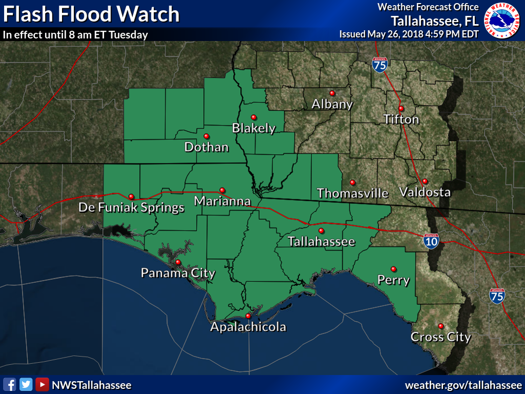 |
| Flash Flood Watch |
Impacts
Though a historic storm in many ways with respect to the time of year that it formed, the impacts associated with Alberto were limited across the Tri-state region. The main threat associated with Alberto was heavy rainfall and flooding. However, dry air entrained in the core of Alberto was a limiting factor in terms of rainfall over the region, but as the core of the storm quickly moved northward, flooding did occur across central Alabama. In general, the highest rainfall totals observed during the event ranged from 3 to 6 inches, with isolated totals to around 8 inches observed in Walton County.
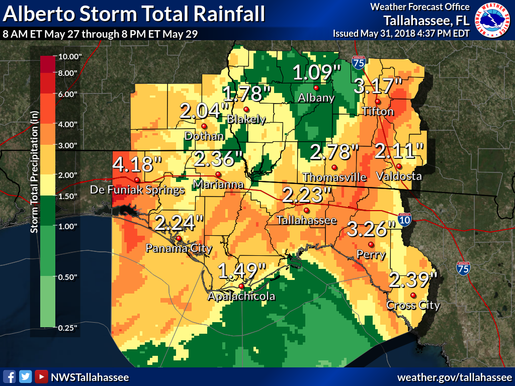 |
| Rainfall Totals Sunday, May 27 to Tuesday, May 29 |
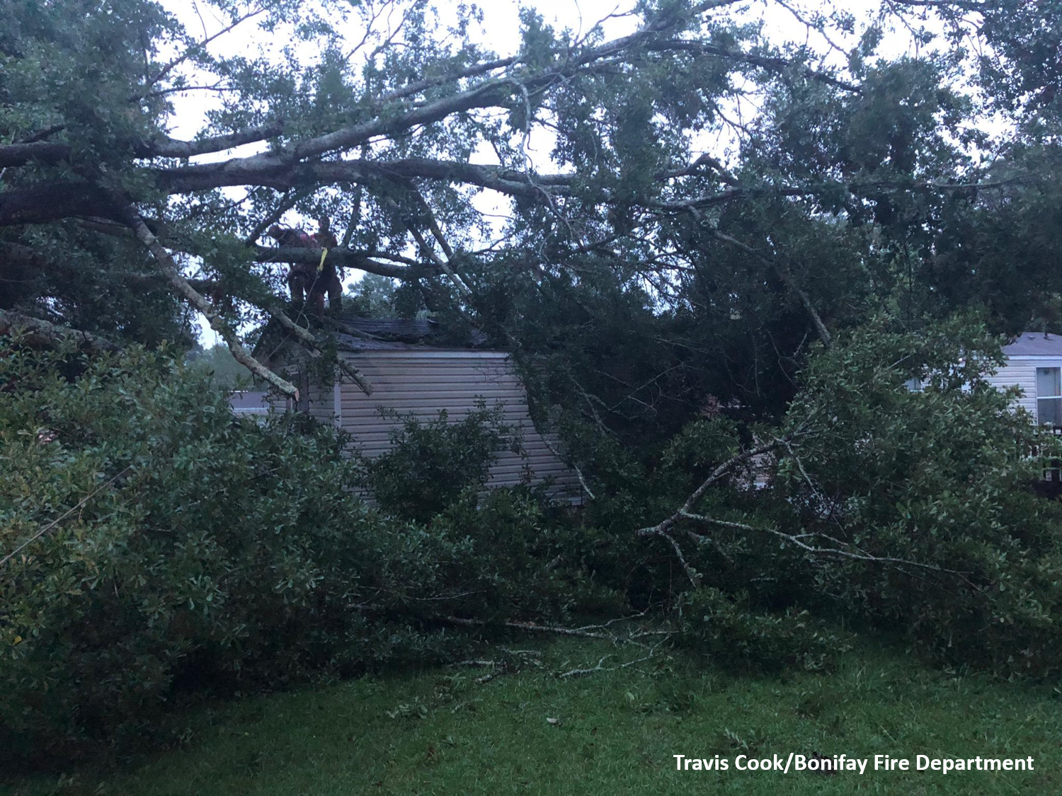
Despite Alberto's place in history based on strength for May storms, wind impacts were minor. Sporadic power outages were observed across the region, with Tallahassee proper seeing roughly 9,000 outages at the height of the event.
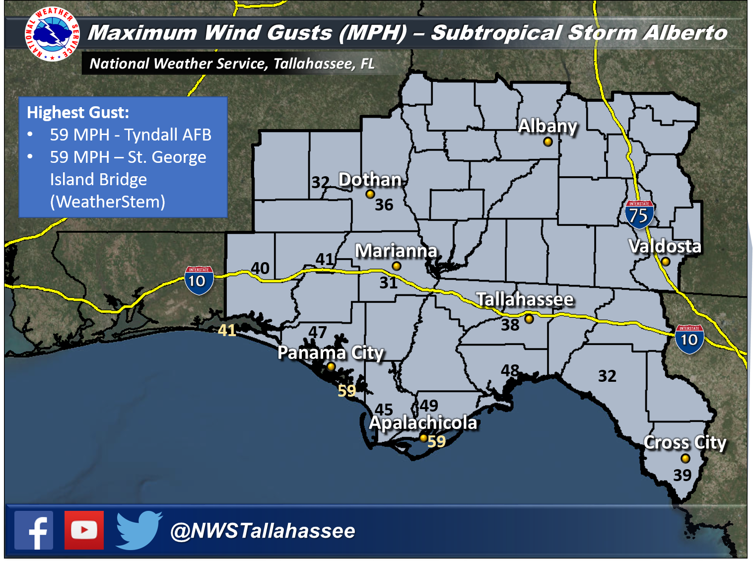 |
| Wind Gusts (MPH) from Subtropical Storm Alberto |
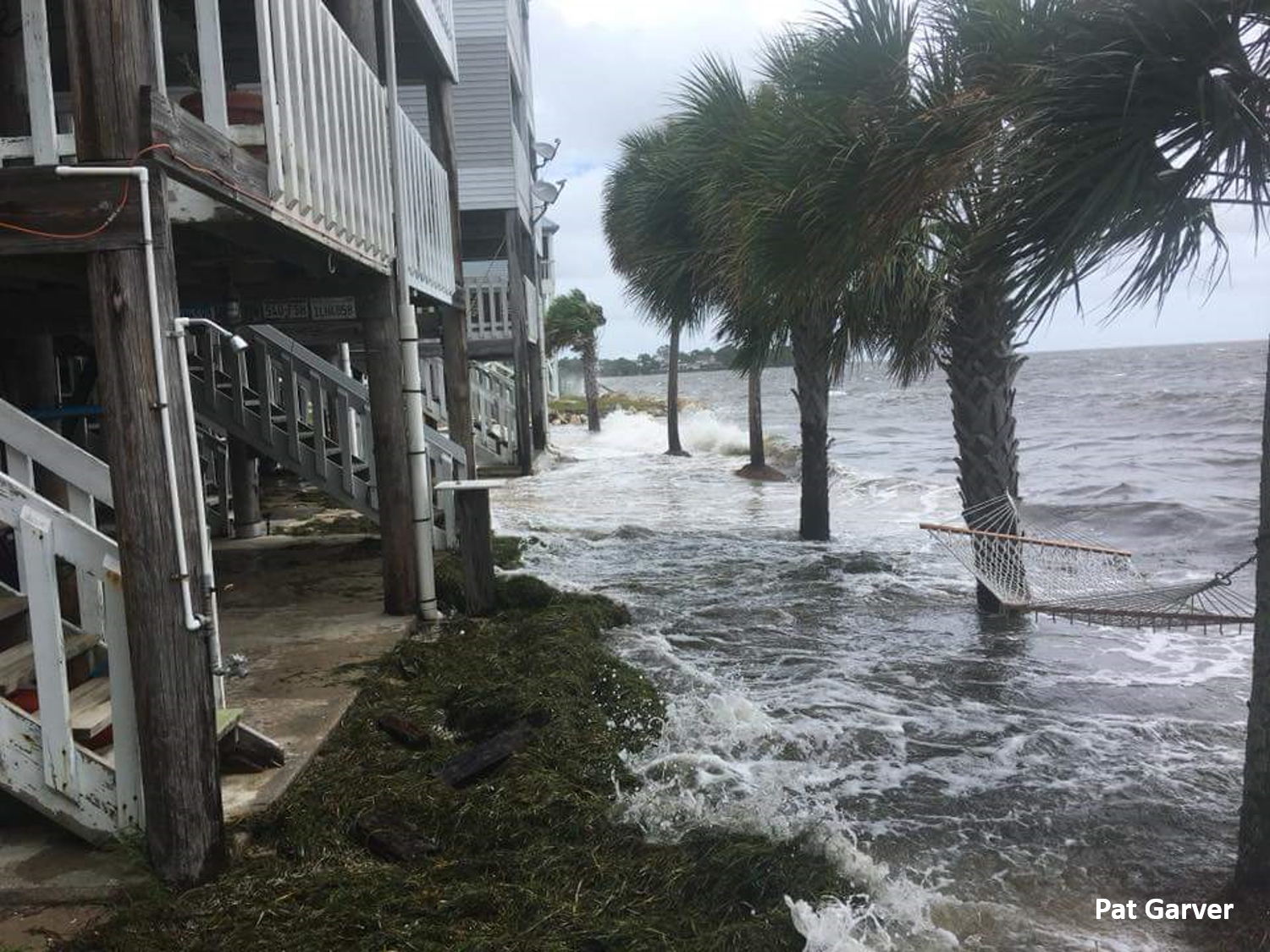
Rough surf and minor coastal flooding affected the Florida Panhandle and Big Bend coasts through the event, with 1.5 to 3 feet of inundation affecting portions of the Big Bend.
Event Photos
 |
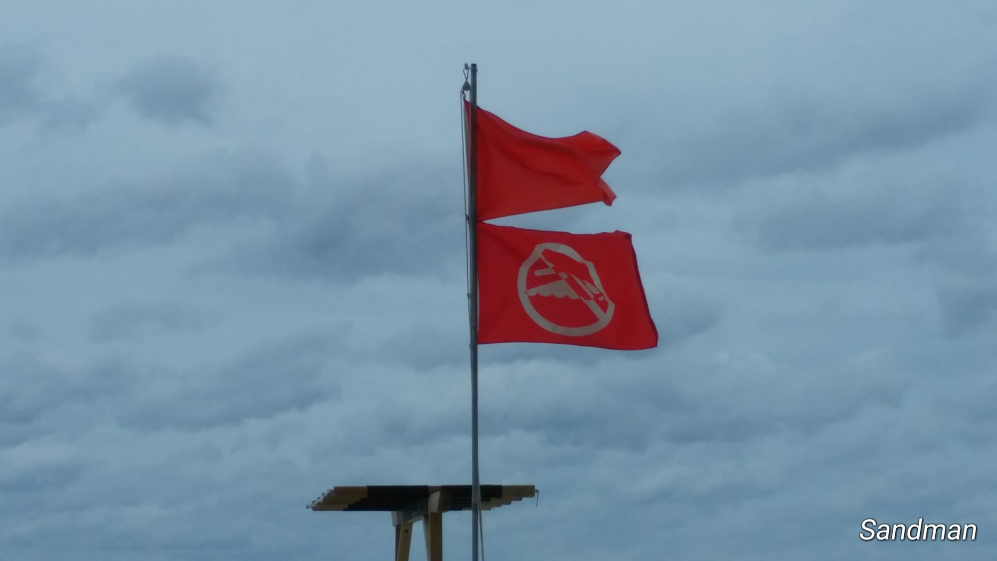 |
| Storm Surge near Shell Point | Double Red Flags Indicating the Water is Closed |
 |
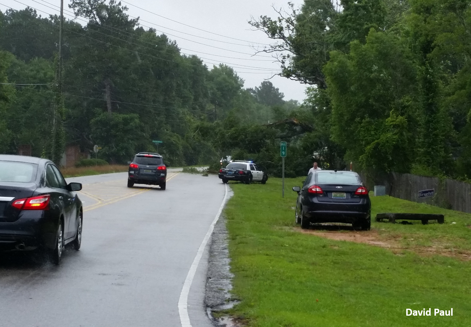 |
| Tree Down on a Mobile Home in Holmes County, FL | Tree Down Near Dothan, Alabama |
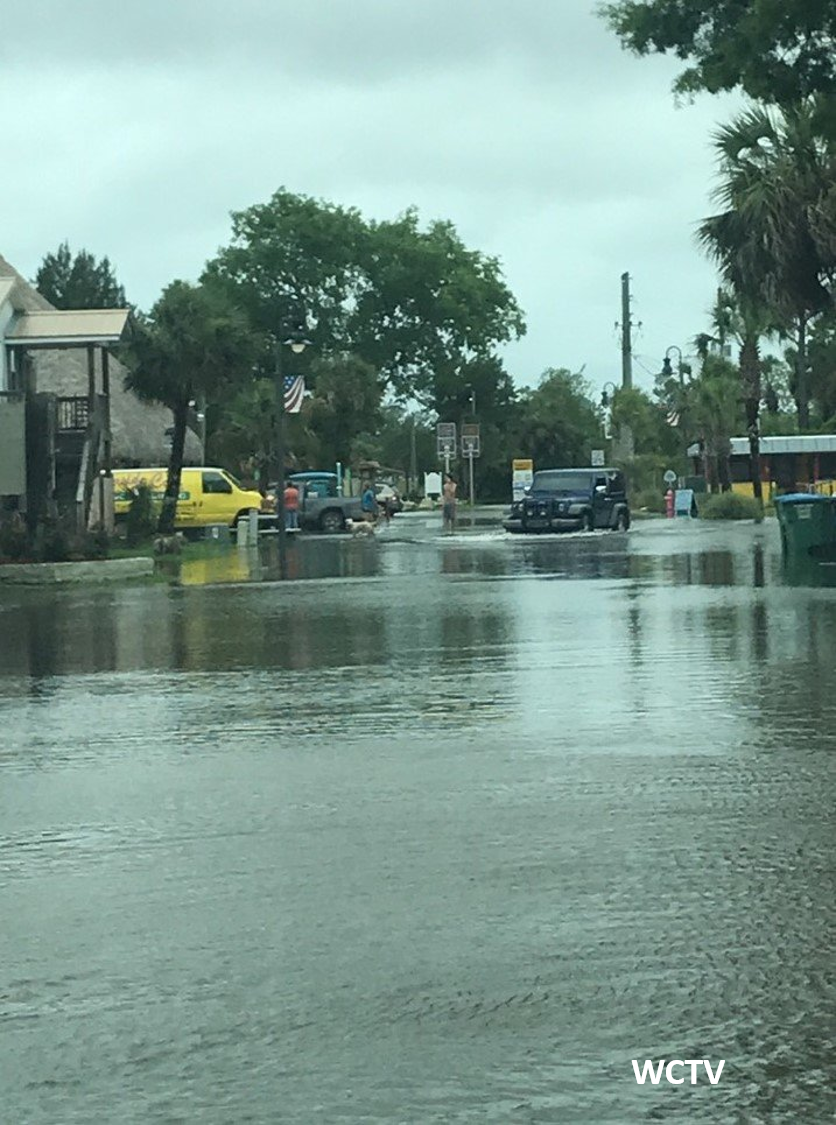 |
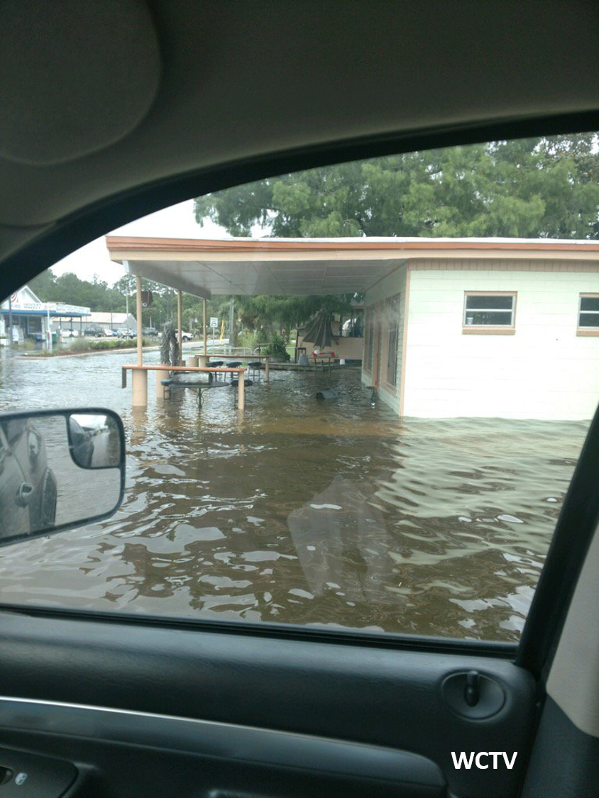 |
| Storm Surge Flooding in St. Marks | St. Surge Flooding in St. Marks |

